
-
 21843 Hits
-
 81.18% Score
-
 13 Votes
|
|
Mountain/Rock |
|---|---|
|
|
39.07080°N / 104.513°W |
|
|
El Paso |
|
|
Hiking |
|
|
Spring, Summer, Fall, Winter |
|
|
7410 ft / 2259 m |
|
|
Overview
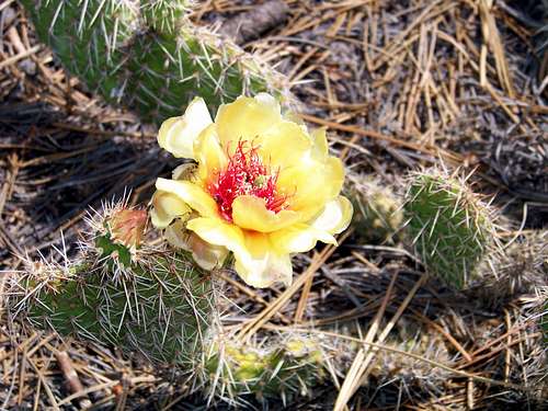 Blooming Prickly Pear
North of Peyton, Colorado, a solitary butte with two satellite cones rises from the prairie. Somewhat like a last gasp of the Ponderosa Pine covered Palmer Divide (the land divide separating the South Platte River watershed to the north from the Arkansas River watershed to the south), Rattlesnake Butte is covered in evergreens and sports rocky outcrops. Rattlesnake Butte allows the visitors to stand with a foot in both worlds: From west-facing outcrops, Pikes Peak rises to 14,110 feet above sea-level. From sunny east-facing outcrops, the Great Plains roll right off the edge of the horizon.
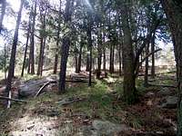
Critters calling Rattlesnake Butte and surrounding area home include deer, foxes, coyotes, and the occasional pronghorn. Additionally, I doubt this butte was named “Rattlesnake Butte” purely at random and that rattlers would enjoy making this sunny, rocky butte-top their home. The shady slopes of Rattlesnake Butte are covered in Ponderosa Pine and Douglas Fir, while more stunted Ponderosa and even a few cedar dot the sun-washed summit area. Prickly Pear are frequent on the sunny summit area along with numerous grasses and wildflowers.
Colorado Rank: Unranked
Prominence: 200 feet
USGS Quad: Eastonville
Rank & Prominence Information: Lists of John
Getting There & Route Information


Driving to Homestead Ranch Regional Park
• East on HWY 24 to Elbert Road.
• North 5 miles on Elbert to Sweet Road.
• East 2.5 miles on Sweet to Golihar.
• North 1/2 mile on Golihar to the park entrance on the the left.
 West Slope of Rattlesnake Butte
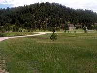 Near end of the driveway
 USGS Marker
 Rattlesnake Butte from the south
West Slope Route
Distance: About 1.25 mile RT, excluding exploration / side trips.
Elevation Gain: Less than 300 feet
Route Details
• From the parking area, head east on the dirt park driveway to Gollihar Road.
• Cross Gollihar Road and walk briefly north along the road to avoid private property.
• Cross a ditch and ascend an embankment. The ascent begins gently but quickly steepens.
• Soon you will find yourself on a rocky, timbered slope (eventually perhaps crossing an old, faint road bed).
• Continue to the summit plateau. The highpoint is to the west end of the summit plateau and a USGS marker can be found near the highpoint.
This is a lovely butte with dynamite views all around. I recommend exploring the various outlooks, not to miss the eastern outlook providing a juxtaposed view of the plains from the rocky outcrops of Rattlesnake Butte.
Red Tape
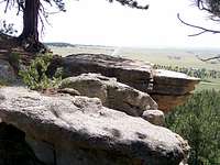 East-Facing Outcrop
 Deer on Rattlesnake Butte
The website for Homestead Ranch Regional Park states:
“Rattlesnake Butte, a prominent landmark in eastern El Paso County from which visitors can see the Front Range and the Sangre de Cristo Mountains in the distance, is located within the park.”
However, be forewarned that no trails exist to the summit of Rattlesnake Butte from the regional park parking area, nor do any signs or pamphlets invite the park visitor to climb Rattlesnake Butte. Take care to not stray onto private property surrounding the park, and keep climbing parties small to minimize your effect on this un-tracked peak.
Camping & Lodging
 Pikes Peak rises above plains
There is no camping available at Homestead Ranch Regional Park and this rural area provides no nearby lodging opportunities. Most visitors to Rattlesnake Butte will be day-trippers from nearby Colorado Springs which offers a wide variety of mom-and-pop campgrounds, motels, hotels, and B&Bs.
Weather & Seasons
 Morning Glory
 Prickly Pear on Rock
 Stunted Pondersa Pine
 Sunny Outcrop, Rattlesnake Butte
Rattlesnake Butte is accessible year-round. Expect dry, dusty heat in the summer, though early summer wildflower blooms and prickly pear cactus blossoms brighten the surroundings. Fall would be a pleasant time to visit the butte, with cooler, crisper air and the mountains to the west turning gold as the aspen leaves change. Winter could bring deep (possibly even impassible) snowdrifts to the area and biting winds, though warm, calm day in the winter would be a delightful time to visit Rattlesnake Butte. Early spring may be a bit sloppy, but would offer the chance to visit the butte before the heat of summer kicks in.