-
 2772 Hits
-
 71.06% Score
-
 1 Votes
|
|
Route |
|---|---|
|
|
42.80080°N / 0.10010°E |
|
|
Mountaineering, Scrambling |
|
|
Spring, Summer, Fall |
|
|
One to two days |
|
|
P.D. |
|
|
5.3 (YDS) |
|
|
II |
|
|
Overview
The route is long and you need generally 6h from Refuge de la Glère or 4h from Refuge Packe to the summit. If you climb the ridge of Crabonouse-Bugarret you need 1h more.
Getting There
-Barèges is a small village in the west side of the famous Col du Tourmalet, between Luz-St-Saveur and Bagnères de Bigorre. The shorter access is from the highway to Tarbes. You take exit 12 to Lourdes, Argeles-Gazost, Pierrefitte, Luz-St-Saveur and barèges. Two km after Barèges is the road to Plateau de Lienz where the road ends and it begins the forest track of 4 km to the end in a small parking. The track follows but it's forbbiden to drive.
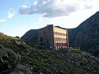
You must walk 1h30m to Refuge de la Glère the first days. This refuge have 64 places and you must reserve it. If you want to walk a little more the first day you can follow for 2 hours to the free hut of Refuge Packe (12 places with small beds and blanckets).
Route Description
Begin in Refuge de la Glère (2.103m) following the signal to Refuge Packe. Walk the path in the spun to reach a small col with a singal takin the right path. Descent some meters to reach the path to walk to Refuge Packe (2.509m, 2h). Descent to col de Rabiet (2.260m). The small cabane de Rabiet is near of the col at right side. Follow the path bordering Lacs de Rabiet at right. We have three option from here:-ravine of Tourrat: the most easy is to follow to the end of the second lake turning to right (South) side to go across the ravine of Lac Tourrat. It's a little longer but is easy to follow.
-direct to Lac Tourrat: the most advisable if you have map and good sense of orientation is to follow to S.W. under the ridge North of Crabonouse in an area without path but with cairns. After a lot of small lakes we climb an spun to reach the Lac Tourrat.
-the ridge North of Crabonouse: is the longest option but you climb the three peaks Pale Crabonouse (3.021m), Bugarret (3.031m) and Dent d'Estibère-Male (3.017m) before the ridge Of Pic Long. I'll write this route in the Pic Bugarret.
In the Lac Tourrat we walk in right side following the cairns to reach the area of scree and stones to reach the col betweeen Pic Long and Dent d'Estibère-Male. We turn to left beggining the ridge west of Pic Long. We leave the first spun walking on left side. We climb the ridge (II-) over the edge and we climb in North side another section (II) with good rock. We search in the last part of the ridge some channels of big blocks of rock (I+) to reach finally the summit.
You can descent across the same route (going down is harder than going up), you can climb the ridge East to Badet (very long) or you can make the rappel to glacier North returning across Hourquette de Bugarret (long but safe)


