
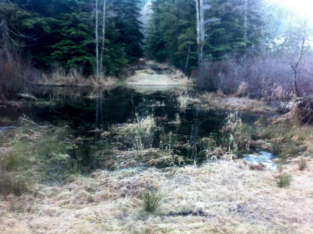
Road Wallow for Mt. Cavanaugh Approach
This photo is fuzzy because it was taken with my cell phone but this is a picture of the pond across the road at the creek crossing southeast of Mt. Cavanaugh. This was from 1/4/14. This is a view to the south side of the creek. I struggled with my bike through the heavy alder and mountain ash on the right, often standing over the water using the branches and once having to push my bike, which had sunk up to the handle bars, through a back water pool. The pond itself looked to be about 10 feet deep in the middle. I doubt it dries up in the summer. But maybe.
The continuation of the road on the south side was blocked by a huge pile of slash (evidently to keep people from plunging headlong into the pond) and then ditch-bermed every 100 yards (at least) until the junction with the main road coming up from the west.
In short: don't go this way. It's not impossible but not pleasant either. Better to try and find a route up the north slope of Frailey.


