Page Type Page Type: Mountain/Rock
Location Lat/Lon: 48.31164°N / 122.03244°W
Additional Information County: Snohomish
Additional Information Elevation: 2722 ft / 830 m
Sign the Climber's Log

Overview


Frailey Mountain from Bald Mountain
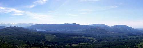
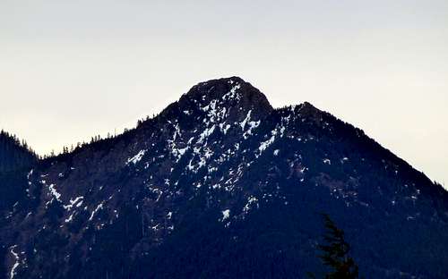
Frailey Mountain from Bald Mountain. Mount Cavanaugh, Stimson Hill, and Mount Washington can be seen on the right side of photo.


Well, January continues to be clear, sunny, and warm in the mountains of Western Washington, which obviously means.....more mountain biking! My target for the day was Frailey Mountain, which is basically an east/west ridge that separates Lake Cavanaugh from the North Fork Stillaguamish River Valley. I have been up on Frailey Mountain on a few other occasions, but the view was never anything to write home about. Recently, however, I noticed what appeared to be some logging activity near the top of the mountain. This gave me an idea that possibly some views had been opened up, and I was not to be disappointed.

I won't lie to you, there does exist some distance between Frailey Mountain's 'trailheads' and the summit ridge. The preferred routing is about 24 miles round-trip, while the optional routing is 21 miles round-trip with a little extra elevation gain thrown in (unfortunately, the old option of approaching from the west end of Lake Cavanaugh is no longer very attractive). This pretty much makes a mountain bike mandatory equipment. The good news is, the roads are in great shape for bike riding, and most of the time, the grades are reasonable.

Update (4-7-14): Recent logging has made possible a much shorter walk-up option from the Lake Cavanaugh/Deer Creek Road. Please see details below.

Frailey Mountain has three high points exceeding 2600' elevation. For simplicity's sake, I will refer to them as the west (2722'), middle (2652'), and east (2666') summits. The west summit has a fairly impressive 1182' of prominence. 

Frailey Mountain from Kinsey Hill
Frailey Mountain from Kinsey Hill. Lake Cavanaugh lies at its base to the north. Mount Cavanaugh can be seen on the far right edge of photo.


Getting There

From Arlington, follow Highway 9 north for 5.5 miles, and turn right onto Finn Settlement/Granstrom Road. Follow Finn Settlement/Granstrom road north for 4.5 miles. Where the road makes an sharp turn to the left, you will notice a well-defined gravel road and gate straight ahead of you. Park here, being sure not to block the road or the gate (Elev. 540'). Do not be tempted to drive in if the gate is open - it is normally locked shut. 

Note: I have been advised by two Summitpost members that they were recently able to drive to the top of Frailey Mountain. I have tried to contact the DNR for specific information on the gate, but have yet to receive a response. The gate has been locked shut every time I have been in this area in the last few years. If you decide to enter, you do so at your own risk.

For the optional route up Frailey Mountain, please see the Stimson Hill or Mount Washington page for information, as they both utilize the same 'trailhead'. I can only recommend this route if you plan to head up Frailey Mountain in conjunction with one of these other peaks. 

Frailey Mountain route map
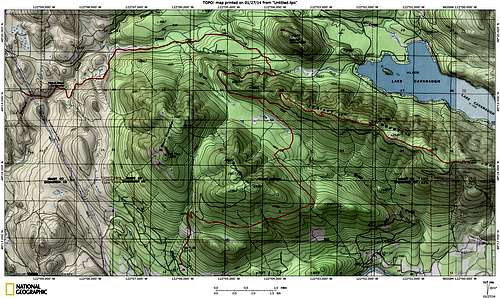
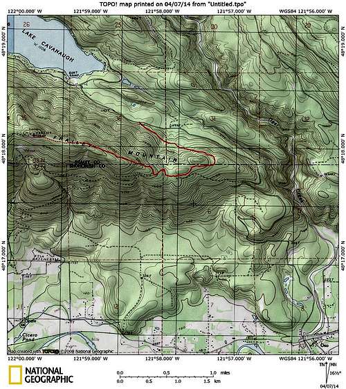
Frailey Mountain route map. The Mount Cavanaugh approach road and West Lake Cavanaugh approach road appear tempting on this old map, but unfortunately, they have been taken over by giant swamps. 

Route

After passing under the gate, begin heading up the mainline. After just 0.2 miles, when passing under some powerlines, you will notice a trail dropping off the road to the right. This trail leads down to Pilchuck Creek Falls. This large, 16 foot drop is actually pretty popular with the whitewater kayaking crowd (you could not pay me enough money to run those falls). Anyway, American Whitewater has a pretty good page if you are interested in such things.
 
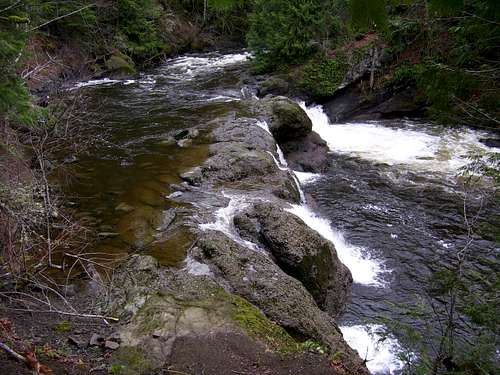
Pilchuck Creek Falls on the way up Frailey Mountain

Another 0.6 miles past Pilchuck Creek Falls, you will arrive at a bridge, where you will notice several camping sites on the north side of the creek (labeled as Pilchuck Bridge Campground on the USGS map). It looks like the camping would be fairly decent here, once some of the trash was cleaned up. I do not know whose property (DNR?) the campground is on, but I saw no signs prohibiting its use.
 
Pilchuck Creek on the way up Frailey Mountain
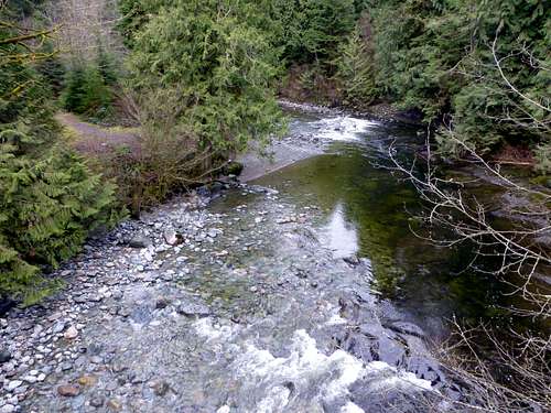
Pilchuck Creek on the way up Frailey Mountain. Campsite is on the left side of photo.

After crossing the bridge, continue up the mainline, ignoring spurs (the first three major spurs will turn uphill to the right). The road will present a fairly gentle grade for the first five miles from the gate. At (N48 19.650 W122 04.219 Elev. 1060'), the mainline will curve uphill to the right and start climbing (I included this waypoint since the road deviates from the USGS plotted roads temporarily at this point). Follow the mainline for 2.3 miles past this point, where you will arrive at a fork in the road (N48 19.047 W122 04.372 Elev. 1780'). The road coming in from the right is where the 'optional route' from Stimson Hill joins in. Take the left fork, which will soon begin climbing steeply up towards Frailey Mountain's ridge crest - there are a few sections where most will elect to 'take the bike for a walk'. At about the eight mile point, you will arrive at a large gravel quarry. Shortly after passing this quarry, the first of the good views begin opening up.
 
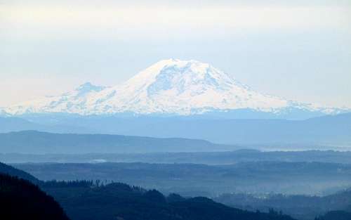
Mount Rainier from Frailey Mountain

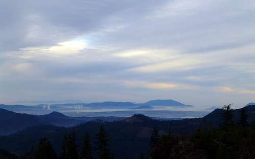
San Juan Islands from Frailey Mountain

Cavanaugh Mountain from Frailey Mountain
Mount Cavanaugh from Frailey Mountain. Bald Mountain can be seen in center of photo.

Continue uphill (steep at times) another 1.5 miles past the quarry, at which point you will be on the west summit. There are two high points here (2721' and 2722'), neither of which have any view to speak of. If you are a peakbagger type, and have to stand on the true summit, I will leave that to you and your GPS to figure out (both are easy scrambles from the road). From the west summit area, continue another 1.5 miles east on the summit ridge. Once atop the middle summit, recent logging will finally give you the views you came for.

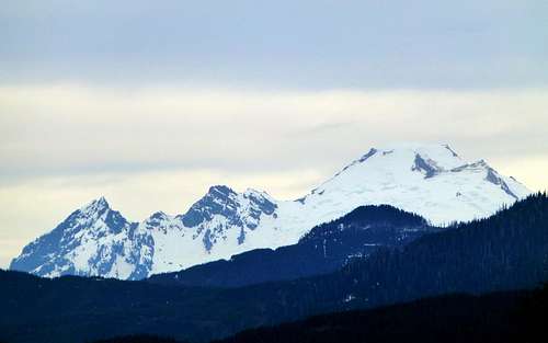
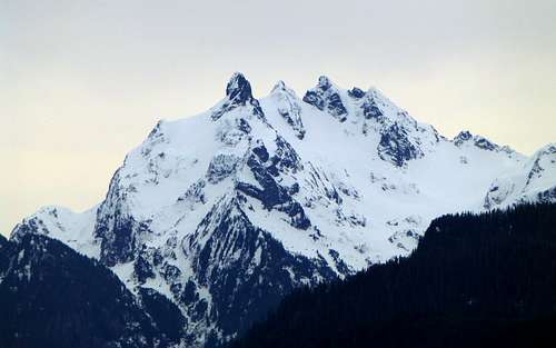
Mount Baker from Frailey Mountain

Big Deer Peak from Frailey Mountain

Three Fingers from Frailey Mountain

Whitehorse from Frailey Mountain

SE pano from Frailey Mountain
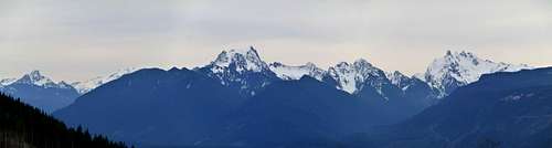
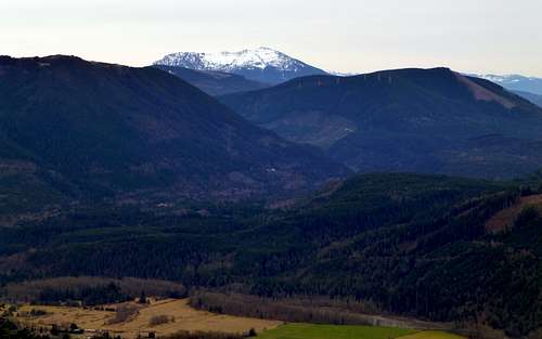
SE pano from Frailey Mountain. Left to right: White Chuck, Glacier Peak, Whitehorse, Bullon, Three Fingers.

'But wait - there's more!' Ok, I know your legs are tired by now, but the really great south through west views are less than a mile away on the east summit. On the way there, be sure to admire the view north down to Lake Cavanaugh. Arriving at the east summit, you will be at what once was a popular hang gliding/paragliding location - I'm not sure if it still gets used or not.

Lake Cavanaugh from Frailey Mountain
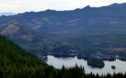
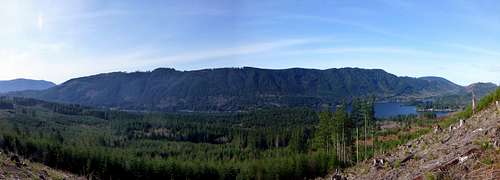
Lake Cavanaugh from Frailey Mountain. Mount Cavanaugh on left side of photo.

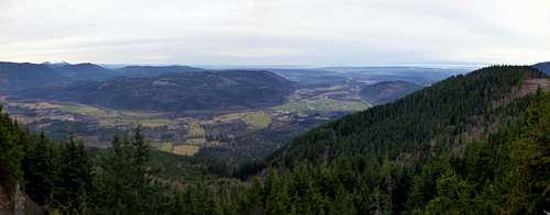
Frailey Mountain pano - south to west

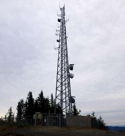
Communication tower on Frailey Mountain's east summit

Wheeler, Olo, Pilchuck, and Blue from Frailey Mountain

Paraglider launching ramp on Frailey Mountain
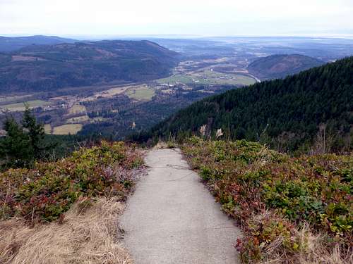
Paraglider launching ramp on Frailey Mountain. Not getting enough flying speed on this launch would result in a pretty nasty drop off of a rock bluff.


Update (4-7-14): Recent logging on the east end of Frailey Mountain now makes approaching from the Lake Cavanaugh/Deer Creek Road an attractive option, particularly for those who do not own mountain bikes. Follow Deer Creek Road 0.7 miles from Lake Cavanaugh, or Lake Cavanaugh Road 4.9 miles from Oso (I know, it sounds backwards) to a prominent logging road leading uphill to the southeast. Follow this road, ignoring minor spurs, to the top of Frailey Mountain's ridge crest in just over three miles (the first 2.8 miles will be 'bikeable', but very steep in places). From this point, easy cross country travel will lead up to the top of the east summit, which is easily recognized by the large communication tower. If it's just the views you are after, the east summit will probably suffice. If you find it necessary to stand on the 'no-view' west summit, walk for a little over two miles on the prominent logging road leading west. Round trip walking distance to the west summit would probably be approximately 11 miles.  
 
Frailey Mountain East Route
Frailey Mountain East Route. Solid red line shows the 'bikeable' portion, which is very steep on some sections.
 

Red Tape

I'm honestly not sure. I did not see any kind of signs at the 'trailhead' gate. I still need to do a little research to figure out which land is public, and which is private in this area. According to the AWW site, the gate is maintained by the Washington State DNR. 

When to Climb

Most years - March to November. My January trip was made possible by unusually dry conditions.

Camping

The only 'campground' in the area is the Pilchuck Bridge Campground mentioned above. I will do some sleuthing to try to determine its status.