
-
 3963 Hits
-
 74.72% Score
-
 5 Votes
|
|
Route |
|---|---|
|
|
46.68713°N / 12.11792°E |
|
|
Hiking |
|
|
Spring, Summer, Fall, Winter |
|
|
Half a day |
|
|
Hike |
|
|
Overview
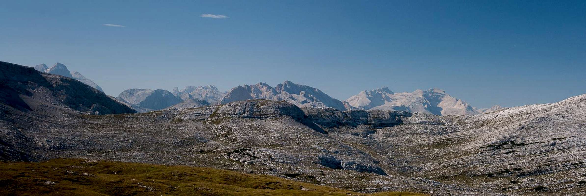
 Looking from Rossalm / Alpe Cavallo across the Fanes Plateau Looking from Rossalm / Alpe Cavallo across the Fanes Plateau |
The southern route from Pragser Wildsee / Lago di Braies to Grosser Rosskopf / Campo Cavallo follows Dolomitenhöhenweg Nr 1 / Alta Via delle Dolomite No 1 in its first part a steep scramble through a narrow valley to a place called Nabiges Loch. There it joins the Fosses High Plateau a karst plain, which offers great views towards the mountain along its edges.
In its second part the route follows the wide and shallow Rosstal / Val Cavallo, which connects the plateau (Rossalm / Alpe Cavallo) with Gamsscharte / Sella di Camosci and the mountain itself. The route is an easy hike and can be done as a ski tour in winter.
Getting There
See the Getting there information on the main page.Route Description
 Route profile (Rossalm Route to the left)
- Start altitude: 1500m
- Summit altitude: 2559m
- Prevailing exposure: North and South on the mountain's west ridge, no exposure before
- Type: Hike
- Protection: None
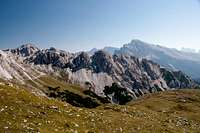
 Gamsscharte and Grosser Rosskopf
From the parking lot at Pragser Wildsee / Lago di Braies turn right along the western shore of the lake. Where the dirt road turns across a bridge into Grünwaldtal, leave it and follow a wide path along the lake's "beaches". Head for the south-eastern end of the lake, where Alta Via delle Dolomiti No 1 starts. It follows a creek bed in south-easterly direction, first through bushes, later heading into a gully right beneath the east face of Seekofel / Sas dla Porta. The track follows the brittle gully and with half a dozen switchbacks finally climbs across a big step into the cwm-like Nabiges Loch.
 |  |  |
Here the Seekofel route branches off to the right, while the Rossalm route stays in the centre of the valley. It stays at the same elevation for abot a kilometre before starting to climb towards the Rossalm Meadows. Here you have a second chance to head for Seekofel / Sas dla Porta. From the present saddle turn north across Rossalm / Alpe Cavallo.
  |
There are several tracks here, all barely visible. Every now and then you find a mark, directing you northwards towards a saddle east of Großer Jaufen / Giovo Grande. A path heads for the summit (half an hour both ways) but stay northward bound and descend into Grosses Rosstal / Val Cavallo Grande. Again, there are several tracks. The main one leads across the east slopes of the unnamed mountains to the west, another one heads in the centre of the valley to follow its base. From the south-east the main route from Brückele / Ponticello through Kaserbachtal joins, a few hundred metres onwards the route across Postmeisteral / Malga Posta also joins.
 |  |  |
Together the routes aim for Gamsscharte / Sella di Camosci, the saddle between Grosser Rosskopf / Campo Cavallo and Gametzalpenkopf. From the saddle the route turns right and climbs the summit across the south slopes. In places it gets precariously close to the vertical north face but always immediately retreats towards the slopes. Finally you reach the wide, plateau-like summit of Grosser Rosskopf / Campo Cavallo.