
|
|
Mountain/Rock |
|---|---|
|
|
38.61292°N / 109.36212°W |
|
|
Grand |
|
|
Mountaineering |
|
|
Spring, Summer, Fall, Winter |
|
|
6185 ft / 1885 m |
|
|
Overview
Round Mountain rises in Castle Valley to the east of Moab, Utah. Castle Valley is basically a trench roughly 7 miles long by 3 miles wide. The southern end of the valley is blocked by the 12000 ft peaks of the La Sal Mountain range. To the east and west, continuous lines of red colored cliffs form the walls of the trench. To the north, Castle Valley drains into Colorado River. Round Mountain rises very abruptly 1000 vertical feet above the floor of the valley.Round Mountain does not have a trail but you can find your own way up the gullies between its cliffs. Maps show a 4 wheel drive road that leaves Castle Valley Road and makes a loop around Round Mountain. This site mentions an approach via the 4 wheel drive road and the southern slopes of Round Mountain. I, instead, decided to park on Castle Valley Road and hike up the eastern slopes of Round Mountain. This required a one mile hike on the valley floor up and down a couple of small dry washes and then bushwhacking up a steep rock filled gully.
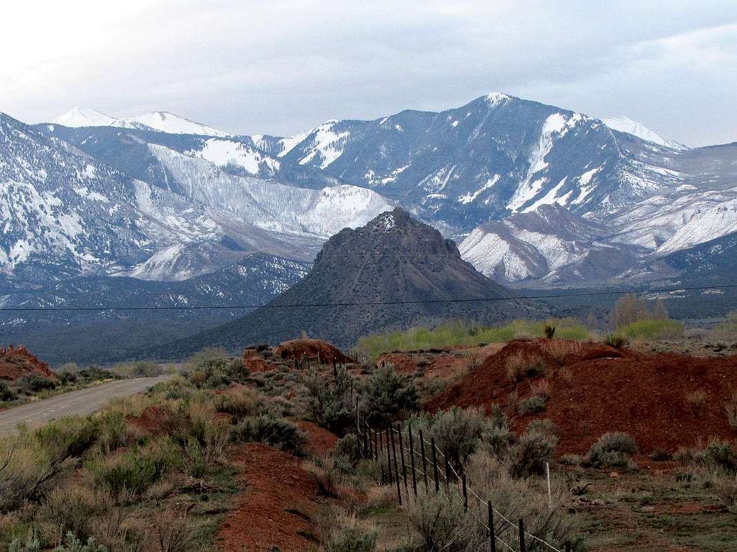
Looking south at the 6185 ft Round Mountain with the 12000 ft peaks of the La Sal Range in the back
Getting There
From the junction of Routes 191 and 128 to the north of Moab, drive 15.5 miles east on Route 128 and turn south onto Castle Valley Road. After another 7 miles on Castle Valley Road, you will find the Round Mountain dirt road. This road was actually not signed and I saw other dirt roads in the area so it became somewhat confusing. That was why I decided to just hike the valley floor to reach the base of the eastern slopes of Round Mountain.
Map
The Path That I Took
Elevation where I parked: 5300 ftRoundtrip Distance: 2.42 miles
East face of Round Mountain from the valley floor.

The eastern walls of Castle Valley.

The formation known as Castle Rock plus Priest and Nuns.

One of the two dry washes on the valley floor that I had to cross.

At the base of the eastern slopes of Round Mountain.

Steep rock-filled gully.

Looking down the gully I climbed. I then had to descend a short distance down the west slopes to go under a cliff, then followed the easy spine of the mountain north to reach its summit.

Views from the summit of Round Mountain.

Zoomed view of Mt. Mellenthin 12646 ft

La Sal Mountains

Southwestern walls of Castle Valley

Western walls of Castle Valley

Looking north, Castle valley
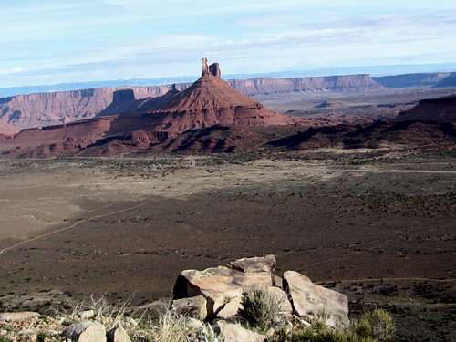
Castle Tower/Priest & Nuns