Toggle navigation
Mountains
Routes
Images
Trip Reports
Forum
What's New
People
Areas & Ranges
Articles
Trailheads
Canyons
Huts & Campgrounds
Albums
Logistical Centers
Fact Sheets
Lists
Custom Objects
Gear
Plans & Partners
WELCOME TO SUMMITPOST
SIGN IN
REGISTER
Cooked on Curl
Additional Parents
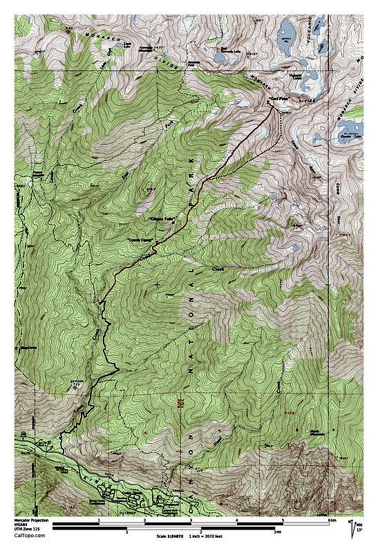
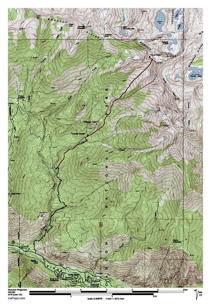
Image
Route Map
View High-Resolution Image
Route Map
The trail is indicated by the blue line. The solid red line was my cross country route. The dotted red line was my intended route not taken.
« PREV
NEXT »
boyblue
on
Jun 14, 2013 3:34 pm
Comments & voting
Other parents
Lat/Lon:
36.83395°N / 118.66365°W
Image Type(s):
Informational
Image ID:
852871
998 Hits
71.06
% Score
1
Votes
Log in to vote
Comments
No comments posted yet.
to post!
Don't have an account?
Cooked on Curl
(Trip Report)
« PREV
Viewing
#23 of 63
GALLERY
NEXT »
boyblue's Image Gallery
« PREV
Viewing
#454 of 713
GALLERY
NEXT »
×
You need to login in order to vote!
User Name
Password
Remember me
Forgot your password?
Log me out when I close my browser.
Keep me logged in all the time.
sign in as a user
Don't have an account?
Register now for FREE
Rating available
Suggested routes for you
People who climb the same things as you
Comments Available
Create Albums
Register Here


