In late April, 1986, the news slowly spread about a mysterious nuclear event that had occurred somewhere in eastern Europe. Nuclear workers in Sweden were alarmed by the presence of radiation that had activated their safety badges. Incredibly, the source of the radiation was eventually found to be nearly 700 miles away from Sweden at the Chernobyl Nuclear Plant near the Soviet town of Pripyat. It seems that there had been a major nuclear accident and the Soviet government was earnestly trying to keep it a secret- even as clouds of radioactive fallout were drifting over much of eastern Europe and Scandinavia.
Soon the jig was up and the whole world began to nervously take notice.
There had never been nuclear disaster of this magnitude before. No one- not even those of us watching the news from thousands of miles away in the United States felt completely safe. Nobody knew what to expect and there was a lot of grim speculation by the 'experts'.
Oh yes, and the media 'helped' by telling us to be afraid... be very afraid...
Cooked on Curl
For many years, it had become my yearly tradition to visit my favorite national park- Kings Canyon- on its opening weekend in the spring. Beginning around mid-April, I used to start making calls to the park's recorded message system once or twice a week until a date was announced for the seasonal reopening of Cedar Grove Road.
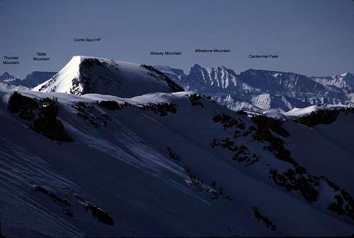
That particular year, the opening was quite a bit later than usual due to an extremely heavy winter snowpack. But, like an on-call firefighter, my gear was already assembled and my plans were already made. This year would be the first in a series of trips designed to explore the western slopes and approaches to Comb Spur- a roughly 2.5 mile long ridge of several peaks that rise to well above 11,000 feet just north of Cedar Grove. Finally, one day I made the call and heard a faint scratchy recording that announced the date of May 10th for the opening. Awesome! I was stoked!
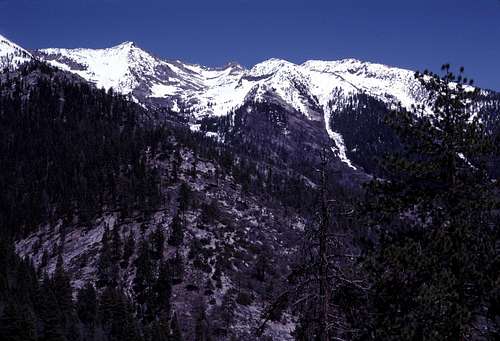
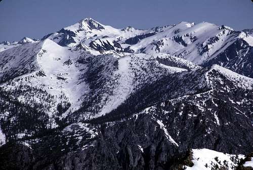
It had been during some of my earlier trips to the Monarch Divide (also on opening weekends) that I first noticed the western aspect of this miniature mountain range. These early season trips revealed Comb Spur at its best with gleaming mantles of spring snow adorning dark rocky cliffs and even a few sharp summits. The peaks looked surprisingly impressive and well worth a visit or two. I knew that it was likely easier to approach from Granite Basin via the Copper Creek Trail, but I was intrigued by the long steep ridges dropping westward from the summits to the various branches of Comb Creek far below. The topography looked confusing and there could be a significant amount of bushwhacking. In other words, this could be a lot of fun!
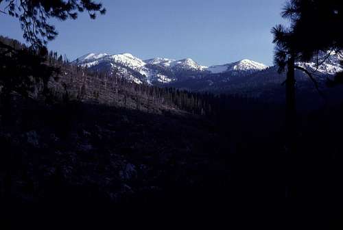
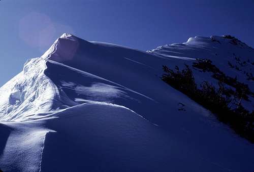
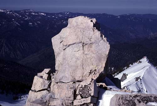
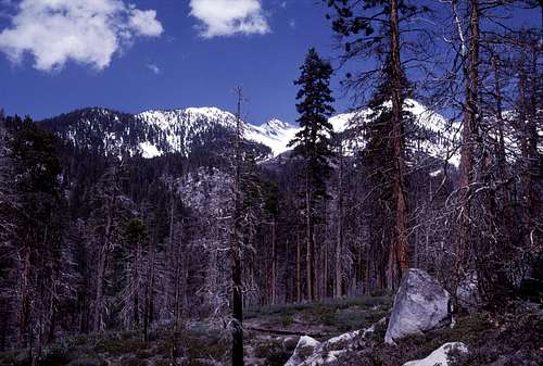
![Comb Spur]() Comb Spur from the southwest ridge of Kennedy Mountain in May, 1984.
Comb Spur from the southwest ridge of Kennedy Mountain in May, 1984.
I think many hikers would shy away from such a trip, but I thought it would be a perfect opportunity for something similar to
real mountain exploration. I was pretty sure (though not certain) that no guide book authors had ever set foot there. To this day, I've never seen a description of the western Comb Spur in any beta source.
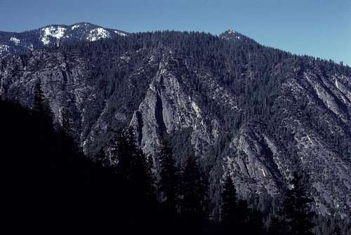
![Comb Spur]() View of Comb Spur from an earlier trip along Lewis Creek.
View of Comb Spur from an earlier trip along Lewis Creek.BITD, there was no WWW as we know it, so by default there were no online satellite views, no such thing as Google, and no SummitPost (can you imagine?). Even Bob was probably still working full time instead of peak bagging. So, the only info that I had for this mysterious area was from the Marion Peak topo map and the pictures I took during my previous trips to the western peaks of the Monarch Divide. I guess the only way to find out what was up there was to put on my gear and start hiking. What a tough life, huh? (Grin)
So, in the very earliest hours of the 10th of May, I was driving across California to Kings Canyon listening to the radio for 'stay awake' music and last minute weather reports. A news story came on with an advisory attached that I thought I'd never hear in a million years. The announcer reported that after drifting through various global air currents and the jet stream for the past two weeks, the cloud of radioactive fallout from the Chernobyl disaster had finally reached the state of California. He said that there was no need to worry. The cloud of deadly particles was mostly confined to the 10,000 foot level and above.
Well, wasn't that was just great! I think the announcer also mentioned that scientists determined that the radiation levels were insignificant and not especially dangerous. They always say that, don't they? Damn! If only I hadn't forgotten to pack my white lead-lined radiation suit!
For the briefest of moments I considered turning the car around and canceling the trip. But it was opening weekend in Kings Canyon! I just couldn't miss this. Besides, the announcer said that the radiation levels were insignificant, right? 'Reassured', I continued my long drive into the dark mountains. (Wait! Are they glowing? Just slightly? Na. Too much coffee and not enough sleep.)
It was still dark when I self issued a wilderness permit at Road's End in Kings Canyon. Definitely one of the benefits of doing trips in the off season. No need to wait for a ranger to drag his or herself out of bed to open a station or a trailhead kiosk at 7 or 8 in the morning. I've always liked being able to start before sunrise whenever possible.
It was no surprise that mine was the only vehicle parked at the Lewis Creek trailhead as I had seen no other vehicles on the road into the canyon and only a couple others parked at Road's End. I was pretty sure that I had much of the park to myself that weekend.
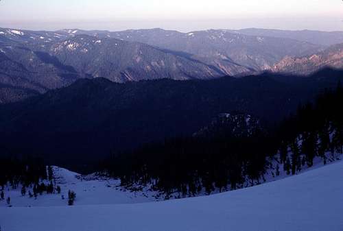
![Kings Canyon]() Looking back down to Kings Canyon from the Lewis Creek Trail.
Looking back down to Kings Canyon from the Lewis Creek Trail.My pack seemed fairly heavy for a mere two day trip. My hips were already complaining as I slowly made my way up the Lewis Creek Trail in the dim light of a predawn sky. I knew that there would be plenty of snow, so I had my crampons, ice ax and snowshoes strapped to my pack. I was also bringing my relatively heavy, but comfy mountain tent (as opposed to my lightweight plastic 'tube tent') in case the weather decided to surprise me. In the spring, sometimes you never know.
The trail contours steeply above the narrow gorge of lower Lewis Creek before emerging onto more moderate slopes near an unnamed creek coming down from the the southern end of Comb Spur. As I crossed the creek, I noticed that everything- pine needles, bushes, and even uphill facing tree bark had been stripped away a full 10 feet or so above the current creek level. The evidence looked pretty fresh and I speculated that a significant avalanche must have traveled down the ravine from somewhere high above- probably during the previous winter.
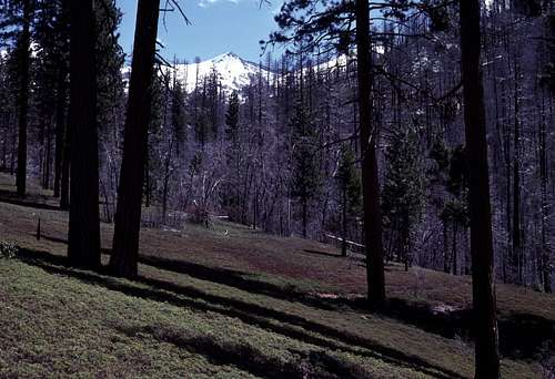
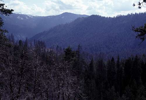
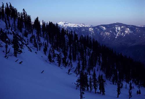
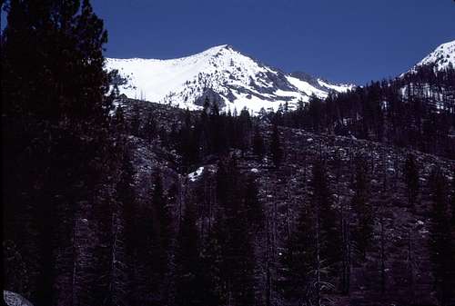
Beyond the creek, the trail levels off a bit and contours through a lovely forest as it slowly climbs toward the crossing at Comb Creek. The views of the Monarch Divide high above to the north, were sublime. The peaks were still deeply covered in snow and appeared magnificent. I was psyched! I knew that the still unseen peaks of Comb Spur were going to be epic.
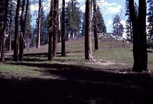
Just before where the trail crosses Comb Creek, I reached the spot where I planned to leave the trail and start heading up a broad trail-less ridge into the unknown. Where I thought that there would be some unpleasant bushwhacking, the bushes were only about calf high and posed almost no hindrance. There was even a very vague use trail that I was able to follow for about a quarter of a mile or so. The only thing that was unpleasant, was the fact that I couldn't see the actual ground where I was putting my feet due to the low ground cover. I hoped that I wouldn't encounter any surprised rattlesnakes under those bushes. As I slowly climbed through a partially burned out forest, I became thrilled to finally see the peaks of Comb Spur emerge into view through the trees up ahead to the east.
![Near Lewis Creek]() The beginning of the cross country portion of the trip.
The beginning of the cross country portion of the trip.
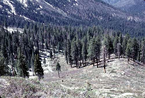
| ![Cross Country Near Comb Spur]() Cross country approach. Comb Spur high point is in the background.
Cross country approach. Comb Spur high point is in the background.
|
Eventually, at about the 6700 foot level, the broad relatively easy ridge crest I had been following became a brush covered side hill. It seemed that the real bushwhacking had finally begun. No problem. I'd been expecting this. I shoved my way into the thick chest high brush and after about 4 or 5 minutes, to my surprise, I popped out of it and into an open forest near an unnamed tributary of Comb Creek. As it turned out, that was the only bushwhack on the entire trip. Very nice and unexpected.
I dropped into the ravine containing the unnamed tributary and climbed out near Comb Creek itself. It was time to start looking for a place to cross this creek. The volume of water was pretty significant that spring, and it took some time to finally find a safe place to cross. I picked a spot where there was a combination of boulders and a fallen log.
Once across Comb Creek, I climbed a steep loose bank and found myself in an area of what seemed to be some ancient moraines of the prehistoric 'Comb Glacier'. There were some hillocks and small ravines to negotiate in a beautiful open forest with a thick primeval duff layer. Cross country travel was easy and fun in this area. I knew that there was a good chance that only a handful of people had ever been to where I was now walking. Goddamn, this was cool!
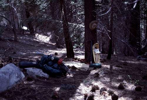
I found the northern branch of Comb Creek and followed it to the base of a steep ridge rising to the northeast. This area was fairly level and close to the creek, so even though it was only about mid day, I decided to camp here. The map showed that the route above would be continuously steep for the next several thousand feet and I didn't think there would be another opportunity for snow free level camping for much of the way. Over the years, I returned to this spot many times and eventually named it, “Comb Camp”.
![Comb Camp]() "Comb Camp"
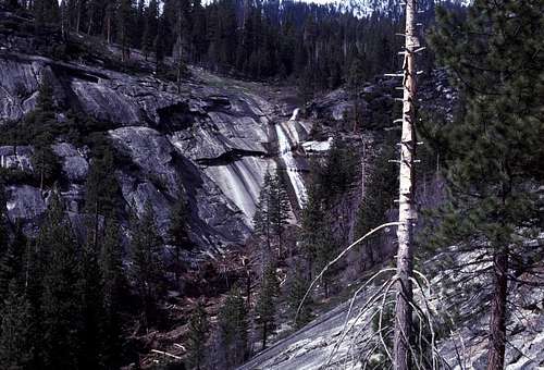
"Comb Camp"I hadn't had much sleep since the day before, so I spent most of the rest of the day napping and doing some exploring in the vicinity with my camera. I found a rather nice little waterfall just upstream from camp. I was elated! In terms of wild, rugged mountain scenery and isolation, I felt as if I'd discovered gold. I couldn't wait for the next morning when I would continue up the ridge and penetrate even deeper into the unknown.
I was up early the next morning- very early. Probably around 2 am. The idea was that I wanted to be down off the mountains before the sun began to warm up the snow slopes. I was well aware of the possibility of spring avalanches at this time of year. By headlamp, I retrieved some trail snacks and sunscreen from my counterbalanced food bags in a nearby tree and was on my way.
The first part of the ridge is a steep narrow slabby climb interspersed with trees, brush and a lot of downfall. It was a good thing that I'd reconnoitered the lower part of the route the previous afternoon. It made navigating by headlamp somewhat easier that dark morning. But it wasn't long before I was beyond my highpoint and navigating through new territory.
The night was very cold and there was no moon. (Sounds a bit like the beginning of a mystery novel, doesn't it?) The sky was a brilliant explosion of stars. The snow clad mountains that I could see up ahead seemed to glow in all that starlight and I stopped more than once to take it all in. It was moments like this that made me feel very lucky and grateful that my path through life led me to this wacky lifestyle.
The ridge I was following eventually transitioned from narrow open slabs to being broader and moderately forested. There were patches of snow that quickly became pretty continuous as I climbed ever higher. The angle of the ridge alternated between moderately steep to almost level. I was in pretty decent shape and able to climb at a pretty good rate.
I reached a level section where the tree cover had thinned and the snow had become patchy. It was here that I saw something lying on a dark patch of bare ground brightly reflecting the beam of my headlamp. When I saw what it was, it almost spoiled the mood, but I decided not to let that happen. I did have to admit to myself something that I sort of suspected all along (but didn't want to acknowledge): Others had been here before- and recently. I reached down and picked up the small empty plastic juice bottle and shoved it into one of the pouches of my daypack. Damn litterbugs!
At the 8500 foot level, I was a bit surprised to suddenly exit the forest at the bottom of a long steep treeless slope. This wasn't quite what the topo map showed and I double checked my altimeter which had seemed pretty accurate up til now. I started to wonder if I was even on the correct ridge. I did some map checking and, yes, I was on the correct ridge, but for some reason, the treeline was about 2 or 3 hundred feet lower than what the map showed. I shrugged it off as an inaccuracy of the map. The important thing was that I wasn't lost. I hoped.
The steep treeless slope was devoid of snow and consisted mostly of small shrubs that were easy to negotiate even in the dark. At the top of the slope, I climbed over a significant amount of deadfall and reemerged onto the snowpack- this time for good. I had arrived at the lip of a hanging valley that would eventually culminate on the crest of the Monarch Divide and Comb Spur.
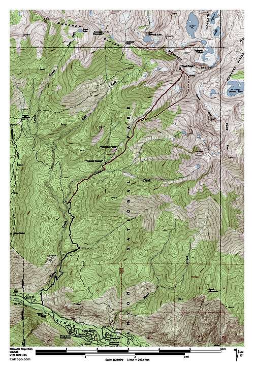
![Route Map]() The trail is indicated by the blue line. The solid red line was my cross country route. The dotted red line was my intended route not taken.
The trail is indicated by the blue line. The solid red line was my cross country route. The dotted red line was my intended route not taken.
| ![Approaching Dawn]() Approaching Dawn from the hanging valley.
Approaching Dawn from the hanging valley.
|
It was decision time. I had wanted to make a traverse of Peak 11572- which is where Comb Spur joins the Monarch Divide- and Peak 11520+ which is the northern most summit of Comb Spur (see map). I originally thought that it would be fun to continue up the long ridge that I'd been following from Comb Camp to reach the latter summit and traverse from there over the former peak to a col that lies to the northwest along the Monarch Divide. But, I was still very concerned about the possibility of spring avalanches so I decided to do the loop in reverse so that I could be out of this hanging valley before everything warmed up later in the day. With that in mind, I began hiking up the hanging valley toward the obvious col to the northeast as the sky began to lighten significantly with the approaching dawn.
![Peak 11520+]() Peak 11520+ is the northernmost peak of Comb Spur.
Peak 11520+ is the northernmost peak of Comb Spur.
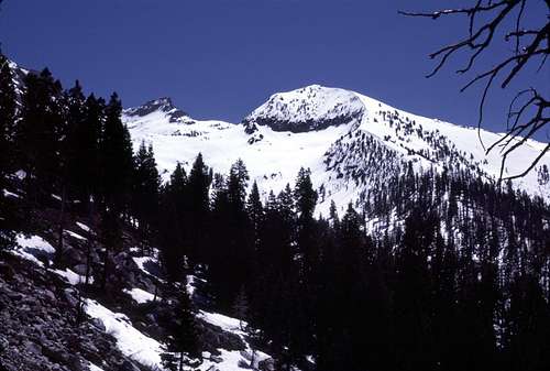
| ![Curl Col]() The col on the Monarch Divide that I was aiming for.
The col on the Monarch Divide that I was aiming for.
|
The lower part of the hanging valley was a minefield of semi buried deadfall that created hidden hollows beneath the snow surface. It quickly became rather tedious so I altered my route towards the smoother more solid appearing snow in the middle of the valley where I sat on an exposed tree trunk to put on my snowshoes.
![Mount Silliman]() Distant Mount Silliman catching the sun.
Distant Mount Silliman catching the sun.
| ![West Toward Lower Kings Canyon]() View west toward lower Kings Canyon and the western regions of the park.
View west toward lower Kings Canyon and the western regions of the park.
|
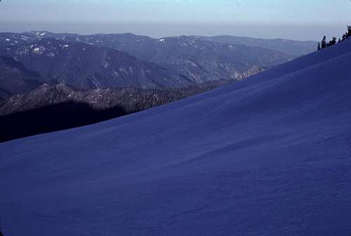
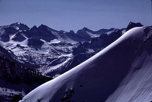
The steep snow was perfect for snowshoeing and I made very rapid progress toward the upper steep sections of the hanging valley. I had been to the mountains many times before, but this was surely one of those rare times when I felt like I was really mountaineering. The biting crunch of my snowshoe crampons and ice ax spike in the frozen snow along with the incredible views- especially to the west- was intoxicating.
![West From Upper Hanging Valley]() View west from the upper slopes of the hanging valley.
View west from the upper slopes of the hanging valley.
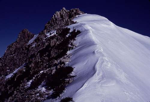
| ![Spur Ridge]() Part of a long spur ridge that extends from the Monarch Divide to Lewis Creek.
Part of a long spur ridge that extends from the Monarch Divide to Lewis Creek.
| ![Southeast Slope of Spur Ridge]() Looking up the southeast slope of the spur ridge.
Looking up the southeast slope of the spur ridge.
|
Yeah, that was a good moment and so it was quite stunning just how abruptly things became so damn miserable...
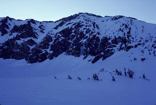
Soon, I reached the foot of the steep snow slope at the base of the col I had been aiming for. I was feeling pretty strong and I was able to climb the steep icy snow fairly quickly. I couldn't wait to see the view from the top, so I picked up the pace a bit. Just below the crest, I started to feel a little dizzy. Maybe I was going too fast? I stopped and rested in my steps. Eventually, the dizziness faded, but my stomach began to churn rather uncomfortably. Was I going to heave? Oh man! When was the last time I'd eaten anything? Thinking... A granola bar at least a couple hours ago when I was below that steep treeless slope far below. Too long without refueling. A rookie mistake. Damn! It was too steep to do anything about it now so I slowly struggled to the top of the col.
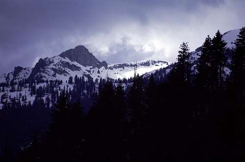
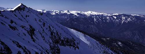
The col- which is actually along a NW to SE trending part of the Monarch Divide- had a stunning view. Rarely have I seen such a panorama of peaks so deeply ensconced in snow this late in the season. It was almost mid-May, but it looked like mid-March. Just amazingly beautiful and impressive. I tried to forget how wretched I felt as I forced myself to take a couple of pictures.
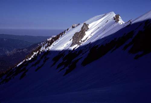
![Peak 11572]() Looking up the northwest ridge of Peak 11572 from the col.
Looking up the northwest ridge of Peak 11572 from the col.
| ![Curl Peak From the Col]() Peak 11440+ from the col.
Peak 11440+ from the col.
|
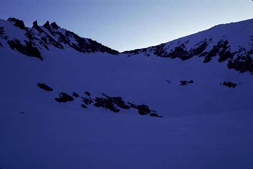
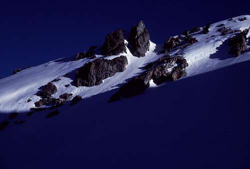
In spite of the amazing view, I found myself distracted by the struggle to keep my stomach under control. Ugh! I needed a comfortable place to take a break so I could recover. The route I planned to take- to the southeast up Peak 11,572 was mostly continuous snow to the top. Looking northwest, I spotted a peak whose summit consisted of dry warm looking boulders. This was designated on my old map as Peak 11,443. It was only about 250 feet higher than the col, so I pointed my snowshoes in that direction and began to climb the ridgecrest on the weird wind sculpted snow.
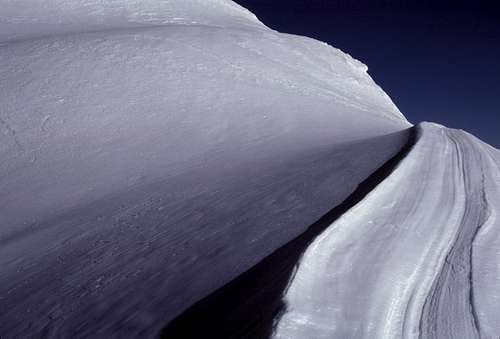
![Wind Sculpted Snow]() Wind sculpted snow along the ridge toward Peak 11440+.
Wind sculpted snow along the ridge toward Peak 11440+.I felt worse and worse as I struggled to the top of the rocky peak. What a change from just 20 or 30 minutes earlier! I knew I had a bad and rare case of altitude sickness- maybe the worst ever for me. I deliberately breathed much more deeply and rapidly than needed to replenish my body's oxygen supply, but it appeared that the damage was done. Shit!
![Southeast Ridge of Curl Peak]() Looking down at my snowshoes on the SE ridge of Peak 11440+.
Looking down at my snowshoes on the SE ridge of Peak 11440+.
| ![Summit Block of Curl Peak]() The summit block
The summit block
|
At last, I reached the edge of the snow and removed my snowshoes. I weakly climbed the rocks to the summit- well almost the summit. The actual highpoint was a small, but nicely shaped block of granite about 6 feet high, if I recall correctly. I didn't see an obvious way to climb it and, quite frankly, at the moment, I wasn't in the least bit interested. I just wanted- needed- to sit down. Which is what I did- putting my head down between my knees and staring at the rocks between my boots taking frequent small sips of water and deliberately hyperventilating.
Lethargy swept over me like a tsunami. I knew I needed to eat something. My brain cells demanded it, but my stomach cells were not going to cooperate. Usually, in my case, slowly consuming crackers was a good cure for the nausea brought on by AMS, so I always brought a small box or two of Cheez-Its. This trip was no exception, so I started to reach for my pack, but then I stopped. I suddenly realized that I'd very cleverly left my crackers inside the food bag that was counterbalanced in a high tree about 4,000 feet below back in Comb Camp. Sometimes I'm a regular Albert Einstein.
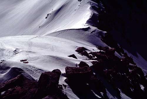
![Hanging Valley From Curl Peak]() Looking straight down into the hanging valley and my approach.
Looking straight down into the hanging valley and my approach. | ![My Approach Route from Curl Peak]() Looking down the hanging valley toward the bottom of Kings Canyon.
Looking down the hanging valley toward the bottom of Kings Canyon.
|
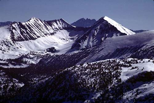
![Panorama South from Curl Peak]() Looking south from "Curl Peak". Peak 11520+ is on the left. Mount Silliman is in the distance on the right.
Looking south from "Curl Peak". Peak 11520+ is on the left. Mount Silliman is in the distance on the right.![Annotated Zoom Toward Comb Spur High Point]() Annotated zoom toward southeast.
Annotated zoom toward southeast.
| ![Peak 11572 from Curl Peak]() Peak 11572; where Comb Spur joins the Monarch Divide.
Peak 11572; where Comb Spur joins the Monarch Divide.
|
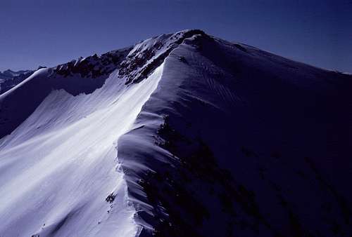
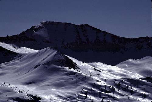
I rummaged through my pack and found a bag of dried apricots and some pepperoni sticks. My stomach sent me an urgent warning against the greasy pepperoni, so I stuck with the apricots. As I nibbled them and sipped some water, I found the summit register wedged between a couple of the rocks I was sitting on. I don't remember much about it except that the party that left it up there had named the peak, “Curl Peak”. I didn't get it at first, but then I realized that it was probably due to its proximity to Comb Spur. I wondered if all the peaks of Comb Spur had 'hairstyle' related names.
| 200 Degree (Approx) Panorama From Summit |
I started feeling a little better so I got up to take some pictures of the incredible view. The scenery was like a dream-scape; it just didn't seem real. I wandered over to the summit block to size it up. I wasn't so sure about the side facing me. Could I climb it if I was feeling 100 percent? Maybe, but first I'd probably traverse around the northeast side to see what it looked like from the southwest. The traverse, which was mostly along the top of a steep snowfield, looked tricky and would demand more focus and strength than I had at the moment. Nailing this thing was just going to have to wait until my next visit- whenever that would be. (Sadly, as it turned out, never.)
Before long, I decided to start heading down. The nausea had faded, but I still felt enshrouded by a thick blanket of lethargy. Putting my snowshoes back on became a major effort, but soon I was following my tracks back down the ridgecrest to the col. There was no chance that I was going to continue on with my originally intended route to Comb Spur. I was depressed and felt like a big douche-bag. (Still do.) I tried to rationalize by planning to return next year.
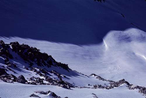
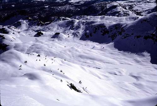
One thing I didn't have to rationalize was my decision to head down the hanging valley this early in the day. There was far more evidence of potential avalanche hazards than I'd been able to see in the dim light earlier that morning. In addition to some typical wet slab slides from the upper slopes of nearby peaks, I was now seeing hundreds of 'sun balls' that had come down the lower slopes below the surrounding cliffs. 'Sun balls' (which are little snow balls that spontaneously roll down a snow slope) are usually regarded as evidence of unstable snow.
The snow I was on was just the right consistency for plunge stepping down the steep slope, so I removed my snowshoes at the top of the col. I made quick progress down the steep slope which was probably a good thing given that all around me was evidence that I was in some serious avalanche country. I seemed to be in a shooting gallery that hadn't quite yet opened for the day. I hurried down- only pausing briefly now and then to take a couple of pictures.
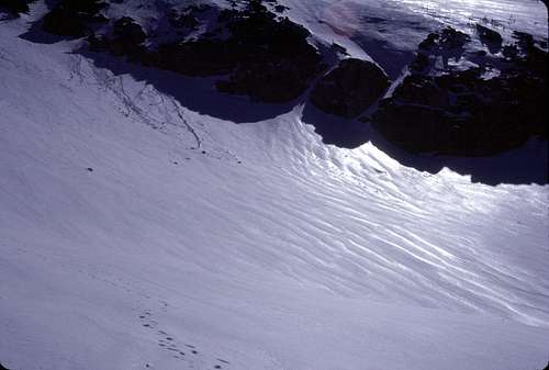
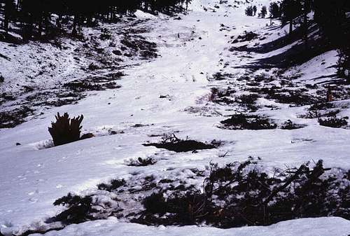
![Mini Avalanches]()
Some s
mall recent slides.
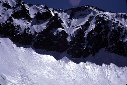
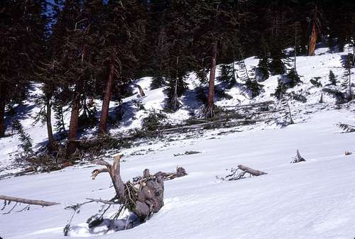
As I approached the lower part of the hanging valley, I had kind of a revelation when I saw, in the light of day, what had actually occurred there to cause all that deadfall I'd encountered that morning. It seems that sometime during the previous winter, there had been a monstrous avalanche that had swept down and pretty much destroyed everything in its path.
I saw smashed trees sticking up out of the snow that looked like they had been hundreds of years old before being reduced to shattered trunks and splintered branches. This was no mere wet slab slide. I'm no expert, but the evidence seemed to indicate that this was a 'climax avalanche'- the 'EF5' of avalanches. It's a safe bet that no human eye saw it happen in the dead of winter dozens of miles from the nearest plowed road. What a spectacle it must have been!
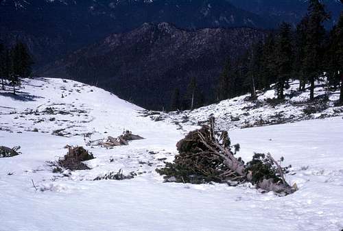
![Upper Path of Avalanche]() Swath cut by a possible climax avalanche.
Swath cut by a possible climax avalanche.
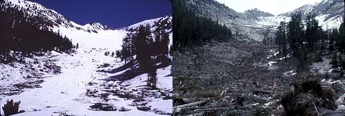
| ![For Comparison Purposes]() Left is the view in 1986; right is the view in 1987- a drought year- from almost the same location.
Left is the view in 1986; right is the view in 1987- a drought year- from almost the same location.
|
When I reached the lip of the hanging valley, I saw 'the rest of the story'. Below I could look down the bare slope that had confused me just before dawn that morning. This wasn't supposed to be a treeless slope according to the topo map. It seems that the avalanche had removed almost every tree on the entire slope. I found spots where entire trees had been literally ripped out of the ground leaving behind only the truncated roots surrounding round deep craters. Not only that, but the ridge itself had acted like a cleaver- dividing the avalanche into two separate branches. The south branch terminated hundreds of feet below in acres of smashed trees that choked the valley that lay south of the ridge.
The northern branch- the main one- continued down the course of the creek toward my camp. In my notes, I named this, “Green Creek” because of the profusion of green pine needles that had stained the ground and the snowbanks that lined it a distinct greenish color. I wondered how far down “Green Creek” the carnage went. I finally got an answer when I was almost back to camp. The waterfall I'd 'discovered' the day before had a huge mass of smashed trees at the foot of it that I hadn't really noticed the day before. Apparently, this was the terminus of the avalanche since there was no discernible wreckage below that area. So I gave the waterfall a name as well: “Climax Falls”.
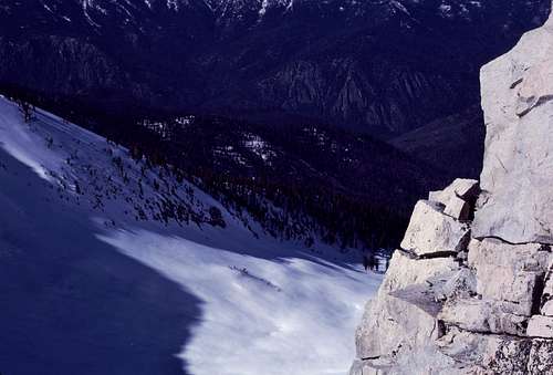
It didn't take me long to break camp and pack everything up for the hike back down to the trailhead. I basically followed the exact same route as my ascent. The only unpleasant parts were the tricky stream crossing at Comb Creek and the short bushwhack I described during the approach. I was actually amazed at how relatively easy it was to find my way up into this interesting, scenic and seldom visited region.
Soon I was back on the Lewis Creek Trail and I finally arrived at the trailhead by late afternoon. Nothing left but the long drive back to San Jose (with a traditional stop at the Jack-In-The-Box in Fresno).
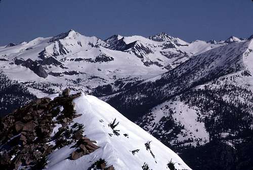
![Mount Palmer]() Parting shot of Palmer Mountain from Cedar Grove Road.
Parting shot of Palmer Mountain from Cedar Grove Road.
For me, there's always an interesting adjustment period to go through after arriving home from a mountain trip. This time was no exception. After a hot shower, I sat down with a simple dinner to watch the late news. I was paying attention with only about half my mind. The other half was still trying to wrap itself around the events of that day. It seemed hard to believe that this was still the same day that I'd awakened in the dark wee hours of morning, found my way up thousands of feet of steep untracked forest and snow to the crest of the Monarch Divide, and had a rare (for me) and intense bout of AMS while (almost) bagging an unnamed summit. Then there was the discovery of the massive avalanche and the long drive home. Man, what a day!
When the news anchor began an update regarding the Chernobyl disaster, my attention snapped to the TV. I suddenly remembered something that I'd totally forgotten about while on the trip. During that long drive to Kings Canyon... The news story on the radio about the fallout cloud drifting over California at, what, 10,000 feet? A disturbing question began to take form in my weary mind: Was that really AMS I had suffered from? Or something much more sinister?
Na! No F***ing way! If I had gotten radiation sickness I'd still have symptoms like that terrible nausea I'd experienced. There would also be bloody stools and urine- wouldn't there? I remembered that I felt fine and pretty much recovered by the time I was about half way down that hanging valley- somewhere below... what... 10,000 feet?
Oh, man! But... No. I think I almost talked myself into actually believing that I'd become cooked on Curl Peak, but luckily I came to my senses after a good night's sleep.
What really happened was I went from sea level to over 11,000 feet in little more than 24 hours without proper acclimatization. (Not unusual for me.) I was in excellent condition so once I got to those nice smooth firm snow slopes, I was able to climb very quickly. Too quickly. (That's unusual.) All this was exacerbated by my failure to stay properly fueled and hydrated. (Oops.)
So anyway, it's been more than 25 years since I took that trip, and I'm still kicking and reasonably healthy. (However, my son was born with gills and can breath underwater like a fish... Ha! JK!) I'm just glad that while I was up there, my oxygen and food deprived brain had forgotten about that fallout warning. I really didn't need the extra dimension of worry during those blurry moments on Curl Peak.
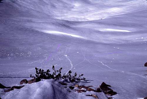
But, then there's still the mystery of this photograph:
![Charged Particles?]() Radioactive particles affecting unexposed film? (Note the purple streaks.)
Radioactive particles affecting unexposed film? (Note the purple streaks.)


Comments
Post a Comment