
|
|
Route |
|---|---|
|
|
31.04773°N / 7.91726°W |
|
|
Hiking, Mountaineering, Skiing |
|
|
Spring, Summer |
|
|
A few days |
|
|
T3+ |
|
|
Overview
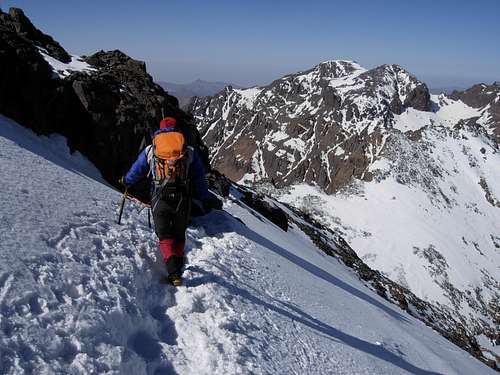 Jebel Toubkal final crossing by Silvia Mazzani | 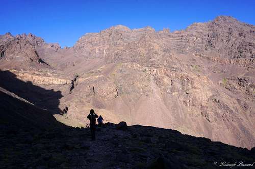 Along the South Cwm at 3400 meters |
Jbel Toubkal is the highest mountain in the Moroccan High Atlas and therefore the highest mountain in Northern Africa. Two main routes lead up to the summit of Toubkal: The South cwm (also called Ikhibi Sud) and North cwm (Ikhibi Nord) routes. The South Cwm route is slightly easier compared to the North Cwm Route and most people who summit Toubkal do it along the South Cwm route. Therefore, the South Cwm route is mostly referred to as the normal route on Toubkal. The split-up between these two routes is near the Toubkal Refuges at 3200 meters. The larger part of these 2 routes, between Imlil and the Refuges, is the same. All major routes to Jbel Toubkal start in the village of Imlil: ‘’the gateway to Toubkal’’. Imlil, at 1740 meters, is quite easily reached from Marrakech. The part between Imlil and the Toubkal Refuges, the larger part of the normal route, is described here as well.
Climbing Toubkal via the normal route requires at least two days. Day one consists of climbing up from Imlil to the Toubkal Refuges. The second day is used to summit and the return (the same way back) to Imlil, which is a (very) long descent. Alternatively, you can traverse Toubkal and descend the mountain via the North Cwm Route. Because of the long descent from Toubkal to Imlil (2400 vertical meters), it is also a good option to spend another night in the Toubkal Refuges and descend back to Imlil on the third day.
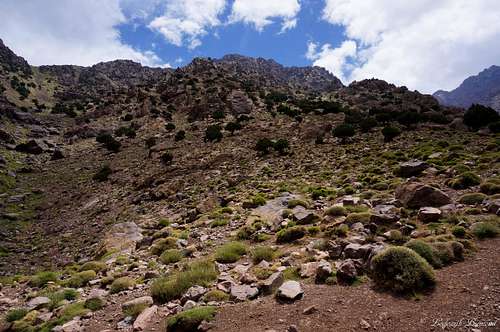
The normal route is graded T3+. The first part from Imlil to the Toubkal Refuges is mostly T2 and T3 on (in summer) very well visible trails. The summit part of the route (South Cwm), is mostly T3 with a couple passages slightly more difficult: T3+.
Route part 1: Imlil - Toubkal Refuges
 1. Imlil town Centre |  2. The shops just before the start of the trail | 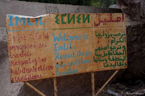 Imlil Sign |
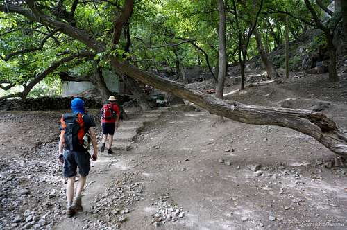 3. Start of the trail just outside Imlil | 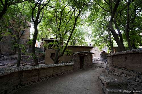 4. Crossing the forest | 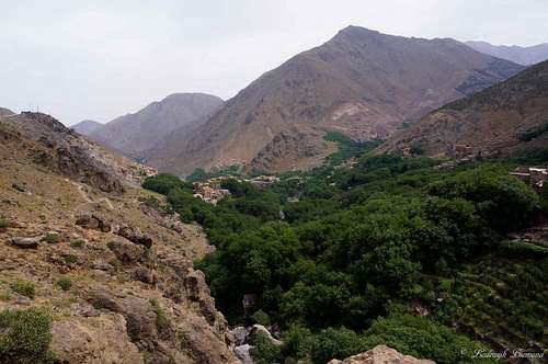 5. View from the Trail back to Imlil |
The normal route to the summit of Jbel Toubkal starts in Imlil at 1740m. Imlil can be reached easily from Marrakech. See the section ‘’How to get there’’ for more information. First of all, go to the town’s center (1.; The numbers correspond with the numbers of the photos). This is where the river crosses underneath the main road. From here, a smaller, paved road leads towards the south, follow it. You will pass a street filled with small shops (2.). Be prepared, the owners will try to sell you all kinds of stuff. Continue towards the south for some more minutes. The paved road stops and changes into a hiking trail. At this point you’ll leave Imlil and enter a forest (3.,4.). Follow the trail towards the south. At this point the trail is gaining quite some elevation. After about 20 minutes the trail leaves the forest again. You can see the canopy to the east of you (below). The trail continues towards the south along the western face of the valley. Opposite to you, on the other side of the valley, Aremd (1950m) is dominating the view (6.,7.). Keep following the trail towards the south. When you look back you have some great views over Imlil as well (5.).
 6. Aremd and the Trailhead | 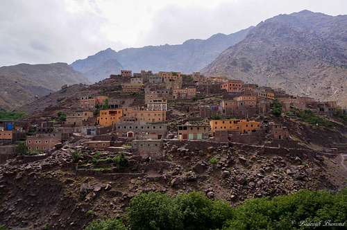 7. Beautiful Aremd (1950m) | 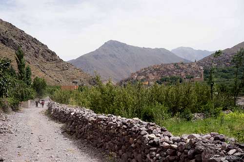 8. Normal Route with Aremd |
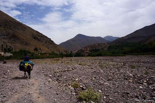 9. On the Floodplain | 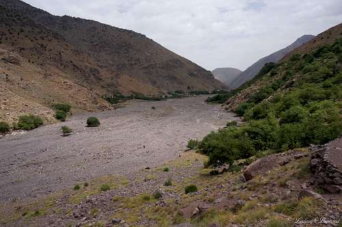 10. The big Flood plain | 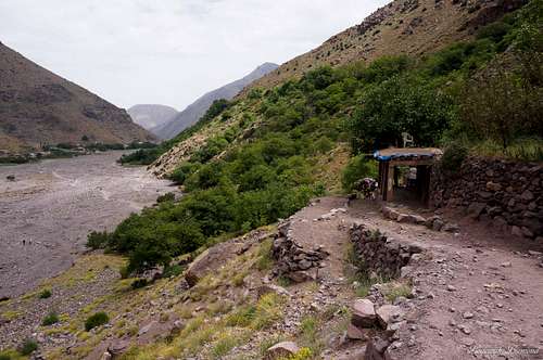 11. The trail directly after leaving the Plain |
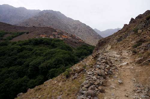
Shortly after passing Aremd the trail gets back to the valley floor (8.). The big floodplain is up ahead now. Cross the floodplain along the whole length and leave it at the south-eastern end (9.,10.). The trail is (if there is no snow present) visible throughout this whole section. The trail continues on the eastern slopes of the valley and keeps heading south (11.). The trail is gaining some more elevation at this point and vegetation is decreasing (12.,13.). After an hour of hiking (14.), and passing some shops with friendly Berber’s trying to sell you stuff, you will eventually reach Chamharouch. Just before it, there is a junction in the trail, take a right here. If you take a left the trail leads to the Tizi ‘n Tarharat (saddle, 3670m). Chamharouch is a small village at 2350meters a.s.l. famous for its large boulder (15.). This boulder is painted white and below it is a mausoleum with a so-called tomb of the Kings of Jinns (translated Chamharouch). Many people stop here for some drinks and to enjoy the river/waterfall that flows through the village. After crossing the river at Sidi Chamharouch, you are again on the left bank. Do not stay too close to the river, for the road might be a little difficult to find. It stays relatively higher on the flank. If in winter, you should be crossing the snowline by now. Follow the trail through the village and after a couple minutes you have left Chamharouch again.
 12. Looking up from the trail | 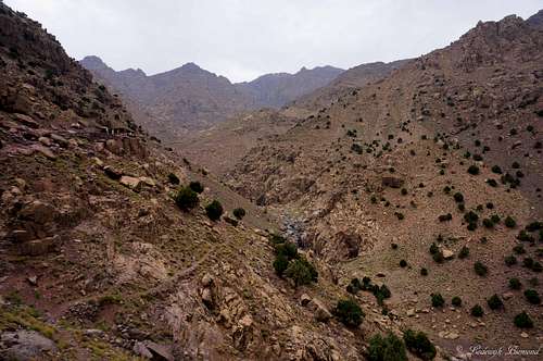 13. Rugged Atlas Mountains | 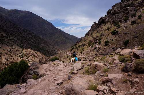 14. Along the Trail beneath Chamharouch |
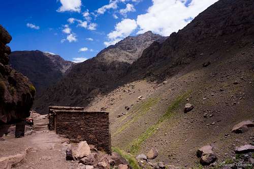
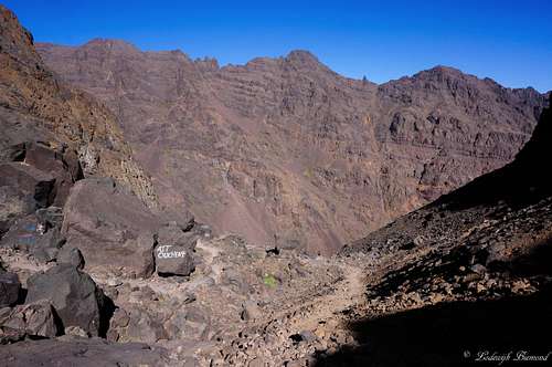
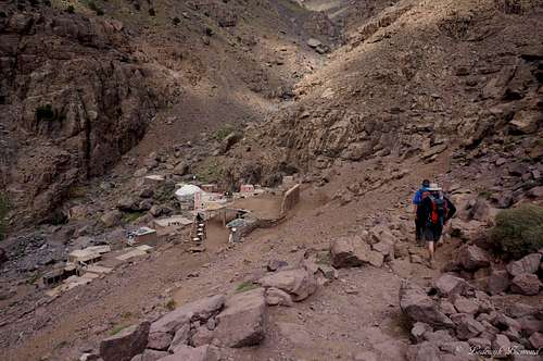 15. Chamharouch | 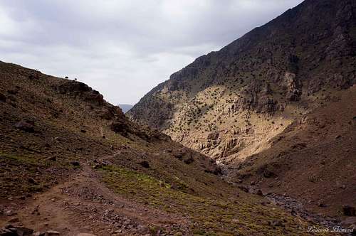 16. View back down to Chamarouch | 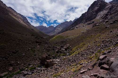 17. the Toubkal Refuges in the distance |
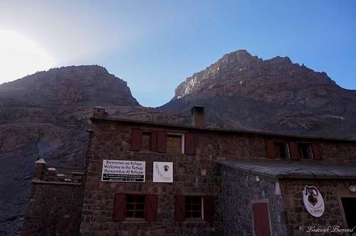
The trail is still very well visible and continues towards the south.(16.) The amount of vegetation on the hillslopes is rapidly decreasing. There are som emosses and small plants present, but the area is now dominated by the typical brown/reddish rock. Large peaks rise up from the valley floor, many over the 4000 meter barrier. The trail steadily keeps gaining elevation and follows the western flank of the valley.(17.) Down to your left you can see the Assif ‘n Isougouane river at all time. Behind it, high peaks like Tichki (3753m) and Afekhoi (3755m) are dominating the view.(18.) Out of sight, more towards the south are Tibherine, Imouzzer (4010m) and of course Jbel Toubkal (4167m). Soon you will reach the 3000m barrier and the Toubkal Refuges can be spotted in the distance for the first time.(19.,20.) It’s not far to the refuges anymore. Some 30 more minutes and you’ll arrive at the Toubkal Refuges at 3204m. a.s.l. (21.,22.) Spent the night in (or camp in front) ether the Refuge du Mouflons (‘’new hut’’) or the refuge Neltner (‘’ old hut’’) and leave for the summit the next day.
 18. Atlas Mountains at 3000 meters | 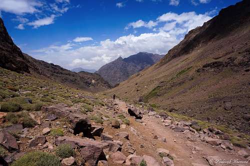 19. The trail just beofre the Refuges | 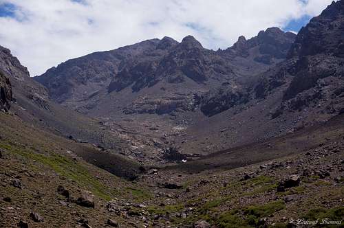 20. Refuges (3200m) with Timesguida (4.089 m) |
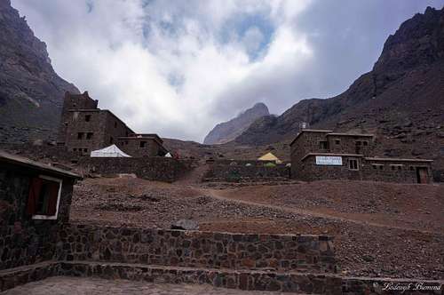 21. Toubkal Refuges with Ras n Timesguida | 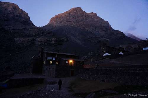 22. The Refuge & the Saddle behind |  Sunset from the Refuges at 3200m |
Route part 2: Toubkal Refuges - Toubkal Summit
 23. Early morning view on the saddle | 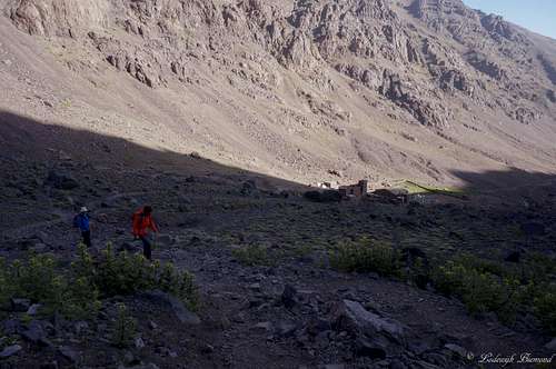 24. The split-up just above the Refuges | 25. Heading towards the saddle |
 26. The saddle at 3500m | 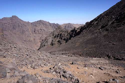 27. Looking down the West Face | 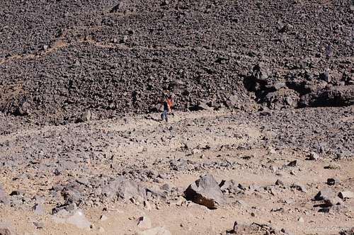 28. just before the Tizi 'n toubkal saddle |
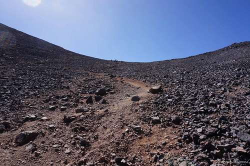
Looking up towards Toubkal from the Refuges you’ll notice Toubkal itself is out of sight. What you do see is a saddle point confined by Gui Imlil (3560m) to the left and Tete d’Ouanoums (3970m) to the right. This saddle, right in front of Toubkal, is where you need to go.(23.) First, leave the Refuges ina southern direction. After a couple of minutes you’ll notice some trails branch off to the left in the direction of the saddle. Leave the main trail (24.) (the main trail continues going south towards Ras and Timesguida) and keep heading east in the direction of Toubkal and the saddle in front of it. The trail zigzag’s up the eastern face of Toubkal and is rather steep.(25.) I would say the grade is T3+ here. Besides the relative steepness, this is the part of the trail which is most difficult to recognize. At some points it is difficult to locate the trail. You can use the paintings on the large boulders for route finding. (these painting look more like graffiti though, and are not nice to look at to say the least). After some 30-45 minutes you’ll reach the saddle (26.) and the trail gradually becomes less steep.(27.,28.) At this point you can see the mighty Toubkal for the first time. Keep heading up the west Face (29.) of Toubkal towards the saddle (Tizi ‘n Toubkal) that connects Toubkal West (4040m) with Toubkal itself. At the saddle (30.) you have the first view towards the south. You are able to look down into the deep towards the immense Sahara Desert. All you can see is sand and nothing but sand, until the haze, consisting of sand in the air, blocks the eye from viewing any further.
 29. The trail towards the Tizi 'n Toubkal Saddle | 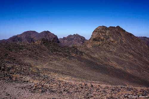 30. Toubkal West from the Tizi Col | 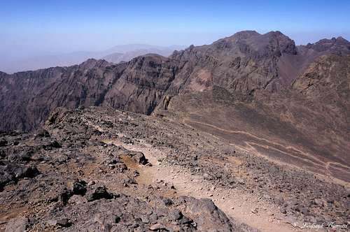 31. Ras Ouanoukrim from the Tizi col at 3900m |
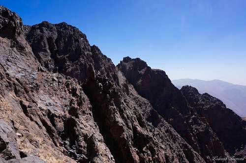 32. The steep S-Face as seen from the final ridge | 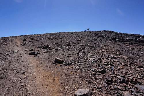 33. Nearing the summit of Toubkal | 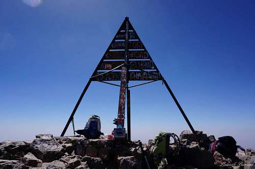 34. Jbel Toubkal Summit (4167m) |
From the Tizi ‘n Toubkal saddle the trail leads over the S-SW face (31.) , almost in a straight line, towards its summit. Watch out for the big drop to your right (the steep South Face) (32.).This last part is somewhat steeper again (T3), but relatively easy in the summer period when there is no snow. In winter you have to be more careful though: Stick not too far from the big vertical drop to your right, and do not go too low to your left, the slope gets more and more angled and is dangerous in winter. (usually dead hard frozen). Most accidents happen here. After another 30 minutes, the typical, pyramid shaped summit structure comes in sight (33.) and soon after you’ll reach the roof of Northern Africa: Jbel Toubkal at 4167 meters.(34.) For the descent there are two options. Ether go down the same way or traverse the mountain and descend along the North Cwm Route. Just below the Toubkal Refuge the North Cwm route joins the original route back to Imlil.
Route Overview
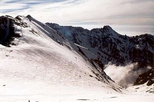
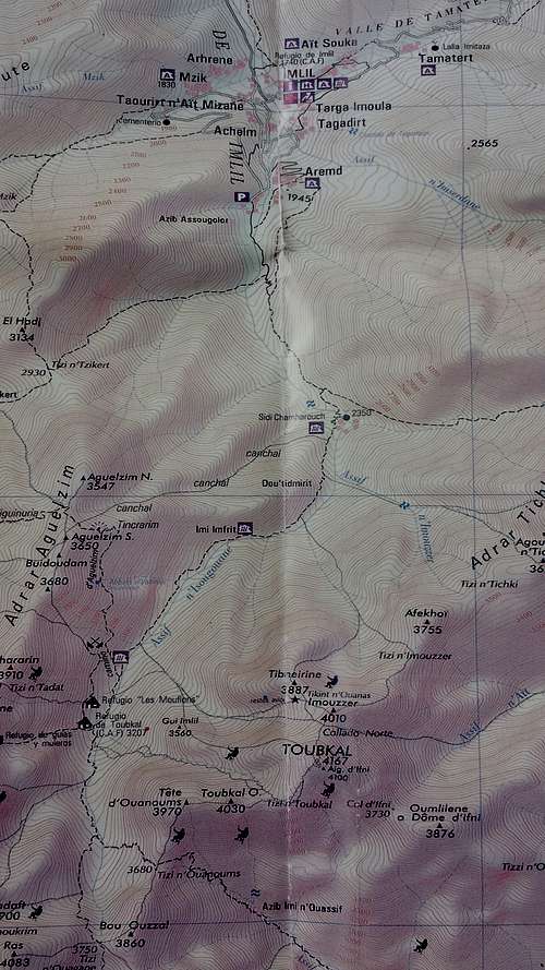 ROUTE MAP | 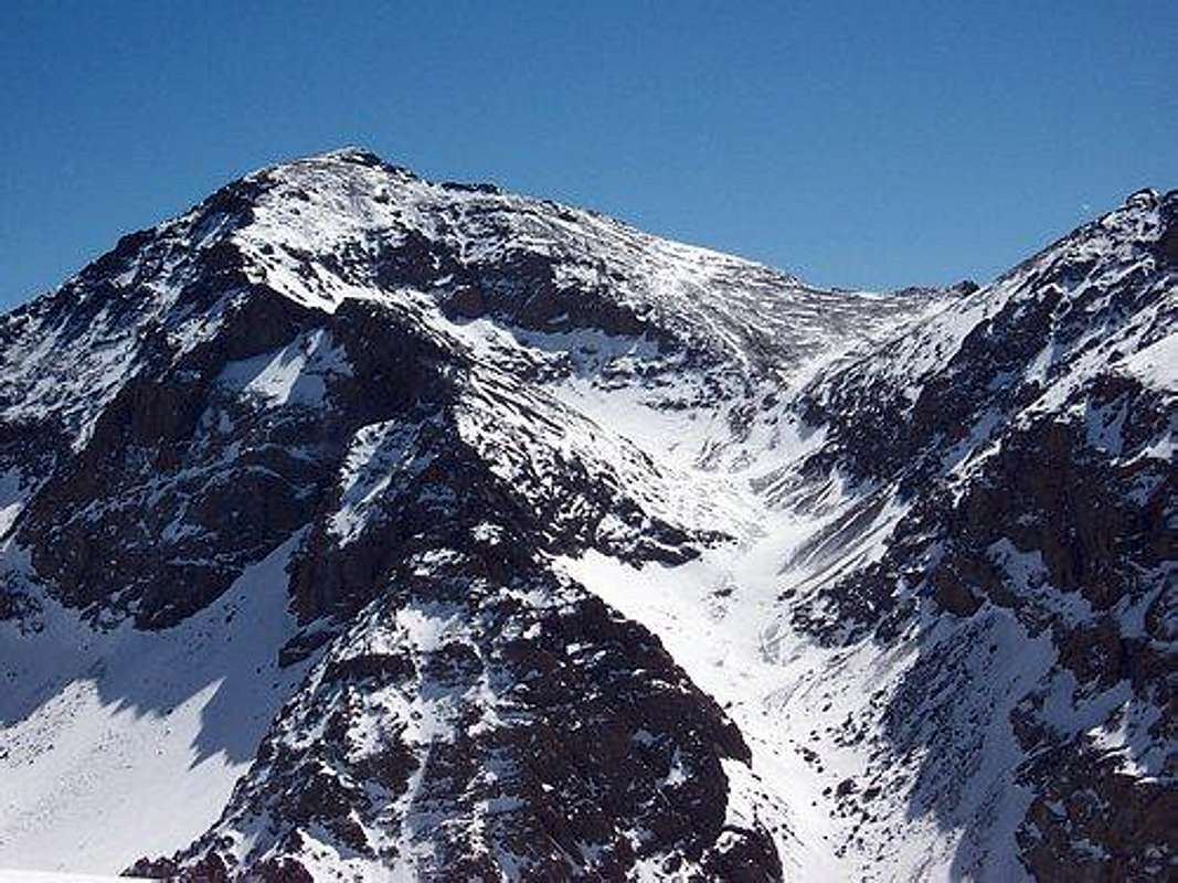 Toubkal South Cwm: The whole upper part of the route is very well visible on this photo; it leads through the couloir up to the saddle at right. From there it goes more or less directly to the summit at left |
Essential Gear
 Jebel Toubkal summit signal by Silvia Mazzani | 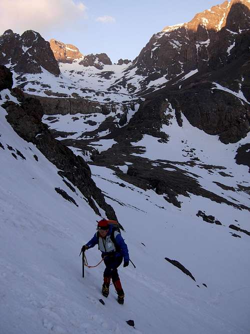 Jebel Toubkal Normal Route | 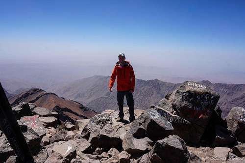 Summit of Jbel Toubkal ; July |
Good hiking shoes are mandatory. There is a lot of scree along the route, I saw many people slipping. You have to be careful with your ankles so wear high shoes. Climbing gear is not needed. Furthermore, take warm clothing with you, even in summer. Temperatures can drop below zero, even when temperatures are as high as 40 degrees during the day in Imlil. Take some shorts and T-shirts as well.Finally, the sun is immensely strong on the higher parts of the mountain. Take something to cover your head with, to protect yourself from the sun. I didn’t use gloves , a shawl etc.
In spring and winter the biggest part of the mountain is covered with snow. Along with the warm clothing climbing gear can be useful. Especially crampons and an ice axe. A rope is often used as well for the summit ridge. Check the conditions of the mountain if you are planning a trip and take the appropriate gear and clothing.
Last but not least. You have to spend the night at one of The Refuges (or camp in front of them), so take a sleeping bag with you along with some cash money to pay for the hut. The hut sells all kinds of food and drinks.
When to Climb
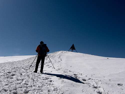
 Tizi 'n Toubkal Saddle in March by Diego Sahagun |  Tizi 'n Toubkal Saddle in July |
Toubkal can be climbed all year long. During the winter months including autumn and spring there is snow present on large parts of the mountain. In spring snow retreats to about 3000m. In winter the whole route is covered by snow. Generally most people climb Toubkal in the Spring season (end of march- until may). During the summer months temperatures can get high, even in the higher altitudes. In the summer months there is no snow left on the mountain and temperatures are just above freezing point at night (at 3200m) and during the day at the summit temperatures were as high as +15 degrees C. On the lower parts of the mountain (above Imlil) temperatures are usually above 25 degrees C.
Accomodation
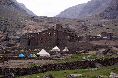 The Toubkal Refuges (3207m) | 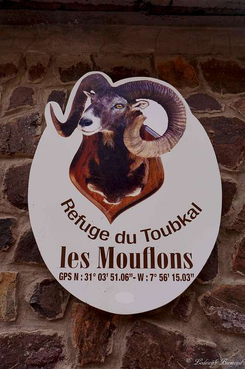 | 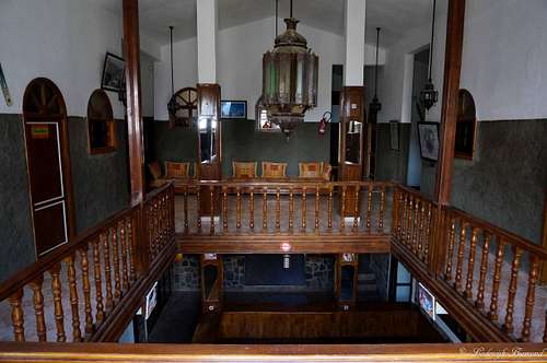 Inside Refuge des Mouflons |
Climbing Toubkal requires spending the night at the Toubkal Refuges at 3207 meters of altitude. You can choose from the Refuge du Mouflons or the French Alpine association’s Refuge Nelter. It is also possible to camp in front of the huts on a large terrain. Costs are of course lower, but I can imagine it being cold at night at 3207m. Below are the official websites for both Refuges. You can make reservations via the internet site. You have to pay upon arrival. We stayed at Refuge des Mouflons. We paid about 25 euros for a night including dinner and breakfast. Dinner is very recommended!
Getting There
 Imlil (1740m) | 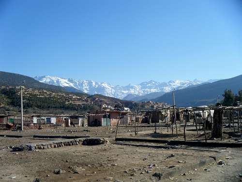 Asni | 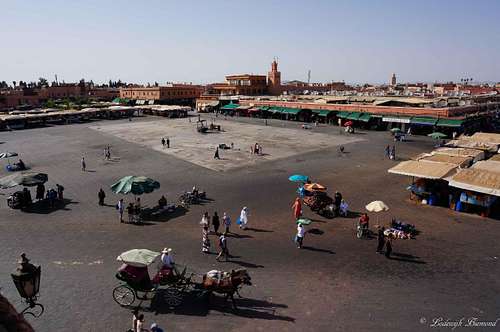 Jemaa El Fnaa, Marrakech |
The city closest to the Central High Atlas is Marrakech. Most people visiting the region fly to Marrakech and travel further from this fascinating city.
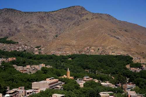
The starting point for the ascent of Toubkal and the other surrounding mountains is the village of Imlil (1740m). In past days it was hard to get there, but some years ago a good paved road (up to western Standards) was opened. Nowadays it will take you about an hour and a half by car to get to Imlil from Marrakech. Take a grand Taxi from Marrakech to Asni. In Asni take a Taxi to Imlil. You have to switch Taxi’s there, since the normal Taxi’s do not go further. Easier is to just arrange a Taxi with the Hotel you are staying in. I can recommend Riad Atlas Toubkal in Imlil. The hotel arranged a pick-up at the airport and directly drove us to the Riad in Imlil.
Of course you can also rent you own car and drive there yourself. Although the roads are good, I didn’t see too many people using a rental car to get to Imlil. Furthermore, traffic is much more chaotic compared to Western Europe.
Weather
Maps and books
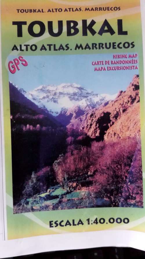
There aren’t many good maps available of the Toubkal area. In Imlil all kiosks sell the same map. The maps is not perfect, but it shows the most important trails and waypoints:
Publisher: Editorial Piolet
EAN/ISBN: 9788495945426
Scale: 1:40,000
Size Folded: 11x17cm
Size: 99x68cm
Another map of the area:
Publisher: Orientazion
EAN/ISBN: 9788493560003
Scale: 1:50,000
Size Folded: 12x24cm
Size: 70x50cm
 | 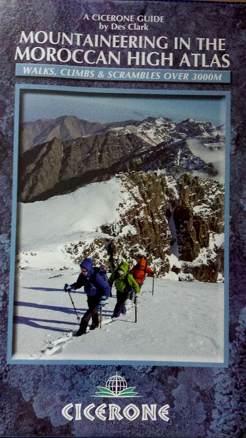 | 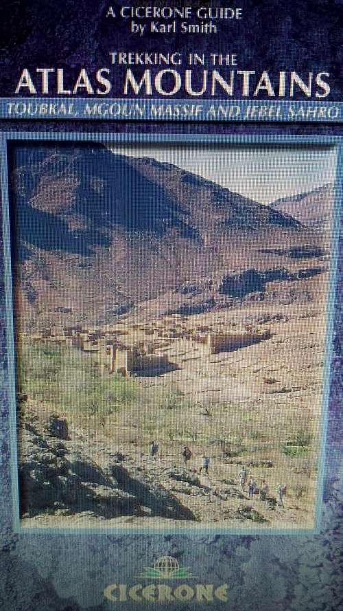 |
Books:
Mountaineering in the High Atlas
Author: Des Clark
Publisher: Cicerone Press
EAN/ISBN: 9781852846114
Size: 12x17cm
Trekking in the Atlas Mountains
Author: Karl Smith
Publisher: Cicerone Press
EAN/ISBN: 9781852844219
Size: 12x17cm
Both books and maps can be ordered online at Stanfords