
|
|
Route |
|---|---|
|
|
52.76094°N / 3.72439°W |
|
|
Hiking |
|
|
Half a day |
|
|
Just Hiking |
|
|
Overview
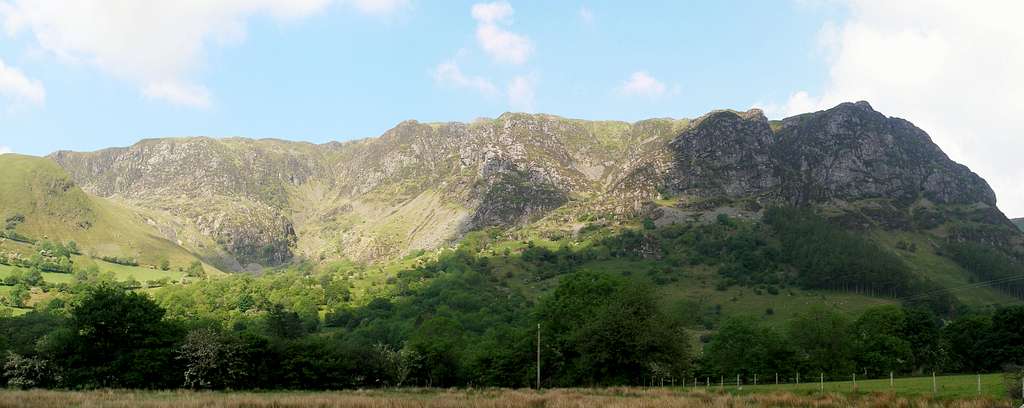
This is probably the shortest and most interesting hiking route to the summit of Glasgwm. It begins, where many of the trails for the Arans begin, at the Fawnog Fawr car park (SH 854 182) in Cwm Cywarch just below the mountains best feature – Craig Cywarch. The route follows the valley up to the pass between Glaswm and Aran Fawddwy, before following the line of the Aran Ridge to the mountain’s rounded summit. Although the mountain isn’t really much of a prospect for most hikers, this route is really quite nice and shows off the best Glasgwm has to offer. |
Getting There
To reach the trailhead turn off the A470, which runs between Dolgellau (SH 729 181) in the west and Machynlleth (SH 748 008) in the south-east, at Dinas Mawddwy (SH 858 148) and take the road towards Aber-Cywarch (SH 867 157). Just after you cross the bridge at Aber-Cywarch turn left up an unclassified road signposted for Cwm Cywarch. Follow the road, which is narrow and winding, until you reach the parking area at Fawnog Fawr (SH 854 182). The route begins here. |
Route Description
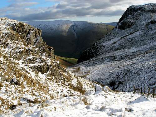
Leave the car-park by following the road north until it terminates at Blaencywarch Farm (SH 852 159). From here continue north along the footpath which gradually turns to the left along the north-eastern slope of Craig Cywarch. The path follows the contours of the valley, and after around a kilometre crosses a stream by a concrete footbridge. As you walk up the valley you will pass along the northern crags of Craig Cywarch, which terminate at the head of the valley. The path then follows the stream up the valley, and eventually, near the valley’s head, it crosses back over the stream. From here there gradient eases and the path follows a fence to the head of the pass and another fence which runs across the spine of the Aran Ridge. You will know you’re in the right place if you have just bypassed a small pond and the boggy ground that surrounds it. At the fence junction turn left, and follow the fence (the one which runs the length of the Arans) that leads up the northern slope of Glasgwm. The summit area is characterised by a couple of small lakes and is marked by a small cairn. |


Essential Gear
Naturally you will need all the paraphernalia associated with hill walking in Wales: full waterproofs, fleece, hat, gloves, map, compass and of course some lunch. |
Maps
Guidebooks
| Snowdonia (Official National Park Guide) by Merfyn Williams The Mountains of England and Wales: Volume 1 Wales (Cicerone Guide) by John and Anne Nuttall Hillwalking in Wales Vol 1 (Cicerone Guide) by Peter Hermon Hillwalking in Wales Vol 2 (Cicerone Guide) by Peter Hermon Hillwalking in Snowdonia (Cicerone Guide) by Steve Ashton |


External Links
 Upper Cwm Cywarch (Photo by Nanuls) Upper Cwm Cywarch (Photo by Nanuls) Don't know if it's still there, but this was on the trail to the summit (Photo by JoeHarris Don't know if it's still there, but this was on the trail to the summit (Photo by JoeHarris Craig Cywarch (Photo by Nanuls) Craig Cywarch (Photo by Nanuls) Craig Cywarch (Photo by JoeHarris) Craig Cywarch (Photo by JoeHarris)Government Bodies and Official Organisations Snowdonia National Park Authority Association of National Park Authorities Royal Commission on Ancient & Historical Monuments in Wales Hiking, Climbing and Mountaineering Organisations and Companies British Mountaineering Council Plas y Brenin National Mountain Centre Weather Tourist Information North Wales Tourism Partnership Local Information from Gwynedd.com Local Information from Snowdonia Wales Net Travel Welsh Public Transport Information Accommodation Youth Hostel Association in Wales Maps and Guidebooks Cordee Travel and Adventure Sports Bookshop Wildlife and Conservation |