
-
 2369 Hits
-
 76.66% Score
-
 7 Votes
|
|
Route |
|---|---|
|
|
46.63518°N / 10.50790°E |
|
|
Hiking |
|
|
Summer, Fall |
|
|
Half a day |
|
|
Hike |
|
|
Overview
 Munwarter, Piz Chavalatsch and Plaschweller Munwarter, Piz Chavalatsch and Plaschweller |
From Lichtenberger Höfe / Malghe di Montechiaro there are two routes which run to Plaschweller / Monte Plagabella, one through Gutfalltal (which is the longer one of the two) and one along the east slopes of the mountain, where you can find the little Tschagainhütte, a small log cabin. This latter route is the more popular one, mostly because it is also part of the route to Glurnser Köpfl / Monte di Glorenza. Both mountains are separated by a wide high plateau at the northern end of which Glurnser Köpfl stands.
The ascent to one or both mountains is a hike in character. It starts along a dirt road but soon turns into a steep path up to the high plateau. From there a mere stroll of several hundred metres takes you to Glurnser Köpfl, while a steep climb along thenorth-east ridge takes you to the higher Plaschweller. None of the route is exposed or in any way difficult.
Getting There
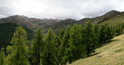
 Plaschweller seen from Tschagainhütte
See the Getting There section on the main page. The trailhead is at Lichtenberger Höfe / Malghe di Montechiaro.
Route Description
- Start altitude: 1550m
- Summit altitude: 2534m / 2374m
- Prevailing exposure: South-East
- Type: Steep Hike
- Protection: None
From the small parking lot at Lichtenberger Höfe / Malghe di Montechiaro follow the road for a few metres before turning left and heading up the north slopes of Gutfalltal. The path levels out and soon reaches an intersection, where you have to leave it to the right. A steep mountain path awaits you heading up the east slopes of Plaschweller / Monte Plagabella. Numerous switchbacks take you to a cross, above which (several metres higher) the small log cabin of Tschagainhütte awaits you with a couple of benches to rest.
 |  |  |
Above the cabin the path gets less steep but still climbs the east face in switchbacks. Finally you reach a small valley whichruns to the north, quickly opening out onto the plateau at the end of which you see Glurnser Köpfl / Monte di Glorenza. To the left (west) the wide east ridge of Plaschweller / Monte Plagabella rises to that mountain's summit. For Glurnser Köpfl / Monte di Glorenza simply cross the plateau. The trail is marked and heads directly for the summit but you can also take the roundabout approach across Totenkopf / Dosso dei Morti (2390m), which stands at the western end of the plateau.
For Plaschweller / Monte Plagabella return to the east ridge, on which only the remnants of cairns and markings can be found. However, the destination is obvious and only near the summit cone you can make a wrong decision. Still, even that amounts only to a detour of about 200m and an additional scramble across a ditch to the north of the summit. This ditch can be very welcome in windy or stormy weather.