
-
 9604 Hits
-
 85.87% Score
-
 21 Votes
|
|
Route |
|---|---|
|
|
47.45700°N / 12.90297°E |
|
|
Hiking, Mountaineering |
|
|
Summer, Fall |
|
|
Most of a day |
|
|
II |
|
|
Overview
 Breithorn from Mitterhorn
For the more experienced hikers or mountaineers Steinernes Meer in the Berchtesgaden Alps has an interesting route to offer: the Saalfeldener Höhenweg, connecting Breithorn with Persailhorn or generally speaking connecting Riemannhaus with Peter-Wiechenthaler Hütte.
This high trail has it all: an easy ascent on Breithorn, an interesting traverse to Mitterhorn over an exposed but not too difficult ridge with deep views to the south and the most difficult rock parts being secured with steel ropes. From Mitterhorn the trail uses the north slopes of the east - west running arete to Persailhorn. From Persailhorn you have to choose: one of two via ferratas or the “normal route”, which is the proper Saalfeldener Höhenweg.
At last, if you start at Riemannhaus, you arrive at beautiful Peter-Wiechenthaler Hütte, standing high above Saalfelden, with several sun terraces and - after a more noisy and crowded Riemannhaus - normally with very relaxed athmosphere.
The route uses the south - north running ridge crest of Steinernes Meer between Breithorn and Mitterhorn. It then follows the east - west running subridge from Mitterhorn to Persailhorn. Persailhorn is a summit which stands west to southwest and in front of Steinernes Meer, thus building an impressive peak.
The part from Peter-Wiechenthaler Haus to Persailhorn, which is signposted as “Saalfeldener Höhenweg” was the former, old normal route to Persailhorn. After being set up the two via ferrata were getting the “normal routes” to Persailhorn because together they offer an interesting round trip. Consequently the old normal route was no longer maintained. It is now repaired and maintained again and can be used as an easier descent route from Persailhorn.
In my opinion, the best descent route is the Südwandklettersteig. This Via Ferrata is not very difficult, uses the southern rockwalls of Persailhorn which usually are drier and warmer than the normal route or the second Via Ferrata and has a nice and sometimes exposed route.
 Persailhorn (left), Mitterhorn (center) and Breithorn (right center) as seen from Saalfelden; in the deep notch white Riemannhaus, to the right Sommerstein and Schöneck (thanks to user flow for this picture)
Getting There
 Peter Wiechenthaler Hütte as seen from Persailhorn
Saalfeldener Höhenweg connects Riemannhaus with Peter Wiechenthaler Hütte. These two alpine club mountain huts are the trailheads for this alpine trail.
To get to Peter Wiechenthaler Hütte you start from the town of Saalfelden. To reach Riemannhaus, best trailhead is in the Sandten valley above Maria Alm.
You reach these neighbouring villages from
You reach Saalfelden by train, too, from Kufstein - Wörgl - Kitzbühel or from Salzburg - Bischofshofen.
For the schedules please refer to the ÖBB homepage.
The Saalfelden trailhead is in the northern part of the town, called Bachwinkel. Follow the main road of Bachwinkel up to its end at the beginning of the woods, there are parking areas alongside the road. Bachwinkel is signposted from the road number 164 between Saalfelden center and Lofer.
Follow the signposts up to Peter Wiechenthaler Hütte.
 Persailhorn
For the Maria Alm trailhead follow the road leading from the village into Griesbachwinkl and Sandten valley. After some kilometers the road changes into a dirt road which climbs up steeply to the parking area at about 1.200 m. After the parking area the road is closed for public traffic. Follow the road up to the supply cableway valley station of Riemannhaus. Follow then the trail number 401 steeply up into the valley between Breithorn and Sommerstein / Schöneck up to Ramseider Scharte and to Riemannhaus. Spectacular views to the Sommerstein tower.
Route Description
 Breithorn from Mitterhorn - Persailhorn traverse
I describe this trail from Riemannhaus to Peter Wiechenthaler Hütte. This is the common sense of this route;
advantage: the altitude difference between Riemannhaus und Breithorn as highest point of the route is quite moderate;
disadvantage: you have to descend one of the the via ferratas from Persailhorn to Peter Wiechenthaler Hütte - the ascent is clearly much more fun.
Section 1 to Breithorn
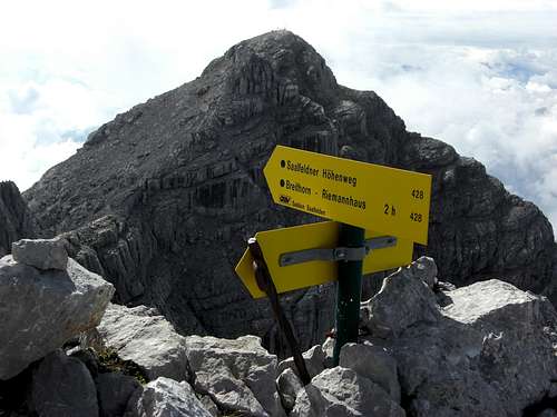
At Riemannhaus follow the signposts and trail number 401 alongside some nice karst features to the west. After about 5 minutes Eichstätter Höhenweg to Ingolstädter Haus branches off to the right. We keep on the left hand. Our trail starts to ascend the northeast ridge of Breithorn and zigzags up this karst and scree ridge to the summit without difficulties.
On clear days Breithorn summit offers great views over the Berchtesgaden Alps, the austrian glacier mountains and Loferer and Leoganger Steinberge.
 Ascent route to Riemannhaus with huge Sommerstein Ascent route to Riemannhaus with huge Sommerstein |  Breithorn ascent ridge Breithorn ascent ridge |  Arriving Breithorn summit Arriving Breithorn summit |
Section 2 to Mitterhorn
Looking from the summit to the north you can see the sharp arete from Breithorn to Mitterhorn. The scree trail descends the north ridge of Breithorn for some minutes until it reaches the beginning of a difficult part of the connecting arete Breithorn - Mitterhorn. There the trail descends to the right, avoiding those difficulties and traversing the east face of this arete on some ledges with short and easy rock scramble. It reaches a broad col between Breithorn and Mitterhorn which has to be crossed to the west side of the connecting arete. The northern limitation of this col is another sharp and wild looking arete, called "Drei Docken". The trail traverses this part of the connecting arete, first using some ledges and scree sections and descending into a sharp chute.
Arriving at the chute the trail starts to ascend, first using the lower part of the chute then leaving it to the left. A nice rockwall has to be climbed (UIAA grade I - II) with the help of fixed steel ropes. Then you are back on the ridge crest which has to be followed to the summit block of Mitterhorn. This is a nice and exposed but easy part of the trail.
With the help of a steep and easy trail Saalfeldener Höhenweg quickly reaches Mitterhorn summit.
 The col between Breithorn and Mitterhorn, view to Persailhorn The col between Breithorn and Mitterhorn, view to Persailhorn |  On the ridge to Mitterhorn On the ridge to Mitterhorn |  Exposed traverse at the Drei Docken, view to Mitterhorn Exposed traverse at the Drei Docken, view to Mitterhorn |
Section 3 to Persailhorn
You have to follow for a short while the north ridge of Mitterhorn until the trail turns to the left and leaves the ridge. The route traverses the northwest side of Mitterhorn summit block down to a notch in the west arete of Mitterhorn, which is the connecting arete to Persailhorn too. This part offers nice rock scramble and some scree filled ledges until you reach the above mentioned notch.
Shortly after you have left the Mitterhorn north ridge there is a trail branching off to Ahlehorn, Weißbachscharte and Ingolstädter Haus or Peter Wiechenthaler Hütte. This route offers an alternative to Persailhorn and its Via Ferratas.
From the notch west of Mitterhorn there are impressive views into the Schneegrube, a steep cirque southwest of Mitterhorn and back to the Breithorn summit.
After a short walk on or near the ridge crest the trail leaves this ridge because the ridge becomes more and more difficult. The trail descends, traversing the north slopes of the connecting ridge to the west, using gras overgrown or scree filled ledges, alternating with short rock walls or chutes which offer nice climbing experience, some of them being secured with fixed steel ropes.
This descent ends at the lowest notch in the connecting ridge Mitterhorn - Persailhorn in front of Persailhorn summit block. The arete end in wild spires and rock faces and the notch offers again great views into the steep and deep Schneegrube and to Mitterhorn and Breithorn summit and their connecting arete.
An easy trail leads up to the Persailhorn summit, using a gras overgrown rock ridge before reaching the summit cross with its marvellous views deep down to Saalfelden and onto the southside of Steinernes Meer.
 Connecting ridge Mitterhorn - Persailhorn Connecting ridge Mitterhorn - Persailhorn |  Rock scramble at the north traverse of connecting ridge Mitterhorn - Persailhorn Rock scramble at the north traverse of connecting ridge Mitterhorn - Persailhorn |  At the notch west of Mitterhorn At the notch west of Mitterhorn |
Section 4 to Peter Wiechenthaler Hütte
There is an unusual broad range of choice: three different routes to descend to Peter Wiechenthaler Hütte !
Südwandklettersteig
This Via Ferrata uses the south and southwest exposed rockfaces of Persailhorn. The Via ferrata branches off to the left after a descend on the west arête of this huge mountain. Not too difficult (KS 3 - C) it is nevertheless an exposed route which leads steeply down a flight of rockfaces and stone chutes, with some nice traverses on rock ledges and some iron ladders if the rock gets too difficult.
At last it enters the southwest side of the mountain on a steep ledge under an overhanging cliff on a ladder and traverses down to an old scree fan. On the lower west ridge you soon reach Peter Wiechenthaler Hütte ona good trail.
Wildentalklettersteig
uses the north side of Persailhorn which is the colder and wetter side of the mountain. In fact both Via Ferrata offer a great Ferrata loop from and back to the hut.
The Wildentalsteig is similar in its difficulty (KS 3 - C). It branches off from Südwandsteig route to the right on the upper west arête of Persailhorn (signposts). The route leads steeply down some chutes into the northern rock face and to some ladders on which you overcome some very exposed rock faces. The route continues down some rock slabs to an exposed traverse (“Wastl – Promenade”) and in some ups and downs to the lower northwest slope of the mountain. The route traverses this slope and leads to the lower west ridge, meets the other two routes and arrives at the hut.
Saalfeldener Weg
This is the old normal route to Persailhorn. In many guidebooks and in many internet contributions this route is always mentioned as “no longer maintained”. In fact the route is newly installed, maintained and signposted as the last bit of Saalfeldener Höhenweg. So if you want to finish this trip “honestly” you have to choose this route which leads down the steep and rocky slopes of the west side of Persailhorn. It is the easiest descend route and good mountaineers need no harness and Via Ferrata kit for that one. This can be an advantage. But – in my opinion – one of the two Via Ferratas offer more fun.
 Südwandklettersteig Persailhorn Südwandklettersteig Persailhorn |  Südwandklettersteig Persailhorn Südwandklettersteig Persailhorn |  Südwandklettersteig Persailhorn Südwandklettersteig Persailhorn |
Cute people descend on this route, stay the night at Peter Wiechenthaler Hütte – a mountain hut which can highly be recommended (!) – and do the Ferrata loop the next day. So you get all three routes !!
Route Conditions & Essential Gear
 Mitterhorn and the Saalfeldener Höhenweg as seen from Breithorn
Route Conditions
Saalfeldener Höhenweg is a summer and autumn route until the first snowfalls. Due to its hight and some northern exposed sections there might be snow blocking the route until early summer.
Gear
You need in general full hiking gear with good boots for the normal route. You need skills to master UIAA grade I - II in normally good rock. Additionally helmet, harness and Via Ferrata kit is recommended especially for the Via Ferrata sections of Persailhorn.
Bring enough to drink. As a karst plateau, Steinernes Meer nearly has no water for resupply.
Maps
The following topo maps are recommended:
Alpenvereinskarte scale 1 : 25.000
Blatt 10/1, Steinernes Meer, 2006
Topografische Karte von Österreich, scale 1 : 50.000
Blatt 124
Accomodations
 Mystic Watzmann as seen from Breithorn ascent
Accomodations of all kind - hotels, bed & breakfast, campgrounds - can be found in all major villages around Steinernes Meer:
The following adjacent mountain huts offer overnight stays: