
|
|
Mountain/Rock |
|---|---|
|
|
1.38676°S / 29.59158°E |
|
|
Hiking |
|
|
11959 ft / 3645 m |
|
|
Overview
Like climbing in a fairy tale
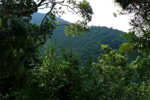
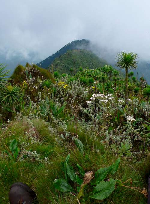
Sabinyo is not climbed because of wide and breathtaking views. By the time you have reached its summit, it is almost certainly shrouded in mist, and during the early hours of the day, when you can still hope for blue skies, you walk mostly through dense vegetation. But that, the vegetation, is exactly what makes this mountain so attractive. In the span of a few hours, you pass from grassland, through the bamboo zone, the rainforest zone, and the heather zone, to the afromontane zone, amidst otherworldly heather trees draped with old man's beard, roots blanketed with deep moss, ever flowering helichrysum, giant groundsels and giant lobelias.
Getting There
The summit of Sabinyo is where Uganda, Rwanda and the DRC meet (map).Point of departure at the Ugandan side is Kisoro. For how to get there, see here. From there, follow the green-and-yellow signs to the Mgahinga Gorilla National Park headquarters in Ntebeko (2360m). Although this road is only 14km long, schedule at least three quarters of an hour for it, even in a good 4x4, as it is in a catastrophic state. It is, however, virtually the only road, so at least there is no risk of getting lost.
The Rwandan side is climbed from the Volcanoes National Park headquarters in Kinigi (2100m), 13km northwest of Ruhengeri, or as it is now officially called: Musanze. Plan half an hour for the drive. For how to get to Musanze, see here.
I've never heard of an ascent via the Congolese side. It is probably neither legal nor advisable. Without a trail, let alone the aid of ladders, like on the Ugandan side, there is just no way you're going to get up and down in one day. Leaving the summit out of reach, as camping is not allowed inside the borders of the national park. But even if it would be legal, it wouldn't be advisable, given the risk of running into armed poachers and rebel groups.
Route
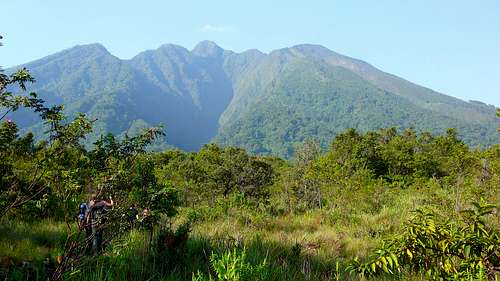
The summit is the steep peak directly below the small cloud
The first kilometer and a half are still outside of the park and near-flat. The terrain is extremely muddy, even in the dry season. You pass a sign stating "End of the former farmland, beginning of the virgin forest" and are at once in the bamboo zone. The track resembles a tunnel here, and you are likely to see footsteps of buffalo and forest elephants. Virtually no altitude is gained during the bamboo zone, but this is about to change...
After between an hour and an hour and a half, the bamboo gives way to equatorial rainforest. This is where our lead guide stopped us, to say, with a sadistic twinkle in his eye: "Congratulations; you have reached the beginning of the climb." From here to the summit, three to four hours higher, it is only steep, steep and steep. The upside of this: it is no longer muddy.
Looking from one shoulder to the next
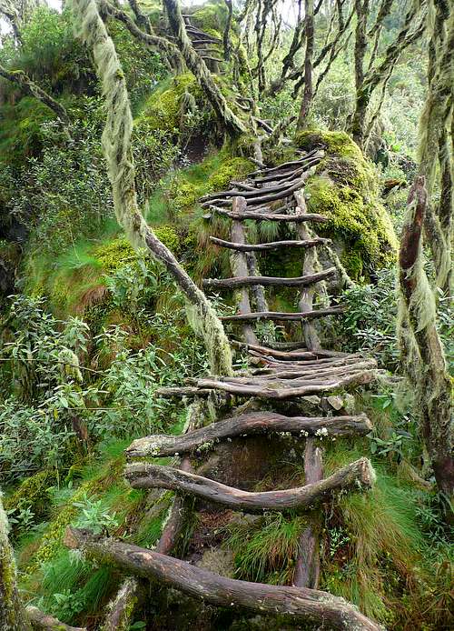
Fairly abrupt, the rainforest stops, and you enter the heather zone: the otherworldly scenery seen above, reminding one of fairy tales and fantasy movies. Some heather trees are completely covered in old man's beard (usnea), while deep moss blankets their complex root systems. Now half of the time is spent climbing twisty stairways. Practical as long as it is dry, but treacherously slippery when wet.
Along the ridge between peak 1 (3380m) and peak 2 (3540m), with Rwanda to the left and another wonky stairway at the bottom
Peak 1 is also the place where the guides will suggest a second and last rest. Time to put on a jacket, as the remainder of the route is totally exposed to wind and clouds rolling over, and the next ten minutes or so will be going down. You can also leave your stick or trekking poles here, as they will find no use between here and the summit anyhow. Pick them up on the way down.
From peak 1 to peak 2 takes about half an hour, and from peak 2 to the summit perhaps a little longer. This last section is the steepest of the entire climb, and almost entirely on stairways. Some of them are truly vertical. When I was there (January 2013), the park authorities were in the process of replacing the shaky old ones, made up of crooked branches held together by nails, by solid modern ones, made up of straight beams held together by screws. Safer, no doubt, but less romantic.
The summit boasts not only more giant groundsels and lobelias, but also three countries, as this is where Uganda, Rwanda and the Democratic Republic of the Congo meet.
Where Uganda, Rwanda and the DRC meet: looking back from the summit (3645m) on peak 2 and 1
Red Tape
In theory, you are not allowed to go anywhere in the national park without a guide. But when I climbed Sabinyo, there were only three guides for about ten clients, so by going a little slower than the first guide, and quite a bit faster than the second, I was actually able to go large sections of the climb alone. Be sure though, to not get in front of the armed ranger, for the buffalo in the bamboo zone have a bad reputation.The trip up and down takes between 7 and 9 hours in favorable weather. Therefore the guides aim to set off by 8 a.m. at the latest.
Foreigners pay USD 95: USD 35 park entrance fee and USD 60 for the climb/guide.
When to Climb

Dark clouds gather over Sabinyo
The current weather forecast can be found here.
Gear

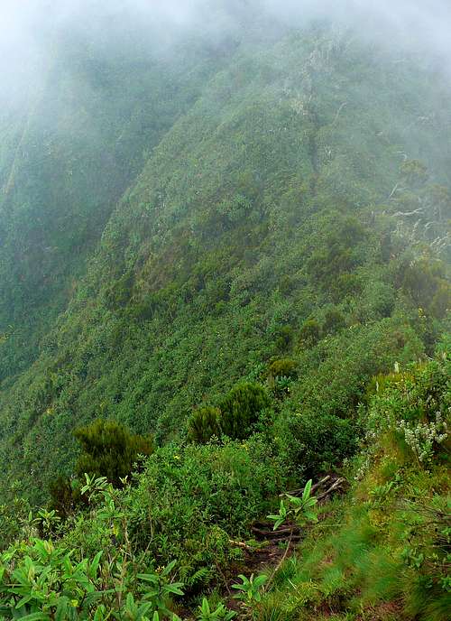
By the time you reach it, the summit (3645m / 11,959ft) is almost certainly shrouded in mist
Trekking poles are a great help in the lower, muddy sections, as well as on the way down. Leave them on peak 1, as you cannot use them between there and the summit anyhow, neither when going up, nor when going down, given that you are either on a stairway, or on too narrow a track for poles.
Despite abundant rain, there are no reliable sources of drinking water. Still, you don't have to carry vast amounts of water, as at this altitude, even at the equator, it never gets really hot. Furthermore, half of the time, you walk in the shade.