SAGA OF THE MOUNTAIN KINGS
SAGA AUTUMNA:
MOUNT DANA
TIOGA
YOSEMITE
October 10-12, 2005
By MtnGuide
INTRODUCTION:
That seed of an idea that starts as a glimmer in the eye
of a young man– or an older one, not so spry -
develops with the savoring of that memory of wonder way up high --
and a hunger for more hard work, and Accomplishment’s sigh.
But the preparation for the attainment involved a lot of time:
for finding and packing food and equipment,
re-visiting childhood haunts down in the valley of the national park,
and lingering for sunset pink on all the Tuolumne domes at the last moments before dark.
It took more daylight than we had:
Finding and unpacking gear
setting up tents in the early dark,
digging for expensive waterproof matches that just wouldn’t spark,
jet-nozzle stoves flaring hugely, but which in the end just wouldn’t work -
almost left us oldtimers feeling like inexperienced jerks.
Driving from sea level to 10,000 feet in a few hours, we hadn't yet acclimatized:
Hauling gear made lungs heave and bulged the eyes.
After rolling on hard ground all night at 20 degrees,
and getting so cold I thought my hands would freeze,
by morning I wasn't feeling so fine.
I just sorta eased out of that sleepingbag,
and over a steaming mug of coffee scanned our coming day’s skyline.
To prevent turnback I almost bailed out of this long-planned climb.
I was thinking that maybe I ought to acclimatize by laying out in the meadows in that warming alpine sunshine.
But, inspired by the dazzling diamonds off Tioga Lake,
and the world-class glamour photos we might be able to take,
I ambled out with the others toward the cliff like a ship's prow
that we’d have to climb or navigate around somehow.
THE HIKE BEGINS:
Like a Rocky Mountain morning, the sun warmed meadows and lakes into backlit rising steam.
Hiking through the thick forest near ice-edged lakes we could hear the gurgling of unseen headwater streams.
As we rose out of the forest into rockfields toward 11,000 feet
the slope inclined into radical steeps.
Our bodies strained in the elevation to find enough air to breathe.
I had been experimenting with a rucksack mounted above a waist pack,
and the jamming of weight at awkward angles was straining the back.
Doug offered to take it, as he had been climbing to altitude all summer
on Mt. Hood, Mt. Rainier, and Glacier Park in Montana -- and is a 100-mile ultramarathoner.
He's also a fireman, so he gets paid to workout:
“First thing every day I jump on the Stairmaster for half an hour, lift weights,
and train to be able to run oxygen tanks and firehoses up 30 flights of stairs.”
I finally relented, and packed him like a packhorse, whereupon he charged off up the steeps in that thin mountain air.
The trail switch-backed many times, until
it quit trying to lead us on and just headed straight up the damn hill.
It was so steep we almost had to kick steps into scree and mud,
but looking back over our shoulders at improving views became a thrill.
Quad muscles burning, we twisted around to watch the scenery:
we rose up, up, up, into the sun-drenched alpine heights,
Watching the meadows and granite domes drop away like takeoff during an airline flight.
After a brief break amid the rocks on a high plateau,
above the top of that front cliff prow so huge from below,
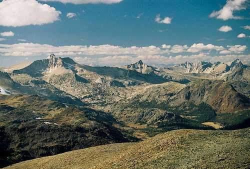
we saw that new country had emerged,
with mulitple ridges of granite out to the far off Southern horizon to Kuna Crest and Mt. Lyell,
where the clouds and land merged.
Finally, high above the steepest 1,000 feet,
there was a fifty-mile view out over Tuolumne.
Southward, Mt. Kuna and The Kuna Crest,
across to Echo Peaks and Eichorn Pinnacle, and Cathedral Peak to Southwest.
Way out there, we could see ranges beyond Glacier Point and Clouds’ Rest.
Directly out to the West we looked into North Peak and Mount Conness.
And far in the distance, to the Northwest, those white ridges of The Matterhorn Crest.
With the feeling of awe from deep within the inner child
we viewed way to the South the glacier-covered ramparts of Mt. Lyell.
Directly North was an apparently snow-capped range, which was really a ridge topped with rocks of white – North of Bridgeport, East of Sonora Pass, it was shining bright in wind-riven, crystalline, autumnal light.
Steeper yet the trail rose,
straining quads, calves, Achilles and toes.
To walk straight up required the heel to drop dangerously far,
threatening that Achilles tendon and calf muscle again, and ilio-tibial band.
So I turned sideways and did the cross-over step, and
switchbacked.
Bill and I were so evenly matched that whenever one of us was about to fade,
the other would merely begin to think,
and the other would pipe up with: “I need a rest and a drink.”
Doug would shoot ahead, get out his video cam, and lay in wait,
but mostly he was contented to just enjoy the views in this dream-like state.
MAXXING OUT:
As we moved from the high plateau of alpine tundra into talus and plates,
the mountain’s slope steepened.
The pace slowed down and pulses quickened.
Breathing became labored.
But even these effects of elevation couldn’t dampen the growing elation.
For when we got close to the saddle in the ridge
before the last steeps
I sensed the potential for great views
and scrambled to be the first to get to the edge and peep
over the rim and down into that magnificent canyon
and out to the East as a prize for all this scramblin’.
I started running, as I’d declared I shouldn’t do,
but the reward was this wonderful view:
down 2,000 feet from the top of that waterfall slot, to the tarn, Dana Lake,
trapped in its own long-dead glacier's remains,
as indicated by terminal and lateral moraines.
It was totally clear to the bottom, tinted a martini blue.
Across the canyon,
and beyond the ancient, uplifted Dana Plateau,
you could see for hundreds of miles,
and the primordial landscape 8,000 feet below.
There were extinct volcano calderas
and Mono Lake’s own gray limpid pool.
You could see range after range across Nevada –
to travel that far would take days -
but still peaks would be sticking up out of Utah's desert haze.
The summit ridge lay still higher, and now the talus slope steeply inclined.
We wanted to get out before dark
so we set a specific turn-around time.
"Half an hour more -- a quarter to three" --
then we headed off climbing again,
probing for plates that wouldn’t dislodge and fall free.
Managing our energy at elevation through measured breathing,
lifting boots increasingly became more like knee heaving.
With perseverance and determination we kept moving higher,
and though summiting was our main desire
I wasn’t going to get a headache, nor puke and stop,
nor expose myself to “mere pain” just to get to the top.
With 5 minutes left before our deadline, no one seemed about to reach the summit --
(though it would've seemed reasonable to get a headache or vomit) –
Doug called on the radio to encourage us higher,
but finally we declared that, due to time constraints and safety,
this was where we would wait for him --
and save enough energy and concentration to downclimb at night
if somebody fell on the boulders along this beautiful cliff rim.
The radio crackled back and he said “I understand.
But I’m going for the top anyway.”
He moved out, like a Marine, upward, faster and faster,
straight up the mountain, stepping long from plate to plate.
Like a robot or a cyborg, he seemed to accelerate.
His dark blue coat had disappeared into the black of the rocks.
But soon he had reappeared against a snowfield, then up out onto the shoulder on his way to the top.
It was a long time – like, half an hour – of scrunching down in the rocks against incessant wind
before we got any indication of what condition he was in.
We were watching the clouds blow in like the Blue Angels, climbing at speed,
to transform from cirrus to cumulonimbus over our heads.
Warm sun disappeared behind clouds turning cold and gray.
Then the radio crackled and a voice screeched in the wind a high thin “YA-Hoooooooo! What a VIEWwwwww!”
“10-4. We hear you too. What’s happenin’?”
“It’s InCREDible! I’ll start down in 5 minutes.”
TROUBLE?
Well, 5 minutes came & went,
while we scanned the boulderfield and crest of this continent.
Bill’s scanning with binoculars,
I’m poised with camera & 200 mm telephoto zoom lens to
capture the returning hero.
We’re watching that skyline against the white clouds and blue sky, and he doesn’t show.
We wait and we wait, always thinking he’ll appear any second. “He said he would… “
Half an hour later we’re getting apprehensive that we’ll have to climb up there and start a search for that blue coat in the black rocks…
Bill says that he's going to head down out of this wind, and I say I’ll be down too, but I don’t want to give up any of this hard-earned elevation.
Bill stops a few hundred feet down and lifts the binocs,
peering again up into the rocks.
Finally the radio squiggles and Doug says, “I’m coming down now. Why don’t you guys head down to Lunch Rock.”
“Good to hear you, Doug, but we’ll wait for you right here, as support team, until you get back into view.
We don’t want to climb all the way back up from down there to rescue you.”
“OK. Thanks."
DESCENT:
Eventually he reappears on the crestline.
I grab my long-awaited shot of silhouette,
and another in the steep rocks, and ...
he disappears again.
Soon he re-appears and is descending faster than us,
then on the slopeline across from us,
he's already parallel –
Why, heck, he’s on a trail!
Finally we just give in to the risk of plates tippingand speed down too.
Eventually we all re-converge, and into a team again we all merge.
We're still in the high wild of the wind and the tundra;
turns out he had to shoot photos and videos, post in the summit log, etc.
Later I saw video of the summit views,
microphone recording that roaring wind,
and a video shot of the summit log with his post:
“Dad, This climb was for you.”
OVER LUNCHCAIRN RIDGE:
Altogether now, we resume descent,
heading down at speed as if our lives depended on it.
Like British expeditions of the 1800s descending from the Himalaya
we moved down-mountain with a huzzah,
viewing out across Tuolumne Meadows' brown autumn tundra,
wondering at the horizon’s brilliant penumbra.
Down below, the winding river was reflecting light
like a twisted ribbon of silver, shining bright.
Hauling aross the flats, and finally cresting
we burst over Lunch Cairn Ridge hardly resting,
and plunge straight down --
down the steeps we’d struggled up,
boots, bodies and packs freefalling,
landing in firm mud, softly and safely in heelcups.
We were downhilling it for a long time
but could see little change in the landscape,
its on such a vast scale way up there.
The most change in the landscape we could decipher
was the front mount’s distant bulk growing a little bigger,
until at last we were alongside that first swale of plateau in the saddle,
behind the front mount’s prow of looming rock middle.
Over another ridge edge and suddenly its steeper yet!
Mind those cracks between those boulders!
Watch that pack slipping off your shoulders!
You’re dangerously close to crashing!
You’re making me feel older!
That’s steep mud you’re stepping into there-between,
wet and slick, waiting to cause careen....
Suddenly Bill’s on his back in the air,
feet flying high, arms splayed, reaching out for anything there!
But he’s a skier, and faster than a throwed bullrider can mumble, “OOMPH!”
he lands on his back and bounces back up again,
like an aerobatics skier, already flyin’ down the mountain
-- and barely missing a beat we’re off again
with renewed momentum.
Down through another band of geology,
where the rock types change again,
I’m noticing they’re green clay, and slippery, when:
my left boot toe catches on the boulder's edge,
and I’m suddenly surging forward
knee barely clearing the surface of that ledge.
The right foot lands solid, in soft damp ground,
locks --
and throws me up & around -- off-balance and twisting,
time stops for a second while I'm hanging in the air,
my shoulders and pack weightless way up there,
then suddenly surge back into motion again,
and I'm nearly slamming into Bill,
about to knock him down the hill,
or maybe launch him into space,
where he’d be thrown into this talus on his face.
So I sit way back, and drop low,
and slow everything down.
TEAM EUPHORIA:
Those guys never even knew what was happening back there,
when I nearly knocked them through the air.
But now, with these airy views for hours on end
all of us are finally feeling free.
We're all just as happy as we can be.
We're gazing out over the valley miles,
and from ear to ear we're all smiles.
Doug's jabberin’ away,
waving his hiking pole up at the ramparts,
planning more long-distance mountain runs,
back in his element.
Bill and I are both quiet, concentrating on our route,
half-listening to Doug but really thinking about our boots,
and how more new rock types are flowing past our hands,
and the changing Sierran vegetative bands.
We’re twisting around and looking back up to where we went,
then out West at the rate of the sun’s descent.
We’re wondering if we’ll beat those growing shadows down in the park
and make it out before it gets dark.
DARKNESS LOOMS:
We’ve all got headlamps to light the way
if we can’t beat the end of day,
but each of us is really hoping
to eliminate the need for hurried loping.
By some miracle we troop out of the forest at dusk
with amodicum of dignity.
Doug made it to 13,000 feet, with none of his usual altitude-sickness.
Bill and I had made it to 12,500 feet, and saved energy for safe return or rescue.
Doug hailed us for our having risen to the challenge to perform our personal bests.
When we emerged from the forest gloom of evening
I was feeling better than when we’d started out that morning.
We all still had energy, having felt no duress,
so we jumped in the truck and ran up to Saddlebag Lake and Mount Conness.
CLOSE OF DAY:
Mount Conness is a Sierran queen.
Her crowning ramparts, like the Statue of Liberty’s crown,
were deflecting radial shafts of light up from the sun unseen, into the undersides of low puffy clouds
which reflected indirect light back down into that
granite basin floor at timberline.
Her throne-room is a glacier-filled amphitheater in white.
Next year we'll climb her, but tonight,
Mount Dana stood behind us, almost the opposite:
brown rock covered with autumn tundra,
vertical rather than broad-browed,
dark back canyon cliffs lit only on their rims by setting sun.
Yet, because we had climbed her, struggled with her,
explored her and given her our all,
we felt like we knew her, and were comfortable with her.
That was enough satisfaction to achieve Accomplishment’s sigh.
Next year we'll also climb North Peak when we will be
as tired and worn out as aging mountaineers can be.
If you want to share in that incredible alpine beauty,
just call, email or PM me,
then grab your rucksack and come along and see.
Grab your rucksack and come along and see...


Comments
Post a Comment