Here is another summit in which I had a few questions about before posting but after thinking about it I decided to post this peak in the Tiger Mountain area.
Sally's Summit
Why choose this peak? Well not for the summit views because there is very little in the way of views on Sally's Summit. Only one or two spots open up from the trees. But this is one area that doesn't get a lot of attention, meaning there actually is a place at Tiger Mountain in which you can be by yourself and enjoy the peace and quiet. In winter this enjoyable little summit can a nice break from the cell phone tower and the T.V. towers that haunt most of the the summits at Tiger Mountain. It is worth the 1/4 mile roundtrip hike on the new Predator Trail (7.5 mile roundtrip from the trailhead) off of Crossover Road and features a charm all to it's own. If you include East Tiger Mountain this ends up being an 8.5 mile 2200 foot elevation gain roundtrip hike.
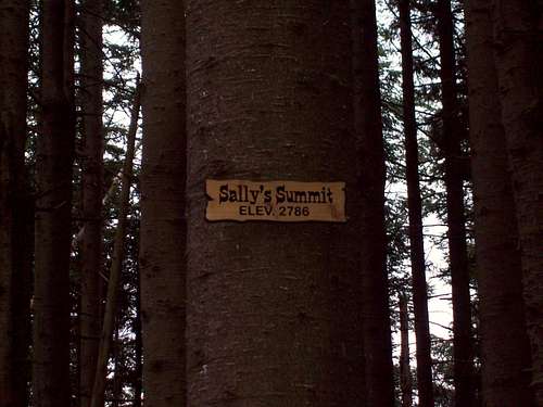
Long live the old Sally's Summit sign
The new sign which is more a sign to the Predator Mountain Bike Trail
Route
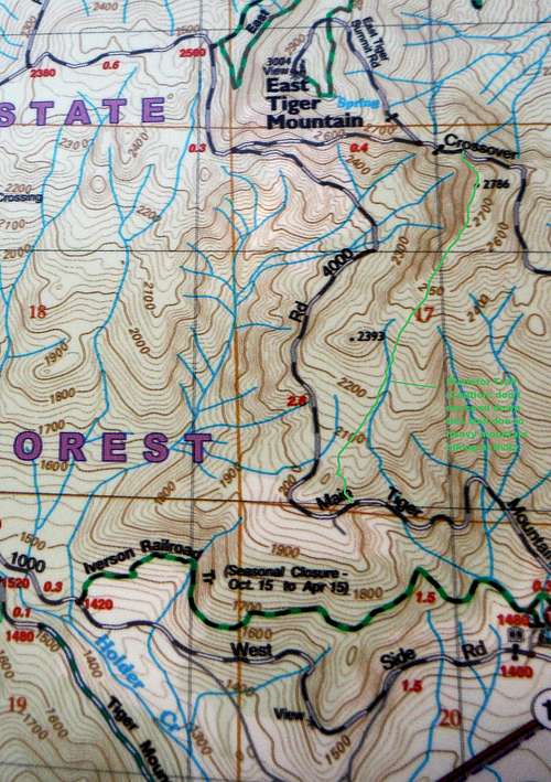
Map of the new Predator Trail. When coming from Crossover Road to the summit go back the way you came. Do not proceed on the Predator Trail past the summit.
To head to the Sally's Summit take the Main Tiger Mountain Road about three miles until you make a right on the Crossover Road. Go past the turnoff to East Tiger and once you hit the gate go to the obvious ridge on your right. This used to be a very faint bootpath here that will follow the ridge to the summit. Now as of 2016 it is the Predator Trail a Double Black Diamond Mountain Biking Trail. You will know you made the summit because you have to cross a large number of logs due to a recent blowdown in the area and you will be greeted by the Predator Black Diamond Sign (formerly a Sally's Summit) sign on the tree.
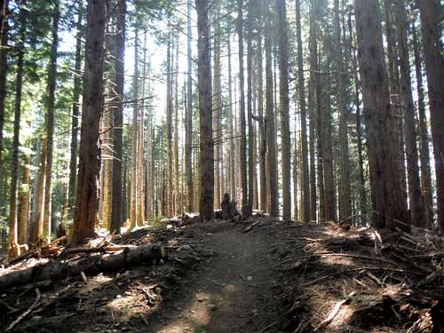
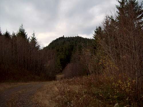
The Predator Trail to the summit.
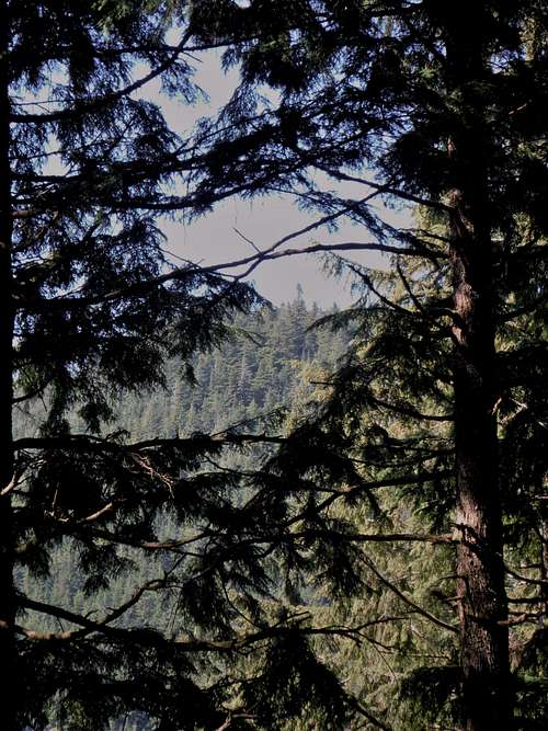
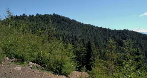
The "best view" on this ridge.
Do not choose to go down this way. It is a busy mountain biking trail and mountain bikes tend to go over 30 mph per hour on this rough trail. I nearly got hit on this trail. Besides there are very few views going down. Go down the way you came and he cautious of mountain bikers when you do.
Getting There
Note: The exact same trailhead as East Tiger Mountain
THE EAST TIGER TRAIL VIA I-90: From I-90 get off on Exit 25 onto Route 18. Head up about 4 1/2 miles and the East Tiger Mountain trailhead will be on your right. If you hit the Tiger Mountain Pass you have went too far.
Red Tape
No overnight parking on this trailhead.
Camping
Camping is prohibited in Tiger Mountain State Park.
Parents refers to a larger category under which an object falls. For example, theAconcagua mountain page has the 'Aconcagua Group' and the 'Seven Summits' asparents and is a parent itself to many routes, photos, and Trip Reports.

 alt="Click for Snoqualmie Pass, Washington Forecast" height=60 width=468>
 alt="Click for Bellevue, Washington Forecast" height=60 width=468>