-
 2954 Hits
-
 81.18% Score
-
 13 Votes
|
|
Mountain/Rock |
|---|---|
|
|
46.51331°N / 11.01989°E |
|
|
Skiing |
|
|
Summer, Fall, Winter |
|
|
8068 ft / 2459 m |
|
|
Overview
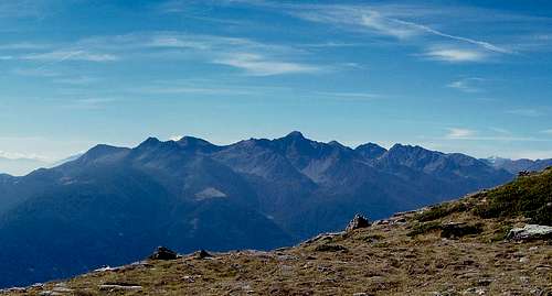
Standing east of Ultener Hochwart / Vedetta Alta on the main Ridge of Ultentalkamm / Cresta Val d'Ultimo in the east of the Ortler / Ortles Group, Schöngroupspitze / Cima Schöngrub is an easy hiking and ski touring summit. Indeed, it is often visited as part of a tour towards the higher mountain in its west though it deserves to be climbed in its own right. Thanks to the poor quality of the schist like rock, out of which it consists, erosion has smoothed its slopes so that it resembles around-topped mountain. Only the small east face is vertical, while the other sides of the mountains are slopes of varying steepness. Also, only from the east side does the mountain resemble anything like a pointy peak, as the German name "Spitze" would suggest.
Climbing the mountain still can be confusing, mainly due to the quality of the maps which are available for the area. The actual hiking trails follow different routes than shown on the maps and it is likely that some of the trails have been abandoned altogether. We climbed the mountain in foggy weather and only with the help of a GPS receiver where we able to find the summit. Starting from Hofmahdjoch in the east it turned out that you have to traverse the south slopes of Schöngrubspitze / Cima Schöngrub to reach the saddle, which separates our mountain from Ultener Hochwart / Vedetta Alta. From there the final ascent follows the steep but broad west ridge of the mountain.
Some words on the name and the history of the area: Schöngrubspitze doesn't have an Italian name - as far as I can tell. No map, not even atlanteitaliano.it, which usually shows all names, indicate a name. From the fact that the accompanying pasture on the south slopes of the mountain is named Malga Schöngrub I extrapolate the name of the mountain. Actually the use of the German Schöngrub for the pasture in itself is rather strange. Ultentalkamm / Cresta di Val d'Ultimo has been the language border between German and Italian for a long time. The villages in Ultental / Val d'Ultimo as well as Deutschnonsberg for the last centuries have used (and still do) the German language. However, the pasture rights in Deutschnonsberg had been awarded to the Italian vilages further south, so that most - if not all pastures carry Italian names. Now Schöngrubalm / Malga Schöngrub definitely lies in this area but appears to be an exception. It would be interesting to see, which village actually owned the rights there.
Getting There
Ultener Hochwart / Vedetta Alta can is most easily climbed from Hofmahdjoch, the saddle which separates the Ortler / Ortles Group from the Nonsberg Group.
- Take Brenner Motorway A22 to the exit Bozen Süd / Bolzano Sud
- Switch to SS38 towards Meran / Merano.
- Take the exit Lana and drive through the town, following signs to Ultental / Val d'Ultimo
- For Hofmahdjoch or Proveis / Proves leave Ultental right after St Pankraz / San Pancrazio. There are parking lots near Hofmahdjoch, the highest point of the road, between and after tunnels #3 and #4.
Red Tape
There is no red tape in the area. The lower slopes of the mountains are used for cattle, sheep and goat grazing and there are many gates and fences. Stay on the marked trails and close any gates you have to hike through.
Accommodation
[img:680277:aligncenter:medium:Malghetta Cloz near the start of the ascent to Schöngrubspitze and Ultener Hochwart]Weather Conditions
Maps & Books
Maps
- Digital Maps
- Regular Maps
- Meran und Umgebung/Merano e dintorni
Kompass Map WK 53
1:50.000
ISBN: 978-3854910596
- Lana-Etschtal/Lana-Val d'Adige
Kompass Map WK 054
1:25.000
ISBN: 978-3854913542
- Lana, Etschtal / Lana Val d'Adige
Tabacco Map 046
1:25.000
- Meran und Umgebung/Merano e dintorni
Books
- Meran, Burggrafenamt, Ultental, Passeiertal
Kompass Guidebook WF951
Franziska Baumann
Kompass Verlag
ISBN: 978-3854913863
- Rund um Meran - Passeiertal, Texelgruppe, Ultental
Henriette Klier
Rother Verlag
ISBN: 978-3763342907


