
-
 3754 Hits
-
 84.82% Score
-
 19 Votes
|
|
Mountain/Rock |
|---|---|
|
|
46.51146°N / 10.99935°E |
|
|
Hiking, Via Ferrata |
|
|
Summer, Fall |
|
|
8619 ft / 2627 m |
|
|
Overview
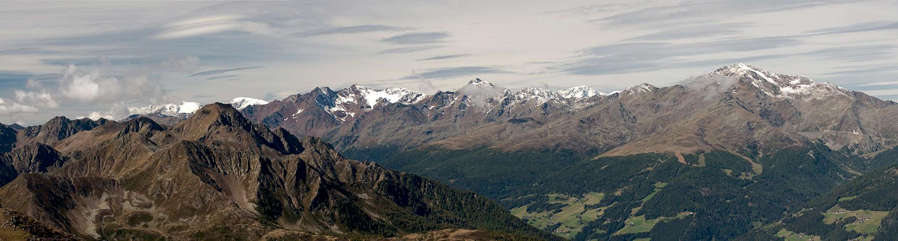
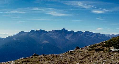 The Ultener Hochwart subgroup of the Ultenkamm range The Ultener Hochwart subgroup of the Ultenkamm range |
The Ultental / Val d'Ultimo Valley cuts deep into the Ortler / Ortles Group from the north-east, cutting the eastern part of the range in two distinct parts. It starts at Lana near Meran / Merano and runs for 30km until it reaches its end at Weißbrunner See / Lago Fontana Bianca. In its centre the valley is only 1100m high while the two accompanying ridges reach between 2400 and (more than) 3000m. The high summits, however, can be found near the central mountains of the Ortler / Ortles Group in the west while the ridges gradually decline while they run to the east. In both cases, however, a sentinel mountain rises before the end, more or less located directly opposite to each other on the northern and southern sides of the valley.
Both mountains are called Hochwart (loosely translated as "High Guardian" = Sentinel) and owe this name to their commanding position among a moderate number of lesser (lower) mountains. In order to distinguish them from each other the northern Hochwart often is named after the village Naturns / Naturno at its northern base - Naturnser Hochwart / Guardia Alta while the southern mountain always is called Ultener Hochwart or Vedetta Alta in Italian. (To make matters worse there are two more mountains of the same name in the vicinity, one in the northern Sarntal Alps / Monti Sarentini, one in the southern Stubai Alps - again almost located directly opposite of each other.)
 |  |  |
Ultener Hochwart / Vedetta Alta is located in the north-easternmost angle of the Ultentalkamm / Cresta di Val d'Ultimo, the south-eastern end of the Ortler / Ortles Group. It is a rocky limestone mountain with very steep slopes and ridges which ends in a round topped summit, which almost resembles a small plateau. The mountain is easily distinguishable from its neighbours thanks to this shape and of course because it is the highest summit of its immediate vicinity.
Also, Ultener Hochwart / Vedetta Alta is rumoured to be one of the best lookout summits in this part of the Ortler / Ortles Group (a fact I cannot confirm as we climbed it in foggy weather). There are numerous hiking trails from about a dozen different trailheads, which combine into four routes which lead to the summit. All routes are very steep and thanks to the poor rock quality (especially on the southern slopes) most of them are not very recommendable. There is one exception, the east ridge, which connects the mountain to its neighbour Schöngrubspitze and which is an exposed scramble on polished but solid rock. Several sections have been protected ferrata-style with chains and cables but still the route can get slippery and dangerous in wet conditions.
Getting There
  |
Ultener Hochwart / Vedetta Alta can be climbed from at least four sides. There are many trails, which combine about 300m beneath the summit, to which four remaining trails lead. Most trailheads can be found in Ultental / Val d'Ultimo between St. Weilburg and St. Nikolaus. Another trailhead is at Proveis / Proves in the south of the mountain, while the shortest access is from Hofmahdjoch, the saddle which separates the Ortler / Ortles Group from the Nonsberg Group.
- Take Brenner Motorway A22 to the exit Bozen Süd / Bolzano Sud
- Switch to SS38 towards Meran / Merano.
- Take the exit Lana and drive through the town, following signs to Ultental / Val d'Ultimo
- The Ultental trailheads are all on the south shore of Zoggeler Stausee / Lago di Zoccolo
- For Hofmahdjoch or Proveis / Proves leave Ultental right after St Pankraz / San Pancrazio. There are parking lots near Hofmahdjoch, the highest point of the road, between and after tunnels #3 and #4.
- For Proveis / Proves simply stay on the road until you get there
Red Tape
There is no red tape in the area. The lower slopes of the mountains are used for cattle, sheep and goat grazing and there are many gates and fences. Stay on the marked trails and close any gates you have to hike through.Accommodation
Weather Conditions
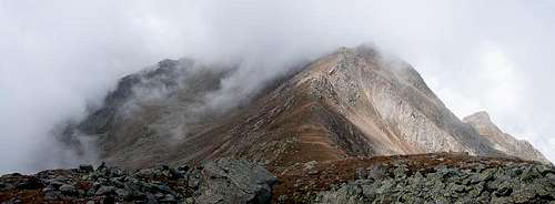 Ultener Hochwart / Vedetta Alta in heavy weather
Maps & Books
Maps
- Digital Maps
- Regular Maps
- Meran und Umgebung/Merano e dintorni
Kompass Map WK 53
1:50.000
ISBN: 978-3854910596
- Lana-Etschtal/Lana-Val d'Adige
Kompass Map WK 054
1:25.000
ISBN: 978-3854913542
- Lana, Etschtal / Lana Val d'Adige
Tabacco Map 046
1:25.000
- Meran und Umgebung/Merano e dintorni
Books
- Meran, Burggrafenamt, Ultental, Passeiertal
Kompass Guidebook WF951
Franziska Baumann
Kompass Verlag
ISBN: 978-3854913863
- Rund um Meran - Passeiertal, Texelgruppe, Ultental
Henriette Klier
Rother Verlag
ISBN: 978-3763342907