
|
|
Route |
|---|---|
|
|
39.51910°N / 106.2552°W |
|
|
Hiking, Mountaineering, Skiing |
|
|
Spring, Summer, Fall, Winter |
|
|
A long day |
|
|
Class 2 |
|
|
Overview
This is a straight forward climb in the winter. For Shrine Mountain, the route is about 7-8 miles round trip (depending on variations) with about 1300 feet elevation gain. For Wingle Ridge, the route is about 8-9 miles round trip (depending on variations) with about 1400 feet elevation gain. Either climb can be done in one day, but many people stay in the Shrine Mountain Inn cabins for a night.I have only done this route in December, January, and February, so it will be described as a winter route.
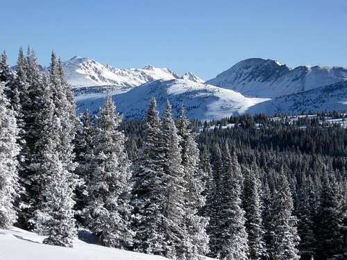 Gore Range as seen from the climb up to Wingle Ridge.
Getting There
The Vail Pass Trailhead is along I-70 5.4 miles west of Copper Mountain Ski Resort or 14.3 miles east of Vail. Take Exit 190 and park at the indicated overnight parking area.The Shrine Pass Road and the trail to the Shrine Mountain Inn Cabins (which are on the way to the mountain) leaves from the parking area. It is well signposted.
Make sure to have a winter recreation pass.
If you climb the Wingle Ridge or Shine Mountain between the day before Thanksgiving (late November) through April, you must have a pass for the Vail Pass Winter Recreation Area. If you book a hut at one of the Shrine Mountain Inn huts, this fee will be included in your reservation (and must be displayed on the windshield).
If you didn't book a hut, you must buy a pass separately. The $6.00 per person per day/night, and children 13 and under are free.
Click Here for more/updated information.
 Part of the trail not far from the trailhead.
Route Description
From the trailhead, located the snowmobile packed Shrine Pass Road. Head up the road for a short distance (maybe 500 feet or so) to the first switchback. I the winter season, there is a marked trail on the left. (Unless you are travelling at night, don’t use the Shrine Pass Road for skiing or snowshoeing in winter).Follow the well used ski and snowshoe track along the hillside. It stays between on the hillside West Tenmile Creek and the Shrine Pass Road. After just over two miles, you will reach Shrine Pass, which is often quite windy.
Locate the trail to the southwest and through the trees. This trail accesses all three cabins of Shrine Mountain Inn (Jays, Chucks, and Walters).
From near Walters Cabin, a (usually marked ski trail climbs southwest to the pass between Shrine Mountain and Wingle Ridge. If you stay on route you can avoid almost all of the avalanche danger, but pay really close attention to the route and don’t be afraid to break your own trail if the packed trail passes through avalanche terrain. The Pass is at 11,740 feet.
Once on the pass, follow the ridge northwest for Shrine Mountain. In winter, the route is usually easy along a windblown ridge.
 Shrine Mountain is to the left as seen from the saddle.
For Wingle Ridge, head south along the ridge. This is a beautiful route with spectacular views. Make sure to avoid the gigantic cornices that hug the east side of this ridge.
 Gore Range from near the summit of the highest point on Wingle Ridge.
 Essential Gear
Skis, snowshoes, and other winter gear are needed in winter.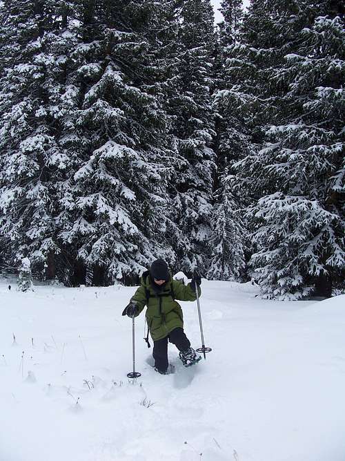 Trailbreaking on Shrine Mountain.