Welcome to SP!  -   
 
 New features are here! - Read More... 
Areas & Ranges·Mountains & Rocks·Routes·Images·Articles·Trip Reports·Gear·Other·People·Plans & Partners·What's New·Forum

Signal Butte Standard Trail
Route

Signal Butte Standard Trail

 
Signal Butte Standard Trail

Page Type: Route

Location: Colorado, United States, North America

Lat/Lon: 39.05860°N / 105.2228°W

Route Type: Trail Hike

Time Required: Less than two hours

Difficulty: Class 2

Route Quality: 
 - 3 Votes


Page By: Ed F

Created/Edited: Feb 5, 2005 / Aug 7, 2005

Object ID: 163826

Hits: 1515 

Page Score: 0% - 0 Votes 

Vote: Log in to vote


Approach


See the Getting There Section on the main page.

Route Description


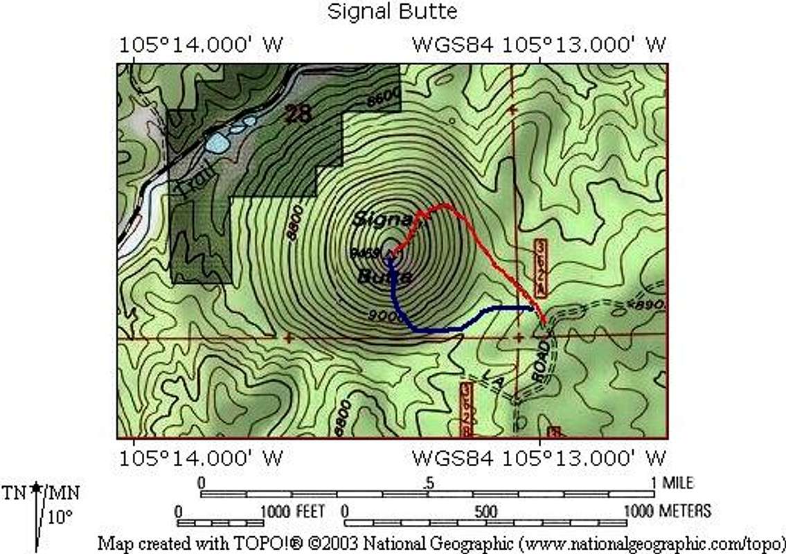
This route is marked as FS 362A and begins in the parking area. Follow the well constructed trail as it winds around the butte and drops you off on the summit. The trail is easy to follow until just near the top, where you can go straight for the summit.

Stats for this Route
Round Trip Length: 1.3 miles
Elevation Gain: ~500 feet


The route is in red below.


Essential Gear


Standard hiking gear.

Miscellaneous Info


If you have information about this route that doesn't pertain to any of the other sections, please add it here.

Images

Signal Butte


"I leave Sisyphus at the foot of the mountain! One always finds one's burden again. But Sisyphus teaches the higher fidelity that negates the gods and raises rocks. He too concludes that all is well. This universe henceforth without a master seems to him neither sterile nor futile. Each atom of that stone, each mineral flake of that night filled mountain, in itself forms a world. The struggle itself toward the heights is enough to fill a man's heart. One must imagine Sisyphus happy."   --Albert Camus   

© 2006-2012 SummitPost.org. All Rights Reserved.