
|
|
Mountain/Rock |
|---|---|
|
|
36.54881°N / 105.41442°W |
|
|
Hiking, Mountaineering |
|
|
Spring, Summer, Fall, Winter |
|
|
12978 ft / 3956 m |
|
|
Overview
 Benchmark
Simpson Peak is a small peak located just south of Wheeler Peak, the highest point in New Mexico. Although the peak stands at 12,978ft, it lacks the prominence to be considered a "true peak" in the mind's of most people. It only has around 170 feet of prominence- not much for a named peak. However, setting aside the prominence issue, Simpson Peak is still a pretty neat peak. It serves as the intersection of a few very prominent ridges. Simpson Peak serves as the connecting point between the ridges that connects Lake Fork Peak, Old Mike Peak and Wheeler Peak. The ridge to Old Mike from Wheeler is very straightforward. From Lake Fork Peak, one can make this a very interested peak to climb due to the fact that the ridge is mostly 3rd class with some 4th class parts.
Most people choose to hike this peak after bagging Wheeler Peak when they are in route to Old Mike Peak. From Wheeler, Simpson looks like a bump. However, when viewed from Peak 12,728 or from around Williams Lake, Simpson seems like a daunting mountain. There is a sporty class 3 to 4 ridge that must be surmounted in order to gain it's prestigious summit. To do this ridge, some people start at Kachina Peak and "ridge-it" till they get to Wheeler Peak (thats what I did). Others might try to access it from Williams Lake by climbing one of the "Double Couloirs" which are located between Simpson Peak and Peak 12,728 (you can see them from Williams Lake). These would also make for a fun winter/spring route. If you look for it, you can find a challenging route up this peak.
Some people would probably consider this peak to be "not worthy" of a home on SummitPost. However, it does provide the those who look with ample climbing and of course, great views...minus the crowds on Wheeler Peak!
 Old Mike and Simpson from Wheeler
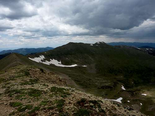 Wheeler and Walter from Simpson
Route Info
Williams Lake Trail- From the parking lot at the Williams Lake Trail head, its about 2 miles to Williams Lake. Take some time here cause its a pretty tight lake. Head east from the lake and started heading up Wheeler Peak. This is a VERY steep trail. Did I mention that it was a steep trail? Well it is. After summiting Wheeler, head south along the ridge to Old Mike Peak. Simpson is that little bump along the way about a half mile south of Wheeler Peak. Williams Lake Trail...Rope??
Bull of the Woods Trail- The trail starts at Twinning Campground and works its way up along a roaring stream till it gets to the saddle between the Wheeler Peak Massif and Gold Hill. Head south along the ridge and go through La Cal Basin and work your way up to Mt. Walter. From Mt. Walter, Wheeler Peak is a hop, jump and a skip away. After summiting Wheeler, keep heading south about half a mile and you will reach Simpson Peak. Head back along the same route or take the Williams Lake Trail.
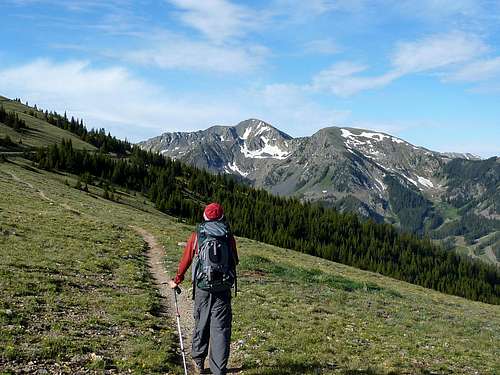 Easy hiking
Alternate Routes- As said before, you can make this an interesting climb by taking the SW Ridge of Simpson Peak. You access this by either doing the entire ridge from Kachina Peak. Or, you could access this ridge from Williams Lake. There are a few couloirs on Simpson's West Face that would also provide good snow routes. The ridge (from the saddle between Point 12,728, is about .35miles long. The ridge is definitely 3rd class and, depending upon the line you choose, can become a 4th class climb. No matter what, this is a fun ridge and should be considered when attempting this peak.
 SW Ridge
Red Tape
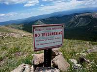 Private Indian Land
There is no red tape to this area that I know of. Only thing that is an issue is that Simpson Peak borders the Taos Peublo Indian Reservation. This has always been an issue for hikers in this area. Be sure to stay off their land as much as possible and to respect it if you do happen to cross parts of it.
 Bad weather...we happened to get lucky
Know the weather! The Sangre do Cristo Mountain range is known for very brutal and sudden thunderstorms. Assess the weather situation CONSTANTLY while above treeline in this area. The peak will always be there.
Camping
Camping can be done in many places along NM 150 while on the way up to TSV. Campgrounds along the road include Lower Hondo, Cuchillo De Medio, Chuchillo, and Twinning. However, Twinning has the best access to either the Bull of the Woods Trail (the trail begins at that campground) or the Williams Lake Trail. Plus its free. Other then that, camping can be down in the back-country. Follow all back-country ethics such as Leave No Trace (LNT). More information about camping in the Carson National Forest can be found HERE.Getting There
From Taos- Head North on HWY 64. Turn right onto NM 150 (Ski Valley Road). Follow this for a long time. If you are going to the Bull of the Woods Trail, then park right next to Twinning Campground at the top parking lot for TSV. If you are going to the Williams Lake Trail, continue PAST Twinning Campground onto Twinning Road (dirt road). Follow this and then veer left onto Porcupine Road and follow that to the Williams Lake Trailhead. Park and hike!External Links

Carson National Forest
Carson National Forest Homepage
Current Conditions
Current Conditions for the Carson National Forest
Wheeler Peak Wilderness Area
Carson National Forest page for the Wheeler Peak Wilderness Area
Taos Ski Valley
Homepage for Taos Ski Valley- A ski resort located down the ridge from Simpson Peak
Wheather Conditions
Current weather conditions for Simpson Peak as forecast-ed by NOAA
Misc
If you have any more additional information or photos, please contact me or add them to this page. Thank you! Click to see how Simpson got its name
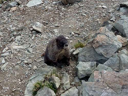 MARMOT!