Introduction
Well it had been a couple weeks since the last serious that I had done and to be honest I have been suffering some serious cabin fever. Well now it is time to turn the table on the winter cabin blues and with the good weather in the forecast I knew it was time for me to do a new mountain. I also wanted to get together with a number of old friends in which I had not been able to much hiking with in over a year. Finally the weather was good and my friends were ready for another good weekend in the mountains.
![Map of the Winter Route]()
It was great for Magellan, Curtissimo and I to finally combine for a good hike. Add on our mutual friend Dave who lead me on a number of trip in the Cascades, and my friend Joel who joined me on a number of good trips this fall, and we had a crowd of good hikers waiting to take on the mountain. It had been over a year largely because my work schedule recently has been completely funky. But finally we were able to combine and luckily we hit a good day to do a decent mountain, Little Saint Helens. None of us had been there and all of us wanted to check this summit out.
Heading Up
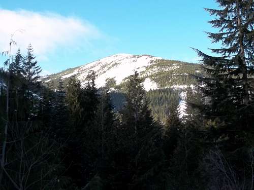
On the way up we walked up the Hanson Creek Road 2 miles all the way up to Hanson Creek Trailhead. This turned out not to be the most peaceful time to be going up this road because a lot of people were coming up here for Christmas Trees. They even had a ranger on the road. Though we walked a number of other vehicles decided to drive all the way up in order to look for Christmas trees in the area. This was despite the fact that the road had more than a foot of snow on it in places and the snow was compacted!!! Lets just say this was a recipe for stuck vehicles which we saw plenty of on the way up. The one good thing though was the fact that we did not need to use much effort or need snowshoes on the way up to the trailhead! All the tire tracks compacted the snow very nicely.
![Curttissimo on the way up]()
Once we got to the trailhead we decided to bushwhack up to the summit. The crusty, posthole style snow was not much fun going up. It was very steep and quiet a pain going straight up. For Joel this was quiet tough because this was his first snowshoe hike. Despite the steep angle of the snow we decided wisely to put on the snowshoes and head on up. Because this was our first snowshoe in seven months we were quiet slow. But we hung in there heading up the mountain. Curtissimo did most of the trail cutting and Magellan finished it off to the summit with me working in a number of areas to cut us a nice route to the summit.
It was a good workout and one I am there thankful to have after not hiking heavily for a couple of weeks.
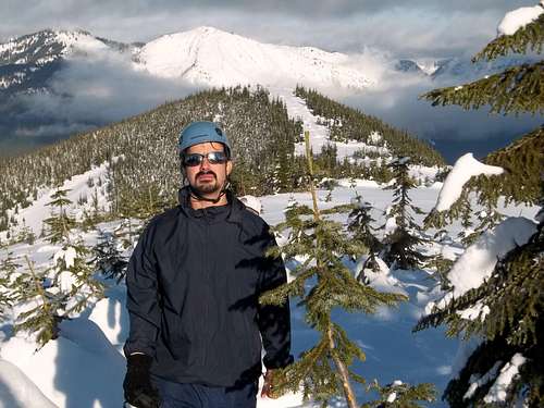
The Summit
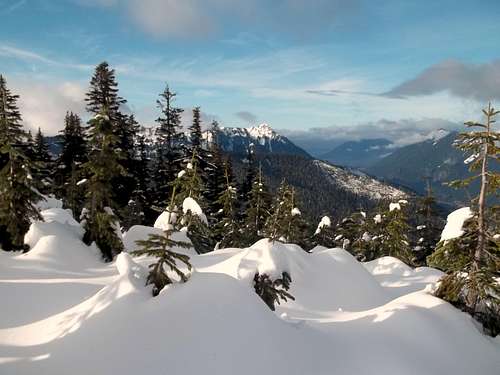
We took our time and enjoy the summit as well as its two viewpoints. The true summit itself has a number of seedlings so views tended to be partial. But if you go a couple yards to the north there is a large treeless plain that had expansive views to the north of Bandera, Granite and many of the other northern peaks. It was quit obvious to us that this is meant to be a winter peak, because I don’t think this mountain would have the same appeal in summer.
Heading Down
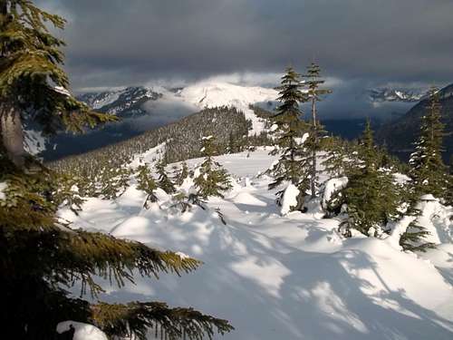
After our break on the summit we decided to head down a slightly different way. This way involved checking out the beautiful open slope of the south side. Literally just as we got there views of Mount Rainier really opened up. This beautiful open area also great some shots of mountain views as well as some cool action shots. Personally this area was the highly of the whole trip. This was another area that would not look nearly as nice in summer as it did in winter.
From there we continued down the steeper slope. I managed a few short glissades but the area quickly became covered with second growth. At this point it was beginning to get dark and we knew that we had to go quicker down the mountain. That being said the tree bombs from the second growth forest. The nasty tree wells and the steep slope were really working on all of our nerves as we were heading down the mountains. Just as we were really feeling the hurt we hit the road.
From there it was just us racing down the road and racing against the sunset. The sun was beginning to set and we were still 3 miles from the car. Add to the fact that there were about 60 trucks on the road and at least 10 of them were stuck. But we just raced down as best we can. If someone really needed help we would help them out but other than that we just set a fast pace back to the car and within an hour and just before dark we were back in our warm cars.
Conclusion
I want to thank everyone for coming on this trip! Everyone here played a major role in the success of the trip. The trip required help from everyone and it got help from all. I want to thank Magellan for having us all ride in his high clearance truck to the trailhead. I also want to thank Curtissimo for doing a lot of the trail breaking and Dave for helping out Joel with his snowshoes. I also want to thank Joel for coming along on his first snowshoe experience. You did well my friend and I will invited on many more trips. It is winter and now it time to enjoy some SNOW!!!
Comments
No comments posted yet.