
-
 9020 Hits
-
 70.63% Score
-
 3 Votes
|
|
Route |
|---|---|
|
|
37.98690°N / 106.9308°W |
|
|
Hiking, Mountaineering |
|
|
Spring, Summer, Fall |
|
|
Most of a day |
|
|
Class 1+ |
|
|
Approach
Use the West Willow Creek Trailhead for this route (town of Creede) to the Equity Mine and follow an old 4 wheel drive road north until you reach the Colorado Trail at a nice saddle. This also gives the bonus of crossing the Continental Divide. This approach consists of crossing 3 saddles enroute to climbing the southern ridge. An easy class 1 hike although somewhat long (10.6 miles RT from the 4WD parking area). These roads are not plowed in winter making the approach many miles longer each way.
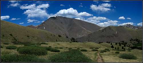
San Luis Peak from the CT
Route Description
Park at 11,500', past (above) the Equity mine where the road turns steeply west up a hill. Either hike the old 4WD road to San Luis Pass and turn right on the Colorado Trail or boot paths can be followed to the 12,300' saddle NE of the mine. Continue east on the trail for 3 miles to the 12,620' saddle on the south ridge of San Luis. This is easily followed to the summit. This route is both more scenic and slightly easier than the standard route on San Luis via Stewart Creek.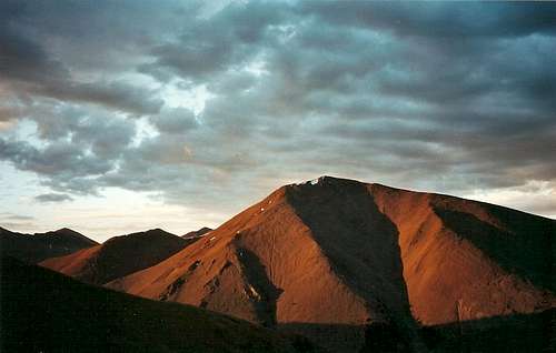
San Luis Peak with the south ridge on the right from the Colorado Trail
Essential Gear
Normal hiking gear. If snowy, ice axe and snowshoes may be needed.Map
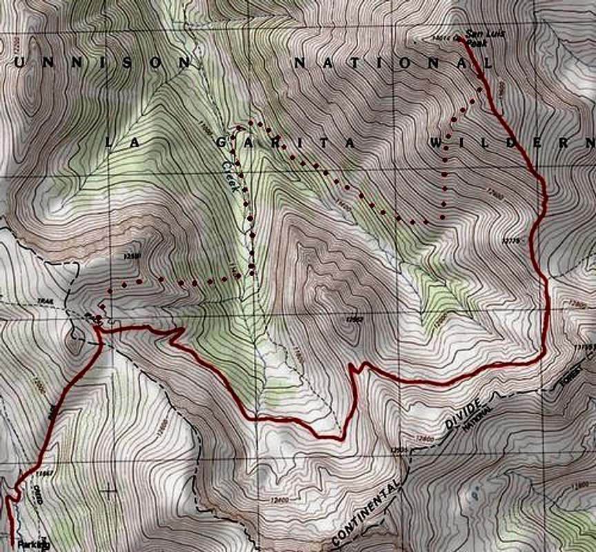
South Ridge Route in solid red