
-
 5850 Hits
-
 0% Score
-
 1 Votes
|
|
Route |
|---|---|
|
|
39.68900°N / 105.945°W |
|
|
Hiking, Skiing |
|
|
Spring, Summer, Fall, Winter |
|
|
Half a day |
|
|
Skin Up |
|
|
I |
|
|
Approach
Exit I-70 westbound directly after the Eisenhower Tunnel and park on the north side of the highway (~11,140').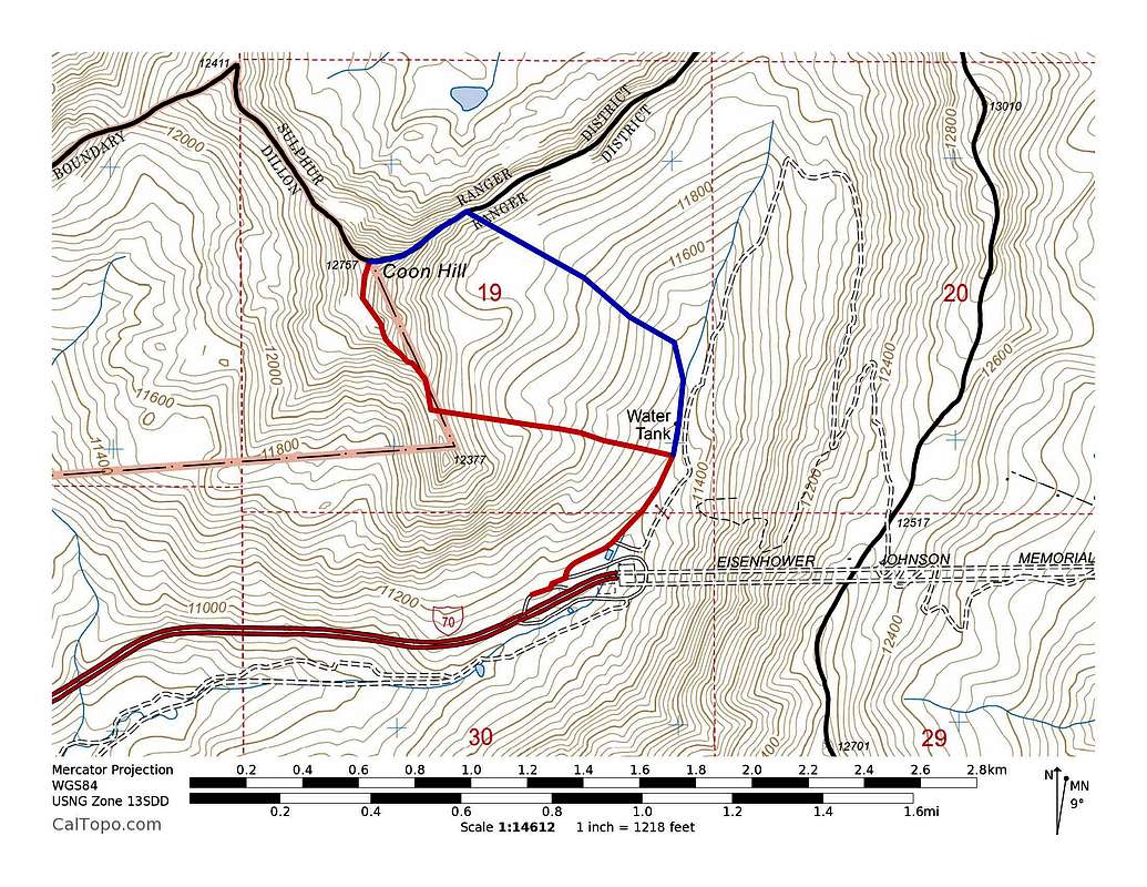
Coon Hill ascent routes. Red = South Ridge. Blue = Northeast Ridge. Click to enlarge.
Route Description
From where you park, head north about 0.4 miles and Coon Hill will be obvious on your left. Gain the saddle between Coon Hill and Elevation Point 12,377'. Hike up the ridge to summit Coon Hill.Essential Gear
Skins and skis are best for snow climbs in the spring.Numbers
~2.8 miles roundtrip~1,700 vertical feet up