
-
 32336 Hits
-
 85.17% Score
-
 20 Votes
|
|
Mountain/Rock |
|---|---|
|
|
39.68900°N / 105.945°W |
|
|
12757 ft / 3888 m |
|
|
Overview
It is the highest peak in the Williams Fork Mountains and also the highest point in the Ptarmigan Peak Wilderness. Coon Hill is located just west of the Continental Divide in Northern Colorado and is less than 1 mile northwest of the west end of the Eisenhower Tunnel of Interstate 70. Coon Hill was once a popular summer hike; there used to be a summit register, but recent parking restrictions have made it less accessible.The South Ridge route is second class and is 2.8 miles roundtrip with ~1,700' vertical feet of elevation gain. Whereas, the Northeast Ridge is third class and 3.2 miles roundtrip with ~1,640 vertical feet of elevation gain.
Coon Hill offers excellent spring skiing off the north, east and south faces. The following refers to the spring. Ascending from the south is not too difficult. It requires an easy skin to the South Ridge and up to the summit. Due to the steepness (35 degrees) this should only be skied when spring conditions exist.
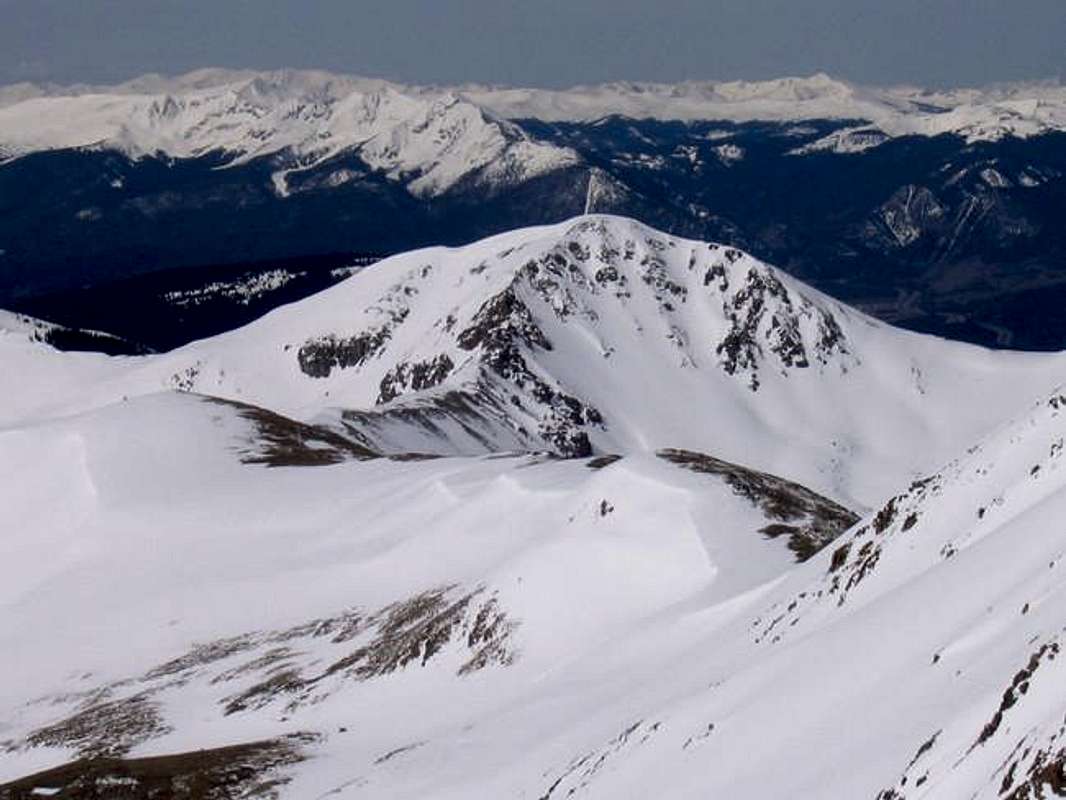
Coon Hill's Northeast Face from the Citadel. Submitted by miztflip
Getting There
Exit I-70 westbound directly after the Eisenhower Tunnel and park on the north side of the highway (11160'). Do not park near the maintenance building. This makes the staff nervous. Head north about 0.4 miles and Coon Hill will be obvious on your left. More detail in "Colorado Mountain Hikes for Everyone - Routes and Maps to 105 Named Summits" by Dave Muller. |  |  |  |  |
Ascent Routes
South Ridge
Class 2, 2.8 miles with ~1,700 feet of elevation gain
Northeast Ridge
Class 3, 3.2 miles with ~1,640 feet of elevation gain
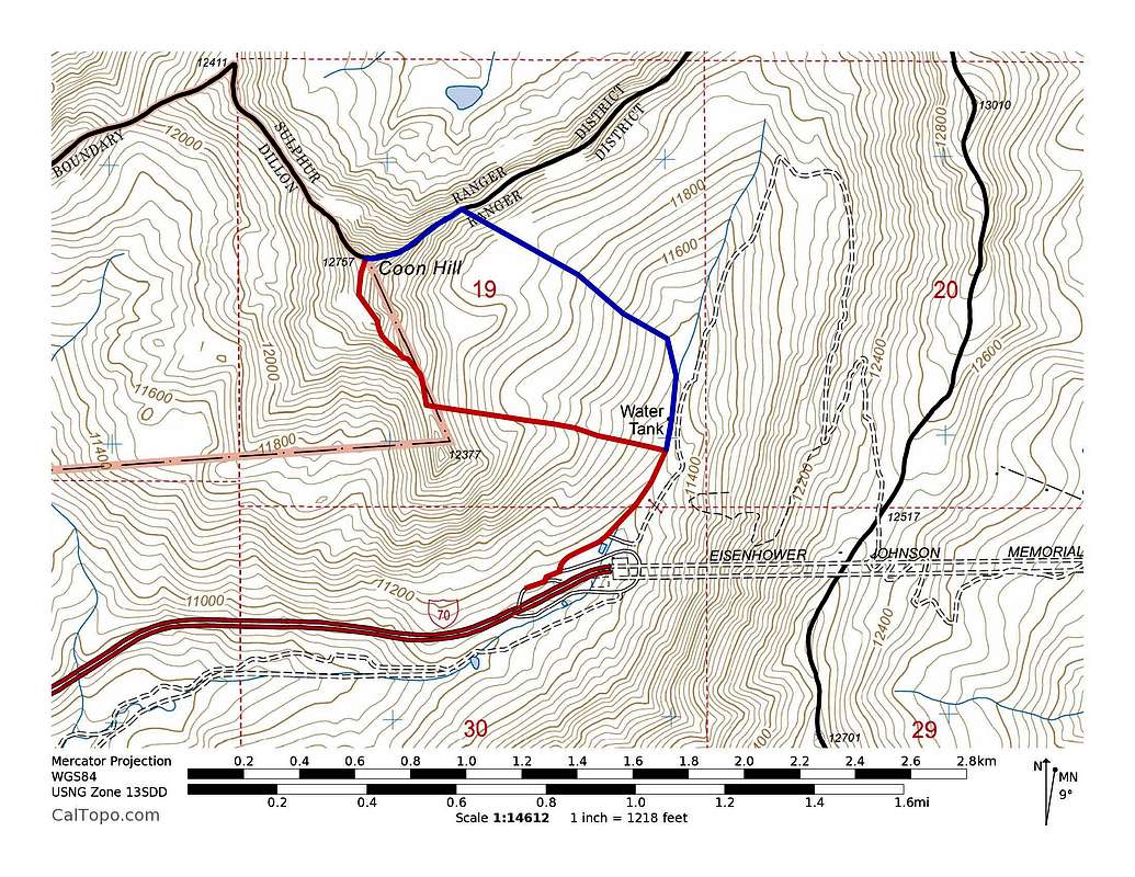
Coon Hill ascent routes. Red = South Ridge. Blue = Northeast Ridge. Click to enlarge.
Ski Runs
The following should only be skied when spring snow stability conditions exist...generally no earlier than April.North Face: I D7 R2, 1000 vertical feet. Exit: Gain northeast ridge and ski the east face.
East Face: I D6 R1, 1000 vertical feet. Exit: Follow valley back to parking.
South Face: I D8 R3, 1200 vertical feet. Exit: Gain south ridge and ski east face.
D System

Skiing Coon Hill's North Face
Red Tape
No permits, fees or passes required to my knowledge. No seasonal closures or rules for wildlife conservation or safety. Recent parking restrictions at west portal of Eisenhower Tunnel.Mountain Conditions
7 Day Forecast for Loveland Pass, COLinks
Stan Wagon's Coon Hill PageLists of John