
-
 1975 Hits
-
 72.08% Score
-
 2 Votes
|
|
Route |
|---|---|
|
|
46.70642°N / 10.57781°E |
|
|
Half a day |
|
|
Hike |
|
|
Overview
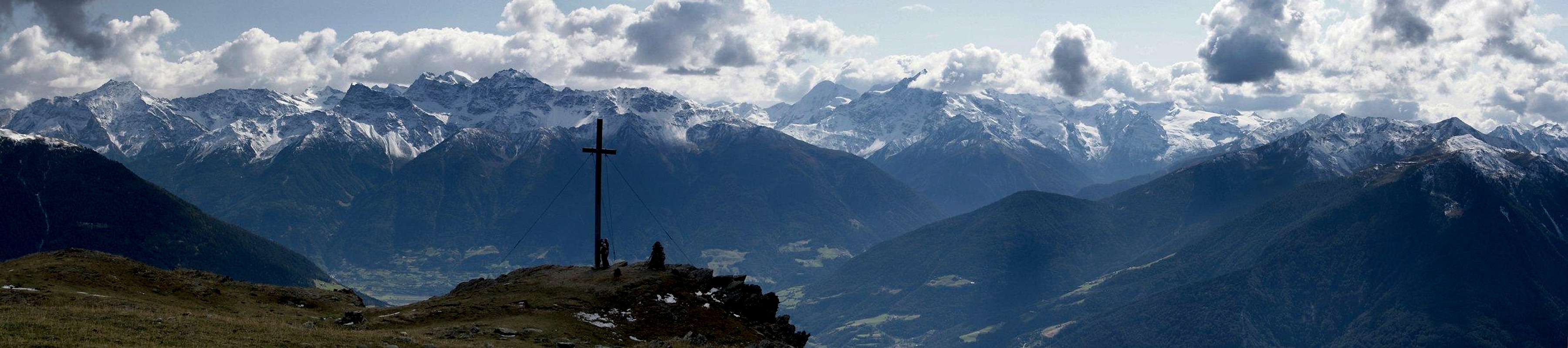
 Spitzige Lun summit from the west ridge Spitzige Lun summit from the west ridge |
The southern route to Spitzige Lun, which starts at Muntaschinig, is the shortest route to the mountain. Still you have to cover approximately 1000m in elevation gain, which makes the route popular but pretty strenuous. The first part of the route runs along a mountain road (which, technically, you can drive up though it is not allowed), before changing to a dirt road and finally to a narrow hiking path. Much of the ascent runs through the forest on the south side of the mountain and only the last 200m offer reasonable views.
The final ascent runs along the rocky west ridge of the mountainbut remains a hike, never turning into a serious scramble. From Spitzige Lun a path leads to neighbouring Nierderjoch / Giogo Basso, both summits often being climbed together.
Getting There
Follow the itinerary as detailed on the main page. Muntaschinig is located on a terrace above Mals / Malles. Take SS40 through Tartsch /Tarces and from there take the road into Matscher Tal / Val di Mazia. After two switchbacks the road to Muntaschinig turns off to the left. It is very narrow. A reasonable parking place is close to a picnic area east of Muntaschinig, where the road to the Gamassen farm turns off to the right.Route Description
- Start altitude: 1376m- Summit altitude: 2324m
- Prevailing exposure: S
- Type: Hike
- Protection: None
 |  |
From Muntaschinig follow the paved road to the Gamassen farm, which passes the village to its east. After about 45 min you'll reach the farm on a meadow overlooking the Vinschgau Valley / Val Venosta. Here you can either follow the road until you reach an intersection at which you have to take the left hand road, heading westward. However, there also is a marked path, staring some 300m above the farm, which cuts short a huge bend of the road. When it joins the road again, follow the latter to the left for a couple of 100m before again hitting the forests following a narrow path.
This path traverses the south slopes of Spitzige Lun. As written in the overview section, due to lumber works going on in the forest, orientation was quite a challenge. In the end, the path heads out onto a meadow on the further end of which you'll find the Seale Lake. Right before you reach the lake, the path turns eastward and heads back to the south slopes of Spitzige Lun. The forest turns less dense and after 30 min you cross the timber line.
Heading back westward the path joins the slightly pronounced west ridge of Spitzige Lun, which it follows to the summit. Only the topmost part of the route is a little rocky.
  |