
|
|
Route |
|---|---|
|
|
Mountaineering |
|
|
Half a day |
|
|
Class 4 |
|
|
II |
|
|
Overview
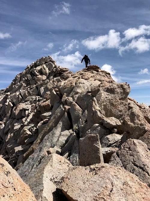
"South Basin Peak" (13,240') is a high point on the ridge between Mt Humphreys and Basin Mountain. The Southwest Ridge is a short, exposed 3rd/4th class scramble on good quality rock. This is a nice climb from the east in early season when snow covers the east side of the ridge.
Getting There
The ridge starts at the large plateau between Humphreys and Basin which can be accessed from multiple directions. The approach from Longley Lake will be described here.
From Bishop head up 168 and take Buttermilk Rd approx 9 miles to a grove of aspens at ~8500'. The road is rough and a 4WD vehicle is needed. (This took 1.5hrs in a Subaru Forester and included filling holes with dirt and firewood and using a shovel (2019)). Hike approx 500' vertical further up the road to where it turns into a trail. This is the Upper Buttermilk Trailhead.
Hike 2-3hrs to Longley Lake at 10,700'. Good camping here.
Route Description
From Longley Lake hike/scramble due north into the canyon that is southeast of the peak. There is loose talus and scree here so climb in early season when there is snow. Continue up westward to a permanent snowfield below the plateau on the Humphreys - Basin ridge. Hike and scramble northeast to the summmit.
Essential Gear
Helmet, and ice axe & crampons if climbing early season.