
|
|
Route |
|---|---|
|
|
38.84420°N / 106.3133°W |
|
|
Download GPX » View Route on Map |
|
|
Hike |
|
|
Half a day |
|
|
Class 2 |
|
|
Route Description
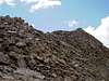
Round Trip-7 milesVertical Gain-4,300-ft
The Southwest Slopes Route has now become the standard route up Mount Yale.
From the Denny Creek TH, hike north on a defined Denny Creek Trail for .9 mile to about 10,400-ft and locate the signed Mount Yale Trail.
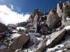
After locating the Mount Yale Trail, turn right and follow it for .5 mile as it switchbacks up Mount Yale’s gentle southwest slope to 12,200 ft. Follow the talus -ridden climbers trail to the summit. Near the summit, bypass a small rock buttress on it's west side. Once on top, you get great views of the surrounding Sawatch Mountains including a good shot of Mount Princeton from the north. Also, you can preview the excellent Horn Fork Basin approach to Mount Harvard and Columbia.
 |  |  |  |