With a Cherry Creek on Top - May 12th, 2012
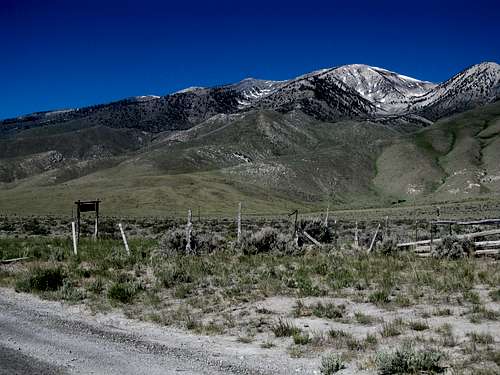
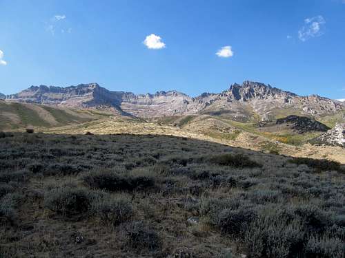
In the two or so weekends I had situated between a trip to Vegas and a week-long (plus) sojourn back home I was determined to hit up some Nevada peaks. I pushed this to the latter weekend, and I definitely wanted to do something cool before flying home. One peak that had always intrigued me was the unnamed highpoint of the Cherry Creek Range in northeastern Nevada. I’ve always been fascinated by the long, linear ranges of the Great Basin, and the fact that there lay this pretty decent one out there, a Range highpoint over 10,000’, yet fairly unknown with at least little info on Summitpost or elsewhere, qualified it as something that would gnaw at me until I went to see it for myself. I was perked to see a good paved road going all the way to the edge of the range, and based on what I could observe on Google Earth it looked like the dirt road leading into Exchequer Canyon would be drive-able at least for a few miles in my Camry.
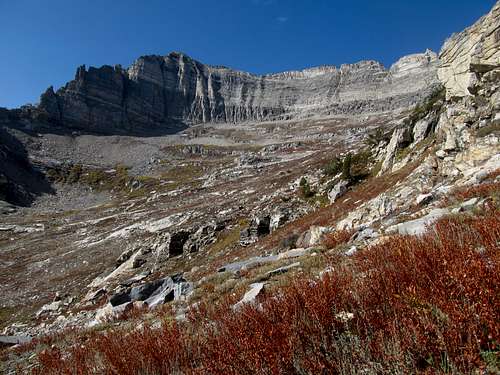
This would be only my second venture into Nevada since moving out west, and first by myself, onto beta-less terrain no less, so I was a little worried. As I pulled towards the range and into the ghost town of Cherry Creek I noticed the peak was a little more cliffy than I had anticipated as well. I found the road leading into Exchequer Canyon and though I could have pushed it further, decided to park it a little before the road veered west into the canyon itself. It was a warm May day, one of those clear sunny afternoons in Nevada which feel warmer than the thermometer actually indicates, and I trudged my way backpack in tow into the cliffy reaches of Exchequer.
I originally planned to gain a south-ish facing ridge from a few miles in the canyon directly to the summit. This proved to be tougher to locate as I noticed all the cliffy outcrops lining the right side of the ravine. I walked past the rock blocking the 4WD and followed it into a meadow, where the track soon disappeared. I first started left through smoother terrain, but worried that I was straying too far from the main canyon. Not wanting to accidentally ascend a side drainage, I made my way back to the right and into the brush.
The brush was quite thick, and after dodging and ducking for a bit I decided to ascend the slope immediately to the right of me and try to gain the ridge crest a little earlier than I had planned for. I started up right before a large cliff outcropping. Immediately I knew was in for it, as the slope turned out to be some of the loosest damn crap I’ve had the pleasure of ascending, with almost the consistency of sand and far more slippery. I struggled my way through the scree while still dealing with some minour brush, cursing myself.
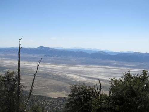
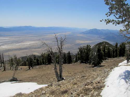
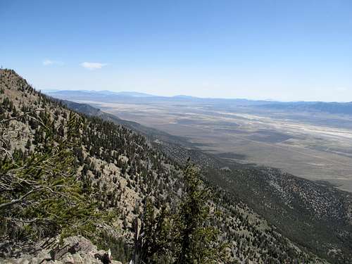
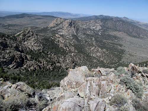
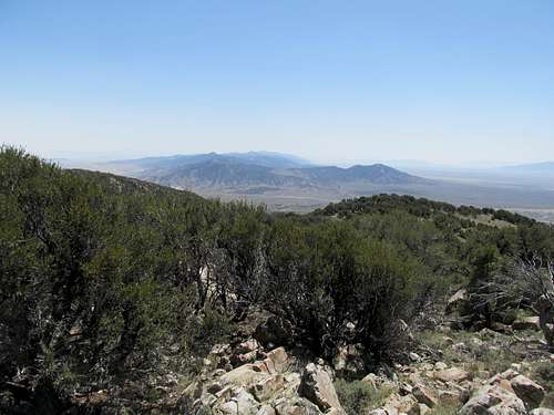
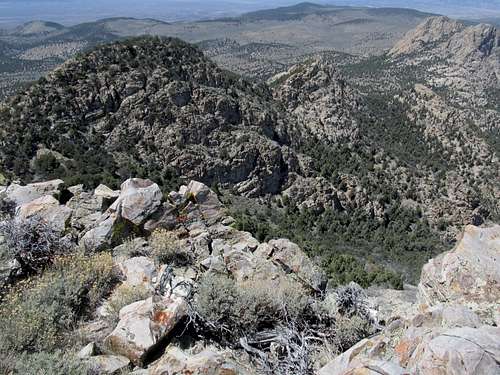
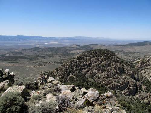
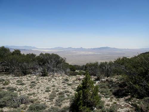
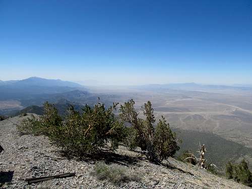
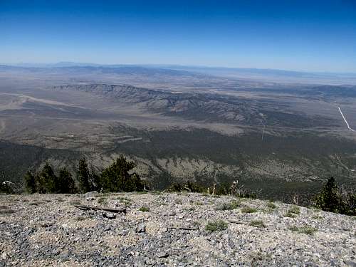
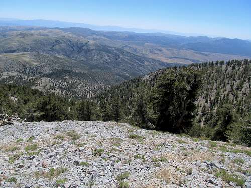
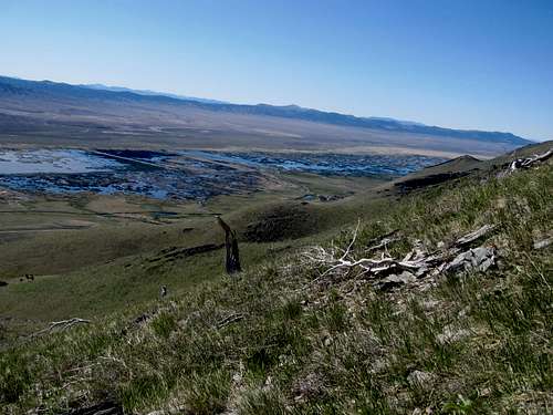
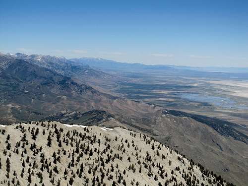
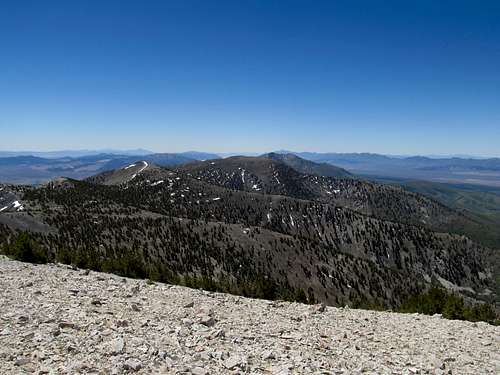
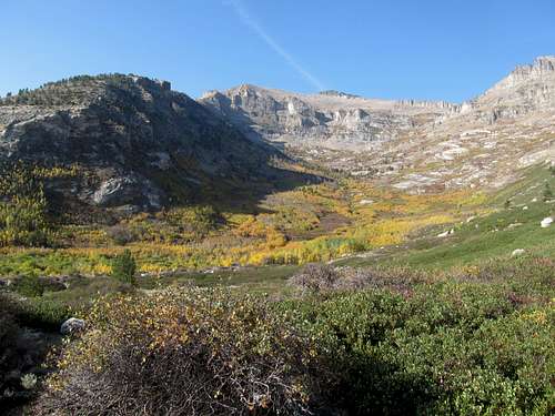
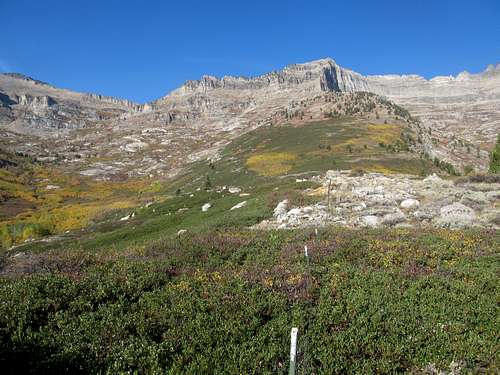
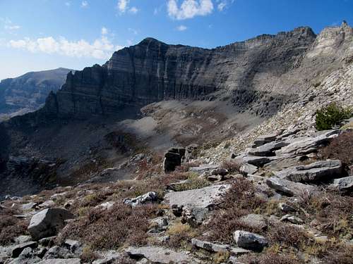
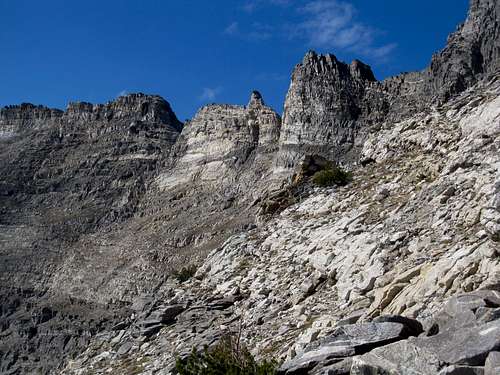
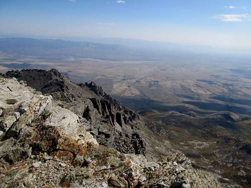
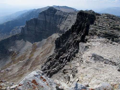
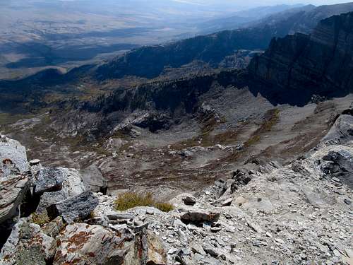
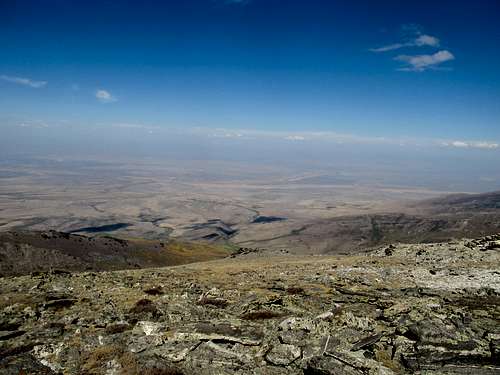
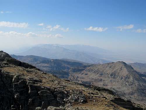
Eventually the climbing got easier, and I was graced with views of the valley below and the Egan and Schell Creek Ranges to the south. The terrain along the ridge crest was pretty easy, consisting of much more open terrain combined with some cool rocky surfaces. Trees limited the view along the ridge in either direction, so I hoped that I was slowly ascending a false summit to the south of the highpoint that was easily visible below. I kept making progress upward, but never topped out. The air was cooler though, as I breathed in the pleasant smell of high altitude pine trees. As the ridge continued north I stayed on the right side of the ridge, occasionally trying to gain the crest before changing my mind out of laziness and continuing to contour ahead. The ridge on the other side of Exchequer was fascinating, and seemingly more open. I wondered if a circular ridge traverse (which I certainly did not feel up to today) would yield better views than the route I had chosen.
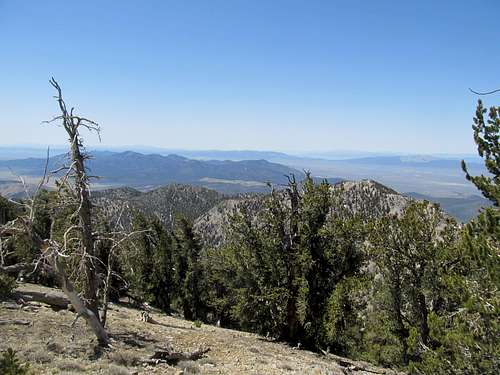
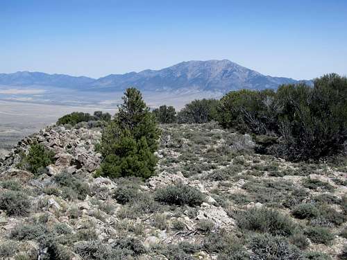
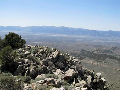
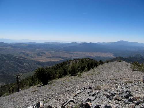
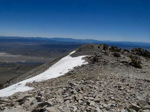
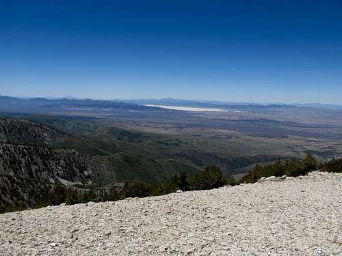
All things come to an end, and I breathed a prayer of thanks for that as I finally made the south summit, though in actuality it was probably further down the ridge than what I can see below. The views south were decent, and back east to Becky Peak and the Deep Creek Range beyond were spectacular, and ahead I could see the traverse to the true summit. Then it was down, besides some cool looking snow along the saddle, then another treed in trudge to finally attain the summit. I was excited, as this was probably the first beta-less summit I’ve attained since moving to Utah. The views left much to be desired, with trees blocking an open vista to the west. I ventured around and about to try and get some pictures of the Rubies and Pearl Peak, still glistening with snow.
Then it was time for the descent, and I opted to descend directly through the canyon. The contour west to the saddle atop Exchequer was a pain in the ass, as the ground was either still covered with snow of the icy kind, or mud of the slippery kind. Things got a lot easier upon reaching Exchequer, and the descent through open terrain was a breeze. Exchequer Springs was beautiful amidst by lush tallgrass, then the route took me between some crazy cliffwalls before dropping me in the brush that I had wanted to avoid on the ascent. I suffered through this section, then struggled a little to find again the dirt track.
The day done, I pulled into Wells exhausted and checked into a cheapo motel.
Settling for Toano - May 13th, 2012
My plan for Sunday was to ascend McAfee Peak north of Elko. As I rounded I-80 west of Wells I saw in the distance a high range covered in snow. I had hoped this was the Jarbidges, but as I examined the map I came to the unfortunate conclusion that it was more likely the Independence Range. A drive north from Elko past the Adobe Range Pass confirmed this, and though I probably could have made it, the fact that I had left my snowshoes back in Utah was reason enough for me to chicken out and try something easier.
Then it was east to Wells then north for Ellen D, a drive up supposedly. The main road was gated and locked, and I had unwittingly at the time probably parked the Camry somewhere along a dirt track while all the time wondering how this road was easily passable for sedans. I had walked probably a mile or so towards Ellen D before realizing that, due to those damn signs on US-93 requiring use of headlights at all time, my lights were still on back in the car. Not wanting a dead battery out here in the middle of nowhere I trudged back to where I parked. It was already hot as hell, and I didn’t feel like retracing my steps back, so I decided to aim for my 2nd backup plan of the day.
It was almost noon as I pulled off at the exit near the Toano Range 25 miles or so west of Wendover. I was already in a hurry to try and snag this one and get my summit of the day, but was first delayed as I helped an old Shoshone couple from Pocatello change their truck tire at the exit. Then it was onto the rough road of my own, as my poor Camry braved the rutted and rocky road approaching the Toano Range. I parked barely a quarter mile before the T intersection Dean mentions in his SP page, and started through the endless sagebrush fields.
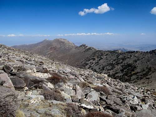
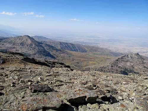
Up until this point I had limited experience in cross country travel through wooded terrain. I was a little worried about the 1000 or so feet of the mountain I would have to ascend blindly through the trees, but figured it would be easy enough as long as I aimed in the correct general direction, and that sooner or later I would end up on the ridge crest. For the most part travel as easy through the trees, the worst being a select few areas choked up with brush and rocks. The terrain opened up into high pasture once I did crest the ridge, and after some minour scrambling I was on top.
This summit was a pleasant little surprise and still ranks as one of my favorites. Pilot Peak loomed big, but of more fascination were the rounded red rock summits of the Toano Range to the north, giving the area a more exotic feel than one would suspect from I-80 below. The Salt Flats beckoned to the east too, as did the endless ranges west into the Great Basin, twice of which had already resulted in failure for me today. Perhaps it was meant to be, as in the end I got my summit after all, and an old couple got some help changing their tire.
It was on this note that I travelled home and spend a great week catching up with friends and family.
All About the Hamilton - June 9th, 2012
The second weekend upon returning west I got a text from Greg, looking to trek west into Nevada again. We debated between Table, Pearl and Hamilton, ultimately choosing the latter two. Up first on Saturday was Hamilton, a behemoth west of Ely along US-50. I left SLC in the early AM and made it to Belmont Mill, where Greg and Kadee were camped out for the night. This would also be my first encounter with an insane little pup named Oquirrh. A Vizla, Oquirrh had climbing in his genes (or anything really involving very high speeds), and a hike with him meant him running circles around us nonstop as we made our way two feet at a time up the mountain.
At Belmont Mill I hitched a ride with Greg and Kadee up a small drainage to an open meadow. The eastern face of Hamilton lay ahead, and we trudged up first through a steep section which quickly mellowed.
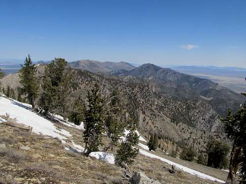
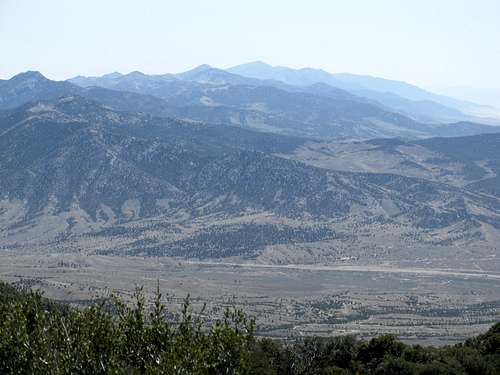
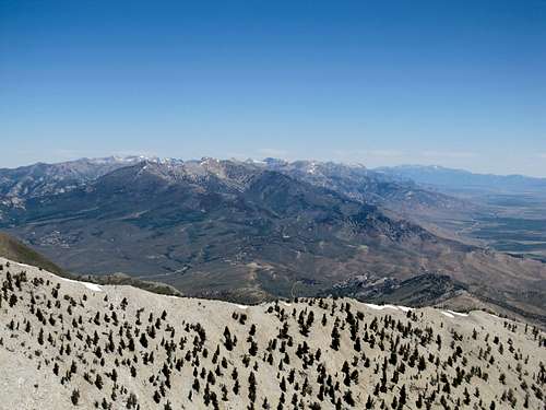
A cool rock ridge connected us to the ridge crest and a false summit north of the real one. Then a pleasant traverse, and the summit of Hamilton was easily attained. The temperature and the views were perfect, and I glimpsed for the first time the Monitor Range and the Nevada giants southwest and beyond the town of Eureka.
The descent was easy enough, and while Greg and Kadee proceeded towards our destination for the next day I drove to Eureka in hopes of a motel room to catch Game 7 of the Celtics/Miami series. Alas, a wedding in town meant that every motel was sold out, so I trucked it back to Ely to stay at the always charming Hotel Nevada, where I drowned my excitement, then frustration, then sorrow, in one dollar margaritas as once again the #$@$%#!@ck!&@ refs gave away the game to Miami
(burn in Hell David Stern! Burn in hell!)
Pearl of the Rubies - June 10th, 2012
I woke up with a mild hangover and drove the 60 or so miles of dirt roads to the Ruby Lake NWR, where Greg and Kadee were already waiting for me. Kadee would sit this one out as Greg and I pursued the summit of Pearl Peak, an impressive barren giant guarding the southern end of the Ruby Range. Again I hitched a ride in their truck as we drove up a few hundred feet to the end of the 4WD roads.
The ascent first went through barren fields, then a small forest, then talus, to the ridge crest, where a short traverse north took us to the summit of Pearl.
The views were boundless and breathless on this clear day, with endless vistas and endless mountain ranges far in the distance in every direction.
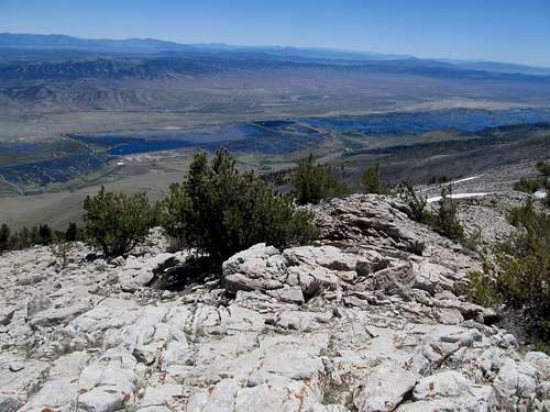
We surveyed the summit log and began a pleasant descent towards the blue marshes of Ruby Lake below, a scene that, with ignorance of our location, could almost lead one to believe they far away from civilization somewhere in the African Savannahs.
And thus that was it for Nevada for a long while. As the temperatures got warmer, the snows melted, and the days…well, got shorter actually, attention spans turned northward, to the spectacular peaks of the Northern Rockies and the Greater Yellowstone habitats. I would not return to Nevada until the end of September, ironically, same as in May, two weeks after another Vegas vacation.
A Hole-some Climb - Sep 29th, 2012
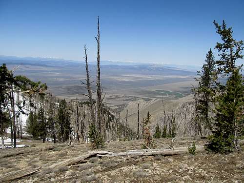
As had become typical over the course of the summer, going into Friday I still had only the vaguest ideas of what peaks to pursue. Eventually my sights set upon Ruby Dome, a peak which has always been high on my list. Though it seems like a pretty basic, if long ascent, a vague sense of uneasiness accompanied me as I journeyed west through the early morning. Most likely this was due to the fact that I was in a rush, hoping to get up and down the peak in time to catch some of the Ohio State Michigan State game, which kicked off at 3:30 EST. Whatever I felt about it though, Ruby Dome was not to be. West of Wells I got stuck for about 40 minutes on the highway as they cleaned up what looked to be a pretty nasty looking accident. Running late and figuring it’d now be a stretch get the summit and see the game, I banged a U-ey at the next exit and quickly looked up the beta for Hole-in-the-Mountain Peak, which, if Ruby Dome ranked as a 1-must-do for me in the area, HIM Peak would be 1a. The road leading towards the range was rough, but I made it to the 2WD trailhead before continuing up a fairly steep 1.5 mile stretch of dirt roads to the upper 4WD parking spot.
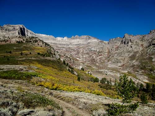
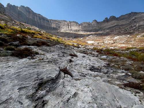
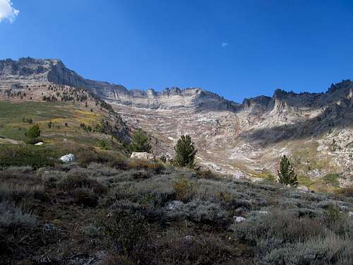
Having quickly brushed up on the route details on my phone prior to losing service near the trailhead I vaguely remembered something about heading up on the ridge before descending down into Lizzie’s Basin. Not recalling the exact details I started up the slope via the vague trail leading up from the 4WD trailhead. I marveled at the cliffs on either side of the ridge which seemed to get more dazzling colorful with each step I took closer to them; the aspen in full bloom only accentuated this effect. The trail meandered, so eventually as it started to head in what appeared to be the wrong direction I decided to cut off the trail and try to straight shot it into the basin, half visible behind the bushes.
Big mistake. I was waddling through thick groves of small bushes and stunted aspen, struggling at times to move even one foot. It took forever, backtracking, seeing open ground, ploughing ahead, getting stuck in more brush, but eventually I reached the small creek below the Calico Wall. To my left I saw a trail coming down a hill, and I figured this was probably the route I should have taken, though I wasn’t sure. Nevertheless I continued, aiming in a straight shot at the grassy gully that would gain me the summit ridge.
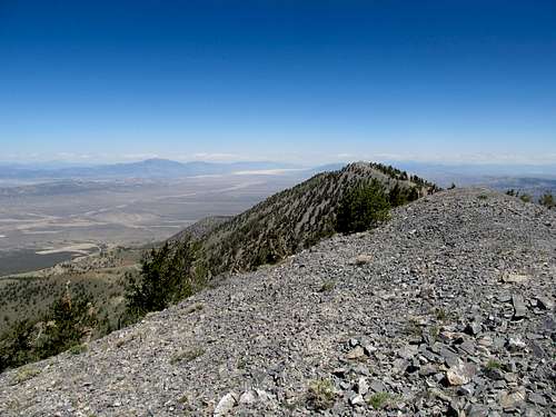
Lizzie’s basin was jawdropping from beginning to end. The cliffs started to disappear as I went up the grassy chute, though new rock formations appeared in more immediate proximity to me. The going got tougher further up, as some areas in the chute were loose and slippery; in general I tried to stick to the left when in doubt. The top arrived quicker than I had imagined, and I started going up boulder by boulder.
It was steep, and you couldn’t really see too much of what was ahead of you, so I somewhat purposefully underestimated my elevation gain enough where the sudden appearance of the summit after gaining a minor rock band was to me a half-surprise.
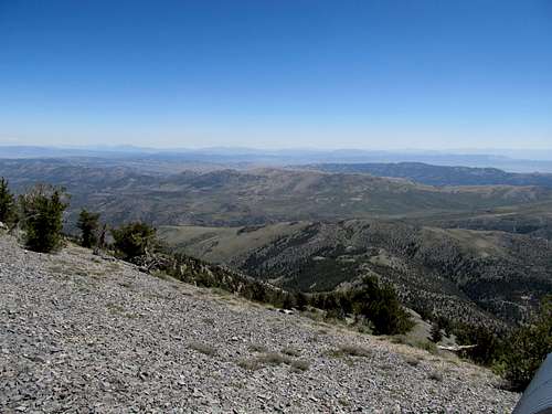
The views to distant ranges were marred by the haze, but those of the East Humboldt and down into the Rubies were more than satisfactory. It was vaguely warm, though a small breeze blew every once in awhile to remind me that I was well into Fall. The register was quite interesting, with the logo of the 1970’s LA Rams on the cover (one of my favorite uniforms), and signed by many eminent hikers, (Including Cedron Jones, whose Peakbagging Montana book I had been use at various points during the summer).
I could have stayed longer, but college football beckoned, so I descended carefully boulder by boulder, then quickly down the chute before gazing up at the Basin to take my final pictures, mental and digital, of this amazing little spot, so hidden, yet quite exposed to the millions who have driven past it on US-93 and I-80.
I beelined it into Wells and watched some good college football into the early night. To make my schedule for McAfee Peak then a Pats 1 PM EST game work the next day I needed an early bed and early rise. But that story will best wait I suppose for another TR.


Comments
Post a Comment