
|
|
Route |
|---|---|
|
|
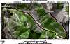
43.81470°N / 114.2053°W |
|
|
Scramble |
|
|
Most of a day |
|
|
Class 2 |
|
|
Approach
To access the more commonly used route for Phi Kappa and Summit Creek Peak, drive northeast from Ketchum on Trail Creek road for twelve miles. On the south side of the road, very near the summit, is a large pullout and trailhead for the Summit Creek Trail.
Route Description
Follow the mellow Summit Creek trail for about 4 miles to high mountain pass. From here, Phi Kappa's southeast ridge leads north from the pass. Take this ridge directly to the summit of Phi Kappa. From here, the connecting, northwest running ridge is evident. Follow this to the summit of Summit Creek Peak. It is possible to return from the route you came, but I would suggest taking the steep gully running southwest off the summit. This will save you a few miles and a re-ascent of Phi Kappa Mountain.
 |
Essential Gear
None, this route is very mellow and a great conditioning hike.
Miscellaneous Info
If you have information about this route that doesn't pertain to any of the other sections, please add it here.