Sunol Regional Wilderness is a scenic 6,858 acre park consisting of hills, small mountains, ridges and ravines that rise eastward above the flats of Alameda Creek just north of Calaveras Reservoir in southern Alameda County. This easy to reach park is situated barely 3 or 4 air-miles east of the dense megalopolis known as the San Francisco Bay Area. In spite of this close proximity, one will experience a sense of peace and quiet isolation from the noise and turmoil of city life. This seclusion is in large part to the presence of Mission Ridge which forms a substantial barrier to the west of the park. Usually, the only reminders of the great city beyond are the occasional low flying commercial aircraft which often fly over on their way to the various international airports the dot the region.
Hikers enjoying the view from near the summit of Flag Hill.
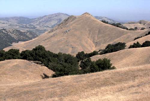
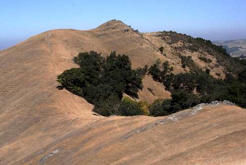
A close approach. Taken from the summit of Maguire Peaks. Mission Peak is in the background.
The park features many miles of trails that will attract just about any hiking enthusiast young or old. In addition to hiking, many of these trails are also open for mountain biking and horseback riding. There are several rock outcroppings that are popular for bouldering such as the basalt formation known as Cave Rocks along the Indian Joe Trail. There are peaks to bag, wildlife to observe, birds to watch, and gorgeous scenery to be photographed or just simply admired.
Alameda Creek
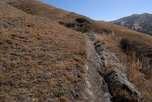
Cave Rocks along the Indian Joe Trail
Aside from the flat valley floor along Alameda Creek, the park is very mountainous in nature. Elevations within the park range from a low point of about 350 feet above sea level near the confluence of Welsh Creek and Alameda Creek to 2201 feet at the park's unnamed highest peak. There are deep gorge-like gulches, narrow undulating ridgelines and several moderately high peaks within the park. The landscape is typical for Northern California and the Diablo Range. It consists of oak woodlands interspersed with extensive grassy savannahs. The valleys and gulches are thick with trees providing welcome shade in the hot summer months. The creeks themselves are often lined with lush vegetation (Watch out for poison oak!). There are also the obligatory dry regions of chaparral- mostly consisting of sage, juniper, and manzanita. These areas are usually easy to avoid, so bushwhacking is rarely- if ever- necessary in Sunol Regional Wilderness.
Getting There
Sunol Regional Wilderness lies along Calaveras Road- a 17.5 mile route that runs between the City of Milpitas and the town of Sunol. Each end of this road intersects with Interstate 680 in those respective communities.
From Milpitas
Take the Calaveras Road/Boulevard exit from I-680 and head east. After a mile, the city streets are left behind as the road winds its way up into the hills. To stay on Calaveras Road, make sure you veer left at about the 3.3 mile mark. From here, the road becomes very windy as it snakes in and out of several ravines high above Calaveras Reservoir. About 13 miles from where one leaves I-680, the junction with Geary Road is reached. Turn right and follow Geary Road about 1.85 miles to the entrance kiosk.
Take the Calaveras Road exit from I-680 and follow it south about 4.5 miles to Geary Road and turn left. Follow Geary Road about 1.85 miles to the entrance kiosk.
Flag Hill from the Sunol Wilderness parking area.
IMPORTANT NOTE:
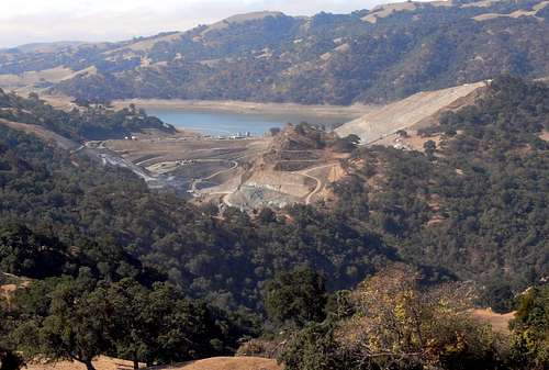
While the route from Milpitas may seem closer and more accessible from San Jose, I highly recommend staying on I-680 and using the Sunol route. The distance between freeway and park is shorter and far less windy. There are less cyclists to contend with and you may also want to consider that Calaveras Road between Milpitas and Geary Road is often subject to delays and closures due to the Calaveras Dam Replacement Project which is slated to continue until December of 2017 or so.
Overview of the Calaveras Dam Replacement Project
Trails
Simply put, there are trails in Sunol Wilderness for every level of hiker out there. They vary from easy, albeit interesting strolls that can be done with small children, to longer moderately challenging hikes that will keep even the most avid hiker busy for much of a day. Most of the trails are well maintained and very accurately portrayed on the park map/brochure. Many of these trails are also open to mountain biking and horseback riding. So, pick your adventure and get going!
Bridge Over Alameda Creek
Trail Map
Here's a small sampler of some of the trails:
Shady Glen Trail
This trail is a good introductory hike for your preschooler or for those who just enjoy a mellow stroll while listening to birds and other sounds of the forest. This loop is less than a mile in length and features some nicely constructed stairs and a bridge over a brook (dry in summer). A picnic table with an inspiring view of Flag Hill is available at about the halfway point. (See the park map/brochure for the location of this trail.
Shady Glen picnic table and Flag Hill
Flag Hill Trail
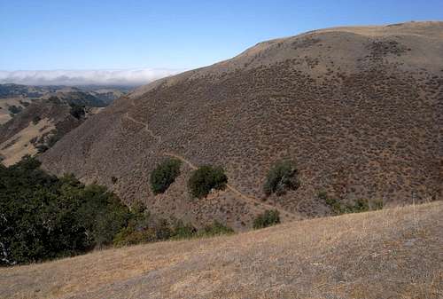
This 1.25 mile trail is one of the most popular in the park. Beginning near the headquarters, the trail winds its way up the south face of Flag Hill through a variety of oak trees and open grassy meadows. The views are excellent along this well graded trail and you'll likely be stopping frequently for photo opportunities. From the top, you'll enjoy awe inspiring views of the valley to the south containing the park headquarters and parking areas (can you see your car?). The blue lake in the distance is Calaveras Reservoir. To the north, one has a tantalizing view of one of the finest mountains in the park: the twin summits of Maguire Peaks.
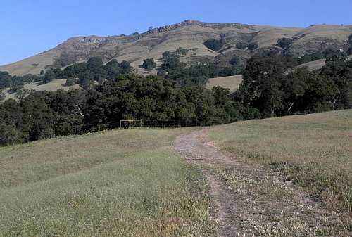
Flag Hill from Hayfield Road
Portion of Flag Hill Trail
One can simply retrace the Flag Hill Trail back to the parking area or, if there's still some energy left, one can leave the summit to the north, and follow Flag Hill Road east to its junction with High Valley Road and, from there head in a southerly direction to the old ranch buildings where Hayfield Road can be followed back the the parking area. This makes the total hike a very enjoyable 3 mile loop.
Looking north from Flag Hill at Peak 1423.
Hayfield Road and the 'Turtle Pond'
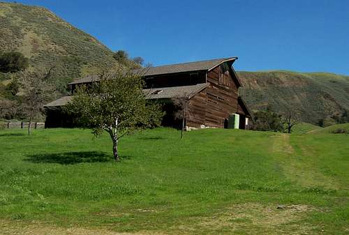
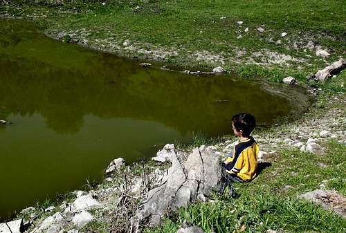
This is a relatively easy and well graded dirt road that will take the hiker into the heart of the park where the old abandoned JB Ranch is situated about a mile from the parking areas. There's a nice picnic kiosk, 'port a potties' and water (of questionable quality). A good hike for young children. After some refreshments at the ranch, continue to the trail junction just beyond the ranch to the north and follow Cave Rocks Road about 1/3 of a mile to the east where a small pond is located just north of the trail. If you can approach the pond very slowly and quietly, you and your kids will be rewarded with the sight of several dozen fresh water turtles of various sizes sunning themselves on the shore and on rocks or branches lying in the water.
Old JB Ranch barn.
Matt watching the turtles in the 'Turtle Pond'.
The route can be easily retraced to return to the parking area, or continue a short distance further along Cave Rocks Road to the junction with the Indian Joe Trail and follow the latter about one and a half miles back down- making a very enjoyable loop of about 3 total miles.
Canyon View Trail
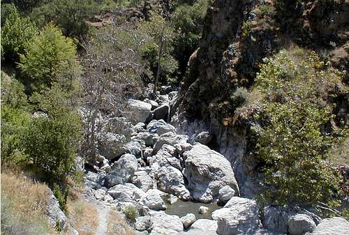
This trail, a bit more than a mile in total length, is another very popular and scenic trail. Its popularity is probably, at least in part, due to the name of its ultimate destination: Little Yosemite. This area is worth a visit, but don't expect it to have much resemblance to the 'real' Yosemite. The biggest similarity to the 'real' Yosemite are the disproportionately large crowds that seem to visit this area on any given day. There is a small cliff and a bouldery cascade to enjoy, but don't expect much solitude.
Little Yosemite
Choose your path.
Indian Joe Trail
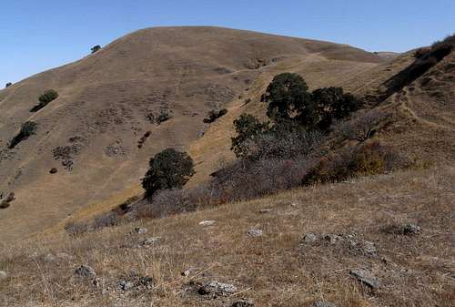
This is a slightly longer albeit shadier alternative to Hayfield Road. This 1.5 mile trail features a close approach to Cave Rocks- a popular area for bouldering.
Nora and Matt hiking up Cerro Este Road
Cerro Este Road
This approximately 2.5 mile long trail begins where the Canyon View Trail ends- at Little Yosemite. This interesting trail climbs through nearly all of the park's several plant zones including chaparral, oaken forests, and grassy meadows. Finally, the trail ends at the gated park boundary about a stone's throw from the high point of Sunol Wilderness- Peak 2201. I highly recommend this trail.
Maguire Peaks Trail
Be careful out there!
These are just but a few of the wonderful trails that penetrate this fine region. I have other favorites, but you'll just have to do some of your own exploring. Please see the Maguire Peaks page for more information about the trails in the northern section of the park- specifically in the Welsh Creek Road area.
Note that several miles of the Ohlone Regional Wilderness Trail passes through the park as it winds its way from Mission Peak Preserve in the west, to its destination at Lake Del Valle in the east. Sunol Regional Wilderness is but one of several parks and open spaces through which this 27 mile trail travels through. Remember that a special permit is required for travel on this trail beyond the park boundaries. (See Red Tape section)
Peaks
There are but a handful of peaks that lie within Sunol Wilderness. None of them are worthy of any kind of bragging rights, but all are fun to climb and they all feature outstanding views from their summits.
Here's a small sample of these peaks:
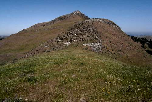
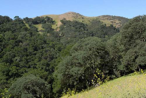
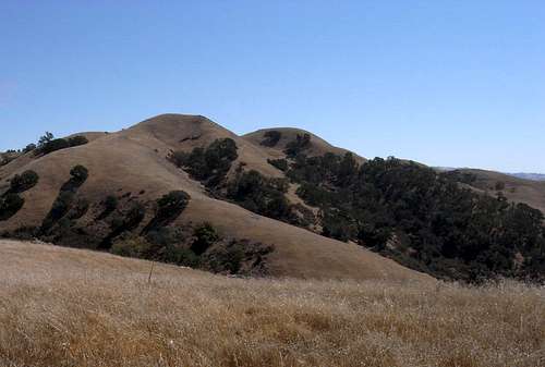
Maguire Peaks
This massive mountain with its distinctive twin summits lies near the northern part of the park. A popular peak for peak-baggers due to its inclusion on the CC list, its isolation, rocky cliffs and its 500 foot prominence. Most will approach from along Welsh Creek Road (parking permit required- see Red Tape section). For the more adventurous, a longer approach can be made from the park headquarters at the end of Geary Road. For more information on this peak, please visit the Maguire Peaks page.
Maguire Peaks
Maguire Peaks east ridge and east summit.
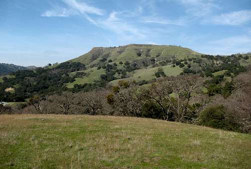
Flag Hill
This popular peak is very easily climbed via either the Flag Hill Trail (from the park headquarters) or from Welsh Creek Road from the north via the Welsh-Flag Hill Trail. A fine view of nearly the entire park can be had from its rocky summit.
Flag Hill
Approaching Peak 1423 from southeast.
Peak 1423
This somewhat isolated peak is easily reached from the top of Flag Hill by following Flag Hill Road to a point near a livestock water cistern. Leave the road and follow a series of obvious use trails to the summit where fine views are had in all directions.
East slopes of Peak 1423.
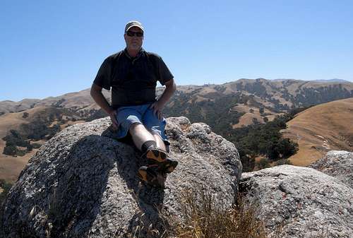
boyblue on the summit of Peak 1423.
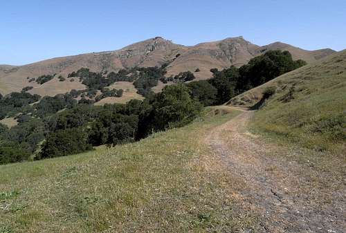
Vista Grande
Not sure if this actually counts as a peak, but, what the hell... climb it and decide for yourself. The Vista Grande Trail easily brings one to the top. A more interesting route follows the Eagle View Trail from its junction with Cave Rocks Road. Combining the two trails makes for a fine loop.
Happy cows- Vista Grande looms in the background.
Part of Eagle View Trail cuts across Vista Grande.
Peak 2201
The highest peak in Sunol Wilderness is also one of its most disappointing. From most vantage points within the park, it appears somewhat impressive looking and worthy of bagging. Rising nearly 1000 feet higher than Flag Hill, it truly dominates the southern region of the park. When one arrives at the summit, however, the true nature of the peak is revealed. It has a very small amount of prominence and turns out to be a mere bump along a spur ridge of higher Apperson Ridge (private property) to the east. What's worse is that most of the region to the east has been developed into housing subdivisions. So much for Sunol Wilderness. And, as if all that wasn't bad enough, the park's ever present livestock seem to love using the broad summit as a toilet. (Yech!) Don't expect to be able to sit and enjoy the view while eating a sandwich.
Peak 2201 from near Vista Grande
South face of south summit of Peak 2201
On the positive side, the sweeping views to the south, west and north are pretty outstanding. Even majestic Maguire Peaks- about 500 feet lower- seems insignificant from up there. On clear days one can see the floor of Santa Clara Valley as well as San Francisco Bay toward San Francisco.
I suppose the actual hike to the top is the best part. This summit is easily reached via scenic Cerro Este Road. There's also an interesting use trail that climbs to the top from near the junction of Eagle View Trail and Eagle View Road.
There are several other minor summits and spot elevations scattered throughout the park. Get out and do some exploring!
Wildlife
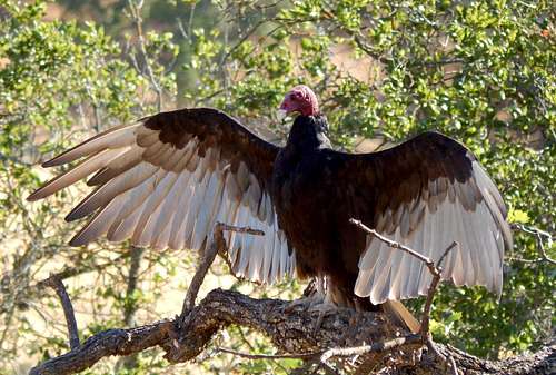
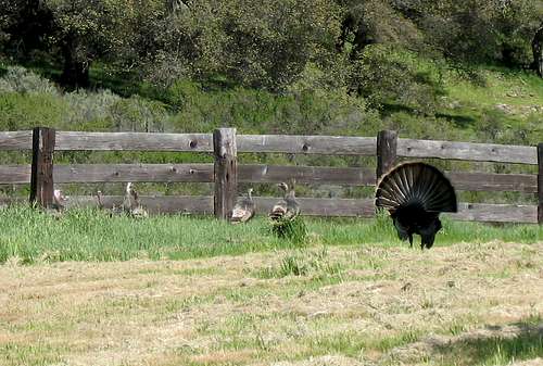
Natural inhabitants of the park include deer, skunk, possum, squirrels and a wide variety of other creatures including bobcats and even an occasional cougar. There are many species of birds to enjoy. Turkey vultures and redtailed hawks seem to dominate the skies while closer to the ground, one will often encounter wild turkeys or quail. Other birds such as bluejays, mockingbirds, and acorn woodpeckers will fill the air with sounds and music to enhance your hiking experience. On the ground during warmer months will be seen lizards, and a few different types of snakes including rattlesnakes or the much more common gopher snake. Watch out for slow lumbering salamanders during wet spring months and tarantulas in the fall. Turtles are a common sight in some of the small ponds that dot the park here and there.
Turkey Vulture guarding her 'vulture-etts' (not visible).
Wild Turkeys
Turtles playing in the 'Turtle Pond'
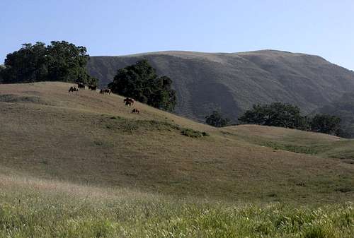
Note that grazing rights are leased out to local ranchers, so it's very common to encounter domestic cattle in the park. These sleepy creatures rarely impede trail users, but watch out for copious amounts of 'fertilizer' on many sections of the trails.
Lonely Bull
Deer and Picnic Kiosk
When to Visit
Sunol Regional Wilderness can be visited year round. Winter and spring are undoubtedly the best times due to the presence of green grass enhanced by copious amounts of wildflowers. Temperatures are much more conducive to hiking, but be aware that they can drop to below freezing in the winter and there's also a possibility of encountering snow on the higher peaks (not a bad thing, of course- just be prepared and check ahead).
Nora and Matt in Spring
Spring Flowers
Summertime temps often climb up into the 90s and even into the 100s. Bring plenty of water no matter when you visit. Make sure you check ahead for conditions. Hot temperatures and dry conditions can cause the park to close due to fire danger.
There are family campgrounds within Sunol Regional Wilderness, but they are presently closed until November, 2017 due to the Calaveras Dam Replacement Project.
Backpacking campgrounds are located along the Ohlone Wilderness Trail near the eastern boundary of the park. For regulations and reservations, phone 1-888-327-2757.
Red Tape
Park hours are from 8:00 am to dusk all year.
An entry fee of $5.00 per vehicle is charged to all drive in visitors.
A permit is required for parking along Welsh Creek Road. These are obtained for free (once the regular vehicle fee is paid) at the entrance kiosk along Geary Road or at the Sunol Visitor's Center.
A special permit is required for hiking beyond Sunol Wilderness along the Ohlone Wilderness Trail. These can be obtained at the entry kiosk or the Sunol Visitor's Center for $2.00 each (every member of a hiking party above the age of 12 must have one). They are good for one year after the date of purchase. These permits are actually in the form of a very detailed map/brochure that is well worth the fee even if you don't actually plan to travel on the Ohlone Trail.
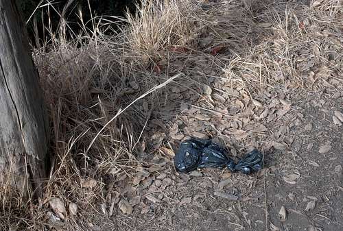
Please keep this park clean! Don't litter and do try to pick up the bits of trash left by others who are thought-challenged. By the way, leaving little baggies of poop from your dog along the trails is unacceptable. The idea is to pick up and remove the doggy doodoo- not add a plastic bag and leave it on the side of the trail! That's called littering. What the hell are you thinking!?
-End of tirade. Apologies to the vast majority of you who would never dream of leaving plastic bags of dog poop on a trail. :-)
^^^ Very Uncool! Please carry it out! ^^^
History and Etymology
'Sunol's Valley' was named for Antonio Maria Sunol, a Spanish landowner who lived in San Jose with his wife, Maria Dolores. Sunol's land was eventually sold and subdivided into ranches- several of which would eventually become Sunol Regional Wilderness when it was formed in 1962.
Many of the named features in the park are from various ranch owners of the past including Maguire (Peaks), Welsh (Creek) and Jacob's (Valley).
The Ohlone Indians were living in the region for centuries before the arrival of European settlers. Acorn grinding holes originating from the Ohlones can be found in various location in the park. Indian Joe, for whom Indian Joe Creek is named, may have been the last known surviving member of the Ohlone Tribe.
(Source: Alameda County Place Names by Page Mosier and Dan Mosier.)
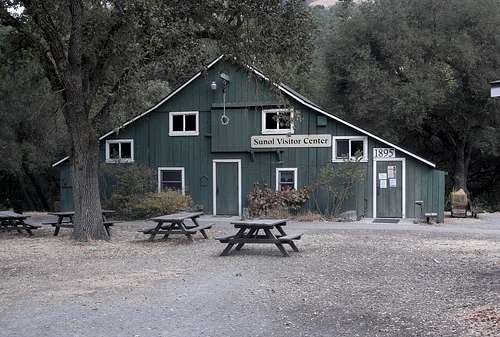
Be sure to check out the Visitor Center for some interesting artifacts and displays that reveal the park's natural and cultural history.
Children refers to the set of objects that logically fall under a given object. For example, the
Aconcagua mountain page is a child of the 'Aconcagua Group' and the 'Seven Summits.' The
Aconcagua mountain itself has many routes, photos, and trip reports as children.
Parents refers to a larger category under which an object falls. For example, theAconcagua mountain page has the 'Aconcagua Group' and the 'Seven Summits' asparents and is a parent itself to many routes, photos, and Trip Reports.

 Hikers enjoying the view from near the summit of Flag Hill.
 A close approach. Taken from the summit of Maguire Peaks. Mission Peak is in the background.
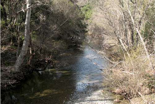 Alameda Creek
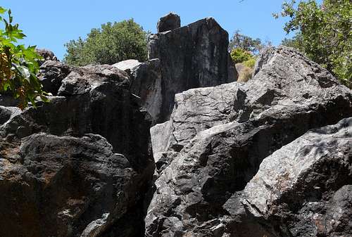 Cave Rocks along the Indian Joe Trail
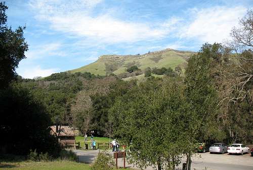
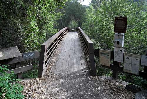 Bridge Over Alameda Creek
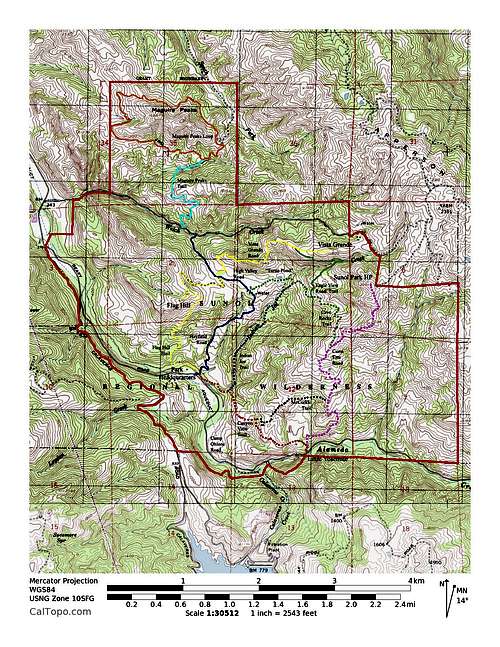 Trail Map
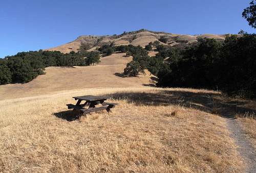
 Little Yosemite
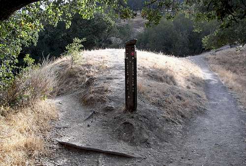 Choose your path.
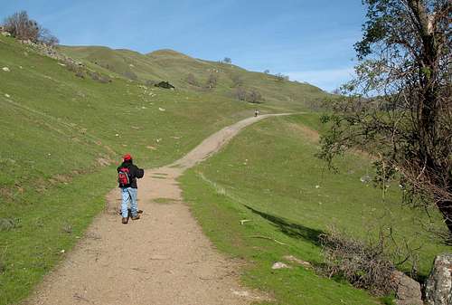
 Maguire Peaks Trail
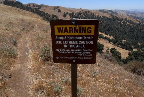 Be careful out there!
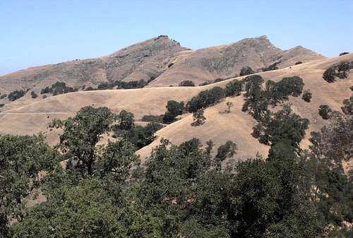
 Wild Turkeys
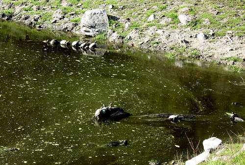 Turtles playing in the 'Turtle Pond'
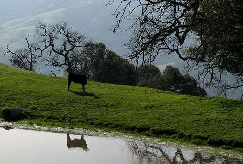 Lonely Bull
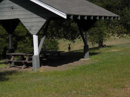 Deer and Picnic Kiosk
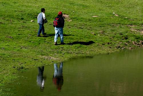 Nora and Matt in Spring
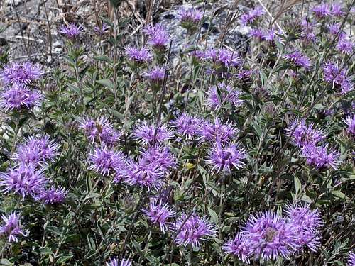 Spring Flowers
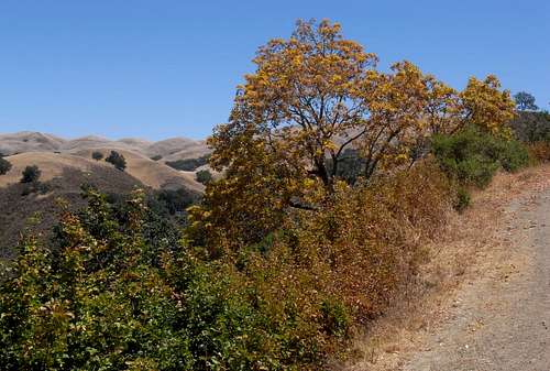 Brightly colored tree in summer.
 Shady view of Mission Peak.