
-
 4503 Hits
-
 73.06% Score
-
 3 Votes
|
|
Route |
|---|---|
|
|
44.11443°N / 113.6705°W |
|
|
Hiking, Mountaineering, Scrambling |
|
|
Spring, Summer, Fall, Winter |
|
|
Half a day |
|
|
Class 3 |
|
|
Overview
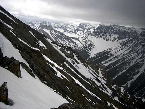
- Southwest Face- Enter an obvious broad gully around 8500 feet and follow an easy, but incredibly loose scree face steeply to the summit. The scree is usually too small or to large for good traction and the solid sections of limestone are usually no more than a few feet long. Depending on the time of year and exact route, snow lingers and may require ice ax and cramp-ons. The views from this side of the main Lost River ridge are all encompassing. This is mostly a Class 2 scramble, but the loose scree may force you to use your hands rendering the route a Class 3. The descent on the loose scree is incredibly quick and easy. Follow the spots with the most dirt for the easiest descent. It's possible to lose 3000 feet of vertical in 30 minutes.
Approach
Road Approach
From ID-93 turn off east onto DoubleSprings Pass
Road at approximately 46 miles north of Arco. It will be approximately 25 miles
to the trailhead from this turn off. Leave the DoubleSprings Pass at 9.5 miles
with a hard right turn. Proceed on the most traveled road up and over
HorseHeaven Pass and descend into Mahogany Creek (signed). Cross the stream (1
of 4 ) which may be several feet deep and ascend to the ridge. At approximately
13.9 from the DoubleSprings Pass Road turnoff you'll encounter a split. The
right hand split ascends the West Fork of the Pahsimeroi River Valley. You'll
take the left fork up the East Fork of the Pahsimeroi River Valley. Follow
this road to the complete end for the SW Face route.
4WD is required for the spring creek crossings, short steep hills, and large rocks in the dirt roads.

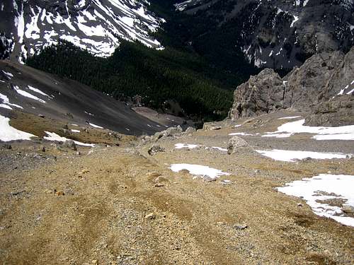
Scrambling Approach
Park as high up into the East Fork valley that you can and stay close and just above the river on the east side. Look for a small forested area that rises slightly into the SW Face (visible on the USGS map). Follow the tree band as high as it will go and then enter the scree field. Follow the few solid sections of limestone and angle slightly left as you rise up. Just under the summit you angle back to the right under a cliff band on the ridge and ideally exit at a small notch where you'll walk just east and south a few hundred feet to the true summit.
