
|
|
Trip Report |
|---|---|
|
|
Nov 15, 2009 |
|
|
Hiking, Mountaineering |
|
|
Fall, Winter |
The futility of "early starts" in winter
Despite statewide forecasts calling for snow, myself and some fellow crazies on 14ers.com were determined to hike a fourteener this week. Jeff and I planned to carpool from Denver, while two others were on the fence about joining us at the trailhead. Road conditions were awful as expected; we left Denver at 3:45 and arrived at the snowy Baldwin Gulch trailhead around 8:15. Rounding out the party, Steve had driven up from Pueblo and arrived minutes behind us.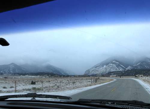 Approaching Baldwin Gulch on CO 162
 Gearing up at the winter trailhead
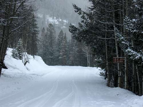 There is a jeep road that goes nearly to the summit
Picking our approach
We geared up and set off at a brisk pace down the jeep road with Steve breaking trail. The snowshoeing was smooth at first, but gradually the fresh powder grew deeper, and this began to slow us. We had planned to deviate from the jeep road at some point and find a more direct route to the north ridge--I had even plotted a potential route in my GPS--but we failed to locate a feasible path through the dense forest. At around 11,000' we agreed on a line following a gully perpendicular to the saddle between Mount Antero and PT 13,762 to the north.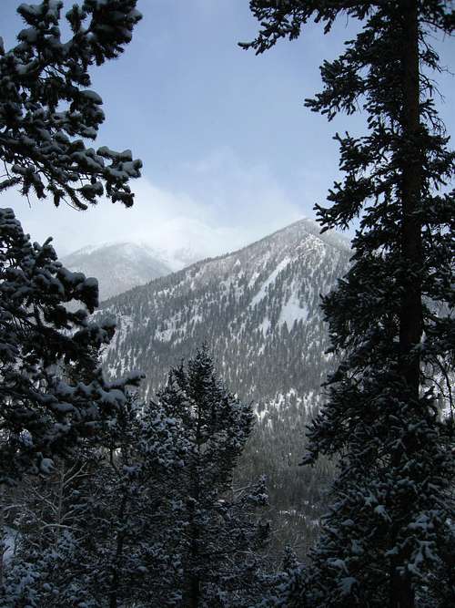 Some thirteeners looking awfully snowy
 Steve and his buddy Cooper breaking trail
The alpine treadmill
The ascent along the gully was shades steeper than it looked, and the white stuff was still deep. At times we were snowshoeing in place, and only by kicking down to the dirt or rocks could we gain any traction. The weather did not deliver as forecasted but rather gave us alternating sunshine, dark clouds, flurries, and light snow. We crested the gully at noon and were disappointed with progress, having gained only around 500' since leaving the jeep road. We stopped for awhile and soaked up the fleeting sunlight and pristine alpine scenery.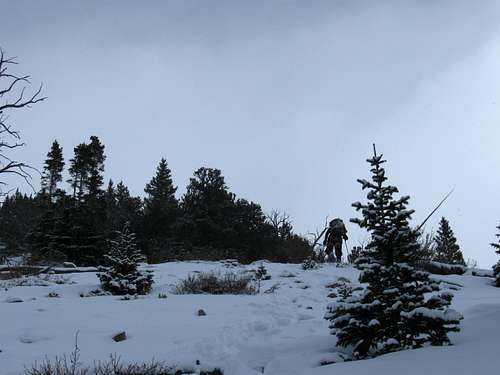 It's a winter wonderland!
 Steve and Cooper lead the way
 Jeff enjoying the powder
 Boulder Mountain
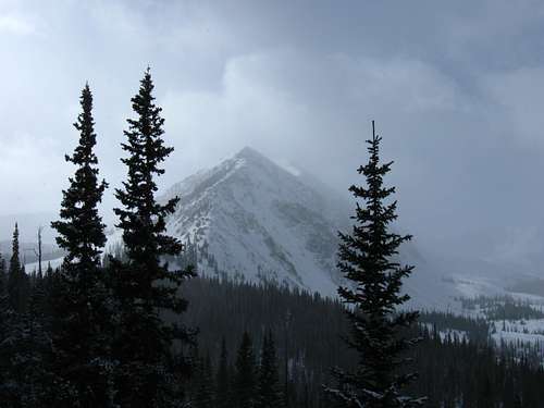 Cronin Peak
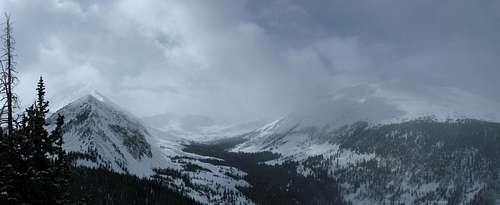 Cronin and Boulder pose for the camera
 Cronin beckoning
 Stopping to rest in the sunshine
Approaching the crux
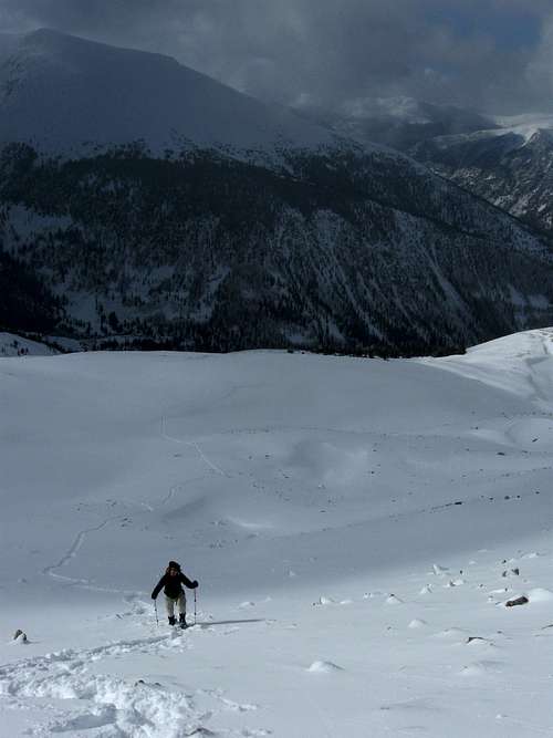
We still had 1000' to go before the final 45-ish degree rock slope that would put us on the north ridge. This part of the hike was easier; in places we would sink frustratingly deep, but in other areas the snow was shallow or packed enough to stay on top. We made good progress and reached the base of the slope in just over an hour. Still, we were looking at a 4 o'clock summit. A quick sanity check revealed we all were prepared to descend in the dark, so on we went.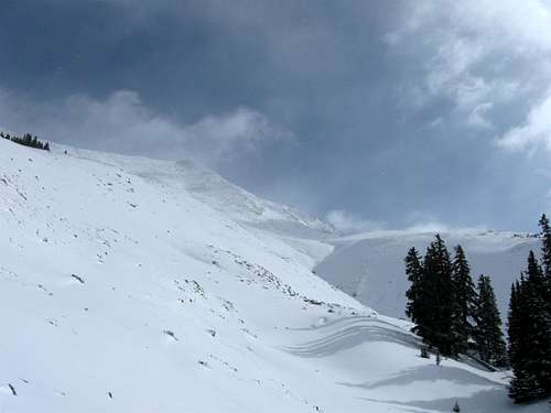 View of the summit
 Cooper preparing for the journey ahead
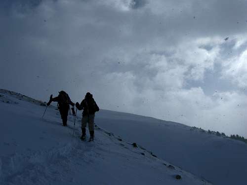 Steve and Jeff pushing forward
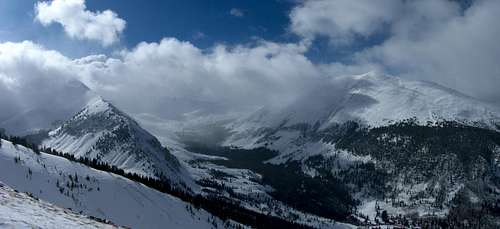 Last sunny view of Baldwin Gulch
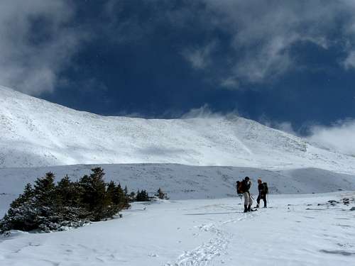 We intended to climb to the low point in the saddle
 Looking back as we near the slope
"Hey, I think the snow is shallower just up there"
We were about halfway up the incline and my optimism was getting stupid. Steve had taken off his snowshoes in anticipation of rock-hopping, but the snow was so deep there was none to be had. We all stepped carefully to avoid ankle-busting surprises as we trudged up towards the ridge. Around 13,400' I bent over to remove my snowshoes, stood up, and started feeling weird. Steve was 10 feet away, talking to me, but I couldn't hear what he was saying. Someone was turning the volume down, replacing the sounds of wind and crunching snow and poles scraping rock with a dull ringing. I was looking at Steve through a tunnel."Dude.. DUDE! I think I'm gonna pass out." I don't know that I've passed out before and didn't like the prospect of a first at this altitude.
"Seriously...!? Well sit down and put your head between your knees!" It's a neat trick. A few minutes later I felt much better. I realized I hadn't brought any salty snacks this time--a silly mistake I won't make again.
Jeff informed us both his insulated drinking tubes were frozen. Then mine froze--this is new! Usually I blow the tube out to prevent this, but I had delayed for a few seconds and it was now rock solid. Steve had around 1L tucked into his shell. We checked ourselves again and decided to continue.
 Viewing our route from the base of what would be the crux
Okay, I'm pretty sure this is mountaineering
While we had been climbing to the ridge, the weather shifted, and we were now socked in. The wind was picking up. The temperature was slipping. Cold and fatigued--both mentally and physically--we finally gained Antero's north ridge at the low point in the saddle, still 800' below the summit. In awe of the desolate cornice-encrusted ridge framed only by the driven snow and ice, leading up into clouds backlit dimly by a weak and faraway sun, I attempted to take a photo; but my camera, now tucked against my chest, was still too cold to operate. I was convinced we would not reach the summit--it felt hopeless and awesome at the same time. We plodded upward. I concentrated intensely on each step.Around 4:30 we reached the peak. As it was well below freezing, everything was coated with frost, including the dog, which had nearly completed his metamorphosis into mountain goat. Steve out front, having summited Antero several times before, stood aside allowing Jeff and I to be the first to tread on this holy ground. The weight of our success didn't strike me then. All we wanted was to snap a photo and split. My camera was uncooperative. The rest of these photos are Jeff's.
 Steve, Cooper and I slogging up the crux
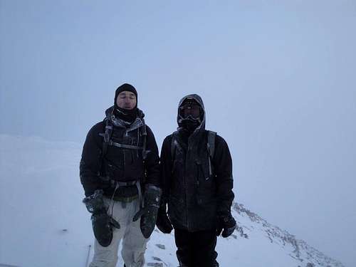 Jeff and I on the summit
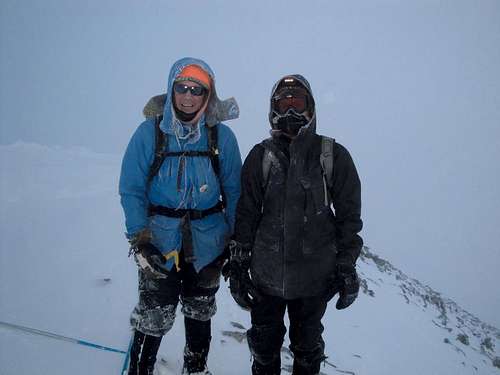 With Steve on the summit
Details
We cruised off the summit, opting for a gully descent to save time and energy. As dusk fell the skies cleared and the sun played its final glorious amber rays across the horizon. Just before dark we re-joined our ascent trench and followed it by the light of our headlamps. As I sucked more oxygen I began to reflect on what we had accomplished; ignoring the difficulties posed by our own errors, it was still no small feat given the conditions. Sure, there were no crevasses or glacier, but we aren't Joe Simpson either. This was overall the most mentally and physically taxing thing I've done in my brief history of hiking in Colorado and probably ever.Anyway, I felt privileged to be strolling at 12,000' under a clear, starry, moonless sky. The night was steadily growing colder, and we quickened the pace. On reaching the jeep road we tracked our way back to the trailhead and parted ways. Round-trip time was nearly 12 hours at 8 up and 3.5 down covering 9.8 miles and over 4,900' of gain.
Thanks and kudos to Jeff and Steve! Awesome hiking with these guys.


Comments
Post a Comment