
|
|
Mountain/Rock |
|---|---|
|
|
39.05758°N / 106.66042°W |
|
|
Pitkin |
|
|
Hiking |
|
|
13282 ft / 4048 m |
|
|
Overview
Tabor Peak's severe and elegantly triangular E Face provides a handsome backdrop to one of Colorado's loveliest high altitude mountain lakes.

Summit Ridge: steep but not forbidding
According to Lists of John, Tabor has the distinction of being Colorado's 414th highest peak. Despite its accessibility -- the trailhead is less than an hour from Aspen -- this is a wonderfully under-visited area, meaning that one of Tabor's many delights is that you are unlikely to meet anyone else while you're there. Tabor boasts a direct route -- up a gully above the lake to a dip in the ridge line -- but it is best climbed via its N Ridge, which provides a gorgeous and gentle approach to the peak. With long, steep drop-offs on either side and a narrow crest, the summit ridge itself looks daunting, but in fact is positively user-friendly: the rock is good, the exposure limited, and the climbing never exceeds 2+.

Horace Tabor, Leadville's Matchless Mining Millionaire
"Tabor Peak" is the unofficial name for a peak that is, from the USGS's perspective, Pt. 13,282. "Tabor Lake" however is an official name, and the peak simply takes its informal name from the lake below it. The lake was named after one of Colorado's more colorful characters, Horace Tabor. Tabor was emblematic of Leadville's boom years, when silver was king and his Matchless Mine lived up its name. In the manner of frontier towns aspiring to grander things, Leadville duly acquired its very own Tabor Opera House (as did Denver). When he died in 1899, 10,000 people reportedly attended his funeral. Among them, was the great love of his life Baby Doe Tabor. Unfortunately, things were complicated for much of their relationship by his being married to a wife who was unwilling to grant him the divorce he sought. With the bottom having fallen out of the silver market and the Matchless Mine in debt, Baby Doe spent the 35 years she lived after Horace's death in severely reduced circumstances, dwelling in a converted mine tool shed. I wonder if she ever visited Tabor Lake.
Getting There
The Tabor Creek Trailhead is off the Lincoln Creek Road SE of Aspen.
From Aspen: on Rte 82, drive about 11 miles E to the Lincoln Ck Rd turn off on the right (ie S). From the top of Independence Pass, the turn off is about 9 miles W on Rte 82. This is a major, well marked turn off.
Drive 4.1 miles on the Lincoln Creek Rd; the marked Tabor Creek Trail turn off is on your right. It comes shortly after the New York Creek trail head turn off (at about 3.3 miles).
The Lincoln Creek Road to this point is just about negotiable with a regular low clearance vehicle, but only with difficulty. High clearance strongly recommended.
Routes
There are two obvious routes on Tabor. One involves following the valley up to the lake and then cutting up to the summit ridge from the lake. The other entails paralleling the valley at altitude, along the N ridge of Tabor. I will describe a loop that combines the two: up along the ridge, and down via the lake.
Depending upon the season, perhaps the trickiest part of the route (especially in early summer when the melt is under way) is crossing Lincoln Creek immediately below the TH parking lot. It should be possible to get across on log bridges, but you may find that your day starts off with a cold wade through fast moving water.
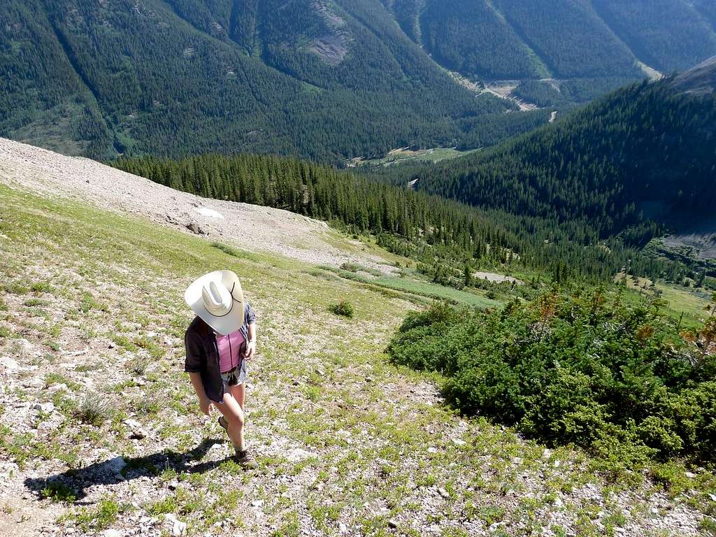
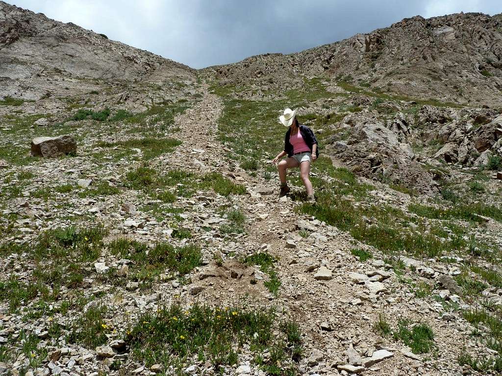
Having crossed the creek, the trail climbs steeply to... another road, and one that is infinitely better graded than the one you've just grounded your car on several times.
 Heading up the flanks of the Tabor Ridge shortly after forsaking the Tabor Ck trail
This is part of the extensive water engineering project in the area. Cross the road, and head up through the woods on the trail, on the E side of Tabor Creek.
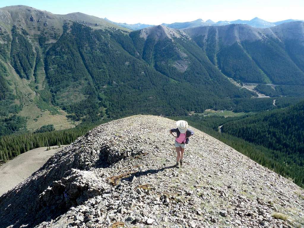 On the nothern end of the Tabor Ridge, looking back into the Lincoln Ck drainage
When the trail crosses the creek to the W side, forsake the trail and head directly W up the slopes of the Tabor ridge. Initially, you are in sparse tree cover, but this rapidly gives way to tundra and the occasional scree field. Scree, and some minor rock bands, can easily be avoided, and soon you'll be on the ridge proper.
 On the ridge, looking S at what is to come
Then it's simply a matter of following the ridge as it wends its way S.
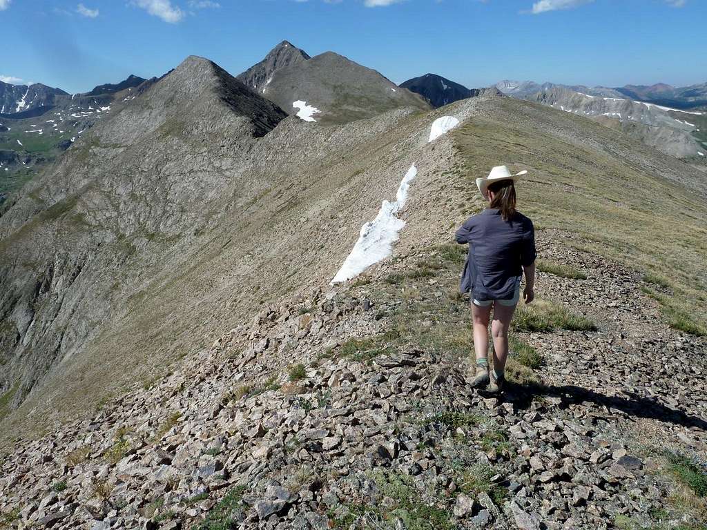
 On the ridge: the dark triangle is Tabor Peak
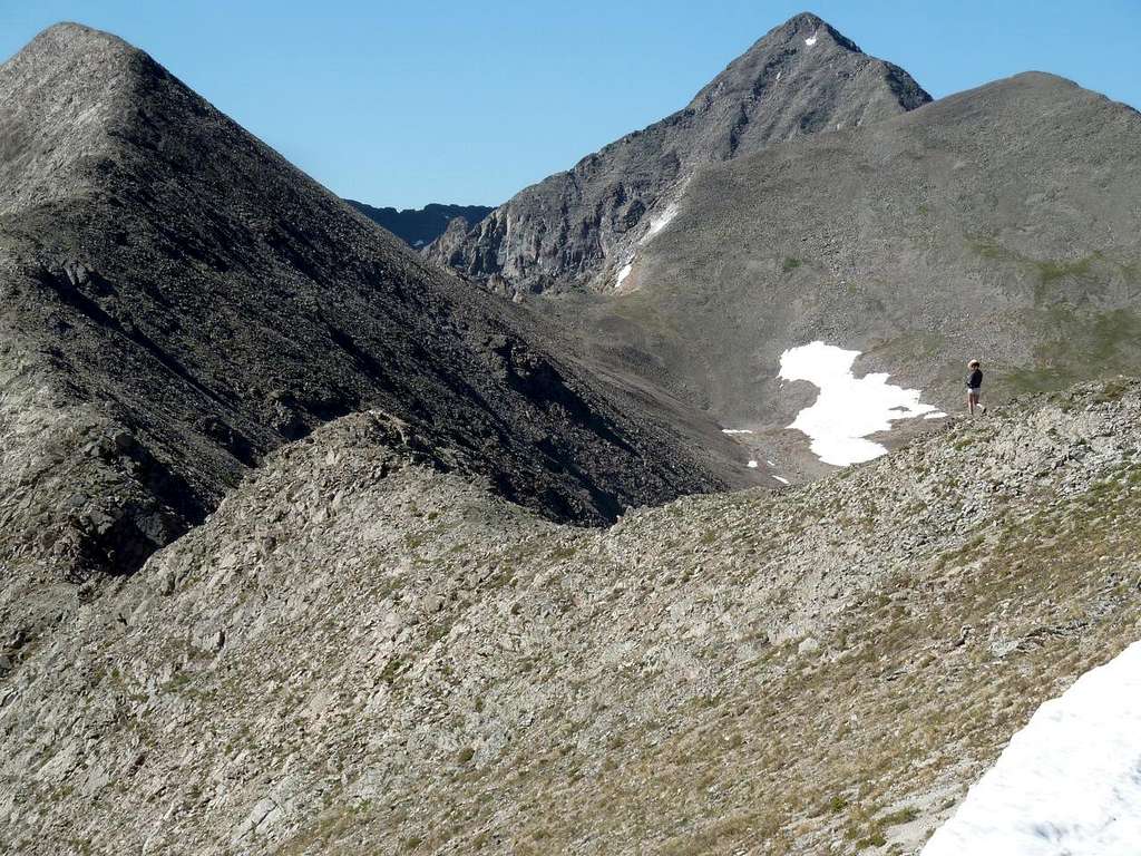 Continuing S on the ridge
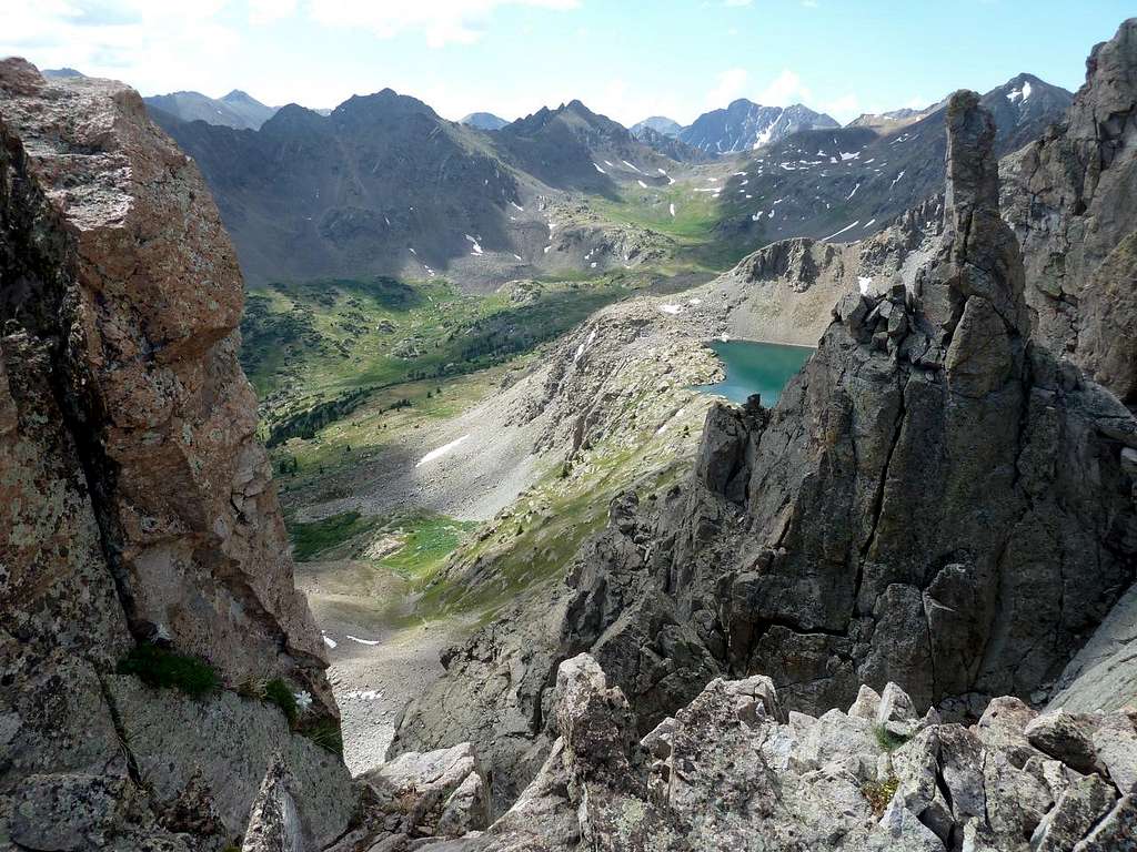 Looking SE into the upper reaches of the Tabor Ck valley. Tabor Lake is to the right
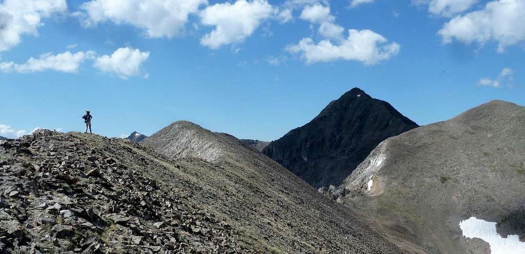
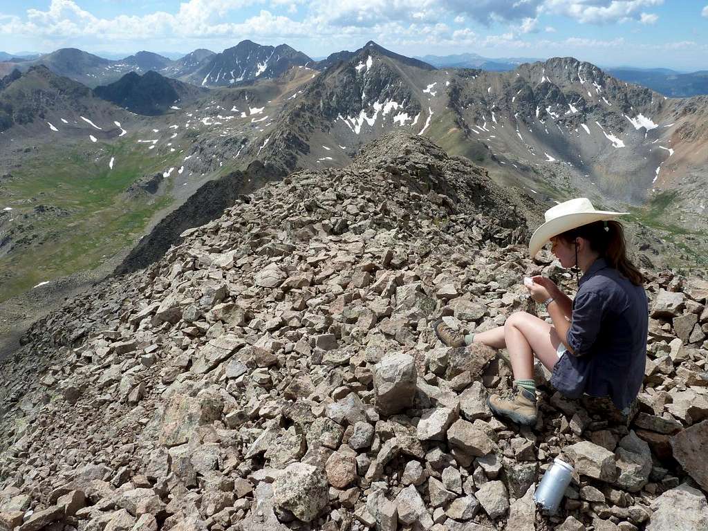
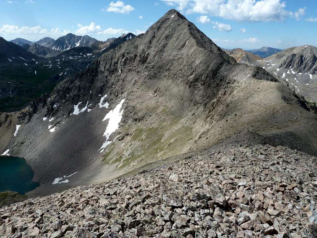 The summit triangle
Vertiginous though it appears, the final summit ridge -- up one side of the summit triangle -- is actually perfectly benign. It is broad enough to ensure that there are no real concerns with exposure, the rock is good, and the obstacles modest. 2+ only occasionally. The top comes up sooner than you expect.
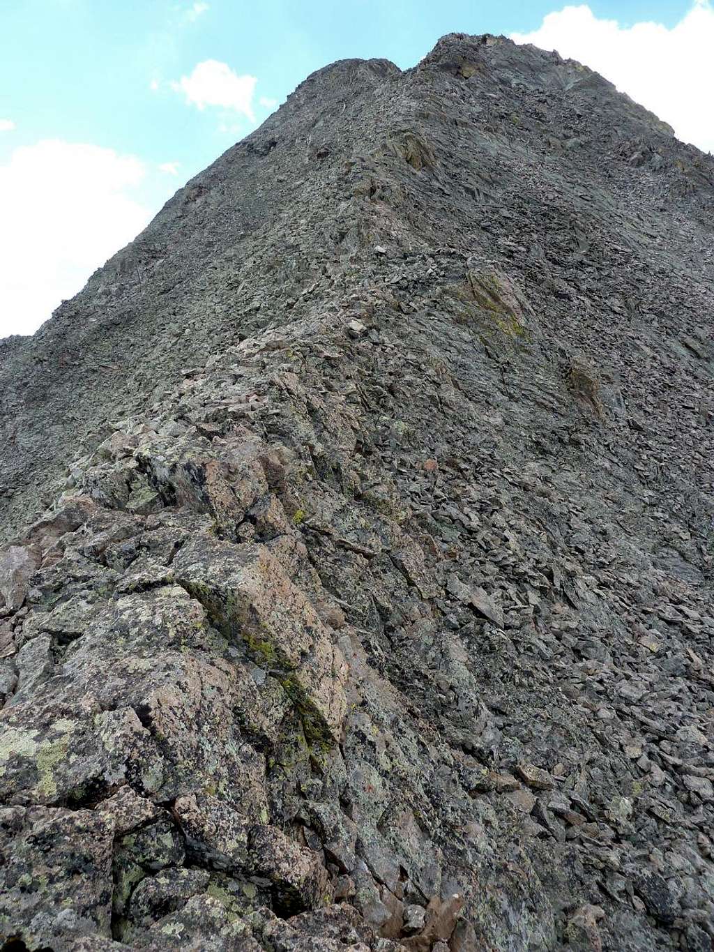 The final segment of the ridge: solid rock and a real sense of being "up there"
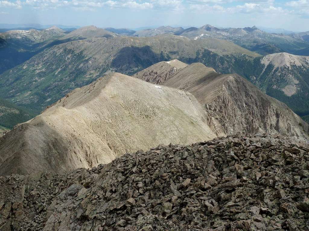
 View S from the top: Tellurium, Petroleum, Anderson, and Truro
 Looking back N along the Ridge, most of the route is visible
Return down the summit ridge until, at the end of the summit triangle, you reach a low point on the ridge directly above the lake. You can peer down an initially gentle, but then steep gully. This is your descent route.
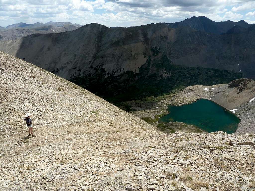 At the top of the gully
 Descending the gully
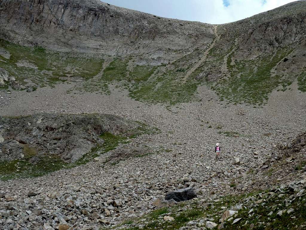 The gully is the pale streak coming down from the low point in the ridge
From the lake, you can pick up a trail that heads N to avoid rock bands (and waterfalls) immediately E of the lake. The trail then heads S below the waterfall (an interesting spectacle, this. The waterfall is almost within a cave -- it is recessed). The trail grows fainter and seems to continue in a N direction, almost as though it is heading to the head of the valley. I recommend eventually cutting down to the valley floor and picking up the main trail to head back down to the TH.
If you are heading up the valley, and are looking to locate the lake, the normal approach seems to be to bushwhack up the creek draining the lake. This will bring you to the flat areas below the waterfalls, where you should be able to pick up the trail that avoids the rock bands and takes you to the lake.
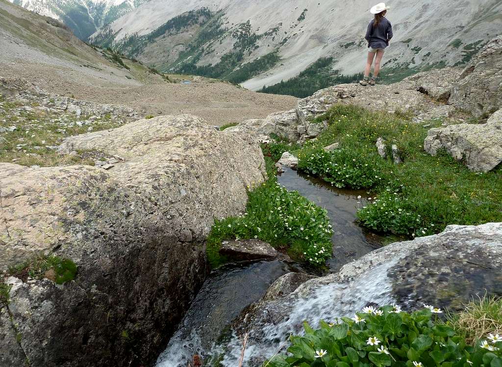 The outflow of Tabor Lake: part of a complex set of waterfalls
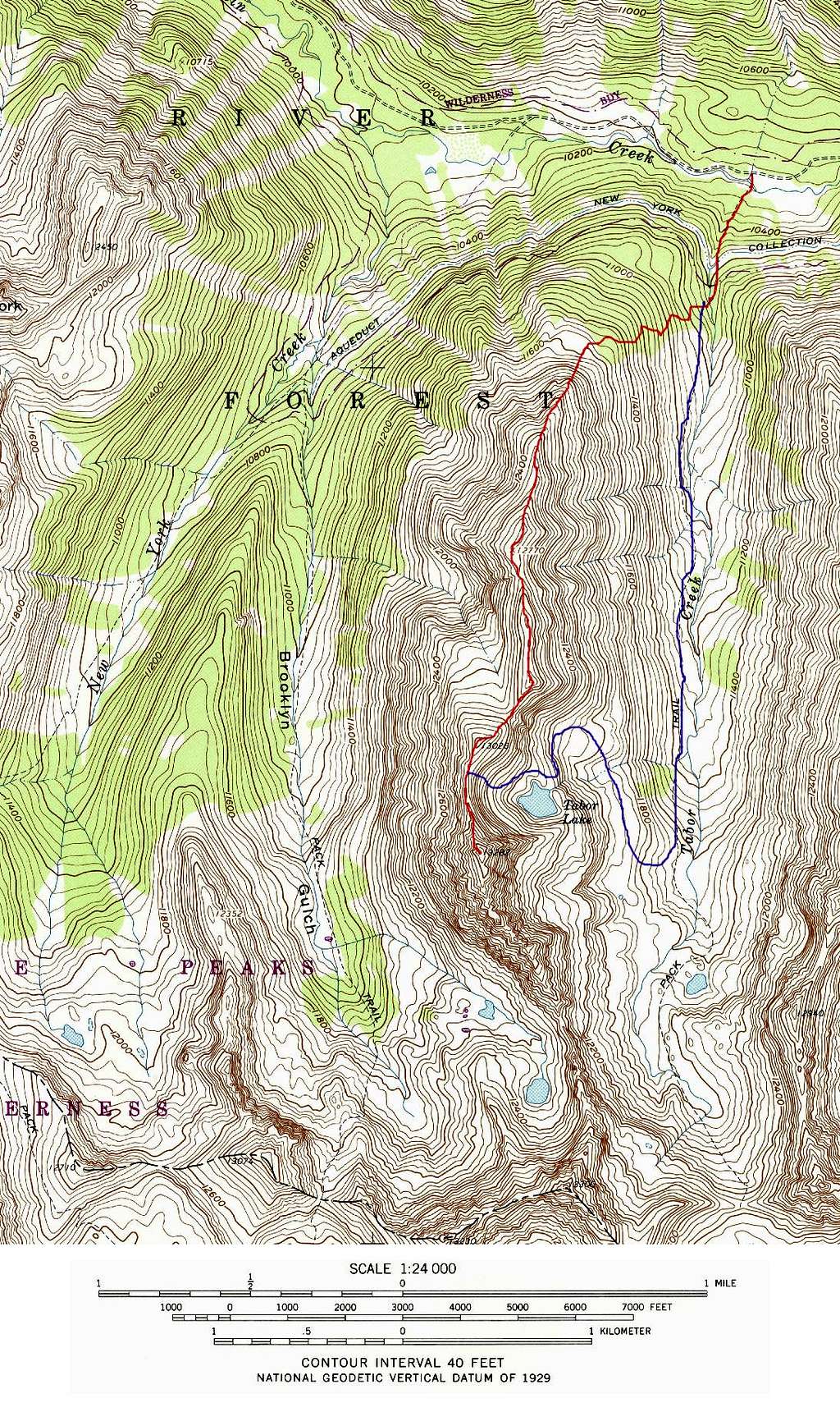 Tabor Peak Routes. Red = N Ridge; Blue = Gully Route
Camping
There are designated Forest Service campsites along the Lincoln Creek Rd. These sites are available on a first come, first served basis. Upper portions of the Tabor Creek valley are flat and look very tent friendly.
External Links
Area weather forecast
Forest Service Info on Tabor Ck Trail