
|
|
Mountain/Rock |
|---|---|
|
|
47.69942°N / 14.03684°E |
|
|
Hiking |
|
|
Spring, Summer, Fall |
|
|
7648 ft / 2331 m |
|
|
Overview
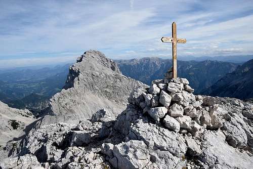
The summit cross
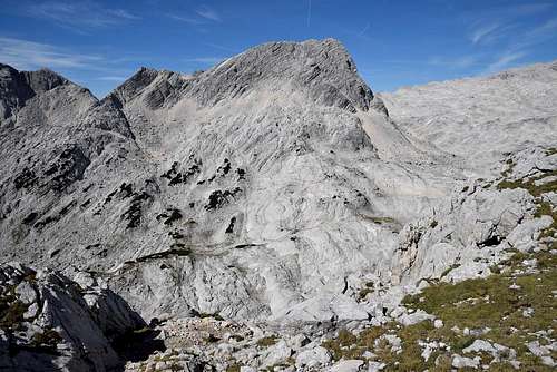
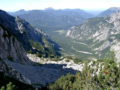
Temlberg can’t boast a high steep walls fallen deep into the valley because of its situation in the centre of this part of Totes Gebirge.
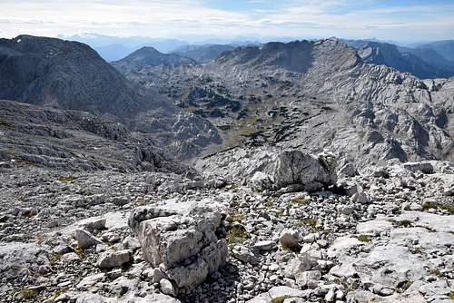
There are about 300 meters high steep rock faces on the east and north side of the summit, falling into the kettle called Weitgrube. Seen from the north Temlberg has a shape of the sharp triangle.
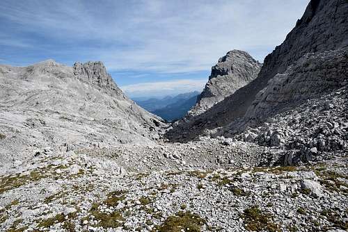
There is a steep scree slope on the west side of the summit, ending in the saddle Temlbergsattel in altitude about 2000 meters above sea level. Through the west side leads the only marked path for ascent and descent.Towards the south-west from the top of Temlberg falls a rocky ridge to the summit of Größtenbergwinkel.
Other three summits (Grosser Priel, Spitzmauer, Schermberg) offer breathtaking views into the Stoder valley or Hetzau valley, into the depth almost 2000 meters. Temlberg is situated among the limestone kettles and peaks on the karst plateau and offers wonderful panorama of surrounding karst, almost a lunar landscape.
Probably for reason the lowest atractivity (there is no via ferrata route to the summit of Temlberg, only one marked path and some climbers routes) and for reason worse attainability Temlberg is a bit ignored. It’s a pity - when you stay on the top of Temlberg next to a small wooden summit cross and look around, you understand why Totes Gebirge is called Totes Gebirge – The Dead Mountains in English. You can see a very characteristic bizzare dry landscape of karst plateaus with sharp limestone peaks above them. Just this typical face of Totes Gebirge is very attractive for hikers and climbers.
Getting There
Temlberg from the saddle Meisenbergsattel
From A9-highway you have to take the exit 36 St. Pankraz or exit 48 Windischgarsten. Then take the road to Hinterstoder. There is a car park on the right side of the road at the end of Hinterstoder, next to the house called Johannishof.
2. The ascent from Hetzau valley:
From A1-highway you have to take the exit 207 Vorchdorf. Then take the road to Pettenbach, Scharnstein, Grünau im Almtal and then to the valley Almtal. At the end of the valley Almtal turn off to the left to the valley Hetzau. There is a small car park next to Almtaler hut.
3. The ascent from Almtal valley:
From A1-highway you have to take the exit 207 Vorchdorf. Then take the road to Pettenbach, Scharnstein, Grünau im Almtal and then to the valley Almtal. There is a big car park at the end of the valley Almtal, next to the lake Almsee.
Routes
1. From Hinterstoder (605m)
From the car park next to the house called Johannishof goes a broad marked path No. 201 towards Prielschutz hut. A broad path goes pass the farm Polstergut to the lower station of a material cableway for Prielschutz hut. Then the path rises up to Prielschutz hut (1420m). It takes about 3 hours. From the hut continues the marked path No. 201 to the ravine Klinserschlucht (1807m) and then to the saddle Klinserscharte (1805m) and at the and to the saddle Temlbergsattel (about 2000m). It takes about 2 hours.
 Brotfall and Spitzmauer | 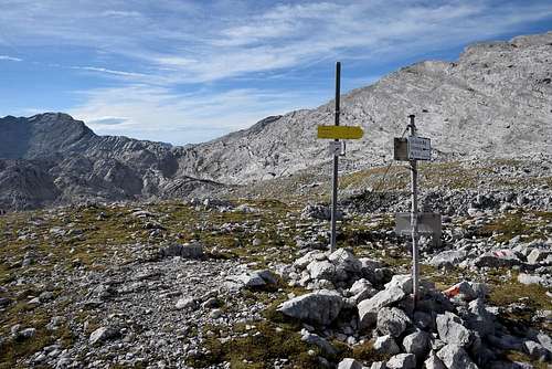 In the saddle Temlbergsattel | 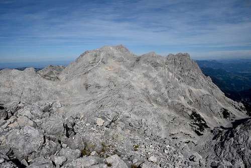 The massif of Grosser Priel and Brotfall |
2. From Almtaler hut (714m)
From the car park next to Almtalerhaus hut goes a broad marked path towards Welser hut. A broad path ends next to the lower station of material cableway for Welser hut (942m). From here rises up the marked path to Welser hut (1740m). It takes about 3 hours. From Welser hut continues the marked path No. 215 to the saddle Fleischbanksattel (2123m). Some places below and above Welser hut are secured by steel cables and ladders. And then to the saddle Temlbergsattel (about 2000m). It takes about 2:30 hours.
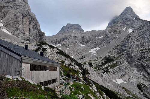 Welser hut and Schermberg | 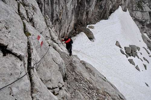 The route from Welser hut to Fleischbanksattel | 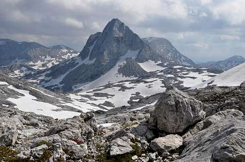 Temlberg from the saddle Fleischbanksattel |
3. From the lake Almsee (600m)
From the car park next to the lake Almsee goes a broad marked path No. 214 through the valley In der Röll towards Pühringer hut. After about an hour you come to the end of the valley (800m). From here rises up the marked path to the saddle Röllsattel (1755m). The route is called Sepp-Huber-Steig and some places are secured by steel cables and ladders. From the saddle Röllsattel descends the marked path No. 214 to the crossroad with marked path No. 201. Then you can take the right to Pühringer hut (when you want to stay overnight there) or take the left towards to Temlberg. It takes about 3 hours to the crossroad. From the crossroad continues the marked path Nr. 201 to the saddle Rotkogelsattel (2000m) and then to the saddle Temlbergsattel (about 2000m). It takes abou 2:30 hours.
 The valley In der Röll | 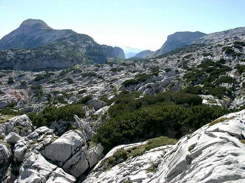 In the saddle Röllsattel | 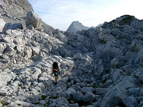 In the saddle Rotkogelsattel |
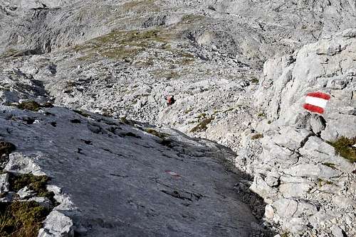
From the saddle Temlbergsattel leads the only marked path to the top of Temlberg – through the steep scree slope in the west side of Temlberg. It takes about 40 minutes to the top.
 The last part of route to Temlberg | 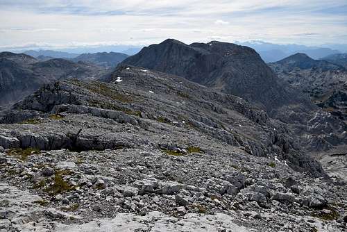 SW ridge of Temlberg | 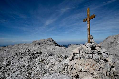 Schermberg in the background |
Red Tape
No limitations.When to Climb
The ascent is possible anytime of a year because the mountain huts have winter rooms which are opened. But the best period for hiking is from June to October – snow free period.
Mountain huts
Welser hut (1740m)
Pühringer hut (1638m)
On-line maps: www.austrianmap.at or www.kompass.de