Welcome to SP!  -   
 
 New features are here! - Read More... 
Areas & Ranges·Mountains & Rocks·Routes·Images·Articles·Trip Reports·Gear·Other·People·Plans & Partners·What's New·Forum

This trail map was scanned...

 
[ Sizes: Orig | Med | Small | Thumb ]
This trail map was scanned...
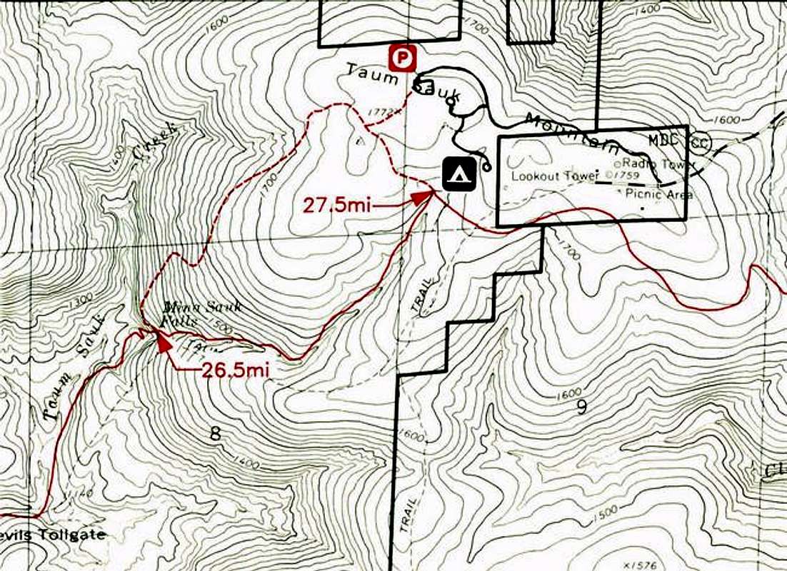
This trail map was scanned from the Ozark Trail Map for the section between the Bell Mountain Trailhead and the Highway 21 Trailhead which passes over Taum Sauk Mountain. This map was produced by the Ozark Trail Council. The hike starts at the Parking area designated with a square P symbol. Mina Sauk Falls loop hike is on the map as well. The red mileage labels are the cummulative distance from the Bell Mountain trailhead.


Comments

No comments posted yet.


Sign in to post!

Don't have an account? Register now.


Rate This Image
Current Score: 86.26

Log In To Vote
 Taum Sauk Mountain Trailhead (Trailhead)

Above the shut-ins on Taum...
« PREV

Viewing
#5 of 11
GALLERY
Below first drop of Mina Sauk...
NEXT »

 csmcgranahan's Image Gallery

Above the shut-ins on Taum...
« PREV

Viewing
#155 of 659
GALLERY
Mt. Garfield and it\'s west...
NEXT »


 Ozarks (Area/Range)


 St. Francois Mountains (MO) (Area/Range)


 Taum Sauk Mountain (Mountain/Rock)


 Taum Sauk Mountain State Park Trailhead (Route)


 Taum Sauk Area Ramblings (Trip Report)


Image Data

csmcgranahanSubmitted by csmcgranahan
on May 1, 2005 5:37 pm

Image ID: 103180
Hits: 5617 

Lat/Lon: 37.56660°N / 90.7333°W


"The most important thing in life is sincerity. If you can learn how to fake that, you're all set."

© 2006-2012 SummitPost.org. All Rights Reserved.