Fun, Fun, Fun...
The View From the Ridge on Three Top |
Three Top Mountain caught my attention when I climbed nearby
Elk Knob the week before. It looked like a fairly rugged peak from a distance and when I got home and checked out the peak on Topozone I was excited to find a mountain with lots of tightly packed contours. I also found, thanks to the
Amphibolite Mountain page, that it was a peak with public access.
I found out quickly why I had never heard of Three Top Mountain. Try doing a search online for it and see what you come up with. I didn't find squat. I finally ended up contacting
Peter Larkins, whose
Amphibolite Mountain page had originally turned me on to the peak, and he let me in on the tightly guarded secret directions to the peak. Scroll down for that info...
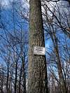
![Hikers Not Welcome?]() "Hunters Parking"
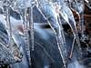
"Hunters Parking"![Icy Stream]() Icy Stream
Icy Stream
The trail up Three Top starts from a
"Hunters Parking Area" on the far side of a
brown steel gate. The first quarter-mile or so was fairly flat. Along this section you will cross three small streams that may or may not be running in dry weather. I took my time and stopped to shoot some
photos. Shortly after crossing the third stream the trail makes a sharp right and heads
up the ridge. The trail is an old ATV track and is unmarked. Numerous other trails branch off the main one as you ascend but it should be pretty obvious which path is the right one.
For the next quarter mile or so the trail paralleles the afore-mentioned stream up a shallow ravine. Its moderately steep but the
trail is wide and smooth, so its pretty easy going. As you get higher up on the ridge the trail makes a series of long switchbacks. Through the trees I could see a rocky peak that I assumed was the summit. Occasionally, the trail would head directly away from it causing me to wonder if I had the right path. I never hike without a map so I guess I was a little over sensitive to the possibility of getting lost. I jsut kept following the main trail and before long I had gained the top of the ridge.
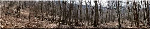
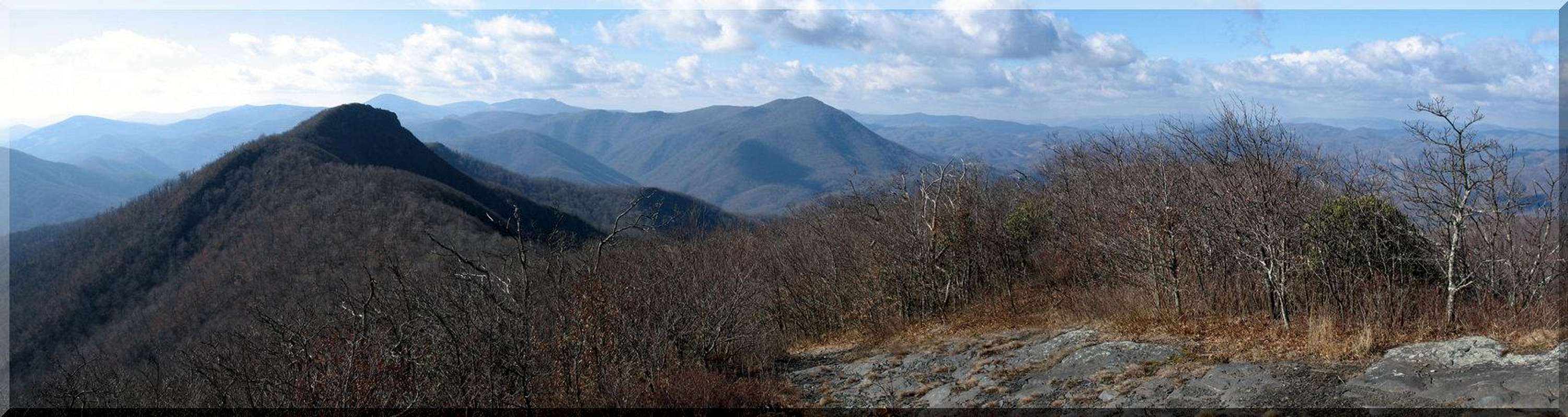
![Three Top Trail Pano]() The Trail
The Trail
The trail heads southwest just below the crest of the ridge. For the most part this section of trail is
flat until you near the summit. Here and there you can spot pieces of
Snow Quartz lying about in the woods. This may be more interesting to some than others, I guess. The
last section up to the summit is a bit steep but short.
![Tattered Flag]() Summit Flag
Summit Flag![Watch Your Step]() Watch Your Step
Watch Your StepThe trail tops out at a
sheer drop facing north. What used to be an
American flag is attached to a nearby pipe sticking out of the summit rocks. The
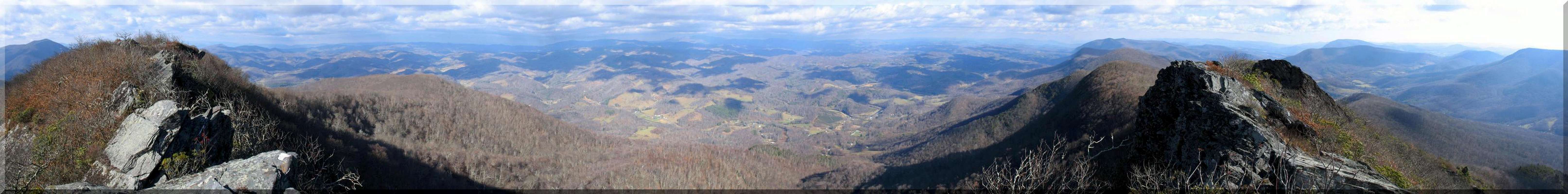
views from the summit were great but
the ridge to the southwest caught my attention. It's very exposed and narrow. It looked fun. There's not much of a path out onto the ridge. You have to
fight the scrub a bit at first. Out on the exposed ridge the wind was pretty strong making for some interesting moments. I almost lost my camera taking a
couple shots. Scrambling around on the ridge was incredibly fun though. There are not many peaks in the Southern Appalachians with terrain
like Three Top has. The views were
amazing.
It started
clouding up and the wind was really starting to howl so I decided it was time to get back down into the trees. I wanted to get over to the other two "tops" of Three Top Mountain but I couldn't locate any trails heading off in that direction. It would have been a tough bushwhack and I wasn't sure I'd have time so I decided to save it for another trip. The trip down was quick and painless. By the time I reached the
parking area some flakes of snow had started to fall.
It was a great hike that I would highly recommend to anyone. The peak looks like it is rarely visited and there is a lot of fun scrambling to be done on the summit ridge. Weather forced me down early so I'm sure there are a number of places I missed. I'll definately be back to do more exporing.
Looking West From Three Top |
Getting There...
If the directions below look complicated, don't let it freak you out too badly, it's not as bad as it looks...
Directions to Trailhead:
The odometer readings below start from the intersection of Three Top Road and NC-88 in the little hamlet of Creston, NC.
0.0 miles - Intersection of NC-88 & Three Top Rd. Head south on Three Top Rd.
0.3 miles - Three Top Rd. makes a left turn just after crossing a bridge.
0.8 miles - Turn left onto Eller Rd. Almost immediatley the road splits. Keep going straight. This is Hidden Valley Rd. Head up Hidden Valley Rd. where you will soon pass some "No Tresspassing" signs. Don't worry about these, the trailhead is on state land.
1.9 miles - The road becomes gravel, continue straight. I believe at this point the road becomes marked as
Oak Trail. Keep making your way up the ridge.
2.9 miles - The road makes a final sharp right-hand turn and levels out. Look for "NC Game Land" sign and
turn, doubling back to the left. Follow this two-track to the parking area.
3.3 miles -
Parking area and
gate. Trail to summit begins on the other side of the gate.
Trailhead Co-ordinates: 36.42362°N, 81.59890°W
Trailhead Elevation: ~3580'
Summit Elevation: ~5100'
Elevation Gain/Loss: ~1500'
Trail Length: About 3.5 miles round trip. It took me about 50 minutes to climb with stops for photos on the way. The trip back down took me about half as long. Plan to spend some time playing around on the summit ridge though!


Comments
Post a Comment