
-
 8047 Hits
-
 0% Score
-
 0 Votes
|
|
Route |
|---|---|
|
|
46.46000°N / 13.70000°E |
|
|
Hiking |
|
|
Summer, Fall |
|
|
Most of a day |
|
|
Walk-up |
|
|
Approach
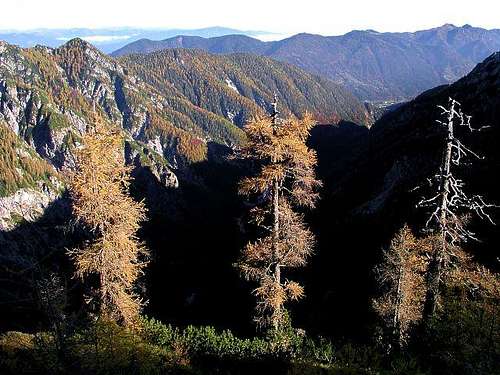
Mala Pišnica valley from above
The trail starts in Kranjska Gora, 810 m, the well known tourist resort in Sava valley. If you have your own car, you can drive southwards (towards Vršic Pass) one more kilometer and park by Jasna lake (restaurant). From here you already see into the Mala Pišnica valley.
And a tip for logistic:
It is very unlikely that you will be also returning by the same route. So, why not considering leaving bicycles on Vršič pass? The return to Jasna lake will be a very quick and pleasant one!
Route Description
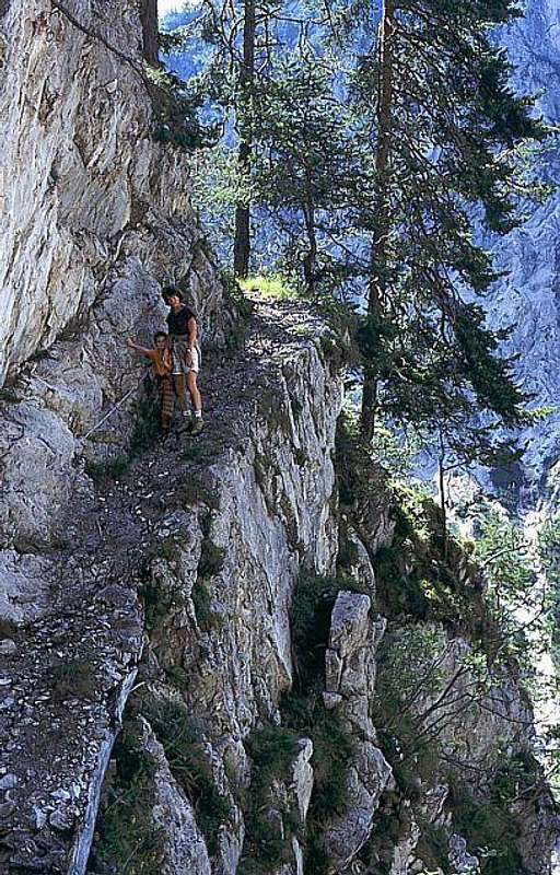
With children through Mala Pišnica valley
The path goes above Mala Pisnica valley in a SW direction. It is first clearly seen, but later you should not be tempted to proceed down, by the beautiful creek of Mala Pisnica. It jumps over a few rock barriers, so passages are usually not possible. The true path (hunters') is some 100 meters above the bottom of the valley, on its NW side (right if you go up). The path is on some places steep, also protected by steel ropes (now they are new, I think), but mostly it is enjoyable and comfortable. It's likely that you will not meet anybody on the whole tour.
After 1 h 30 min the path descends again down to the creek and you reach the hunters hut. Normally it is closed. From the hut you proceed by the valley (SW direction). The path is becoming less and less readable, in many turns it follows the easiest passages through steep woods (you keep more towards right). At the end the direction of this hunters path is towards the west and so it reaches lighter larch woods below the Grlo pass, 1457 m. If you are lucky, on these slopes below Grlo you can find the oldest larch in Slovenian mountains. Its top is already cut off by blizzards, but the tree is still very strong and alive.
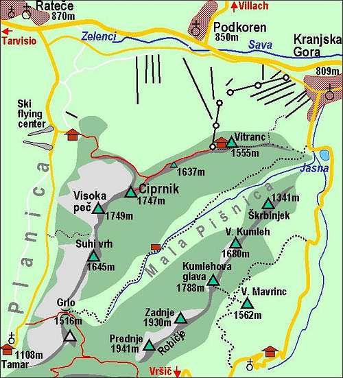
On Grlo Pass you meet the marked path from Planica valley (Tamar). Now you go by it (left), crossing the northern and eastern slopes of Slemenova špica. They are quite rocky and over a few details some pegs help you. But there are no bigger difficulties. Below the Sleme plateau you meet the marked path, coming there from Vršič over Vratica Pass, 1807 m. You follow this path towards the west on Sleme plateau and from it in some 15 minutes to the summit of Slemenova špica.
From Sleme you can descend either to Vršič or Planica (Tamar) by a marked path. A bit more than an hour and half (less and easier to Vršič). From there you need of course a transfer back to Kranjska Gora (or you walk 2:30h+).
For the ascent from Jasna lake to Slemenova špica you will need some 4 hours.
Rating the Route (by hiking standards)
0. General. From 830 m to 1911 m, NE exposition, mainly through woods and finally over grassy slopes. A few rock passages above the creek, secured by a steel rope. Not marked, hunters path. Equipment: good shoes, poles, a good map and device for orienting is very useful.1. Effort. 1100 m of altitude, 4 hours.
2. Power. 1 - no difficulties.
3. Psyche. 2 - easy.
4. Orientation. 3 - medium.
