The Drive In
Driving North from Las Vegas on HWY 95 we drove 11.3 miles past the water tower you see when passing through Indian Sptings. Went South on a dirt road for 5.9 miles where you reach a fork in the road. We turned left onto 553 and continued on 553 as far as it would go until you got to another T-Intersection. This is Gravel road 552, which we turned left at. A high-clearance vehicle is definately needed through here. We then followed 552 around up to the base of Mt. Stirling. Elevation where we parked was about 6,085 feet.
The Hike
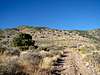
Sierragator and I started hiking about 8:15AM along road 552 which headed South in between 2 ridges. After a short distance the road ceased and turned into a wash. There was a lot of bush wacking. There were some trails made though from horses in the area which helped some. We then came up towards the end of the wash and then gained a ridge which headed south up towards the main ridge leading to Mt. Stirling.
The ridge leading up to the main ridge was striaght foward. There was some more bush wacking involved and trees to get through. There was lots of evidence horses in the area but we did not see any. Once we reached about 6950 feet you could make out
Papoose Lake and
Bald Mountain, about 13 miles north of Groom Lake and
Area 51.
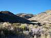
We then gained the summit ridge at about 7,820 feet (WPT 5). The views were great to the North, West, and SW towards Pahrump and Death Valley. From here it was an easy hike along the main ridge to Stirling. After a short distance we noticed a ridge that we could take for the return trip (WPT 9). This was right off the highpoint before the main summit. There was a little loss in elevation after this where we reached a saddle (WPT 6, 7,850 ft) and then the final stretch up to the summit. Not far past this saddle we ran into some petroglyphs. This was very interesting to see.
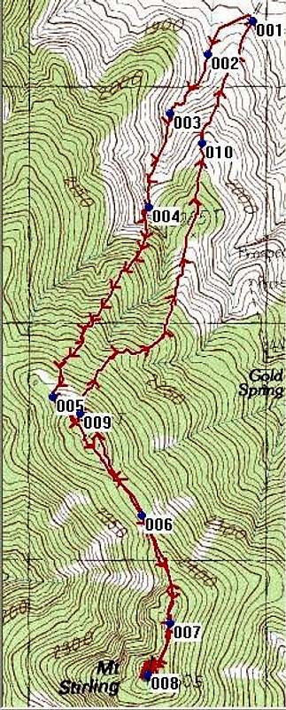
Waypoints
WPT Latitude Longitude Description
WPT 1 36.477913 N 115.9633067 W Park
WPT 2 36.47667 N 115.9654633 W End of Road in Wash
WPT 3 36.47442167 N 115.9672583 W Bush-wached trail in wash
WPT 4 36.470865 N 115.9683117 W Rocky Outcrop at base of ridge
WPT 5 36.4636983 N 115.9729483 W On top of main ridge to Stirling
WPT 6 36.4591817 N 115.9687917 W Saddle
WPT 7 36.4550567 N 115.9675383 W Petroglyphs
Summit 36.45400 N 115.968 W Mt. Stirling summit
WPT 9 36.46307 N 115.9716733 W Returning Ridge
WPT10 36.4732783 N 115.96577 W Parking spot visible on ridge
![Mt. Stirling GPS Trace]() GPS Trace
GPS Trace![Mt. Stirling Elevation Profile]() Elevation Profile
Elevation ProfileThe Summit
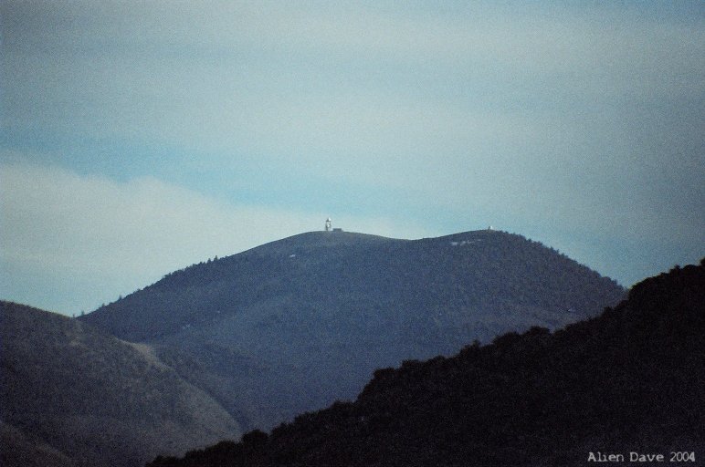
The summit provided great views North to Mercury, and the Nevada Test Site. The entire
Sheep Range from North to South was visible to the East as well as the
Spring Mountains to the Southeast all the way down to
Mt. Charleston. To the SW you could see Pahrump and Death Valley.
Telescope Peak was barely visible through the haze.
The total distance to the summit was 2.42 miles with about 2220 feet of elevation gain. The summit register was cool looking as well. We were the first two to summit Mt. Stirling since August 2006. I didn't realize this peak was so rarely climbed.
The Return Hike
The return hike nice. We just had to hike up a little bit from the saddle to get onto the sub peak where we then took the other ridge down. With 20/20 hind site this is the ridge we should have taken up. WPT 9 marks where we went down on this ridge.
Halfway down the ridge we were rewarded with a view of a wild burrow. With all the evidence of horses and burrows in the area there had to be lots more. We saw a famliy picnicing under a tree right where the vehicles came into view coming down the ridge. The total distance roundtrip was 4.65 miles. Next we tackled
Jaybird Peak.
Comments
No comments posted yet.


