-
 39662 Hits
-
 87.64% Score
-
 25 Votes
|
|
Area/Range |
|---|---|
|
|
36.27150°N / 115.6945°W |
|
|
Hiking, Mountaineering, Trad Climbing, Sport Climbing, Toprope, Bouldering, Ice Climbing, Aid Climbing, Big Wall, Mixed, Via Ferrata, Canyoneering, Skiing |
|
|
Spring, Summer, Fall, Winter |
|
|
Overview
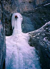
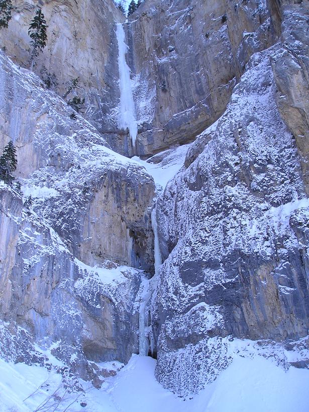
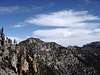
The northern portion of the range primarily consists of high mountains that typically receive a large amount of snow in the winter. With 9 of these peaks being above 10,000 feet, this portion of the range rewards the summer visitor with temperatures considerably cooler than those in the Vegas Valley below. In winter, the high peaks present quite the alpine environment for skiers/snowboards, mountaineers, and even ice climbers (here’s a shot of the Vegas Hose Monster (WI5+).
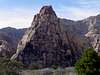
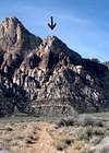
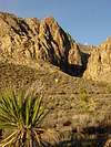
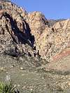
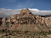
The middle portion of the range primarily consists of the sandstone bluffs of the Red Rock Canyon National Conservation Area. These bluffs serve as a sort of mecca for rock climbers of all abilities. With beautiful weather all year long, generally good rock, and incredible scenery, the area is very popular.
The southern portion of the range, as well as the lower elevation portions found elsewhere in the range, primarily consists of desert mountains dominated by yucca and cacti. More rugged than one might guess, these peaks are seldom visited.
Even spelunkers can find enjoyment in the Spring Mountains, as the range also hosts a number of fine caves.
*You might also check out a fledgling outdoor site (www.backcountry-explorer.com), which provides access to trip reports, beta, photos and other stuff covering hiking, scrambling, climbing and canyoneering around Las Vegas. A new hiking and scrambling guidebook, Rambles & Scrambles: The Definitive Guide to Peakbagging Around Las Vegas, is now available.
Named Peaks in the Range
Named peaks within the Spring Mountains include (north-to-south):| Peak Name | Elevation | Image |
|---|---|---|
| Mount Schader | 4,384 | No SP Page |
| Jaybird Peak | 6,565 |  |
| Mount Stirling | 8,217 |  |
| Wheeler Peak | 9,167 |  |
| Willow Peak | 9,967 |  |
| Bonanza Peak | 10,397 |  |
| Kyle Peak | 5,751 |  |
| McFarland Peak | 10,742 |  |
| The Sisters | 10,197 |  |
| Angel Peak | 8,861 | No SP Page |
| Mummy Mountain | 11,528 |  |
| Fletcher Peak | 11,918 |  |
| Charleston Peak | 11,918 |  |
| Cathedral Rock | 8,597 |  |
| Harris Mountain | 10,014 |  |
| Griffith Peak | 11,056 |  |
| La Madre Mountain | 8,154 |  |
| Turtlehead Peak | 6,324 |  |
| White Rock Hills Peak | 6,462 |  |
| Calico Hills | 5,200 |  |
| Bridge Mountain | 6,995 |  |
| Rainbow Mountain | 6,801 |  |
| Mt. Wilson | 7,070 |  |
| Blue Diamond Hill | 4,950 | No SP Page |
| Mountain Springs Peak | 6,641 |  |
| Potosi Mountain | 8,514 |  |
| Ragged Peak | 5,036 | No SP Page |
| Shenandoah Peak | 5,864 |  |
| Table Mountain | 5,152 | No SP Page |
| Bonanza Hill | 3,777 | No SP Page |
| Little Devil Peak | 5,597 | No SP Page |
| Devil Peak | 5,873 |  |
| State Line Hills | 5,413 | No SP Page |
There are also a large number of unofficially-named peaks within the range. Those represented on Summitpost include (north-to-south):
-Macks Peak (10,033 feet)
 |
-Lee Peak (11,312 feet)
 |
-Cockscomb Peak (9,692 feet)
 |
-North Peak (7,047 feet)
 |
-Bridge Point (6,639 feet)
 |
-Mescalito (5,440 feet)
 |
-Juniper Peak (6,109 feet)
 |
-Gunsight Notch Peak (6,021 feet)
 |
-Rainbow Wall (6,924 feet)
 |
-Cactus Flower Tower (6,356 feet)
 |
-White Rock Pinnacle (5,550 feet)
 |
-Decision Peak (6,120 feet)
 |
-Indecision Peak (6,465 feet)
 |
-Black Velvet Peak (6,234 feet)
 |
-Global Peak (5,900 feet)
 |
-Windy Peak (6,246 feet)
 |
Management
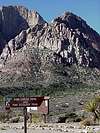
Management of the range primarily lies with the Bureau of Land Management and the US Forest Service. In addition to the La Madre Mountain Wilderness and the Charleston Peak Wilderness, the range also contains the Spring Mountains National Recreation Area and the Toiyabe National Forest, as well as the Red Rock Canyon National Conservation Area already mentioned above.Getting There
Visit the linked mountain pages for information on accessing a particular area of interest.Suggested Hot Spots
I welcome your highly subjective opinions on the best of the Spring Mountains!Best Views
-North Fork of Pine Creek (north side of Mescalito) and Fletcher Canyon (south side of Fletcher Peak) - (DonnieB)
Best Summit
-Rainbow Mtn - (DonnieB)
-Rainbow Mtn - (cp0915)
Best Overall
Best Hike (short)
-north fork of Pine Creek to the first waterfall (below Mescalito) - (DonnieB)
Best Hike (long)
-Bridge Mountain via the north fork of Pine Creek - (DonnieB)
Best Scramble
-"Because we're dealing with particularly scramble-rich country, it's hard to nail down a "best". That said, though lots and lots and lots of great and obscure routes are to be found in this area, one of the more prominent great ones, the Black Velvet Canyon route up The Monument, might take the cake. Fun scrambling (up to 4th class), enjoyable route-finding, seldom-visited country, and awesome scenery make this one fantastic." - (cp0915)
-Lost Creek, including Upper Lost Creek (below North Peak) - (DonnieB)
-North Peak via Lost Creek, McFarland Peak via the north or west routes, Mummy's Forehead (a feature on the northern end of the Mummy Mtn. massif) - (MoapaPk)
Best Snow Climb
-"This is a particularly tough one to nail down, as there are several enjoyable snow climbs in the Spring Mountains. Though the obvious ones, like Mummy Mtn, Mt. Charleston and Griffith Pk, speak for themselves, I lean toward The Sisters as my favorite. With a super short approach, great scenery, bristlecones covered in snow and rime, a little fun scrambling toward the end, some nice exposure on the narrow summit ridge, and a frequently forming summit ridge cornice, it's my favorite Spring Mountains snow climb. I've done it twice." - (cp0915)
-Mt. Charleston (ascending via Little Falls, descending via Big Falls) - (DonnieB)
Best Ice Climb
Best Mixed Climb
-"In an area not particularly known for its mixed routes, the north ridge (direct) is a fine mixed route on Harris Mountain. Although the mixed portion of the route is very short, it is stimulating. With nice exposure, fun climbing, and minimal avalanche danger, this is my favorite mixed route in the range." - (cp0915)
Best Free Route (single-pitch)
Best Free Route (multi-pitch)
-"In an area famous for long multi-pitch lines, it is no easy task to choose the best line. If we narrow the field down to sub-5.10 lines, two choices are almost obvious: Crimson Chrysalis (III 5.8+) on Rainbow Mountain's Cloud Tower formation or Epinephrine (IV 5.9) on Black Velvet Peak's Velvet Wall. The former is a direct, 8-pitch line to a summit of a semi-detached pillar on the north side of Rainbow Mountain. It is very sustained at it's 5.8 grade (though no pitch feels harder than 5.8, most of them don't feel easier either). The line is nearly vertical and the going is very exposed with almost all belays being full on hanging! By the time you reach the last pitch, you have about a thousand feet of air separating you from your backpacks at the base. It is probably the best 5.8 line anywhere in the US. The latter, Epinephrine is equally unforgettable. Originally 18 pitches long, the use of 60 meter ropes now allows most parties to get the job done in 14 to 15 pitches. The lower third of the route offers some of the best chimney climbing anywhere - shady, deep, yet reasonably well-protected - these are incredibly fun to climb. The middle third of the route follows an exposed dihedral and face - a drastic change of pace from the shady dungeons below. As you pull onto the top of the 10th pitch (base of the right-trending ramp system) you have 1200 feet of air below you! The final third (or final quarter) of the route follows a relatively easy slab system (the ramp) to just below the summit of Black Velvet Wall. Deciding which of these two is the choice Red Rocks moderate line is impossible for this author." - (rpc)
Best Sport Route
Best Aid Route
-Original Route (Rainbow Wall) - (DonnieB)
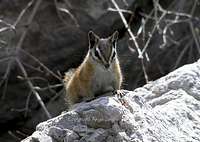
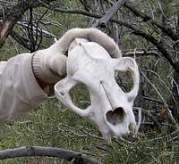
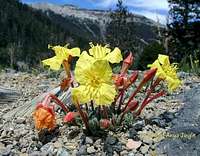
Flora...
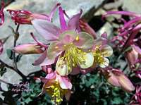

...and Fauna