
-
 8278 Hits
-
 82.48% Score
-
 15 Votes
|
|
Mountain/Rock |
|---|---|
|
|
37.76731°N / 107.79168°W |
|
|
San Juan |
|
|
Hiking, Mountaineering |
|
|
Spring, Summer, Fall, Winter |
|
|
13374 ft / 4076 m |
|
|
Overview
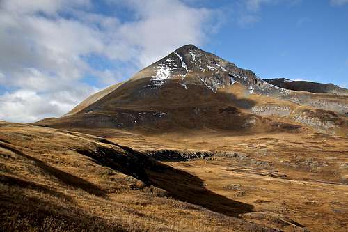
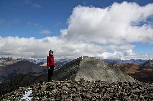
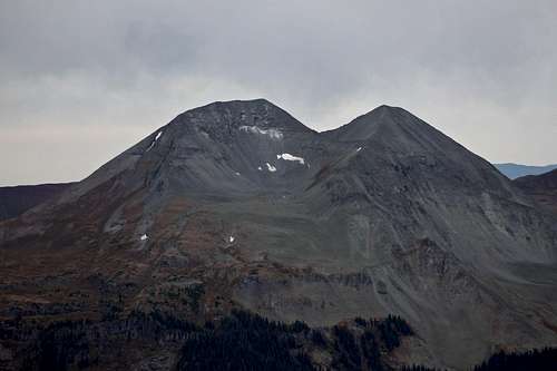 Twin Sisters from V 5 - the closer one is East, and on the right is West
Guide to the Colorado Mountains with Robert Ormes (sort of a bible of Colorado Mountains) briefly mentions: "Twins Sisters on the opposite side of the valley (from Rolling Mountain), is guarded with cliffs here and there and booby trapped with frustrating pockets of scree. It is perhaps more easily climbed by way of its southwest ridge above Colorado Trail."
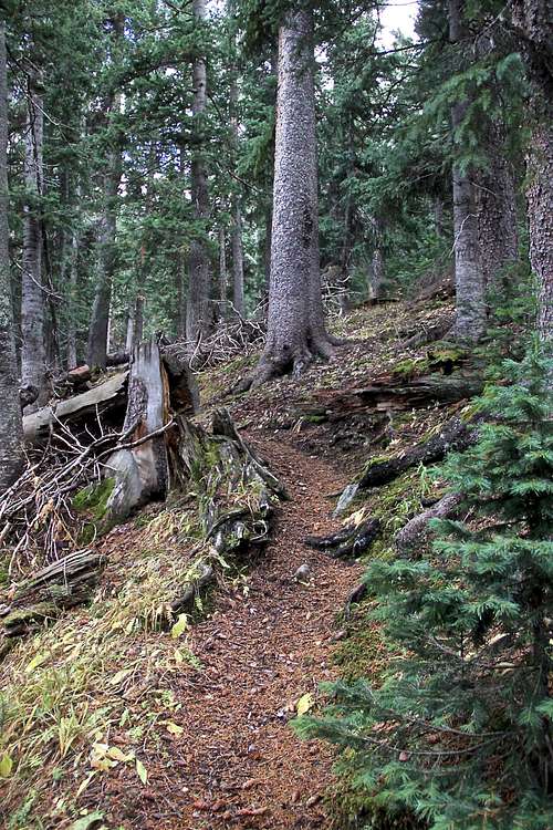
![Hardrock Trail]() Hardrock Trail
Hardrock Trail![Hardrock trail]() Hardrock trail
Hardrock trail![Beattie and Fuller Peaks]() Beattie and Fuller PeaksAs any mountain there are many ways to get up. I will describe my approach, which I found scenic, using a trail and trying to avoid scree, but this is not the shortest way. Climb13ers (link below) describes a shorter alternative, but negotiating with more scree a talus, also sounds like a steeper way. Basically, I started at the west side of Twin Sisters East, used the "Hardrock Trail" to walk around Twin Sisters East north side and gained the high country on the east side of Twin Sisters East slopes. Continued south to gain the saddle.
From the place where you park your car along the 4WD road (limited parking) try to find the unmarked trail on most maps. This will safe you a lot of energy and scree hiking. The trail as mentioned is not marked on most maps, but is in excellent condition. It is a part of Hardrock 100 mile Mountain Run - popular race out of Silverton, Colorado. It does show on The Mountains of Silverton, Telluride and Ouray map by Drake Mountain Maps.
Beattie and Fuller PeaksAs any mountain there are many ways to get up. I will describe my approach, which I found scenic, using a trail and trying to avoid scree, but this is not the shortest way. Climb13ers (link below) describes a shorter alternative, but negotiating with more scree a talus, also sounds like a steeper way. Basically, I started at the west side of Twin Sisters East, used the "Hardrock Trail" to walk around Twin Sisters East north side and gained the high country on the east side of Twin Sisters East slopes. Continued south to gain the saddle.
From the place where you park your car along the 4WD road (limited parking) try to find the unmarked trail on most maps. This will safe you a lot of energy and scree hiking. The trail as mentioned is not marked on most maps, but is in excellent condition. It is a part of Hardrock 100 mile Mountain Run - popular race out of Silverton, Colorado. It does show on The Mountains of Silverton, Telluride and Ouray map by Drake Mountain Maps.
Colorado Rank: 341
Parent Lineage: Twin Sisters, East
Saddle between the sisters: 12,980 feet
Class: 2
Nearby Mountains:
- Twin Sisters East 0.44 miles
- Rolling Mountain 1.87 miles
- Beattie Peak 2.39 miles
- Unnamed 13042 2.47 miles
- Unnamed 13300 2.55 miles
- Fuller Peak 2.72 miles
- "V 9" 2.72 miles
- Vermilion Peak 2.99 miles
- Golden Horn 3.16 miles
- Pilot Knob 3.67 miles
- "V 2" 2.75 miles
- "V 4" 3.85 miles
- Grizzly Peak B 3.92 miles
Getting There
From the town of Silverton drive north on US 550 (Million Dollar Highway) and in a little over 2 miles turn west onto FR585, well signed for South Mineral Creek campground. If coming from Ouray, drive south on US 550 over Red Mountain Pass and watch for this turn off on the west side of the road before reaching Silverton. Take a sharp turn onto a graded dirt road all the way to the campground, about 4.7 miles. The road is passable by passenger cars. Some people may choose to park here, but if you have a 4WD vehicle, you can drive further on a dirt road which turns west and then south past the South Mineral Campground for another 1.6 miles. This section of the road is much rougher and does require 4WD with high clearance. Park along the road at a large open meadow at 10,640 feet. Don't drive all the way to the end of this road, which would be Rico-Silverton TH (great for Rolling Mountain).Route
 Hardrock Trail
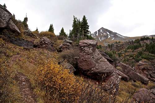 Hardrock trail
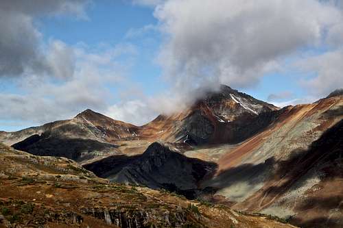 Beattie and Fuller Peaks
About 1 mile back from the Rico-Silverton TH, or ~ 1.6 miles from South Mineral Creek Campground, look for a small cairn on the site of the road. The trail leads down to the creek, loosing about 100 feet and then begins climbing on the other side. Above the creek the trail follows along the forest edge and begins climbing steeply along the north edge of a steep, shallow gully with no water. There are series of switchbacks and the trail is pretty steep here - poor Hardrock runners. Around 11,200 feet, the trail moderates some and begins to contour more, winding through forest and bringing you out into a clearing at the foot of a great, rock glacier. This section of the trail is really pretty. Follow the trail down some to the east, crossing a flower filled basin with some water and then contour through through more forest to a crossing of Porcupine Creek. There are interesting boulders covered with moss and many cairns along the road - I am assuming Hardrock watchers building those.
On the other side of Porcupine Creek, the trail climbs east, then south through a field of gorgers flowers during the summer. The trail climbs through a switchback into a small level area with some waterfalls, ascends another rock band and emerges at another large, level meadow. From here, head for the pass at 12,200 feet on the eastern flank of Twin Sisters East. Basically, you are completely walking around Twin Sisters, East.
From the pass you can walk over tundra with some ponds towards an unnamed lake on the eastern flanks of Twin Sisters East. You can either first ascend up the slopes of Twin Sisters East, initially over tundra, then more scree, nothing more than class 2 hiking, or you can choose my approach. I continued south over the tundra along the eastern slopes of Twin Sisters, East until I could see an approach to the saddle between Twin Sisters East and West. Going up to the saddle involved a lot of scree hiking, but it went pretty fast. Once at the saddle between the Twin Sisters, I ascended the the ridge up Twin Sisters West - easy, and then descended the same ridge and ascended Twin Sisters East and walked over the summit and descended towards and slightly north of the unnamed lake and return to the Hardrock trail and back to my vehicle.
The summit has a cairn with a sign in register. The views are outstanding, especially Rolling Mountain looks very dramatic. To the south get a great view of Engineer Mountain B, then as you turn towards the west, you see Grizzly Peak B, Rolling Mountain, San Miguel, Wilson massif in the back, Beattie Peak, Fuller Peak (Vermillion is sort of hiding behind Fuller), Golden Horn, further north Ulysses Grant with V 4 look impressive. And as you continue to turn, more and more peaks, even all the way to Mount Sneffels. The views east over Grenadier and Needles are impressive as well.
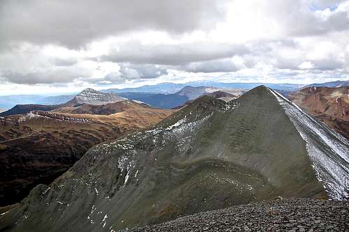
 Twin Sisters East false summit as seen from the approach
 | 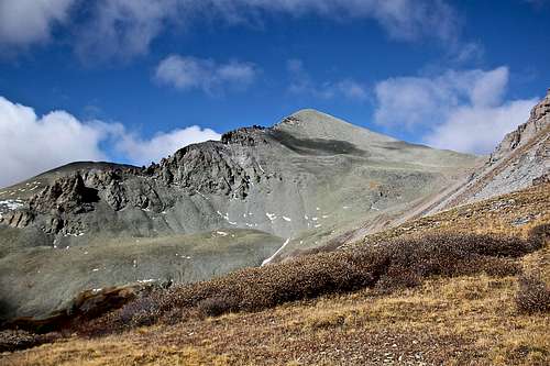 Twin Sisters West - view from its east side, and you can almost see the saddle
 |
 Twin Sisters West as seen from the summit of Twin Sisters East
 | 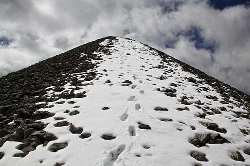 Up Twin Sisters West
 |
 Twin Sister West summit with a view of Twin Sisters East
 | 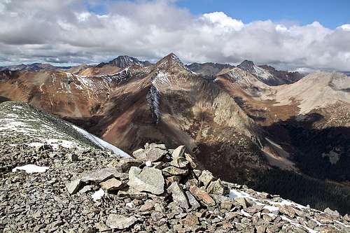 Twin Sister West summit cairn and register
 |
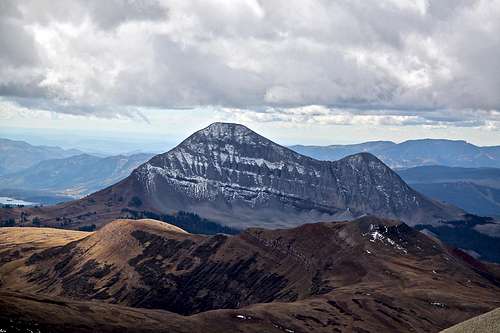 Engineer Mountain
 | 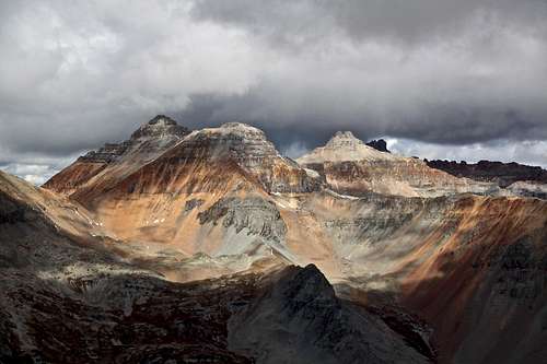 Vermilion group
 |
Red Tape
There is no red tape. Driving 4 WD roads is free. Passenger cars can make it without difficulties to South Mineral Campground. The 4WD road from here requires high clearance 4WD vehicle.Hiking is free.
When to Climb
Summer is obviously the easiest since the roads are open. Winter is possible, but count on a long approach through avalanche prone terrain. Check avalanche conditions prior venturing out in the winter - here.Camping
There are plenty of camping opportunities on your drive in along FR585 - some in developed campgrounds, and some primitive back country camping without a charge.South Mineral Campground - no reservations, vault toilets, popular destination
Golden Horn Campground - no charge, primitive campground along the road to South Mineral.