
|
|
Area/Range |
|---|---|
|
|
40.77650°N / 110.3723°W |
|
|
13528 ft / 4123 m |
|
|
Overview
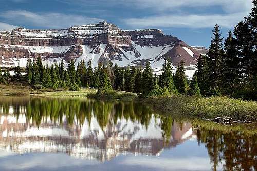
The Uinta Mountains are one of the few mountain ranges in North America that run east to west rather than north to south. Within the Uinta Mountains are about 2000 lakes, and some 900-1000 are full of trout. Along with the San Juans in Colorado, the Uintas have more contiguous area above timberline than any other area in the Continental United States. This is a beautiful area with many lakes, meadows, wildflowers, and some rugged peaks. Solitude is usually easy to come by once you leave the popular fishing holes behind.
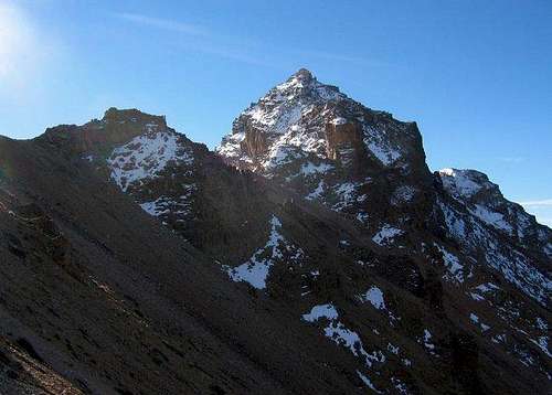
The Uinta Mountains are very rugged in the northeast section. Beginning at Hayden Peak and east to Mount Lovenia, the Uintas are not unlike the Tetons or other ranges. East of Lovenia, the peaks are more gentle, with a few rugged peaks (ie Red Castle and Henrys Fork Peak) scattered about until you are as far east as the Henrys Fork/Kings Peak area. East of Kings Peak, the Uintas become very gentle and the peaks are very rounded with only a few scattered cliffs about.
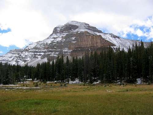
 Mount Beulah
Introduction to Hiking and Climbing in Each Section of the Uintas
Since the Uinta Mountains is a large range, and is so different from one part of the range to another, the range has been divided into four sub-sections as well. Here is a brief overview, but see the individual subsections as well:
Western Uintas/Lakes Roadless Area
Most of these peaks are day climbs, and the highest peak is Bald Mountain at 11,947 feet. Despite being lower than the other sections of the Uinta Mountains, this area receives some of the highest snowfalls in the range. Timberline is lower here than it is farther east, and is anywhere from 10,600 to 10,900 feet. Most peaks are class 2-3, and only Bald Mountain and Hoyt Peak have trails to their summits. Trails are well used along the Mirror Lake Highway (Highway 150), but many trails that are accessed from various roads besides this highway are not well used.
Bald Mountain is a very popular climb, and along with Kings Peak is the most popular climb in the Uinta Mountains. The other summits along the Mirror Lake Highway see a moderate number of ascents, but the other peaks are seldom climbed.
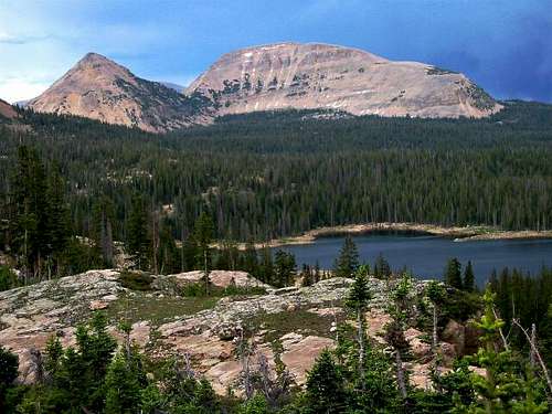
 Reids Peak in the Western Uinta/Lakes Roadless Area.
High Uintas Wilderness Area
This is where the highest peaks in the range are all located, and where you can find some really rugged peaks.
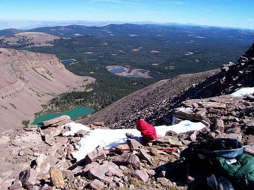
The High Uintas Wilderness Area is by far the largest wilderness area in Utah. It also contains the highest peaks in the Uinta Mountains, and in the state of Utah. Unlike the Western Uintas or High Bollies (Eastern Uintas), most of the routes to the peaks in the High Uintas Wilderness Area are too long for one day climbs, at least for us mortals. A few of the peaks are 40 miles round trip from the nearest road, and only the far western end of the wilderness has any peaks that are normally climbed in one day. The High Uintas Wilderness Area contains all of the 13,000 foot peaks in Utah, and more than half of the 12,000 foot peaks in Utah. The highest peak in the wilderness area is Kings Peak at 13,528 feet, and which is also the highest peak in Utah. Timberline is around 11,000 feet.
Usage is a mixed bag as many areas are crowded and receive heavy use (such as Naturalist Basin, Henrys Fork, Smith Fork, etc), but some other areas are seldom visited and trails are fading away. Some entire basins are usually empty even on summer holiday weekends, while other areas may have full parking lots, and a line of hikers.
Interestingly, no mountains in the wilderness area have a trail to the summit, though a beaten path is slowly appearing on Kings Peak.
 Henrys Fork Peak in the High Uintas Wilderness Area.
High Bollies/Eastern Uintas
As opposed to the peaks in the High Uintas Wilderness, most of the High Bollies are day climbs by their shortest routes. None of the peaks are rugged, but some are interesting, and there are many lakes in the area. Also in contrast to the peaks in the High Uintas Wilderness Area, most of the peaks in the High Bollies can be climbed in one day by the average climber, though long backpacking trips and routes are certainly available and possible. The highest peak in the High Bollies/Eastern Uintas is Eccentric Peak at 12,276 feet. Timberline is around 11,000 feet.
None of the peaks have trails to their summits, but none of the peaks here are difficult by their easiest routes. This region contains the easiest 12,000 foot peaks in the Uinta Mountains.
Despite the ease of ascending the peaks, most of these peaks are seldom climbed. The only exception seems to be Eccentric Peak because it is a county highpoint. Most of the trails in this eastern section of the Uintas are not used much, and many are fading away because of very light or no foot traffic.
 The summit of Marsh Peak in the High Bollies/Eastern Uintas.
Dinosaur National Monument and Vicinity
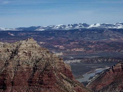
Dinosaur National Monument and much of (but not all of) the surrounding area is also part of the Uinta Mountains. This section of the Uinta Mountains is completely different from the high peaks to the west and is often more desert than alpine. It's still very spectacular in it's own way and the most difficult peaks to climb in the Uinta Mountains are all in this section.
This area of Colorado and Utah, without question, has the most remote peaks in Colorado, and a few of the more remote ones in Utah. They are incredibly spectacular and almost completely ignored, despite the fact that it offers some of the best scenery in the lower 48 states. Over a dozen very inaccessible peaks invite exploration. Only a few of the more accessible peaks are on Summitpost, but there is enough exploring here to keep one busy for years.
There are all kinds of spectacular canyons here as well. From big and scenic to tight slot canyons, this area has enough exploring left for years. There are literally dozens of seemingly completely unexplored slot canyons in the area. Here’s a little secret: There are actually better and much more remote slot canyons than the ones on Summitpost. Buckwater and South Buckwater are the easiest to get to and explore of the slot canyons in the area.
Dinosaur National Monument and Vicinity is a very rugged region full of upturned beds of rock, dinosaur bones, rivers, canyons, and mountains. The area is rich in wildlife and scenic beauty.
 Split Mountain in Dinosaur National Monument.
 Rock Climbing
Technical rock climbing is not usually done in the Uinta Mountains because of the fractured nature of the rock. There are a few places with some good rock though, and I have done some nice technical rock climbs around Anchor Lake in the Western Uintas, Notch Lake, also in the Western Uintas, and Lightning Lake in Upper Rock Creek Basin in the High Uintas Wilderness Area.
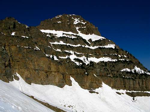
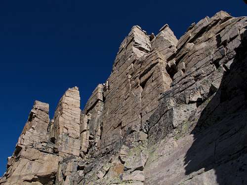 Vertical cliffs of questionable quality on Hayden Peak.
Seasons
Mid-July through Mid-September is the normal hiking season in most of these mountains, though in the far west and add low elevations, the snow melts out faster. Mosquitoes tend to be very thick in July. The roads in the area are usually open in late June or early July. They usually close when ever the first big snowstorm of the season hits, usually between mid-September and mid-October.
October can sometimes bring fine weather, but don’t count on it. Really deep snows can and do come in October. By November, except under really unusual conditions, the mountains will be buried in snow.
Late March through early June is a good time to climb in the Uinta Mountains, but the problem is that most trailheads still aren’t open to the summer parking areas. Late March through early June almost always still has a lot of snow, but travel is much easier then than it is in the real winter. The snow is more consolidated, making trail breaking much easier. The days are longer and it isn’t as cold as it is in the real winter. Note that big snowstorms can and do come at this time, so be prepared for that, and have a good weather forecast.
In winter, most peaks are pretty tough and all are usually multi-day trips. Climbing the Uintas is rather unique in winter because the most difficult part of the trip is actually covering the relatively flat ground to get to the mountain's base. This is because of typically very powdery snow below treeline. Usually, once you reach the steeper parts of the mountains; the parts above timberline, the going actually gets easier because the snow is blown rock-hard.
Many of the Western Uintas are fairly accessible in winter. Castle Peak and Duke Mountain are examples. The mountains near the eastern section of the Western Uintas (i.e. Bald Mountain and Reids Peak) are very long trips in winter and are multi day hikes.
None of the peaks in the High Uintas are that easy in winter, but pretty good winter access can be had to the peaks around Henrys Fork, Swift Creek, and East Fork Bear River. Even so, these are all multi day trips in winter. Some of the peaks are over 70 miles round trip(!) from the winter road closures and many peaks still don’t have any documented winter ascents!
None of the High Bollies are easy trip in winter, because the road closures are so far from the mountains. Marsh Peak has been climbed in winter. See details on the mountain page. Eccentric Peak is a reasonable three day winter trip from the north. See the mountain page for more info.
 Ostler Peak
Geology
The main bulk of the Uinta Mountains is the orange- red, thickly bedded quartzite and sandstone of the Pre-Cambrian Uinta formation. These rocks are over one billion years old. Away from the core of the range, the rocks are all progressively younger in origin, and mostly sedimentary. The bones of dinosaurs are abundant in the Jurassic Morrison formation at Dinosaur National Monument, at the extreme east end of the Uinta Mountains.
The area was heavily glaciated 17,000 to 13,000 years ago, which resulted in many lakes and glacier carved valleys. Only fairly recently did the last of the glaciers disappear. Some sources indicate that a “real” glacier existed above Red Castle Lake until the 1930’s.
 Reids Peak and Bald Mountain
Recommended Books
Hiking Utah’s High Uintas--Access trails only; no peak climbs. Covers trails within the High Uintas Wildreness Area.
High Uintas Backcountry--Access trails only; no peak climbs. Covers Trails in the High Uintas Wilderness Area, as well as a few in the Western Uintas/Lakes Roadless Area.
Utah Mountaineering Guide--Very brief desciptions of most mountains in the Uinta Mountains.

Western Uinta Backcountry Guide--Access trails and peak climbs. Covers peaks and trails in the Western Uintas/Lakes Roadless Area.