Introduction
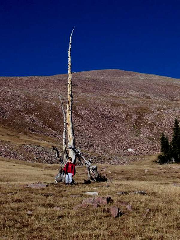
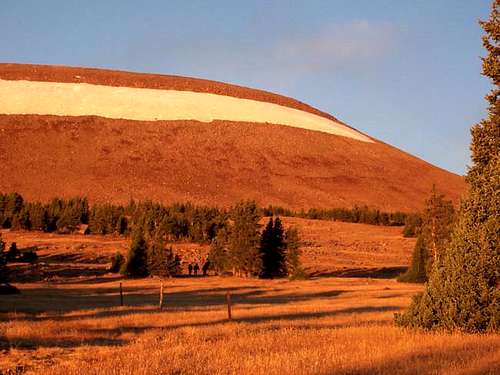
![Kessler wanted to try a...]() Kessler wanted to try a direct route up the Leidy Icefield, but unfortunately, REI does not make crampons and ice axes for 3-year olds, so we had to take the long way around and skirt the icefield.
Kessler wanted to try a direct route up the Leidy Icefield, but unfortunately, REI does not make crampons and ice axes for 3-year olds, so we had to take the long way around and skirt the icefield.
Usually, the weather begins to become really cold in the mountains in late September and early October. This year, however, we had an extra long Indian summer, so it seemed like a good time to take my son Kessler (three years old) to the Uinta Mountains. I know the Uinta Mountains very well, but I know the eastern section much less than the other areas. I hadn’t been to the Uintas since January 2001, so it was time to go again. We dressed warm and headed out for the trailhead. The fall colors were really nice along the drive.
![In the fall, the drive to the...]() In the fall, the drive to the trailhead is very colorful.
In the fall, the drive to the trailhead is very colorful.We camped near Ashley Twin Lakes. This morning it was 10F (-12C), but once the sun came out, it was warm. The trails in this part of the Uintas are not well used, so much route finding is required. We walked up the mountain at what we thought was the correct trailhead, but when the old logging road started to head away from the mountain, we decided to head out cross-country towards the peak. After climbing over several logs we met the old logging road again. I guessed the old road we were on was the correct route in the first place. The road is definitely not passable to vehicles anymore, but makes a nice walking trail. We had a few nice views of Marsh Peak before climbing to timberline. Kessler had to stop at several logs along the way to look for bugs and spiders under the bark of dead trees.
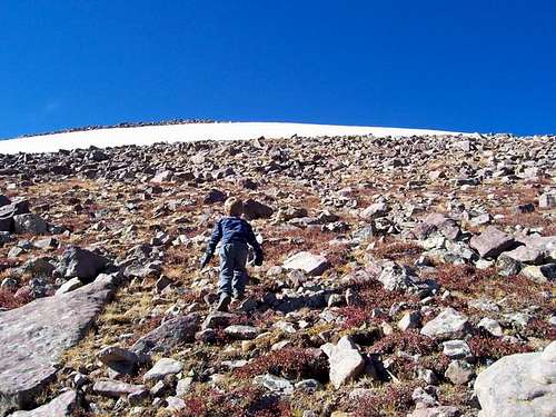
Now that we were at timberline, the views opened up. This is also where the work began. We located an old trail on the south side of the basin that climbed steeply to the basin rim. This would be our route. We climbed to the lip of the basin and found that the trail was faded away, but it was still easy to follow because it was marked with cairns. This is where Kessler really had fun. He would walk to one cairn and spot the next one ahead. He would say, “Dad, look I found the next cairn; it says we have to go this way”. It was a lot of fun.
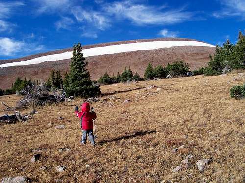
![At timberline on the east...]() At timberline on the east slopes of Marsh Peak. The summit area can be seen in the background.
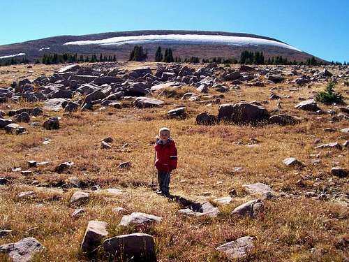
At timberline on the east slopes of Marsh Peak. The summit area can be seen in the background.![Climbing Marsh Peak s south...]() Climbing Marsh Peak's south slope, looking north. Shortly higher than this, you must leave the trail and scramble to the summit (no trail) for the final 1000 feet.
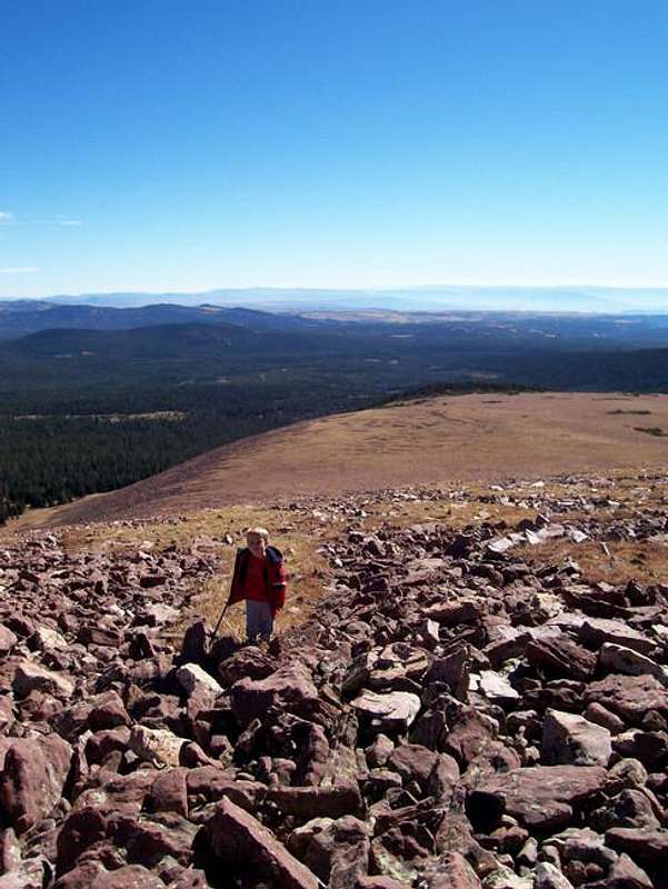
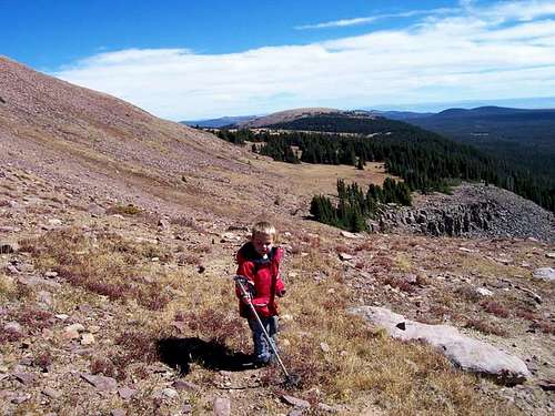
Climbing Marsh Peak's south slope, looking north. Shortly higher than this, you must leave the trail and scramble to the summit (no trail) for the final 1000 feet.![Climbing the south slopes of...]() Climbing the south slopes of Marsh Peak on September 30, 2005. This is a less steep section of the route, so we took a break and we are looking at the maps and trying to identify the surrounding features.
Climbing the south slopes of Marsh Peak on September 30, 2005. This is a less steep section of the route, so we took a break and we are looking at the maps and trying to identify the surrounding features. ![Approaching the summit of...]() Approaching the summit of Marsh Peak, from the south.
Approaching the summit of Marsh Peak, from the south.![Approaching the summit of...]() Approaching the summit of Marsh Peak, looking east.
Approaching the summit of Marsh Peak, looking east.
When we reached the south face of Marsh Peak, it was time to leave the cairned route and climb to the summit. It started out easy and with grass covered slopes, but the higher we went, the more rocks and boulders to climb over were present. Kessler said that “this must be the toughest mountain in the world” because of all the rocks. I talked him into the idea that there were actually tougher mountains, but he said, “This must be one of the toughest mountains in the world, then”.
After much hard work, the climb became gentle and we were very near the summit. Instead of heading to the summit however, Kessler made a beeline to the visible snowfield. Apparently the draw of playing in the snow is greater than that of summit fever!
After a long lunch break, and after an obligatory snowball fight and building of a snowman, we headed for the summit. The sky was cloud free, there was no wind, only silence. We could see many lakes and a sea of peaks. It was beautiful.
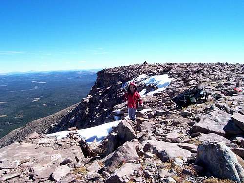
![A look down the southeast...]() A look down the southeast slopes of Marsh Peak. This is where you will leave the trail to scramble up to the summit. This part of the peak isn't very steep.
A look down the southeast slopes of Marsh Peak. This is where you will leave the trail to scramble up to the summit. This part of the peak isn't very steep.![Looking northeast from a...]() Looking northeast from a snowbank just a few feet from the summit.
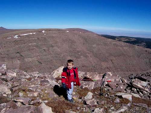
Looking northeast from a snowbank just a few feet from the summit.![Approaching the summit of...]() Approaching the summit of Marsh Peak. The summit is just ahead and where the cairn is located.
Approaching the summit of Marsh Peak. The summit is just ahead and where the cairn is located.![October 1, 2005. Looking...]() Looking north from the summit.
Looking north from the summit.![Descending the south slopes...]() Descending the south slopes route.
Descending the south slopes route.
It was now time to head down the mountain. We headed down the mountain without any trouble, but it was a long hike. By the time we reached the vehicle, we had hiked eight miles (13 kms), much of it off trail. This was a very long hike for a three year old, and Kessler was tired.
We then drove to the trailhead for Leidy Peak.
Today should be an easier climb. Kessler was very excited about this climb because of the highly visible snow/icefield. He wanted to climb up to it. After a beautiful sunrise, we followed an old road for a short distance and then headed out cross country towards the peak and the right side of the icefield. It was a steep climb to the icefield, but the rock was stable. After reaching the icefield, Kessler wanted to build a snowman, but all the snow was too hard, and the rest was ice by this time of year. Kessler wanted to climb the icefield directly, but unfortunately, REI does not make an ice axe and crampons for three-year olds. See top picture.
![Sunrise on the upper east...]() Sunrise on the upper east slopes of Leidy Peak. The North Ridge forms the right hand skyline.
Sunrise on the upper east slopes of Leidy Peak. The North Ridge forms the right hand skyline.![Approaching the northeast...]() Approaching the northeast face of Leidy Peak.
Approaching the northeast face of Leidy Peak.
Now, the climb became a bit more challenging. There were many rocks to climb over and the going was steep. Kessler needed me to hold his hand on several sections and on the larger boulders. Luckily the section of boulders wasn’t too long and the route became grassy. We reached the large summit plateau and headed for the summit. The summit of Leidy Peak is very expansive and it was a longer walk to the summit than it looked. The views were fantastic. We signed the summit register and noticed that we were the 5th party to climb the peak in 2005. The only mishap of the trip happened on the summit of Leidy. A gust of wind blew over Kessler’s punch and blew away his M&M’s. It was the only complaint he had of the trip and it made him cry for less than a minute. Luckily, he was OK with my promise to get him more M&M’s and punch when we got back to town!
![Approaching the gentle...]() Approaching the gentle northeast face of Leidy Peak.
Approaching the gentle northeast face of Leidy Peak.![Approaching the east ridge of...]() Approaching the east ridge of Leidy, after descending the west slopes.
Approaching the east ridge of Leidy, after descending the west slopes.![Approaching the Leidy...]() Approaching the Leidy Icefield from below. This is where the scrambling begins on the North Ridge Route.
Approaching the Leidy Icefield from below. This is where the scrambling begins on the North Ridge Route.
We descended the west slopes of the mountain in order to make a full traverse of the peak. The west slopes were easier than the north ridge, and there were only a few rocks to climb over. We descended to the cairned route, and headed around the south side of the mountain. After a long walk, we were back at the trailhead. It had been a good 5.4 mile (10 kms) hike, and we had both enjoyed it.
The only thing left was the drive home. Kessler slept most of the way.


Comments
Post a Comment