Finding the Time and Place
For quite a long time I wondered whether this year’s annual trip to Colorado was going to work out. Even up until the week before we left the question was somewhat in doubt. The biggest problem with planning was just finding a two weekend window where all of our schedules would work; for myself, my son Andrew and my friend Rob. For six years running I have scheduled the trip for August, but August was out as Rob and I had very high priority items already on our agenda. The week of Labor Day literally ended up being our only option, and I wasn’t thrilled with this choice. We would be arriving in the San Juans on a holiday weekend! All I could envision were crowds, both in Ouray and Silverton and on the trails as well. The only positive I could come up with was that I only had to take four vacation days instead of five. But since you can't always get what you want I had no other choice. Labor Day week would be it for this year’s trip.
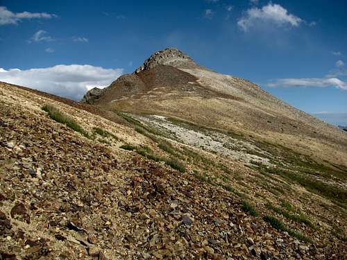
Trying to schedule the trip may have been one challenge, but it was nothing compared to trying to decide where to go on my first jaunt to the San Juans. We would only have six short days for hiking and with how large of an area the San Juans encompass, and with all the summit options, it was a pretty tough task deciding on the final itinerary. And yes, SP was a huge help in the planning process! My initial focus was on the Weminuche Wilderness with Vestal Basin high on the priority list. But I realized that what I wanted to accomplish in the Weminuche would require a weeklong backpack, and we weren’t up for that this year so I started looking at other options. Everything I had read about Ice Lake Basin said it was one of the most beautiful basins in Colorado and from the pictures Blue Lakes Basin looked even more stunning. So I decided on two separate three day/two night backpacking trips; the first to Ice Lake Basin and the second to Blue Lakes Basin. Ice Lake Basin offered a number of 13ers to climb and Blue Lakes Basin would give us a shot at Mount Sneffels.
![Sunset at the Ouray Brewery]() Sunset on the San Juans from the Ouray Brewery
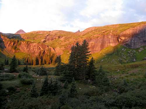
Sunset on the San Juans from the Ouray BreweryWe hit the road on Friday night and to be exact it was a 22 hour 40 minute all night drive from Andrew’s apartment in Indianapolis to Ouray. We arrived just before 5 PM which allowed us plenty of time to enjoy our evening. I had reserved a site at the Amphitheater campground just south of town. After setting up a tent there we headed into Ouray for dinner. For a Saturday night on a holiday weekend I was pleasantly surprised with the lack of traffic. When I think of foothill towns I have visions of Gatlinburg and its obscenely busy weekends, so I was rather surprised to see Ouray so empty. The online reviews for the pizza at the Western Inn were good so we headed there for dinner, and the pizza was as good as advertised. Afterwards we headed over to the Ouray Brewery to have a nightcap on the second floor outdoor deck. Although it was mostly cloudy the views of the mountains were still good and sunset glow made it that much better. It was a great way to end our first evening in the San Juans.
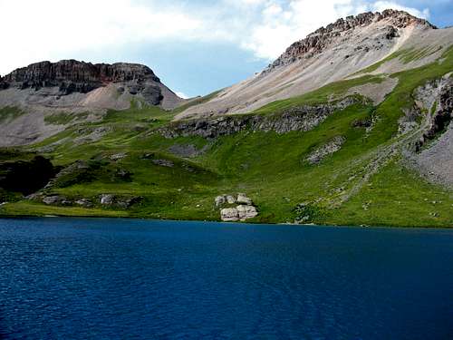
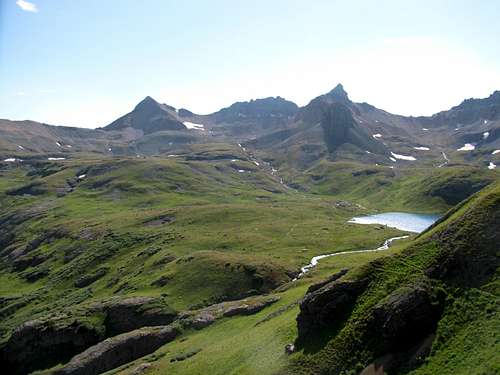
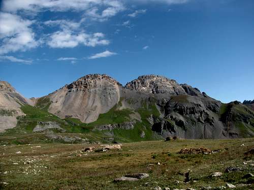
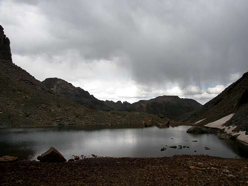
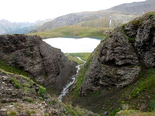
Lower or Upper Basin
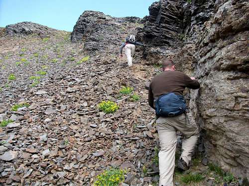
We were up early Sunday morning and before making the one hour drive south from Ouray to Mineral Creek Road we stopped in town at the Red Mountain Cafe for the a $9.99 all you can eat breakfast buffet. Knowing that dehydrated meals were in order for the next 48 hours we stuffed ourselves on the buffet, particularly the sausage gravy and biscuits, which were the highlight. Afterwards we enjoyed the hour drive south on the Million Dollar Highway to Mineral Creek Road. The scenery was spectacular, but the drop-offs were pretty extreme! When we reached the parking lot at the trailhead my expectations on Labor Day crowds were confirmed. There had to be at least 50 cars in the parking area, and we grabbed what was one of the last parking spots.
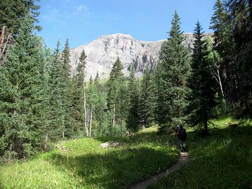
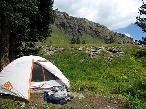
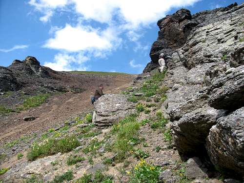
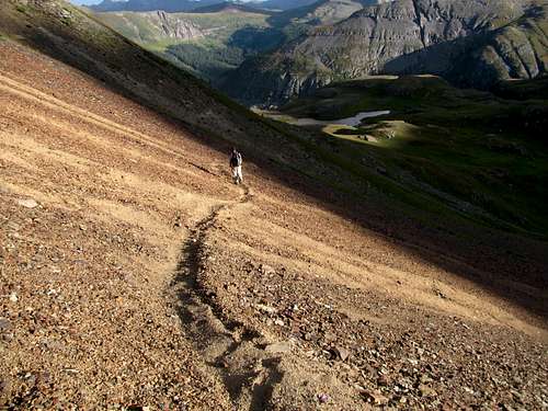
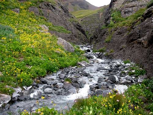
The two mile hike up to Lower Ice Lake was pretty but uneventful. We made it up the numerous switchbacks until we finally reached the lower basin. At this point we had to make a decision on where to camp. I had plans on hitting peaks all three days so it made good sense to head up to Ice Lake and to camp in the upper basin. By camping high we would avoid the over 500 feet of elevation gain to the upper basin each day. But I was concerned with camping up high. It was technically still monsoon season and since the upper basin is completely exposed I was concerned about the chances of thunderstorms in such an open area. When we reached the lower basin we scouted around for a campsite and found a rather nice one just above a stream. It seemed to be as good of a place as any so we decided to make this spot home for the next two nights.
![Ice Lake Basin Trail]() Early on the trail to Ice Lake Basin
Early on the trail to Ice Lake Basin
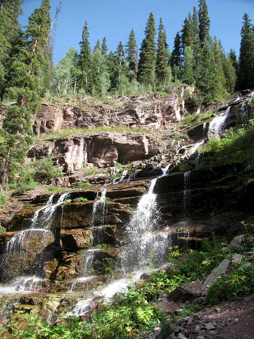
![Falls In Ice Lake Basin]()
Falls In Ice Lake Basin |
![Falls In Ice Lake Basin]()
Falls In Ice Lake Basin |
![Ice Lake Basin Trail]() Early trail views
Early trail views
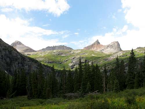
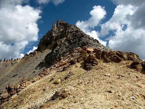
![Fuller, Vermilion & Golden Horn]() Our first view (L to R) of Fuller, Vermilion and Golden Horn
Our first view (L to R) of Fuller, Vermilion and Golden Horn
![Home Sweet Home]() Home Sweet Home
Home Sweet Home
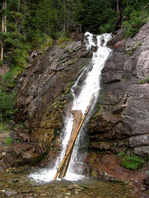
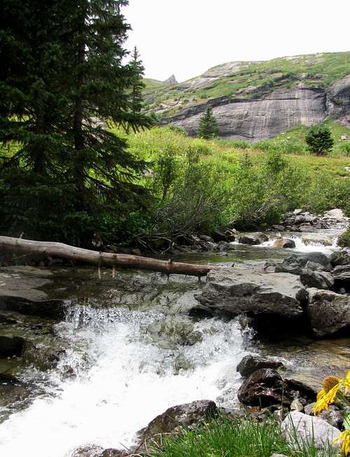
![Ice Lake Basin Stream]()
The stream just below our camp. |
V2 – Not Quite the Standard Route
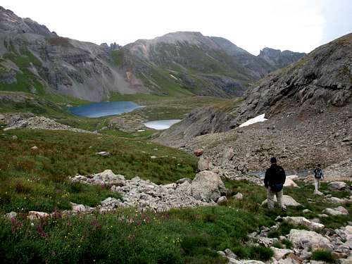
It was around noon when we found our campsite. We took our time setting up our tents and then took some time to relax. The weather was cooperating, allowing us to go for an afternoon hike, so finally around 2 PM we decided to head to the upper basin. Island Lake was one area I definitely wanted to get to during our stay and V2 (13,309 ft) was a good summit option from there, so that ended up being the agenda for the afternoon.
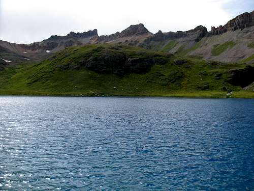
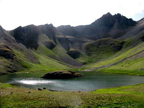
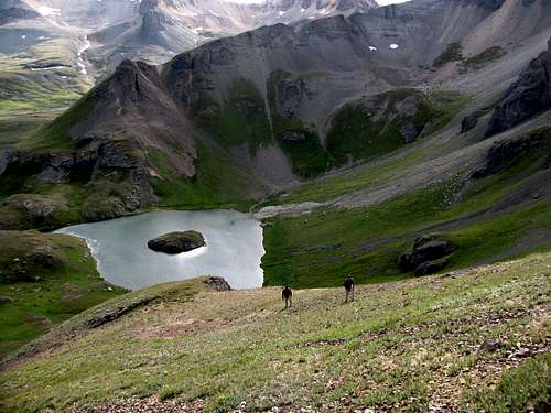
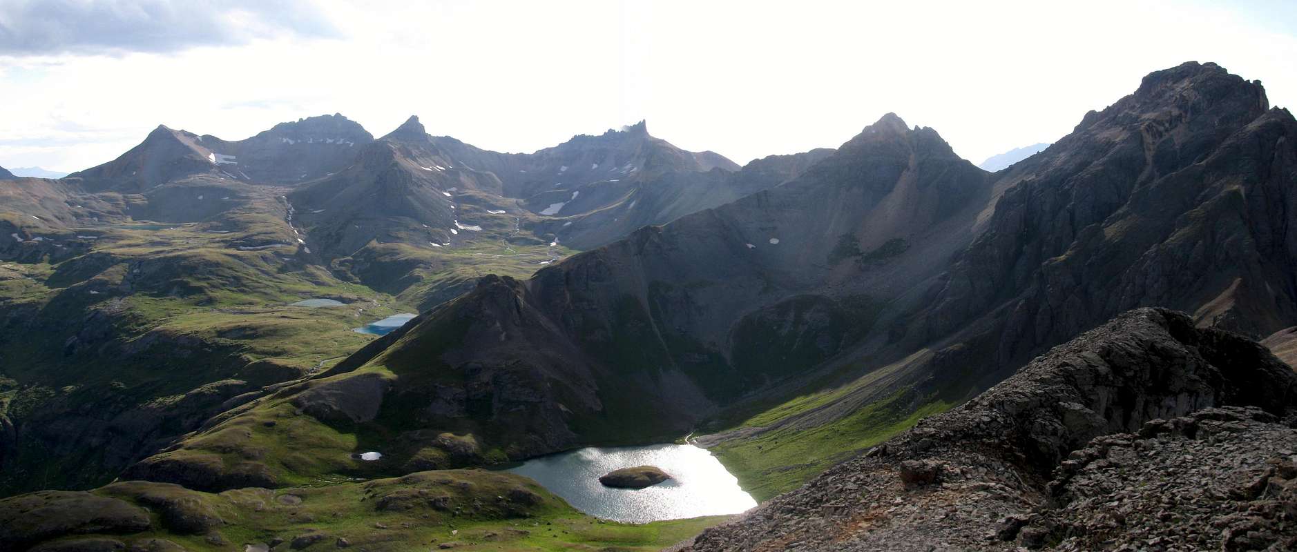
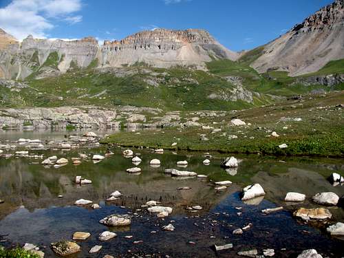
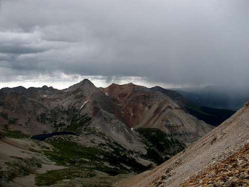
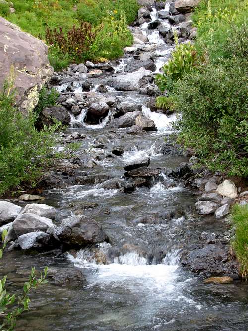
As we made our way up to the upper basin I started developing in my mind the one major lasting impression I would have of Ice Lake Basin. During our three day stay, over and over again, I was amazed by the large volume of water coming down so many different waterfalls, cascades and streams. I can only imagine how beautiful the basin must be with heavy snow melt! There was barely any snow left in the basin and still the water flow was significant. As for Ice Lake itself, I haven’t seen water that shade of turquoise since the last time I was on a beach in the Caribbean. Having a backdrop of half a dozen 13ers just makes it that much more beautiful.
![Falls In Lower Ice Lake Basin]()
Falls In Lower Ice Lake Basin |
![Ice Lake]() V4 (right) from Ice Lake
V4 (right) from Ice Lake
![Ice Lake]() Pilot Knob from Ice Lake
Pilot Knob from Ice Lake
From Ice Lake we headed up to Island Lake. Prior to the trip I wondered if there was a trail to that basin as there isn’t one shown on any of the maps I had. Regardless, from the topo map it looked like it would be pretty straightforward getting there from Ice Lake. My concerns were all for naught. When we were coming up the last stretch of trail prior to entering Ice Lake Basin the spur trail to Island Lake became quite visible. On our hike over to Island Lake we met one couple and chatted with them for a while. They were the first people we had seen since we entered the upper basin, and they would be the last people we would see on this Sunday afternoon. So much for the basin being busy on Labor Day weekend!
![Lower Ice Lake Basin]() Looking down to Lower Ice Lake Basin
Looking down to Lower Ice Lake Basin
![Island Lake Trail]() On Island Lake Trail
On Island Lake Trail
![Fuller, Vermilion and Golden Horn]() Looking back at Fuller, Vermilion and Golden Horn
Looking back at Fuller, Vermilion and Golden Horn
![V4]() V4 from Island Lake
V4 from Island Lake
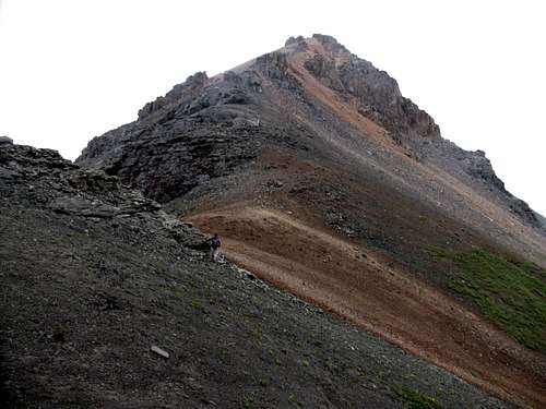
When we reached Island Lake it became obvious that climbing V2 was not going to be a problem. The climber’s trail to the US Grant-V2 saddle was easily visible.
![]()
![]() The West Ridge of V2 The West Ridge of V2 |
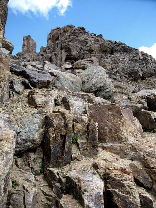
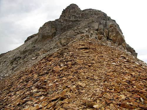
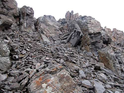
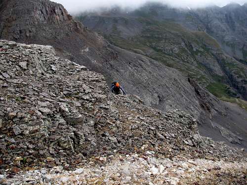
We headed around the lake and started up the trail to the face of the saddle. When we reached a big rock rib Rob and I noticed a gully that looked more inviting that heading all the way over to the saddle. So often routes look so difficult from a distance, but once you start up you pleasantly find that it just looked worse than it really is. In this case the exact opposite was true. The gully didn’t seem to be that difficult as we looked up it, but it would end up being fairly steep and plenty loose, and it was much harder going than any of us expected. The gully did lead to a ledge that then led to the ridgeline, and the hike from the ledge to the ridgeline was fairly steep as well. Note to self: there is probably a good reason there is a climber’s trail all the way to the saddle!
![Not The Standard Route Up V2]() A good look at our brilliant idea!
A good look at our brilliant idea!
![Not The Standard Route Up V2]() Rob and Andrew making it up the gully
Rob and Andrew making it up the gully
![Not The Standard Route Up V2]() Plenty of loose San Juan rock!
Plenty of loose San Juan rock!
![Not The Standard Route Up V2]() Looking down at Rob and Andrew from the V2 ridgeline
Looking down at Rob and Andrew from the V2 ridgeline
![US Grant]() US Grant, from the V2 ridgeline
US Grant, from the V2 ridgeline
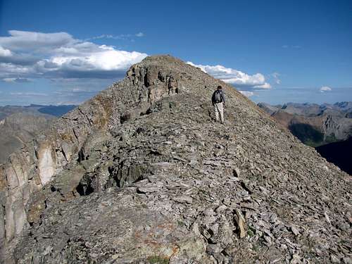
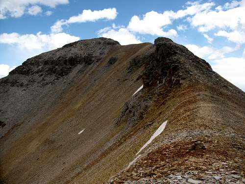
When we finally made it to the ridge we found a trail all the way to the summit, and we all agreed that we would take the standard route down. Once on the ridgeline it was an uncomplicated walk up to the summit, although the north side of the ridge is quite airy.
![West Ridge of V2]() Looking up the west ridge of V2
Looking up the west ridge of V2
![Summit of V2]() Rob approaching the summit of V2
Rob approaching the summit of V2
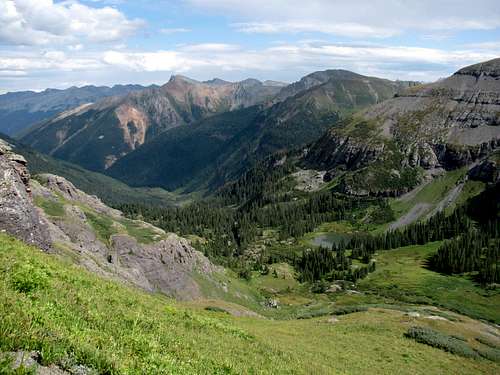
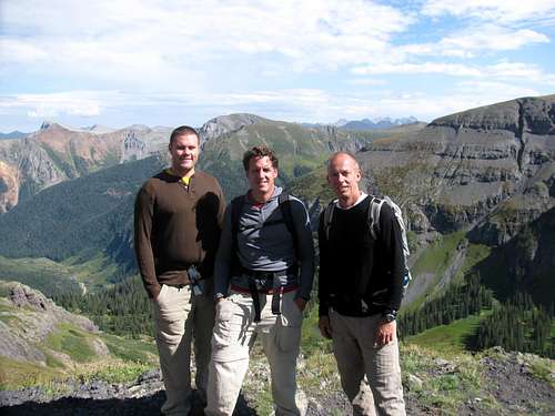
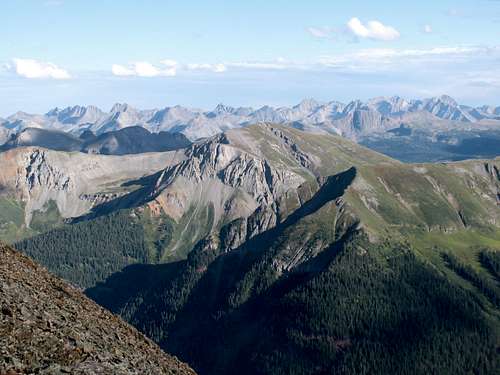
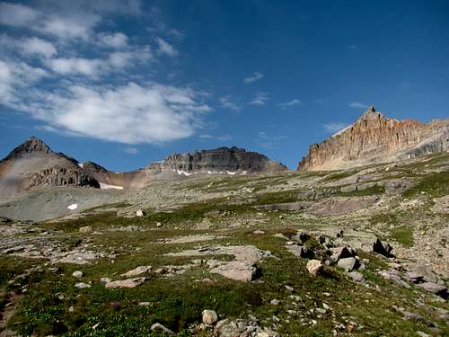
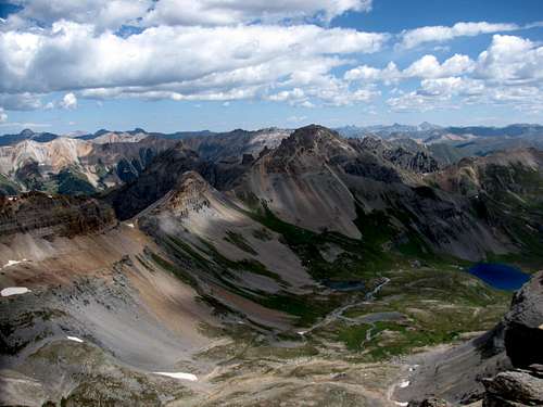
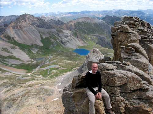
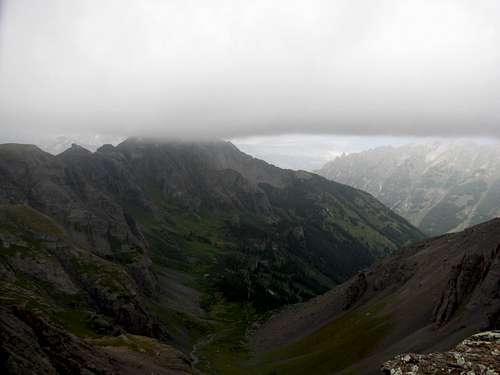
For a 13er with such an unflattering name as V2 the summit views sure pack a punch. We had great views in all directions; back into Ice Lake Basin, towards Uncompahgre and Wetterhorn Peaks and to the sea of peaks in the Weminuche Wilderness. For the views, this is one of my favorite summits.
![]()
![]() The Peaks of Ice Lake Basin The Peaks of Ice Lake Basin |
![A Sea of San Juan Peaks]() Looking east towards the Weminuche Wilderness
Looking east towards the Weminuche Wilderness
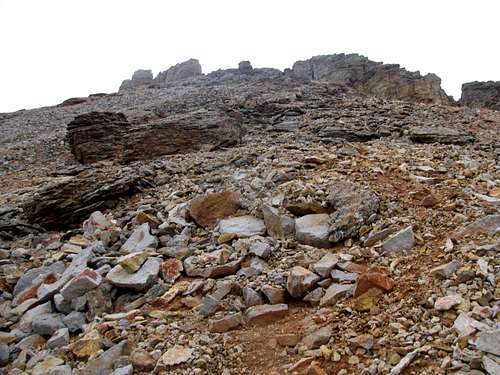
We stayed on the summit for about 15 minutes before heading back down. It was getting late and we wanted to be back to camp before dark so we headed down to the saddle where we were greeted with a steep scree descent. The initial descent from the saddle is steep enough on pebble sized scree that it is easy to lose your footing and slip. By the time I was down near Island Lake I started thinking that maybe we should have descended our ascent route!
![V2 Scree]() Let's go screeing
Let's go screeing
We found a faint trail before we reached Island Lake and we followed it as opposed to heading back to the Ice Lake Basin Trail. The trail stayed just north of the cliffs of the lower basin. We got a little off course but it still saved us quite a bit of time. It didn’t quite lead us to where we expected and we ended up near the entrance of the lower basin. But with a little bushwhacking and a short hike back up the basin we made it back to camp with plenty of daylight and time to boil water for supper and chill down an Expedition Stout for a night cap before hitting the sack.
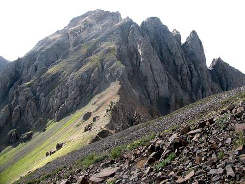
Hopes for a Trifecta
As long as the weather cooperated Labor Day was going to be the big day in Ice Lake Basin as we hoped to bag three 13ers; Golden Horn, Vermilion and Fuller. The plan was to go for Golden Horn first, then attempt Vermilion’s Class 3 northeast ridge and finish off with Fuller. I wanted to go in this direction since I wanted to climb Vermilion’s northeast ridge as opposed to descending it. Roach’s description was the only good beta I could find on the route and I was rather intrigued by his description, as well as the photos I had seen of the ridge. It looked challenging to say the least! Looking at it from the standpoint of what I wanted to accomplish for the week, climbing Vermilion’s northeast ridge was my second highest priority, right behind climbing Sneffels southwest ridge route from Blue Lakes Basin.
![Morning Sunshine on Lower Ice Lake Basin]() Morning sunshine
Morning sunshine
The morning brought blue skies and so for the second time in as many days we made the hike up from the lower basin to the upper basin. Before we knew it we were at Fuller Lake.
![Fuller, Vermilion and Golden Horn]() Hopes for the day
Hopes for the day
![Ice Lake Basin Reflection]() Tarn near Fuller Lake
Tarn near Fuller Lake
![V4 and US Grant]() V4 and US Grant
V4 and US Grant
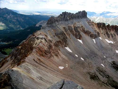
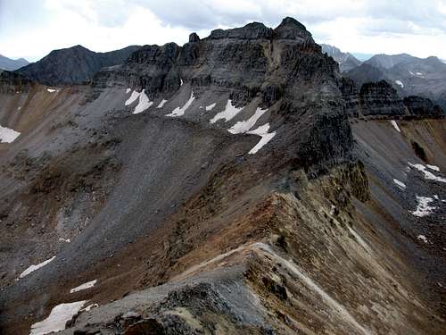
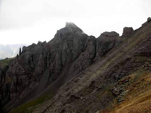
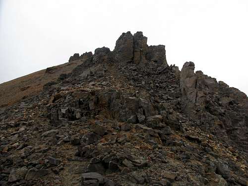
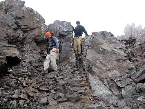
As we approached the climb to the saddle a big patch of snow came into view and it would force us to go left or right. From a route difficultly standpoint, apparently it is a big deal choosing which way to go. One direction has a Class 2+ route to the saddle. The other direction is a minimum of Class 3. The route info I had said go left and that the route through the cliffs would become obvious. We correctly chose the approach up the left side but the route through the cliffs was not obvious. Maybe there were cairns that we missed. Actually I don’t remember seeing much in the way of any cairns on this route, which made the climb that much more fun and adventurous. We wound our way through the cliff bands to the loose scree and rocks that were higher up and eventually made it to the saddle.
![Vermilion-Golden Horn Saddle]() Vermilion-Golden Horn saddle
Vermilion-Golden Horn saddle
![Vermilion-Golden Horn Saddle]() Vermilion-Golden Horn saddle
Vermilion-Golden Horn saddle
When we looked west from the saddle we were greeted with two things; a stunning view of the San Miguels, and some dark clouds that looked like trouble brewing.
![Trouble Brewing]() Trouble brewing
Trouble brewing
We headed up the ridge and getting to the summit of Golden Horn proved to be uncomplicated. We just stayed to the right as we ascended the ridgeline and never ended up on any difficult rock.
![Golden Horn Summit Ridge]() Golden Horn summit ridge
Golden Horn summit ridge
![Golden Horn Summit Ridge]() Golden Horn summit ridge
Golden Horn summit ridge
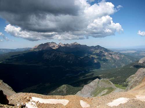
The views from the summit were spectacular although we were only able to spend about 15 minutes there.
![V4 and a Sea of San Juan Peaks]() V4 and a sea of San Juan Peaks
V4 and a sea of San Juan Peaks
![Pilot Knob]() Pilot Knob
Pilot Knob
![Summit of Golden Horn]() On the Summit of Golden Horn
On the Summit of Golden Horn
No Go On Vermilion - Twice
![Vermilion s NE Ridge]() Vermilion's Class 3 Northeast Ridge
Vermilion's Class 3 Northeast Ridge
The weather had held all the way to the summit of Golden Horn but as we sat there Rob did let me know as I gazed at the view of the San Miguels, “I have good news and bad news. The good news is it’s not raining. The bad news is there is hail on your shirt.” The hail fell so softly I didn’t even feel it. But Rob was right. When I looked at my shirt I could see all these small balls of hail. At that point we decided it was time to start heading down. Less than 100 vertical feet from the summit we heard a big clap of thunder so we quickened our pace. At this point I knew that the northeast ridge of Vermilion was a “no go” and that it would have to wait for another day.
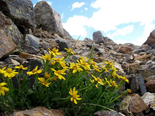
![Golden Horn Wildflowers]() Wildflowers above 13,000 feet
Wildflowers above 13,000 feet
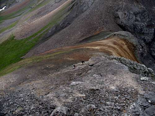
We made it to the saddle and just kept descending. We were well past the big patch of snow we crossed earlier when the weather started to clear. Blue skies! It was only 1 PM and way too early to head back to the tents, at least if the weather was going to cooperate. By the time we stopped hiking to evaluate our options we were near the base of the hike to the Fuller-Vermilion saddle. We all agreed to go for Vermilion and Fuller from this standard route, but all of us needed a rest so we found a good place to take a short break. We rested/slept for about an hour and at 2 PM started up the trail to the saddle.
![Fuller-Vermilion Saddle]() Fuller-Vermilion saddle
Fuller-Vermilion saddle
When we reached the saddle, for the second time in a day, we were greeted with thunderheads coming in from the west. We weren’t there for but a few moments when we heard the day’s second clap of thunder. I had enough time to get a picture of the ridgelines for both Vermilion and Fuller and of the thunderheads heading our way. Then we quickly retreated.
![Trouble Definitely Brewing]() Trouble definitely brewing
Trouble definitely brewing
![Standard Route Up Vermilion]() Standard route up Vermilion
Standard route up Vermilion
![Fuller Peak Ridgeline]() Fuller Peak ridgeline
Fuller Peak ridgeline
![Retreat!]() Retreat!
Retreat!
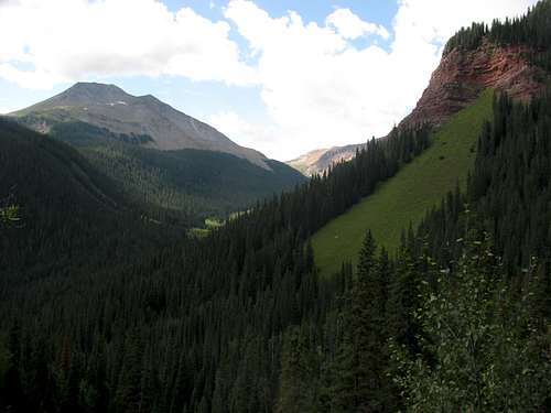
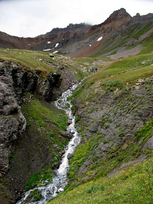
Amazingly we never felt a drop of rain all day, even with nasty clouds around us on the descent. We took an alternate route back to Ice Lake (route map) which was good as it was much shorter than heading back towards Fuller Lake and we also got to see an old mine (boarded up) and some old mining ruins. Working our way down an inlet stream for Ice Lake proved a little tricky, but nothing complicated.
![Tarn on Descent of Golden Horn]() Tarn on descent of Golden Horn
Tarn on descent of Golden Horn
![Descending Golden Horn]() Following the outlet stream down to Ice Lake
Following the outlet stream down to Ice Lake
![Ice Lake Basin Stream]() Ice lake Basin Stream
Ice lake Basin Stream
And as for Ice Lake Basin being busy on a holiday weekend, for the second time in two days we didn’t run into anyone after we reached the upper basin. Considering today was a holiday, this really surprised me!
V4 – Dear Prudence
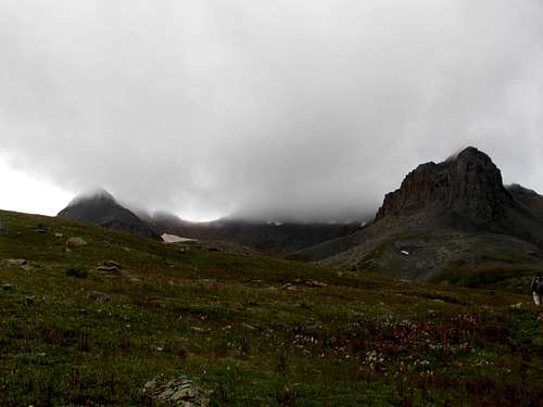
It was our last day in Ice Lake Basin and I was in no hurry to leave. The weather wasn’t great as there were low lying clouds covering the ridges of all of the peaks, but at least it wasn’t raining. It also made me glad we climbed Golden Horn on Monday!
![Glad We Climbed Golden Horn on Monday]() Golden Horn is in there somewhere!
Golden Horn is in there somewhere!
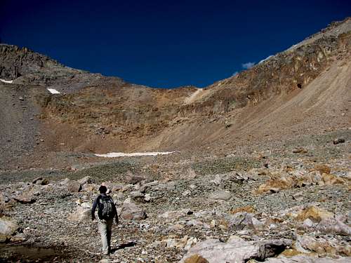
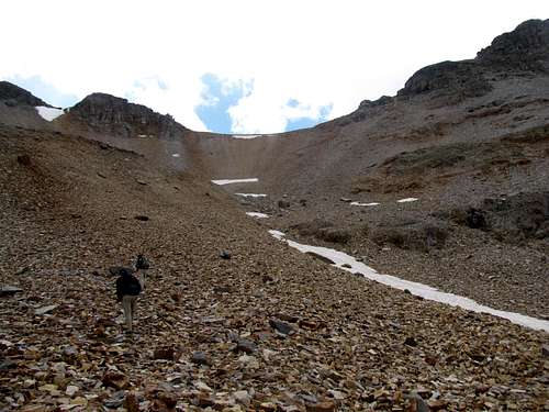
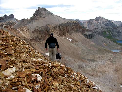
Now all there was to decide was what peak to go climb. After getting shut out on Vermilion twice I suppose I should have been motivated to head back there and cross it off my list, but I wasn’t. I was more intrigued by the area above Ice Lake that leads to V4 (13,540 ft). Ever since we saw that green slope on Sunday I had put V4 on the schedule for Tuesday. It would be a nice way to wrap up this portion of the trip. So for the third time in as many days, we made our way from the lower basin to the upper basin.
![The Route to the V4 Saddle]() The route to the V4 saddle
The route to the V4 saddle
We had two realistic approaches, the southeast ridge or southwest ridge, both of which I had limited or no beta on. One trip report and this map were all the info I had. From the info in the trip report I knew the northeast ridge was not the best choice, with lots of very loose Class 3 scrambling. The southeast ridge was probably the smartest choice, heading up from Island Lake. It sounded doable and right up our alley with just a couple of Class 3 moves below the summit. But for no other reason than that I really liked the view from Ice Lake I was inclined to try the southwest ridge, which I had no beta on. Rob and I debated on which route to take as we stood near Ice Lake and looked at both ridges. We didn’t like the looks of one cliff band on the southeast ridge. Who knows what it looks like up close and personal, but from this distance we didn’t love what we saw. So instead of heading towards Island Lake we decided on the southwest ridge and started making our way around Ice Lake to start the climb up the basin to the saddle.
![Ice Lake Basin Stream]() Ice Lake Basin stream
Ice Lake Basin stream
![Ice Lake Basin Stream]() Ice Lake Basin stream
Ice Lake Basin stream
Based upon the fact that we found no evidence of any climber’s trail I would assume this basin sees little foot traffic. That being said, despite its close proximity to Ice Lake I highly doubt that V4 sees much of any traffic, regardless of the approach. We tried to find animal trails to minimize our impact but even these were scarce. We had no choice but to blaze our own path.
The weather was by no means great. There wasn’t a ray of sunshine and the clouds were low enough that they covered most of the summit ridges. When we made it to the saddle we were greeted with high winds and drizzling rain. A summit bid didn’t look promising and Andrew and Rob weren’t real interested.
![Southwest Ridge of V4]() The southwest ridge of V4
The southwest ridge of V4
![US Grant]() US Grant
US Grant
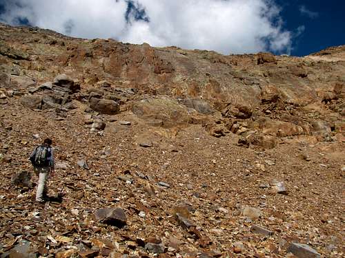
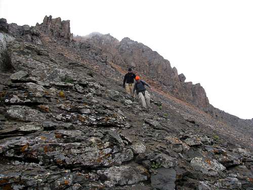
I was reluctant to just throw in the towel so soon so we grabbed a spot behind some rocks to see if conditions would improve. It didn’t take me long to get impatient so I told them I was going to head up the ridge. They decided to wait and see what kind of success I had. There were a few cliffs and towers to negotiate and I was curious to see how difficult it would be to get around them. It was easier going than it looked from below. The rocks were plenty loose but the route never exceeded Class 2 and passage through the first set of cliffs was straightforward.
![Cliff Band on the Southwest Ridge of V4]() Just go left or right of center!
Just go left or right of center!
I found the way around the next tower by staying to the left, and while not difficult it was the trickiest part of the climb so far, as the “path” was narrow, rocks very loose and the incline pretty steep below. Starting a rock slide here would be pretty easy. Once around the tower I could see the upper portion of the ridge. Unless there were some false summits, looking at it from this view reaching the top looked promising.
![Southwest Ridge of V4]() Near the summit
Near the summit
![Southwest Ridge of V4]() Near the summit
Near the summit
I dropped down the ridge to see if Andrew and Rob were going to head up and they were.
![Southwest Ridge of V4]() Rob and Andrew heading up the ridge
Rob and Andrew heading up the ridge
![Southwest Ridge of V4]() Rob heading up the ridge
Rob heading up the ridge
By the time they made it up to where I was it started raining harder and the clouds were getting lower. Andrew and Rob expressed concerns about the change in the weather. We didn’t want to be up on the ridge in a whiteout and the rocks were now slippery enough to make that a concern. I was confident we could make it to the summit but we chose to turn around. I thought it was a conservative decision, but probably prudent considering the weather.
![Cloudline]() Cloudline
Cloudline
We snapped a few “below the summit” pics and headed down. With all that we had accomplished in three days I had no regrets.
![Southwest Ridge of V4]() Rob and Andrew descending the V4 ridgeline
Rob and Andrew descending the V4 ridgeline
![Southwest Ridge of V4]() Rob and Andrew descending the V4 ridgeline
Rob and Andrew descending the V4 ridgeline
![Ice Lake]() Ice Lake
Ice LakeDown and Out
The skies never would clear all day and fortunately heavy rain held off while we broke camp. About 15 minutes before we got to the car the rain started and it never stopped until later into the evening. It was a cold bone chilling rain which was unfortunate as we had most of the afternoon to do some site seeing in Silverton, which we were only a few miles from when we left Mineral Creek Road. We did drive into town to check it out and to celebrate our three good days with an ale at the Silverton Brewery and then headed back to Ouray. We grabbed some supper at The Outlaw (pricey average food) then made it back to the Amphitheater campground and hit the sack early.
It had been a wonderful trip so far. We had been up, down and all around Ice Lake Basin, bagged a few peaks along the way and saw a lot of spectacular eye candy. But as beautiful as Ice Lake Basin is, it would end up playing second fiddle to Blue Lakes Basin, which is where we would spend the next three days…


Comments
Post a Comment