
-
 18883 Hits
-
 72.08% Score
-
 2 Votes
|
|
Route |
|---|---|
|
|
37.10970°N / 118.4917°W |
|
|
Trad Climbing |
|
|
Spring, Summer, Fall |
|
|
Most of a day |
|
|
5.7 (YDS) |
|
|
5.7 |
|
|
12 |
|
|
III |
|
|
Approach
Drive east out of Big Pine to the end of Glacier Lodge Road (about 15 miles). The hiker parking is about 0.6 miles from the end of the road and the site of the former Glacier Lodge (alas, the historic old Lodge burned to the ground a few years back. After a bizarre episode with the Forest Service selecting a moonbase-like design for its replacement, the owner opted to reconstruct a new lodge in a style similar to the old one). For those who would rather cut a mile or so from their round trip, and bypass the sweltering traverse from the hiker parking to the entrance to the NF canyon, parking is available at the Glacier Lodge Store for $3 a night.There was a female bear lurking in the vicinity of the store in August 2004, attracted by the sloppy food storage habits of the denizens of the nearby campground. Please do your part and store food responsibly so both the humans and the bears will experience a minimum of friction.
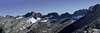
From wherever you park, follow the trail up the north fork of Big Pine Creek. A fast team can do this route from the car in a day, but it is more comfortably done in 2-3 days. The best place to camp is Third Lake (~10,260’, and about 5.5 miles from the road). If Third Lake is crowded, or you just want to be closer to the start, it is possible to camp about ¼ mile south of Third Lake just before heading up the talus and scree towards the north face (see approach picture below). It is also possible to camp about 600 feet higher on a sandy bench at the foot of an old terminal moraine on the way up to Contact Pass. Both the latter two sites will shorten your approach in the morning, but unless there is snow to melt, you’ll have to carry a lot of water.
Cross the outlet stream over fallen logs at the east end of Third Lake, and follow a use trail up onto the moraine. This peters out after about 100 yards, and the rest of the way is on talus and scree. Head more or less directly south, then aim for the leftmost of two prominent couloirs to the left of the massive north buttress.
From the base of the permanent snowpatch at the base of the couloir, find your way onto broad class 3-4 ledges leading to your left. Follow these to the arête, and then climb up and left a few more hundred feet (class 3-4) to a right-facing open book. The route begins in the open book.
 |
Route Description
From a comfortable ledge just below the open book described above, climb up the open book and beyond for several pitches, eventually joining the arête. Follow the arête up and over towers for many more pitches. There are at least two occasions where it is advisable to move the belay from the top of a tower to the start of the next segment of the arête to avoid both rope drag, and really nasty consequences for either a leader or follower’s fall. After passing the final large tower, a refreshingly exposed and poorly protected stretch of ridge must be traversed to easier (class 3-4, some fifth class moves) ground. After this, follow the arête as it becomes more or less horizontal for a few hundred feet more until reaching the talus field below the summit.This is not an easy route to bail on. McNamara (see below) says it’s best to bail to climber’s right, if you must, though this is not an appealing option. At the top of what McNamara calls the tenth pitch (a notch behind a tall tower) there is a great single-rope rappel about 60’ into the gully on climber’s left. From this point on, it’s probably best to just continue up the gully over class 3-4 terrain to the summit talus fields, since down climbing and/or rappelling is bound to be tedious and dangerous due to copious loose rock.
To descend, head east from the summit down talus until just above Contact Pass. From here, either down climb or rappel about 80 feet of fourth class rock to the pass. Descend north from the pass to your camp, or car. Beware an appealing broad gully (actually, there are several) that lead towards the South Fork basin. You will wind up rappelling at least once, and have to climb several hundred feet back up to Contact Pass.
Additional route information may be found in R.J. Secor’s The High Sierra Peaks, Passes, and Trails, Steve Roper’s The Climber’s Guide to the High Sierra, and Chris McNamara’s High Sierra Climbing. McNamara’s book is by far the best, providing several pages of detailed approach, route description, and other lore, as well as the best topo I’ve found for this route. It’s available as a downloadable e-book (my favorite, because it lets me print the topo and key route info on one piece of waterproof paper, and carry it in my pocket whilst climbing), and also in print format.
 |  |  |
Eric O - Aug 12, 2005 1:14 pm - Hasn't voted
Route CommentHi. Having done this route a couple of times, I want to suggest the following change. It would be good to add a specific mention that after climbing the starting dihedral one stays left of the arete for about a pitch. Don't avoid the arete for too long after this (especially not several pitches, as the current description says) or you'll miss some of the most classic moves on this route. About a pitch after the starting dihedral, angle up and right to reach the crest of the arete, and make use of a perfect jam crack that goes directly up the arete over a bulge. That's one of the best moments (if not the best) on the whole route, when the bulge looks difficult then turns out to be awesome because of the sinker hand/fist jams and a big jug to step on.
The current description also does not mention another spot that is critical to finding some of the finest climbing on the route. After topping the first tower and a bit of subsequent up-and-down, the gully at climber's left puts forth a branch that becomes a chimney-sized chute (about 4 feet wide?) that comes between the rock you're standing on and the continuation of the arete (a buttress, at climber's left, rising on the far side of this chimney/gap). Step across the gap to the left. It's visually scary but not difficult. Then get directly on the arete again and some of the very best climbing appears, even through sections that didn't look easy from below.
Also in the "additional information" paragraph you could add that Peter Croft gives good beta for Venusian Blind in his book The Good, The Great, and The Awesome from Maximus Press.