Overview of Trip
Last year we went did the Santa Cruz trek, Pisco, and Huascaran. I didn't get a summit on Huascaran and we both enjoyed the trip so we thought that we would go back. The plan was to do Yanapaccha, Chopicalqui, and Huascaran. I did a trip report on Huascaran last year.
We arrived in Lima short one bag of gear so we took a rest day for our first day in Huaraz. I would plan a rest day for any future trips as the trip from California, via Miami, to Lima, and then to Huaraz is long. The bus ride from Lima to Huaraz is 8 hours. So we had more than 24 hours of continuous travel and waiting around before we got to our hotel.
Acclimatization
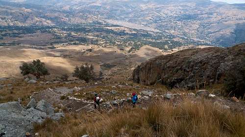
We decided to do a one day hike to lake Aguak (sounds like awak) outside of Huaraz. Aguak is at 4560m which is 14,960 ft. This hike is steep/flat/steep. The hike went well enough and gave us nice views of Huaraz that we had not seen before.
The above image is at the middle flat section. This was taken on the way down.
This shows the view of Huaraz and the trail from below the lake.
The image above is, of course, lake Aguak.
We spent the night in Huaraz and left the next morning for Cebollapampa to do another trek. Oh, and Jackie pushed too hard on the Aguak hike and threw up when we got back to the hotel. She was OK for dinner though soon after!
Above is the Cebollapampa camp and Jackie talking with the guide and cook about the food.
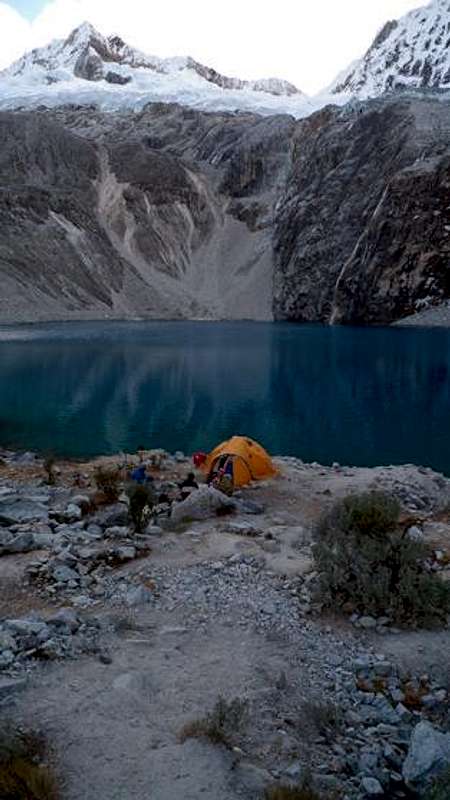
After getting set up in camp we headed out to lake 69 in the afternoon.
A waterfall on the way to lake 69.
Lake 69 is below Chacraraju/Pisco and above the end of the valley. In the picture above, from the end of the valley, you can see all the way back to Cebollapampa, which is on the valley floor below Huascaran Norte.
Above is lake 69 with Pisco in the background. Not a great image, but you should get the idea. From the side of the lake it's very hard to get an image of the lake and the mountains. It's a great view there. I have an image of Chacraraju from the lake, I'll post that here:
On the way back to camp we got to see a great sunset on Huascaran Norte:
We got up the next day and took a taxi to up the road to the trailhead for Yanapaccha.
To Yanapaccha Base Camp
In taxi we had the driver, Jackie and myself, the guide, the cook, the porter and our gear. Gear that would not fit inside was strapped to the roof:
Below is our gear in the foreground and another group in the background. Chopicalqui and Huascaran in the background.
Below is taken from the Yanapaccha trailhead...or close to it. You can see much of the trail to Pisco base camp and the Refugio on the lower left.
This is the beginning of the trail with Chacraraju in the background:
The trail is up and down and it's a decent 2 to 2.5 hours to get to base camp. Don't be fooled if they tell you it's flat. It's a good hike on goat trails.
Here's a view back down the valley to the lakes with the Huandoys on the right:
Here's a view looking back towards the trail head. You can see a couple of porters carrying loads in:
And here's a look forward from close to that spot:
Arriving at base camp:
Cooking at camp (Jackie was sick again, so I ate her portion!):
The mountain from base camp:
The Climb
The moraine was very rough but short. At the start of the glacier there were some interesting large steps/jumps that we had to make over crevasses and I was thinking that it would have freaked out Jackie. She puked again the night before so she didn't go up.
Once we got up a bit on the glacier it was fairly straight forward. But I would say that Yanapaccha, although lower, is a quite a bit harder than Pisco. Many say that it's just a bit more technical but those technical sections take effort also. The guides don't have to put in pickets for you on Pisco as it's a snow hike. The hard part on Pisco is dealing with the moraine.
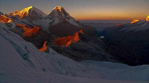
So my guide Eloy had to belay me on several pitches...I forget how many...maybe 5 or 6 each way. Here are the sunrise pictures from 3/4 or so up:
Huascaran:
Huascaran:
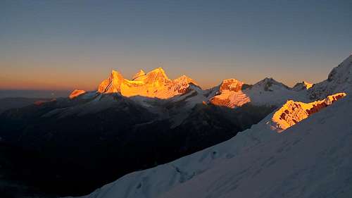
The Huandoys and Pisco:
You can see from the the Huascaran pics above that the climbing on Yanapaccha is fairly steep.
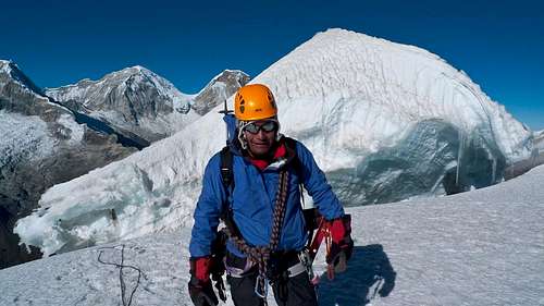
Here's my summit pic with Chacraraju in the background:
Here's the actual summit behind Eloy:
We made good time to summit, taking only 3 hours to get to the platform below the summit and another half hour for me to get to the top behind Eloy.
Here's the summit story (why I don't have an actual summit pic):
I had heard that others were not doing the summit before I even got to Peru this year. We got up there and Eloy thought it was ok to cross the ice bridge that was down in the crevasse (you can't see where it was from the picture). He made it across and placed an ice screw on the wall above and a picket at the summit. The bridge broke on me, of course, but it was not that big of a deal. I fell maybe 3 feet or so and then climbed the wall and then the ridge to the summit. It was very cold up there so I didn't take any pictures.
It took Eloy about an hour to get us back across the crevasse. I belayed him while he went down into the crevasse and stood on a little ledge. He reached across and got one ice tool in at a time and was, at this point, leaning out over the open crevasse. Next he got his left front points in and then he had to commit to get his right foot planted. After he was solid on the wall he moved each ice tool farther up on the top of the crevasse and then pulled himself up. I just copied his moves after he set up a belay for me. He had to come back across to get me set up and to take out the ice screw. We traded off belaying each other, which was cool and a good experience.
I was cold going down and I kept my down jacket on, along with everything else I had, most of the way down. I was shivering a bit at each belay point. So I could have taken one more layer with me. I finally warmed up on the lower part of the Glacier.
Here's the view to the other side from the summit (or from that platform below the summit anyway):
Below is an Image of Eloy rappelling the last pitch:


Comments
Post a Comment