Toggle navigation
Mountains
Routes
Images
Trip Reports
Forum
What's New
People
Areas & Ranges
Articles
Trailheads
Canyons
Huts & Campgrounds
Albums
Logistical Centers
Fact Sheets
Lists
Custom Objects
Gear
Plans & Partners
WELCOME TO SUMMITPOST
SIGN IN
REGISTER
Ozarks
Additional Parents
St. Francois Mountains (MO)
Taum Sauk Mountain
Johnson Shut-Ins State Park Trailhead
Taum Sauk Area Ramblings
Image
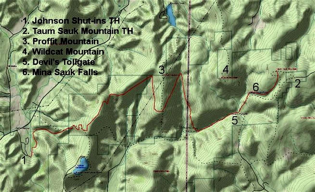
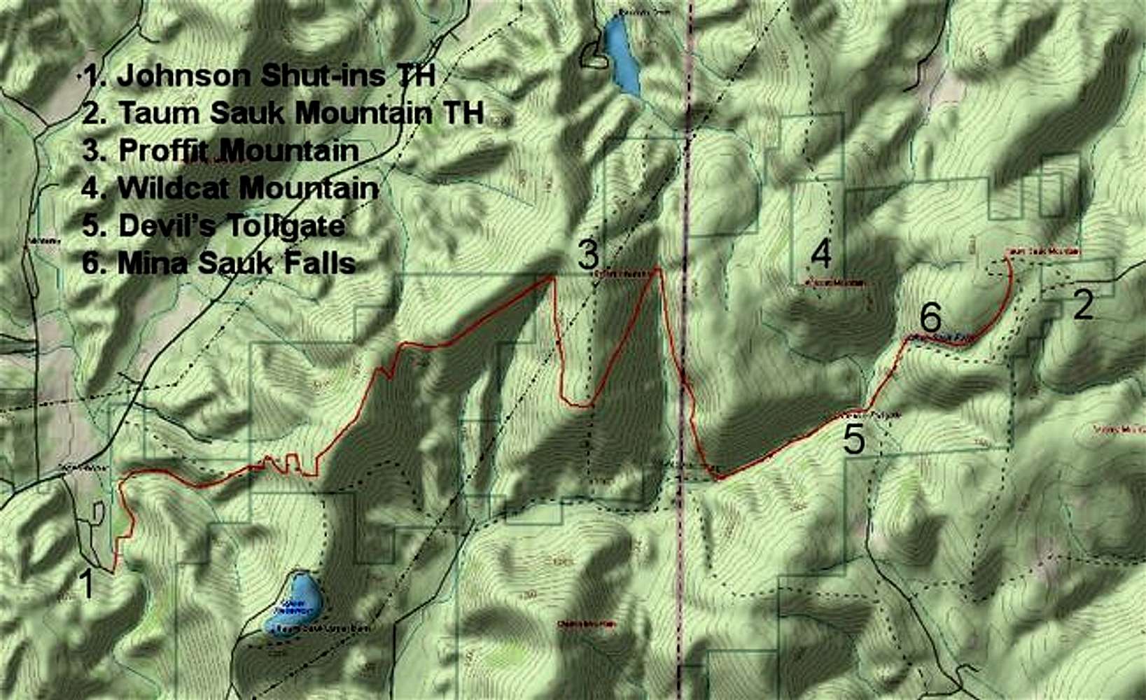
Topo map showing the general...
View High-Resolution Image
Topo map showing the general...
Topo map showing the general location of the Ozark Trail (12-13 miles long) between Johnson Shut-Ins SP and Taum Saum Mountain SP. A much more detailed map is available on the Ozark Trail Council website which is linked to from the route page.
« PREV
NEXT »
csmcgranahan
on
Aug 17, 2005 10:38 pm
Comments & voting
Other parents
Lat/Lon:
37.56660°N / 90.7333°W
Image ID:
121046
9697 Hits
73.06
% Score
3
Votes
Log in to vote
Comments
No comments posted yet.
to post!
Don't have an account?
Ozarks
(Area/Range)
« PREV
Viewing
#44 of 105
GALLERY
NEXT »
csmcgranahan's Image Gallery
« PREV
Viewing
#321 of 660
GALLERY
NEXT »
St. Francois Mountains (MO)
(Area/Range)
Loading....
Taum Sauk Mountain
(Mountain/Rock)
Loading....
Johnson Shut-Ins State Park Trailhead
(Route)
Loading....
Taum Sauk Area Ramblings
(Trip Report)
Loading....
×
You need to login in order to vote!
User Name
Password
Remember me
Forgot your password?
Log me out when I close my browser.
Keep me logged in all the time.
sign in as a user
Don't have an account?
Register now for FREE
Rating available
Suggested routes for you
People who climb the same things as you
Comments Available
Create Albums
Register Here


