
-
 6009 Hits
-
 82.48% Score
-
 15 Votes
|
|
Mountain/Rock |
|---|---|
|
|
46.72762°N / 10.40927°E |
|
|
Hiking, Skiing |
|
|
Spring, Summer, Fall, Winter |
|
|
9672 ft / 2948 m |
|
|
Overview
 Schadler seen from Fuorcla Sesvenna Schadler seen from Fuorcla Sesvenna |
Though more than 2800m high, Schadler (also Scharler) is a somewhat indistinctive summit on the border between Italy and Switzerland. It resides above Fuorcla Sesvenna, the saddle which marks the boundary between the Italian Schlinig Valley and the Swiss Sesvenna Valley. The mountain is part of the Sesvenna Group but does not share the wild aspect of the peaks in the centre of the area. Schadler is a rather popular summit, thanks to the proximity of the saddle, which in itself is a popular hiking and ski touring destination. It is a wonderful lookout peak, since it is located just across the saddle from Piz Sesvenna, the highest mountain of the group and offers nice faraway glances towards the Ötztal Alps and the Ortler group.
The routes to Schadler are very easy. There are marked hiking trails from both sides of the border to Fuorcla Sesvenna and the south slopes of the summit cone are shallow enough to be climbed in any conditions. Still there is no marked trail to the summit. You need to follow barely visible footpaths and have many options to reach the top. Some of these end in short climbing sections which, however, can be easily avoided. Schadler is part of the route to Piz Cristanas and Piz Rims, two 3000ers immediately to the north-west of the mountain.
While not difficult, both routes are very long and cover a big difference in elevation. The Swiss route from S-Charl is about 10km long and covers 1300m elevation gain. S-Charl itself is accessible by car by a long and narrow mountain road which itself is a 45 minute drive from Scuol in the Inn Valley. Schlinig on the Italian side is easier to get to but here the distance is slightly longer and the elevation gain 100m higher: 1400m. Schadler will therefore never be a first choice as climbing destination but is a fine substitute if time doesn't allow to climb the higher mountains in the area.
|


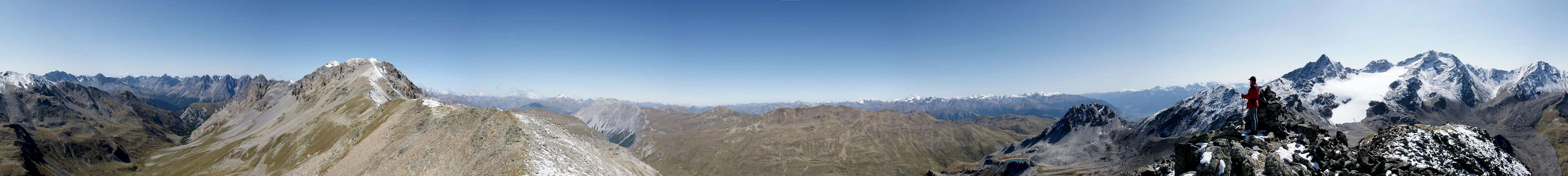
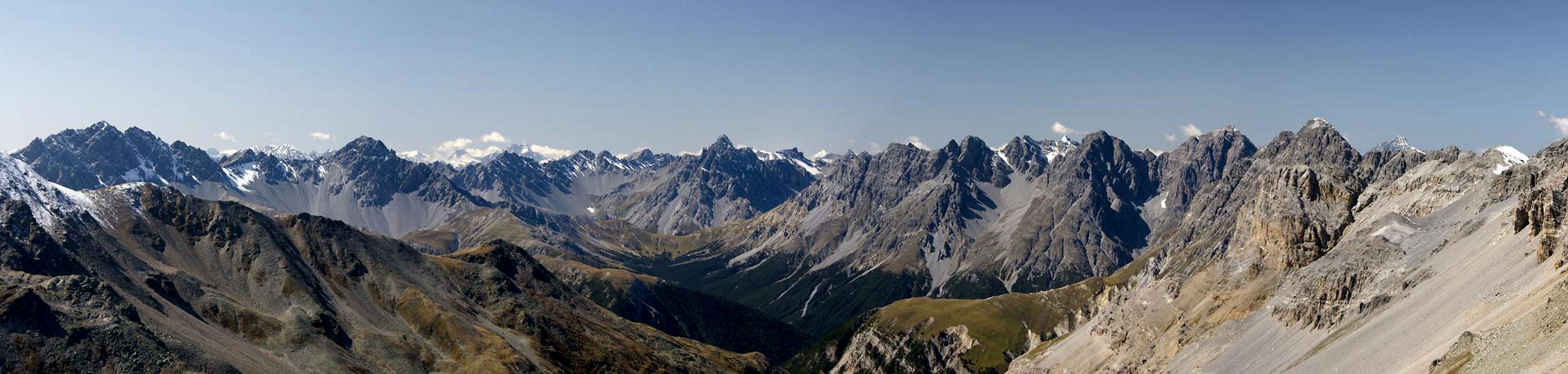
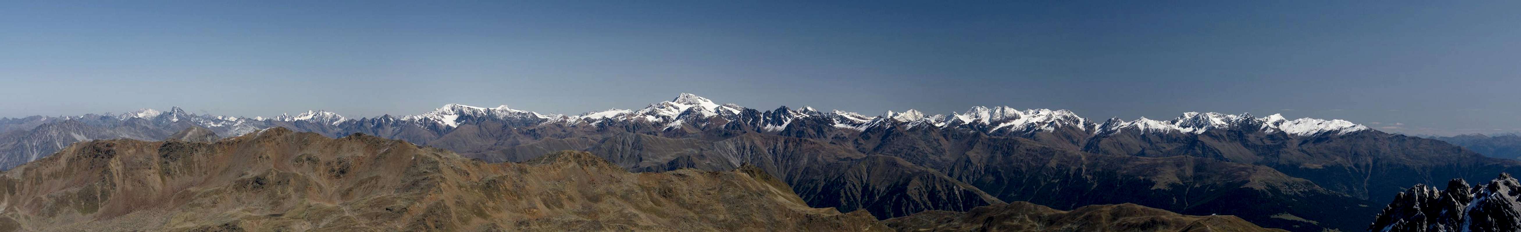
360° Summit Panorama
  |
Getting There
 |
S-Charl
Take B27 through Inn Valley from the Austrian / Italian / Swiss border near Martina. Before you reach Scuol a road turns off left, passing the town and crossing the Inn River. It follows the Clemgia River to the summer village of S-Charl. There are big parking lots around the village, which, however, have to be paid (5 CHF).
Schlinig
Take the Reschenpass road SS 40 until you reach the village Burgeis / Burgusio. Drive through the valley and follow the signs for Watles and Schlinig. The road passes Marienberg Monastery a winds up the slopes of Watles until it reaches an intersection. Straight on is the road to Schlinig, where you need to park your car outside the village on a toll free parking lot. You can also drive to the Watles cable-car and hike from the top station towards the end of the Schlinig Valley where the final ascent to Fuorcla Sesvenna starts.
Red Tape
 |
There are a few things to consider:
- Parking: you need to use the parking lots outside the trailhead villages. The S-Charl one has a fee of 5 CHF.
- While strictly speaking not natural parks, on both sides of the border the areas are considered natural preserves. Deal with them accordingly.
- You are in the border region between the EU aand Switzerland. Passports or IDs are mandatory though you most likely won't have to show them.
Accommodation
 Piz Christanas and Piz Rims Piz Christanas and Piz Rims |  Piz Plazer Piz Plazer |  Föllakopf Föllakopf |
Italy
Switzerland
Weather Conditions
Maps & Books
Maps
- Digital Maps
- www.swissgeo.ch
- http://www.pcn.minambiente.it/GN/index.php?lan=en
- Vinschgau / Val Venosta
Kompass GPS Map GPS 4052
ISBN: 3-85491-659-0
- www.swissgeo.ch
- Regular Maps
- Vinschgau / Val Venosta
Kompass Map WK 52
1:50.000
ISBN: 3-85491-058-4
- Unterengadin-Nationalpark
Kompass Map WK 98
1:50.000
ISBN: 3-85491-331-1
> - Obervinschgau / Alta Val Venosta
Kompass Map WK 041
1:25.000
ISBN: 3-85491-580-2
- Schweizer Landeskarten, available at German Alpine Club
- SLK 259 S Ofenpass, 1:50000, Art.Nr.: 147259
- SLK 1219 S-charl, 1:25000, Art.Nr.: 141219
- SLK 259 S Ofenpass, 1:50000, Art.Nr.: 147259
- Vinschgau / Val Venosta
Books
- Vinschgau-Ortlergruppe
Kompass Guidebook WF950
Kompass Verlag
ISBN: 3-85491-404-0
- Unterengadin
Rudolf Weiss / Siegrun Weiss
Rother Verlag
ISBN: 3-7633-4043-2
- Vinschgau
Henriette Klier
Rother Verlag
ISBN: 3-7633-4205-2