
|
|
Mountain/Rock |
|---|---|
|
|
35.62830°N / 81.74103°W |
|
|
Burke |
|
|
Hiking |
|
|
Spring, Summer, Fall, Winter |
|
|
2964 ft / 903 m |
|
|
Overview
Propst Mountain is located in the new addition to the South Mountains State Park. This new section of the park includes the highest peaks in the South Mountains and thus a number of the summits here replace Benn Knob as the park's highest. Propst Mountain looms above the Broughton Hospital Reservoir and is one of the companion peaks to Buzzards Roost, the highest in the South Mountains. Panorama of Propst Mountain sloping down to the reservoir.
When approached from the area of the reservoir, access is via a tough bushwhack up very steep slopes. You can plan on an elevation gain of about 1500 feet when you begin your hike at the reservoir. There are easier ways to attain the summit, but you'd have to drive in via one of the old gravel roads and park your vehicle at the state park border.
The summit of Propst Mountain was interesting because so many of the trees have been heavily damaged by ice storms. The trees are still standing, but most of their limbs have been stripped off. This has left the forest canopy uncharacteristically open, allowing in ample sunlight which creates quite a lot of undergrowth where there should normally not be so much. While this does create a lot of welcome browse for the vast herds of white-tailed deer around the park (and the wild turkey), it makes for some difficult bushwhacking.
While Propst Mountain is definitely taller than the old champ of the park, Benn Knob, it's probably only the third highest in the park, these days. Hickory Knob may be a few feet taller, but I haven't been there to take a GPS read, so I can't say for sure.
 From below the dam.
Getting There
From NC 64 take Jenkins Road. Drive down Jenkins Road for .3 miles to Branstrom Orchard Street. See State Park lot on left and pull into parking area. Don't drive any farther, or find yourself on posted private property.From the parking area, hike up the dam then see trail/road on the far left of the dam. Hike around lake and bear steadily right until you reach the slopes of the South Mountains. Soon leave the trace of the old logging road and from then on look to your map and compass for bearings to the summit of Buzzard Roost.
 Boulders and cliffs.
Red Tape
None. Free admission. No fires. Cove hardwood forests.
Camping
Plenty of back country camping at sites within the park. See the South Mountains State Park website for details. Signs of former habitation.
External Links
Official South Mountains State Park website.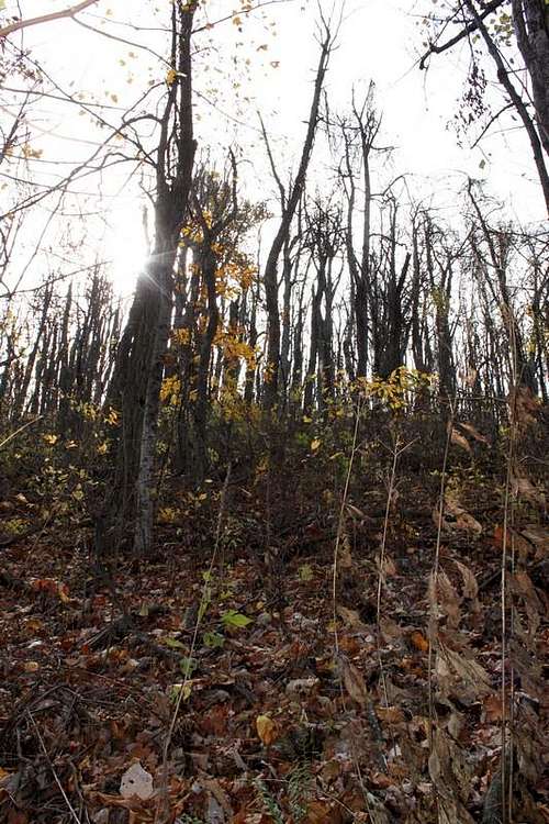 Ice damage.