
-
 5443 Hits
-
 83.69% Score
-
 17 Votes
|
|
Mountain/Rock |
|---|---|
|
|
48.83004°N / 22.99957°E |
|
|
Hiking |
|
|
Spring, Summer, Fall, Winter |
|
|
4619 ft / 1408 m |
|
|
Overview
Mount Pikui/UKR:Пикуй/POL:Pikuj/ [peekooy]
With its 1408 m asl Pikui is the highest mountain of Eastern Bieszczady/UKR: Восточные Бещады/ range stretching from Vyshkivskyi Pereval pass in the East(neighbouring with Gorgany range) to Uzhok pass in the West(neighbouring with Western Bieszczady mountain group on Polish side of the border).
It is located right on the main Carpathian watershed and the administrative border between Lviv and Zakarpattia provinces goes along the ridge of the mountain.
Rising prominently up to 700 meters over surrounding valleys the mountain is a great panoramic point offering in good visibility conditions views reaching peaks of Gorgany and Chornohora in the East to Western Bieszczady polonynas and even remote High Tatras in the West.
A few meter tall summit obelisk memorializes the person of Ivan Franko, one of the most famous Ukrainian poets.
Historically, as a part of the main Carpathian ridgeline, Mount Pikui used to be a border point. Till 1772 between Kingdom of Poland
and Kingdom of Hungary and then till 1945 between Republic of Poland and Czechoslovakia.
Pre-war, local name of the mountain was "Husla" coming probably from the name of highlander's gusle(fiddle) music instrument.
Beautiful beech woods and scenic polonynas(over 20 km long one, going north-west to Uzhok pass area) with a few nature reserves in the area. Sheperd and old, folk culture(Boyko architecture) well preserved in local villages.
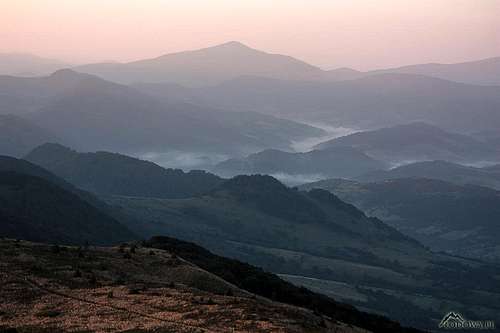 Eastern Bieszczady before the sunrise
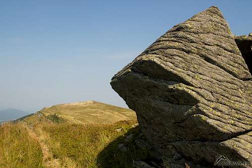 Mount Pikuy polonynas Mount Pikuy polonynas | 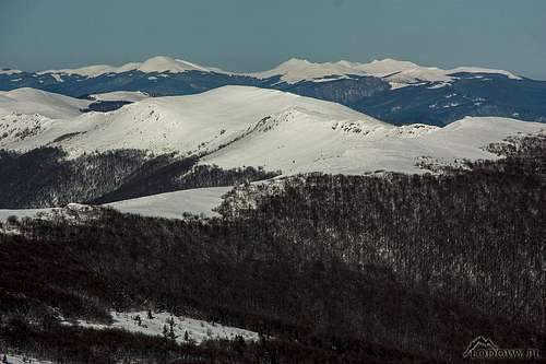 Polish polonynas from Mount Pikui Polish polonynas from Mount Pikui | 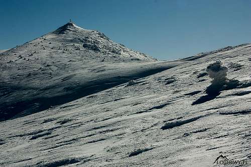 Mount Pikui Mount Pikui |
Getting There
Eastern Bieszczady are the westernmost mountains of Ukrainian part of Carpathian range, located in the very south-west of the country,
in direct neighbourhood of Polish and Slovak borders, not far from Hungarian and Romanian ones.
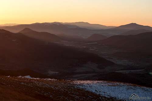
![Before the sun comes up...]() Before the sun comes up...
Before the sun comes up...
![Mt. Pikui and Uzhansky NP map]()
![Mt.Starostyna - Eastern Bieszczady]() Mt.Starostyna - Eastern Bieszczady
Mt.Starostyna - Eastern Bieszczady
![Mount Pikui summit]() Mount Pikui summit
Mount Pikui summit
As Ukraine is not EU or Schengen Area member, standard procedures of border crossing apply. Visas, passports and official border crossing points only.
Mount Pikui area is easily accessible by car, train or public transport. Major cities and towns in the area: Lviv city(driving distance 165 km), Stryj(95 km), Uzhorod(105 km), Mukachevo(66 km), Volovets(30 km). Stay prepared for poor quality of local roads.
The main, transcarpathian E50 highway(good quality) from Lviv city to Mukachevo passes right across the eastern foothills of the mountain.
Transcarpathian railways in the area:
- Lviv city - Sambor - Uzhorod, passes the area from the West (Sianki and Uzhok local stations).
- Lviv City - Stryj - Uzhorod, south and east to the mountains(Volovets station)
The nearest international airports are: Uzhorod(105 km driving distance), Lviv(165 km), Rzeszow(Poland)(320 km) and Kosice(Slovakia)(205 km).
 Before the sun comes up...
Routes
There are numerous paths and also some marked trails leading to Mount Pikui summit from surrounding valleys. Easy hiking, half day trip.Most popular ones are:
- Yellow stripes from North, from Husne Vyzhne village, 3 hours
- Blue stripes from East, from Bilasovica village, 2,5 hours
- Red stripes from Uzhok pass, very scenic trail along 20 km long polonyna ridge, total distance: 30,5 km, 12-13 hours
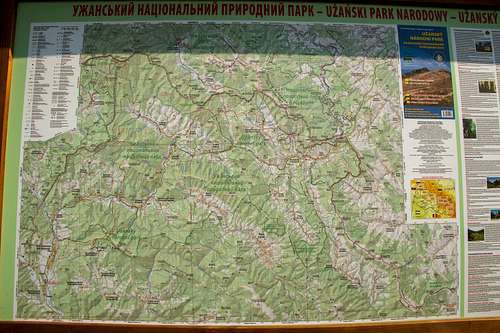
Mt. Pikui and Uzhansky NP map
Red Tape
Stay respectful to Carpathian nature! In neighbouring Uzhansky National Park standard rules of tourist activity and wildlife preservation apply.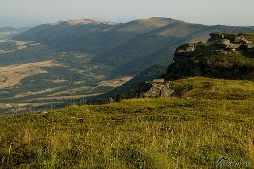 Mt.Starostyna - Eastern Bieszczady
When to Climb
All year round. September/October golden autumn in Carpathian beechland. July/August frequent t-storms.In snowy winter, great touring and backcountry skiing.
 Mount Pikui summit
Mountain chalet "Turbaza Pikui" is located in the upper part of Husne Vyzhne village.
Some tourist huts for rent in Husne and private houses offering rooms in Bilasovica, Libukhora and Husne to be found.
Hiking in the border zone (Uzhok and Sianki area) keep your passport ready for control of the border guards. Ukrainian police road checkpoints are located: on Uzhok pass and in Nizne Vorota(E50).
