|
|
Mountain/Rock |
|---|---|
|
|
47.22670°N / 10.10093°E |
|
|
Lechquellengebirge |
|
|
Hiking, Skiing |
|
|
Spring, Summer, Fall, Winter |
|
|
7779 ft / 2371 m |
|
|
Overview
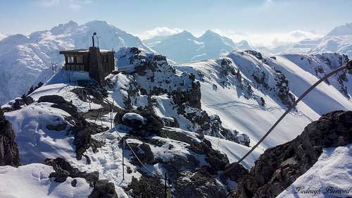
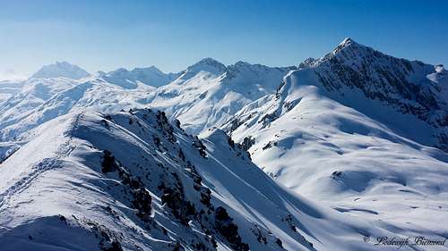
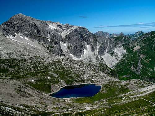 Braunarlspitze (2649m) & Butzensee by EricChu | 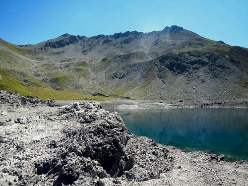 Zuger Hochlicht from Butzensee | 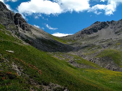 Mohnensattel and Zuger Hochlicht by EricChu |
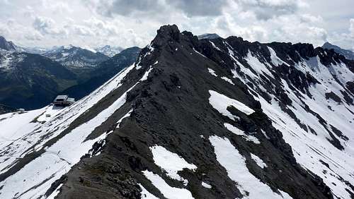
Zuger Hochlicht is located in the Lechquellengebirge, a mountain range that stretches west of the famous village of Lech. The name Zuger Hochlicht comes from the village of Zug, a settlement with only a few houses and hotels at the base of the mountain . The Zuger Hochlicht is with its 2371 meters not particularly high, but it does offer great views due to its prominent location high above the Lechtal Valley. From the summit you can see many of the main peaks of the Lechquellengebirge including Mohnenfluh (2544m) and Braunarlspitze (2649m), but also some of the major peaks of the Lechtal Alps are visible, like Rüfispitze (2640m), Trittkopf (2720m) and Valluga (2811m) .
 Zuger Hochlicht Summit Ridge | 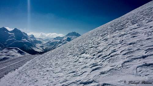 East flank with Lechtal Alps behind |
Zuger Hochlicht can be climbed all year long. In summer the mountain is often climbed together with its higher neighbor Mohnenfluh (2544m). From the saddle that separates the 2 mountains (Mohnenfluhsattel), a marked trail leads up to both summits. This upper part to the summit of Zuger Hochlicht is even fixed with steel cables to ease the ascent, but in my opinion these cables are completely unnecessary, since the path up to the summit is just a walk-up. The Hochlicht can be climbed in winter as well. Due to the vicinity of the Steinmahder chairlift, climbing Hochlicht is quite easy. From the top station you can ether go directly up the East Face (somewhat steep) or go the the Mohenfluhsattel and follow the steel cables up the North ridge to the summit. This last route takes some more time, but is an easier alternative. If you’re planning on climbing Zuger Hochlicht, wether it will be in winter or summer, the views make for a worthwhile trip.
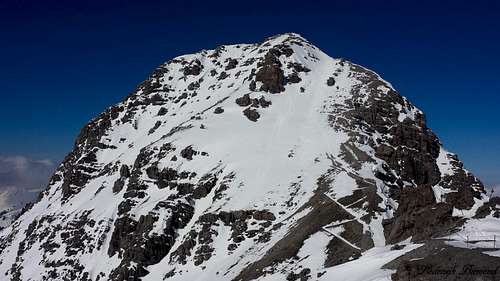 Mohnenfluh (2542m) |  Summit view towards Hochberg (2324m, left) |
On the summit of Zuger Hochlicht are the remains of an old ski facility. I guess it was on old towing-lift with a top station exactly on the summit. The summit structure reminded me of a station from the Lost series : ‘’The Swan’’, but that is my personal interpretation, of course. Of course it is quite sad that these manmade structures are left behind unused and are not removed from an otherwise fine peak like Zuger Hochlicht.
Route
 North Ridge with fixed cables and Mohenfluhsattel | 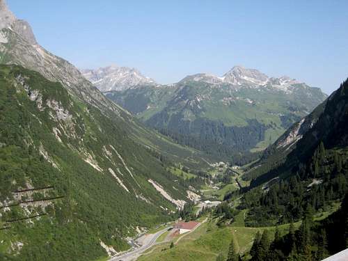 Zuger Hochlicht from Flexenpass |
Summer
All main routes to Zuger Hochlicht start from Lech/ Oberlech. It is however possible to start your ascent from Schrocken (1269m) as well. A marked trail leads up from Schrocken (in a southern direction) to the Hoch gletsjeralpe. At this point the trail splits and you need to take the trailtowards the east. The path continues until you reach the beautiful Butzensee Lake at 2124 meters. From here the Mohnenfluhsattel, the saddle between Zurger Hochlicht and Mohnenfluh is only 30 minutes away. At the Mohnenfluhsattel head towards the south. You are now ascending the North ridge of Zuger Hochlicht. The trail is fixed with steel cables, but they are not necessary to use, since the trail is graded T3 at max. Following the North ridge it will take you about 15 to 20 minutes until you reach the summit of Zuger Hochlicht. (Also see the purple Route on the map below)
The main route for climbing Hochlicht starts from Lech and/or Oberlech. Ether start your hike from Oberlech or take the cableway (Petersbodenbahn) up from Lech. This will shorten the climb by a fair amount. Follow the marked trail to the Kriegeralpe and the Obere Gipslocher. Continue to the Mohnenfluhsattel (follow the signs to Mohnenfluh). This is the orange Route on the map below. This part of the route is easy and graded T2. At the Mohnenfluhsattel head towards the south. You are now ascending the North ridge of Zuger Hochlicht. The trail is fixed with steel cables, but they are not necessary to use, since this part of the trail is graded T3 at max. Following the North ridge it will take you about 15 to 20 minutes until you reach the summit of ZugerHochlicht. A very good description of the route from Oberlech to the Mohnenfluhsattel is described by EricChu on his Route page Oberlech - Mohnenfluh - Butzensee - Oberlech
It is also possible to reach the Mohnenfluhsattel via the red route (see map below). This route starts in Oberlech and reaches the Mohnenfluhsattel via the Obere Gaisbuhelalpe. From the Mohnenfluhsattel the route is the same as described above.
A nice variation is to combine your ascent of Zuger Hochlicht with Mohnenfluh. Go down, back to the Mohnenfluhsattel and head up the North ridge of Mohnenfluh, once again over well-marked trails (T3). This extra summit will only take one extra hour of your time. Descent is the same way back.
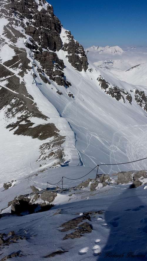 North Ridge: Fixed cables | 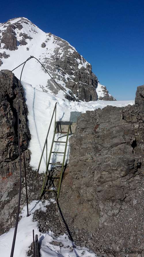 Fixed cables on the summit | 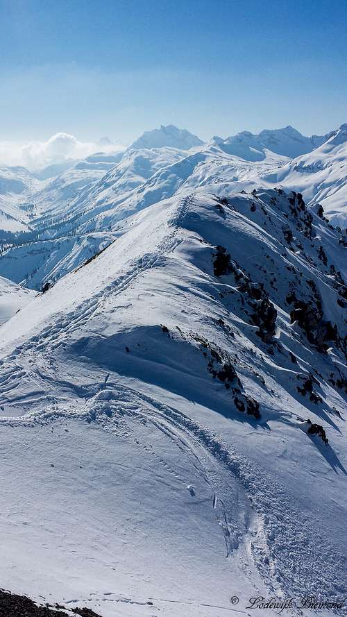 Zuger Hochlicht Summit Ridge | 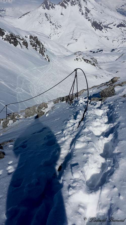 Via Ferrata on Hochlicht |
Winter
In winter the easiest approach is to take the Steinmahder chairlift to reach the base of Zuger Hochlicht. From here you have two options. The first one is to go up the East Face directly. This route involves some steeper terrain and there are no trails to be found. Still, the steepness is limited and reaching the summit will only take you about 20 to 30 minutes.
An easier alternative is to head up to the Mohnenfluhsattel. From here follow the north ridge to the summit. Because of the steel cables route finding is easy, because even with a thick snow layer the cables are visible at all times. This ascent will take you about an hour. Descent is the same way back.

How to get there
How to get There: MAP
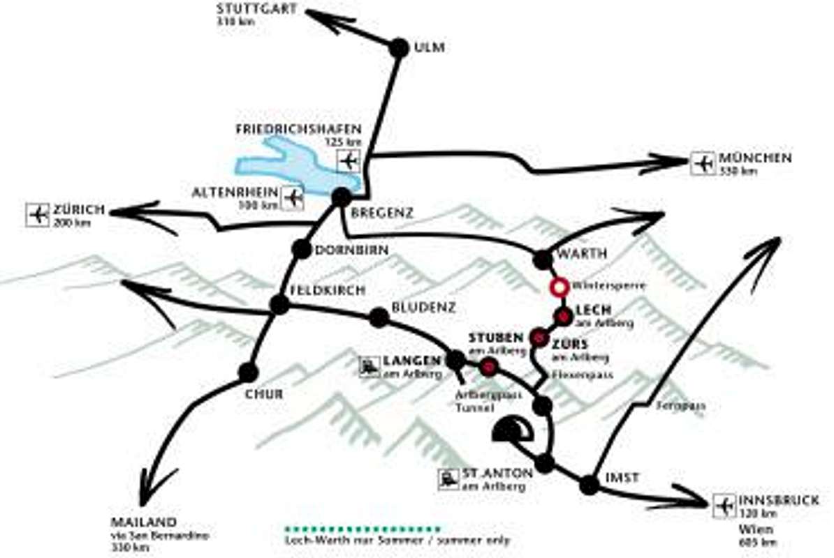
Approaching from the north: coming from Bodensee area the easiest way leads from Bregenz onthe B200 via Alberschwende and Egg to Schröcken. From the Füssen area insouthern Bavaria follow the B179 to Reutte, then the B198 leading to Warth andthen to Lech.
Approaching from Bludenz in Vorarlberg follow the S16 to Arlberg. From Innsbruck take theInntal-Highway via Imst and Landeck to Arlberg again. In the village of Stubenbranch north on the B198 and over the Flexenpass to Zürs and on to Lech.
For detailed information about how to get to Lech see this link: Travel information Lech There is also a description of getting to Lech by bus and train.
Weather
Maps
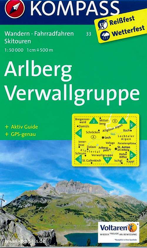 | Kompass Map no. 33 Arlberg - Verwallgruppe 1:50.000 ISBN:9783990440759 |
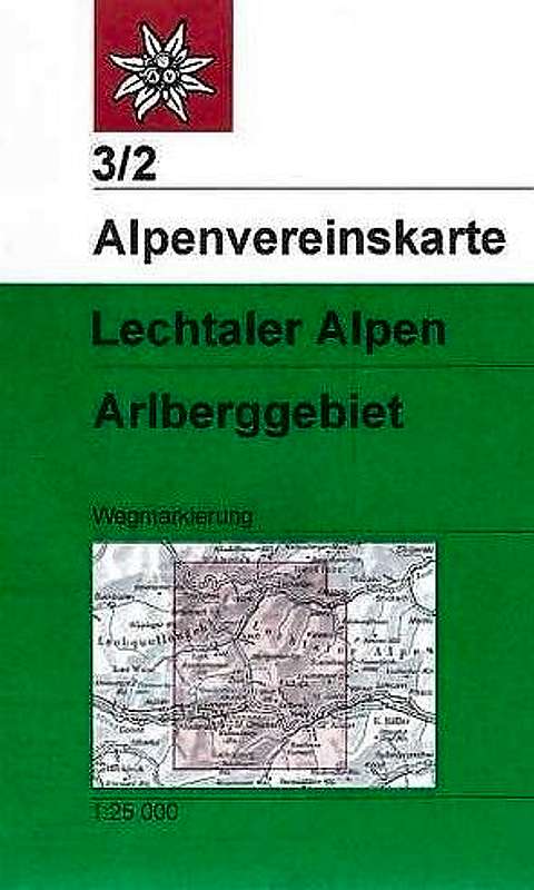 | Alpenvereinskarte 3/2 Lechtaler Alpen Arlbergebiet 1:25.000 EAN: 9783928777155 |
When to Climb
As previously mentioned, Zuger Hochlicht can be climbed all year long. For the route details in summer and in winter time see the ''Routes section''.
Cablecars and Chairlifts
Lech and Omeshorn (2557m)
The Petersboden chair lift starts from Lech.
It is in operation daily from June 24 to October 3, 2016
Operating hours: 8:30 a.m. – 12:05 noon & 12:40 p.m. – 5:00 p.m.
Cablecars and lifts: operating hours and prices